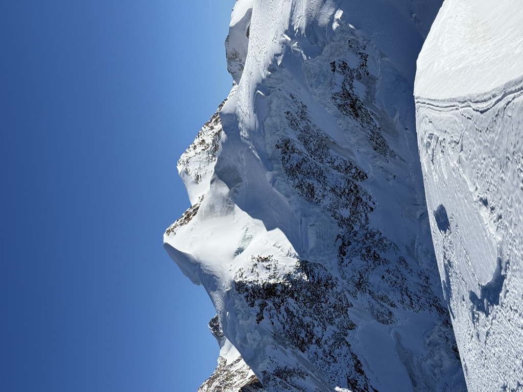
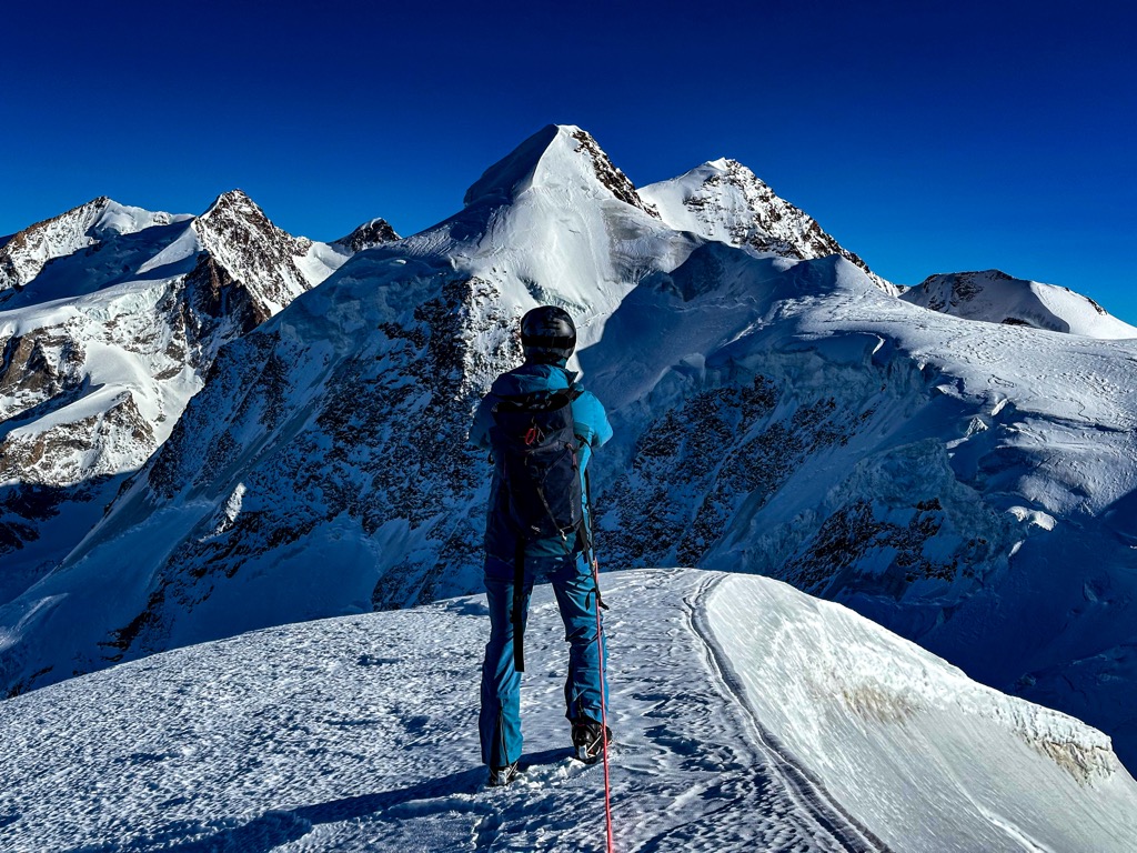
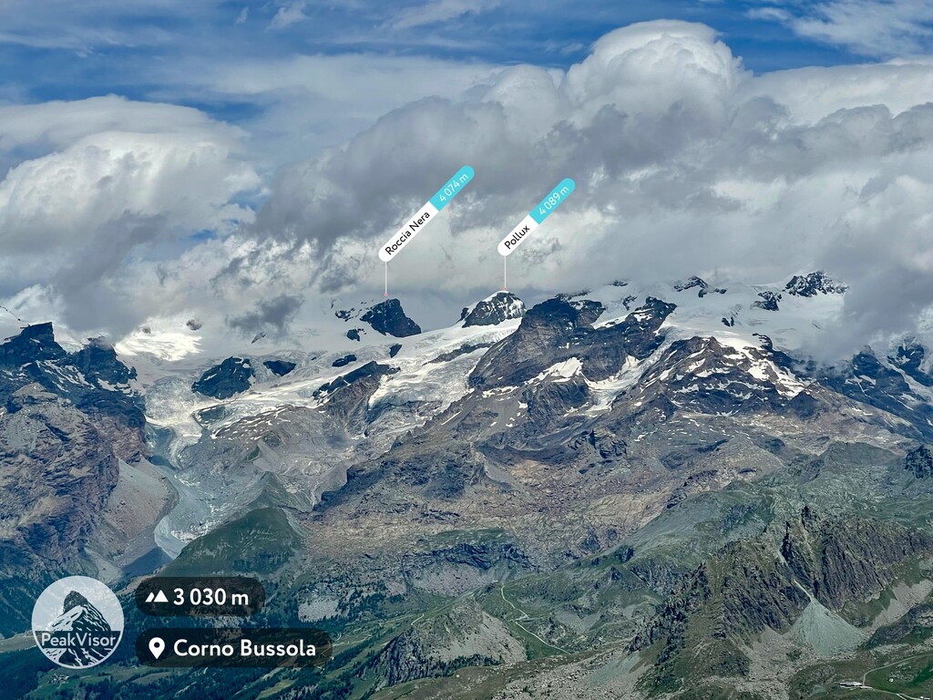
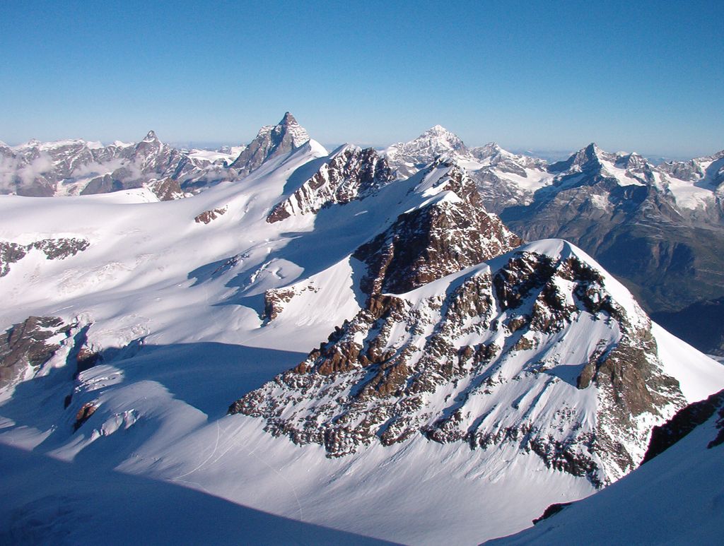
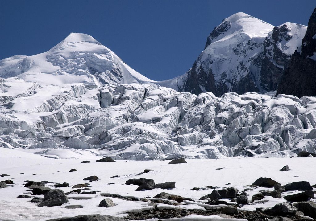
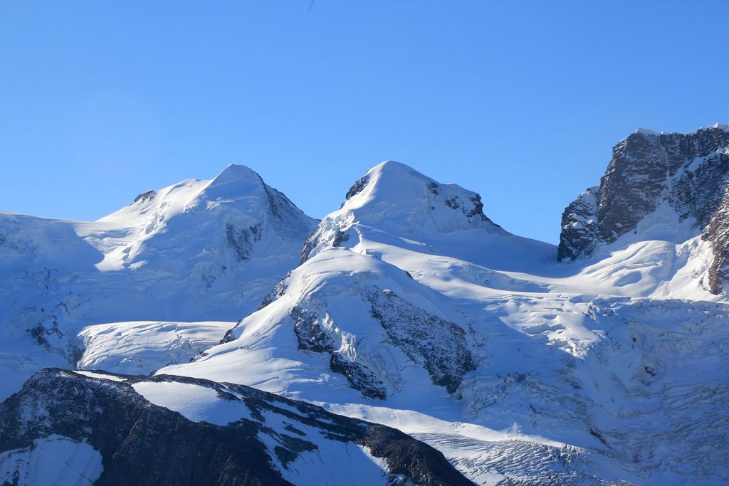
Pollux (Italian: Polluce) is a mountain in the Pennine Alps on the border between Valais, Switzerland and the Aosta Valley in Italy. It is the lower of a pair of twin peaks (German: Zwillinge), the other being Castor, named after the Gemini twins of Roman mythology. Pollux' peak is at an elevation of 4,089 m (13,415 ft). It is separated from Castor by a pass at 3,846 m (12,618 ft), named Passo di Verra in Italian, Col de Verra in French and Zwillingsjoch in German.
The first ascent was by Jules Jacot from Geneva with guides Josef-Marie Perren and Peter Taugwalder (father) on August 1 (the Swiss national day) 1864. Their route was via the Schwarztor, a pass first crossed by John Ball and Gabriel Zumtaugwald in 1845. The impressive north ridge was first climbed by Captain John Percy Farrar (a future President of the Alpine Club) and Wylie Lloyd with guide Josef Pollinger of St. Niklaus in the canton Valais on 18 August 1893.
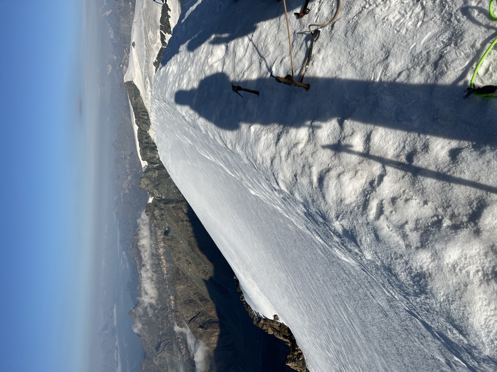
Ascents are usually made from the Refuge Ottorino Mezzalama (3,036 m), the Monte Rosa hut (2,795 m); if traversing the peaks via Pollux's north ridge, PD+, the Refuge Quintino Sella au Félik (3,585 m), and the Rossi-Volante bivouac hut (3,850 m).
The first winter and ski ascent of Pollux was by Dr Alfred von Martin and Karl Planck on 7 March 1913.
There's a trail called Traccia per il Polluce leading to the summit.
The nearest mountain hut is Bivacco Rossi e Volante located 1 153m/3 782ft W of the summit.
By elevation Pollux is
# 85 out of 60693 in the Alps # 52 out of 1787 in Valais/Wallis # 44 out of 345 in Visp # 46 out of 42694 in Italy # 39 out of 1186 in Aosta Valley # 52 out of 10817 in Switzerland # 51 out of 2009 in the Pennine Alps
We use GPS information embedded into the photo when it is available.
3D mountains overlay
Adjust mountain panorama to perfectly match your photos because recorded by camera photo position might be imprecise.
Move tool
Rotate tool
Zoom
More customization
Choose which peak labels should make into the final photo and what photo title should be.
Next
Photo Location
Satellitte
Flat map
Relief map
Latitude
Longitude
Altitude
OR
Latitude
°'''
Longitude
°'''
Apply
Register Peak
Peak Name
Latitude
Longitude
Altitude
Register
Teleport
PeakVisor
This 3D model of Sagarmatha National Park in Nepal was made using the PeakVisor app topographic data. The mobile app features higher precision models worldwide, more topographic details, and works offline. Download PeakVisor maps today.
Download OBJ model
PeakVisor
The download should start shortly. If you find it useful please consider supporting the PeakVisor app.
PeakVisor for iOS and Android
Be a superhero of outdoor navigation with state-of-the-art 3D maps and mountain identification in the palm of your hand!