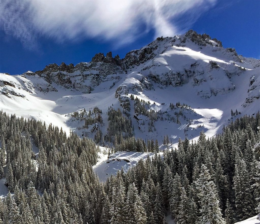
Palmyra Peak is a 13,319-foot-elevation (4,060-meter) mountain summit located in San Miguel County of southwest Colorado, United States. It is situated four miles south of the town of Telluride, on land managed by Uncompahgre National Forest. It is part of the San Juan Mountains which are a subset of the Rocky Mountains, and is west of the Continental Divide. It is immediately south of Telluride Ski Resort, from which it is a prominent landmark, and Palmyra has the distinction of having the highest inbounds skiing terrain of any North American ski resort. Topographic relief is significant as the north aspect rises 2,300 feet (700 meters) above Prospect Basin in one mile, and the west aspect rises 2,100 feet above Alta Lakes in one-half mile. The mountain's name has been officially adopted by the United States Board on Geographic Names in association with the Palmyra Mine, a gold and silver mine located at an elevation of 11,650-feet on the peak's western aspect. Other mines on its flanks included Lakeview Mine, Mountain Quail Mine, Roy Johnston mine, and Turkey Creek Mine.
By elevation Palmyra Peak is
# 27 out of 99 in San Miguel County # 31 out of 133 in Uncompahgre National Forest
By prominence Palmyra Peak is
# 80 out of 99 in San Miguel County # 87 out of 133 in Uncompahgre National Forest
We use GPS information embedded into the photo when it is available.
3D mountains overlay
Adjust mountain panorama to perfectly match your photos because recorded by camera photo position might be imprecise.
Move tool
Rotate tool
Zoom
More customization
Choose which peak labels should make into the final photo and what photo title should be.
Next
Photo Location
Satellitte
Flat map
Relief map
Latitude
Longitude
Altitude
OR
Latitude
°'''
Longitude
°'''
Apply
Register Peak
Peak Name
Latitude
Longitude
Altitude
Register
Teleport
PeakVisor
This 3D model of Sagarmatha National Park in Nepal was made using the PeakVisor app topographic data. The mobile app features higher precision models worldwide, more topographic details, and works offline. Download PeakVisor maps today.
Download OBJ model
PeakVisor
The download should start shortly. If you find it useful please consider supporting the PeakVisor app.
PeakVisor for iOS and Android
Be a superhero of outdoor navigation with state-of-the-art 3D maps and mountain identification in the palm of your hand!