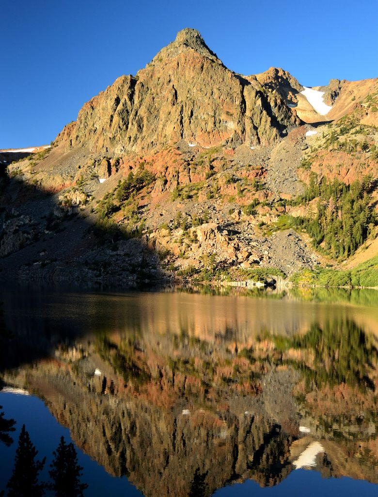
Page Peaks is a 10,929-foot-elevation (3,331 meter) mountain summit located in the Sierra Nevada mountain range, in Mono County of northern California, United States. The mountain is set in the Hoover Wilderness on land managed by Humboldt–Toiyabe National Forest. The summit is situated one mile outside the boundary of Yosemite National Park, and less than one mile east of line parent Camiaca Peak. Topographic relief is significant as the east aspect rises 1,400 feet (430 meters) above East Lake in one-quarter mile. This landform's toponym, which commemorates a miner and prospector named Page, has been officially adopted by the United States Board on Geographic Names.
We use GPS information embedded into the photo when it is available.
3D mountains overlay
Adjust mountain panorama to perfectly match your photos because recorded by camera photo position might be imprecise.
Move tool
Rotate tool
Zoom
More customization
Choose which peak labels should make into the final photo and what photo title should be.
Next
Photo Location
Satellitte
Flat map
Relief map
Latitude
Longitude
Altitude
OR
Latitude
°'''
Longitude
°'''
Apply
Register Peak
Peak Name
Latitude
Longitude
Altitude
Register
Teleport
PeakVisor
This 3D model of Sagarmatha National Park in Nepal was made using the PeakVisor app topographic data. The mobile app features higher precision models worldwide, more topographic details, and works offline. Download PeakVisor maps today.
Download OBJ model
PeakVisor
The download should start shortly. If you find it useful please consider supporting the PeakVisor app.
PeakVisor for iOS and Android
Be a superhero of outdoor navigation with state-of-the-art 3D maps and mountain identification in the palm of your hand!