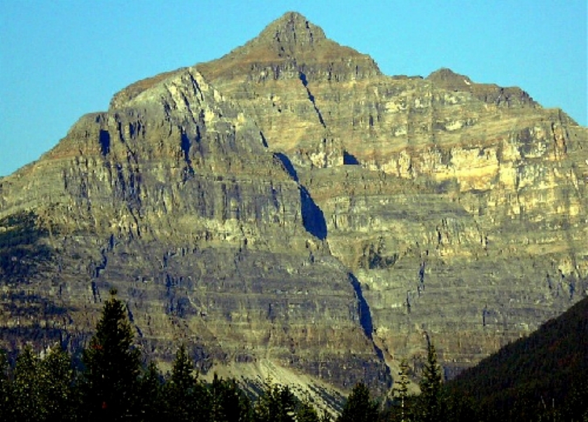
Mount Whymper, 2,844 m, is a mountain located in the Canadian Rockies, British Columbia, Canada, in the Vermilion Pass area in Kootenay National Park.
The mountain is named for its first conqueror, the English alpinist, explorer, writer and engraver Edward Whymper.
In 1901, Whymper and his four guides (Joseph Bossoney, Christian Kaufmann, Christian Klucker, and Joseph Pollinger) first climbed Mount Whymper. Whymper was exploring the area sponsored by Canadian Pacific Railway (CPR) to promote the Canadian Rocky Mountains and the railway in his conferences.
There is another Mount Whymper, (1539 m – 48.95111°N 124.16194°W / 48.95111; -124.16194) in British Columbia, on Vancouver Island, named for Edward's brother Frederick Whymper.
There's a trail called Mount Whymper Route leading to the summit.
By elevation Mount Whymper is
# 40 out of 65 in Kootenay National Park # 53 out of 81 in the Bow Range
By prominence Mount Whymper is
# 37 out of 65 in Kootenay National Park # 26 out of 81 in the Bow Range
We use GPS information embedded into the photo when it is available.
3D mountains overlay
Adjust mountain panorama to perfectly match your photos because recorded by camera photo position might be imprecise.
Move tool
Rotate tool
Zoom
More customization
Choose which peak labels should make into the final photo and what photo title should be.
Next
Photo Location
Satellitte
Flat map
Relief map
Latitude
Longitude
Altitude
OR
Latitude
°'''
Longitude
°'''
Apply
Register Peak
Peak Name
Latitude
Longitude
Altitude
Register
Teleport
PeakVisor
This 3D model of Sagarmatha National Park in Nepal was made using the PeakVisor app topographic data. The mobile app features higher precision models worldwide, more topographic details, and works offline. Download PeakVisor maps today.
Download OBJ model
PeakVisor
The download should start shortly. If you find it useful please consider supporting the PeakVisor app.
PeakVisor for iOS and Android
Be a superhero of outdoor navigation with state-of-the-art 3D maps and mountain identification in the palm of your hand!