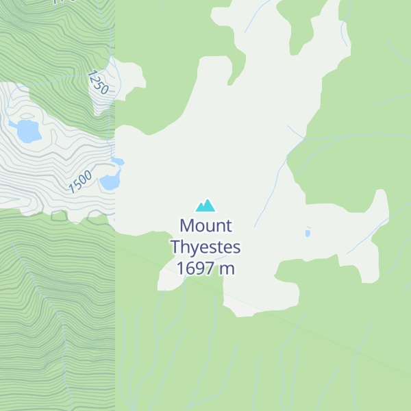
Mount Thyestes is a 1,697-metre (5,568-foot) mountain summit located in the Tantalus Range, in Tantalus Provincial Park, in southwestern British Columbia, Canada. It is situated 4 km (2 mi) immediately west of Brackendale, 7 km (4 mi) northwest of Squamish, and 10.7 km (7 mi) southeast of Mount Tantalus, which is the highest peak in the Tantalus Range. Its nearest higher peak is Omega Mountain, 2.4 km (1 mi) to the northwest, and Mount Pelops lies 3.6 km (2 mi) to the west-northwest. Precipitation runoff from the peak drains into tributaries of the Squamish River. The first ascent of the mountain was made in 1942 by R. McLellan, H. Parliament, and F. Roots. The mountain was named for Thyestes, son of Pelops and grandson of Tantalus according to Greek mythology. The mountain's name was officially adopted on June 6, 1957, by the Geographical Names Board of Canada.
By elevation Mount Thyestes is
# 17 out of 17 in Tantalus Provincial Park # 21 out of 24 in the Tantalus Range
By prominence Mount Thyestes is
# 7 out of 17 in Tantalus Provincial Park # 10 out of 24 in the Tantalus Range
We use GPS information embedded into the photo when it is available.
3D mountains overlay
Adjust mountain panorama to perfectly match your photos because recorded by camera photo position might be imprecise.
Move tool
Rotate tool
Zoom
More customization
Choose which peak labels should make into the final photo and what photo title should be.
Next
Photo Location
Satellitte
Flat map
Relief map
Latitude
Longitude
Altitude
OR
Latitude
°'''
Longitude
°'''
Apply
Register Peak
Peak Name
Latitude
Longitude
Altitude
Register
Teleport
PeakVisor
This 3D model of Sagarmatha National Park in Nepal was made using the PeakVisor app topographic data. The mobile app features higher precision models worldwide, more topographic details, and works offline. Download PeakVisor maps today.
Download OBJ model
PeakVisor
The download should start shortly. If you find it useful please consider supporting the PeakVisor app.
PeakVisor for iOS and Android
Be a superhero of outdoor navigation with state-of-the-art 3D maps and mountain identification in the palm of your hand!