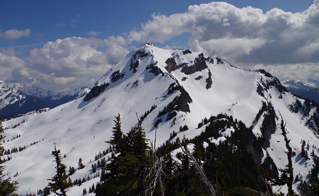
Mount McGuire is a 2,008-metre (6,588-foot) mountain summit located in the Cascade Mountains of southwestern British Columbia, Canada. It is situated 4 km (2 mi) north of the Canada–United States border, 19 km (12 mi) southeast of Chilliwack, and 7.4 km (5 mi) northwest of Canadian Border Peak, which is its nearest higher peak. Precipitation runoff from the peak drains into tributaries of the Chilliwack River. The steep western slope of the peak plunges 1800 metres into Tamihi Creek. The mountain was originally known as Tamihi, a Halkomelem name that means "deformed baby finishes." Such infants were sometimes left exposed on the mountain to die. The mountain's name was labelled on 1917 map as McGuire, and officially adopted on October 6, 1936, by the Geographical Names Board of Canada. The peak was first climbed in 1906 by James J. McArthur and survey party via the Southeast Ridge.
There's a trail called Mount McGuire Trail leading to the summit.
By prominence Mount McGuire is
# 83 out of 370 in Fraser Valley Regional District # 40 out of 269 in the Skagit Range
We use GPS information embedded into the photo when it is available.
3D mountains overlay
Adjust mountain panorama to perfectly match your photos because recorded by camera photo position might be imprecise.
Move tool
Rotate tool
Zoom
More customization
Choose which peak labels should make into the final photo and what photo title should be.
Next
Photo Location
Satellitte
Flat map
Relief map
Latitude
Longitude
Altitude
OR
Latitude
°'''
Longitude
°'''
Apply
Register Peak
Peak Name
Latitude
Longitude
Altitude
Register
Teleport
PeakVisor
This 3D model of Sagarmatha National Park in Nepal was made using the PeakVisor app topographic data. The mobile app features higher precision models worldwide, more topographic details, and works offline. Download PeakVisor maps today.
Download OBJ model
PeakVisor
The download should start shortly. If you find it useful please consider supporting the PeakVisor app.
PeakVisor for iOS and Android
Be a superhero of outdoor navigation with state-of-the-art 3D maps and mountain identification in the palm of your hand!