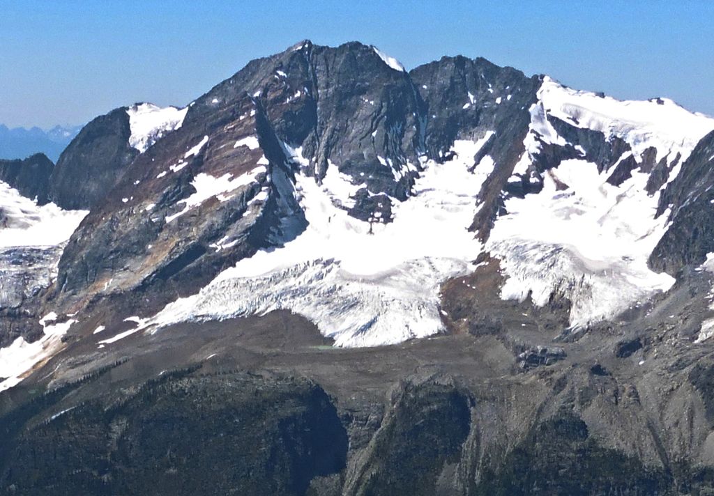
Mount Macbeth is a 3,059-metre (10,036-foot) mountain summit located in the Macbeth Group of the Purcell Mountains in British Columbia, Canada. It is situated 52 km (32 mi) north of Kaslo, and its nearest higher peak is Truce Mountain, 10.94 km (6.80 mi) to the south-southeast. The first ascent of the mountain was made in 1960 by A. Maki and Robert C. West via the north face. The peak was named for the character in William Shakespeare's Macbeth. The name follows the Macbeth-theme of features surrounding the Macbeth Icefield, such as Mount Lady Macbeth, Mount Macduff, Mount Fleance, and Mount Banquo. The Macbeth name was submitted December 1960 by Robert West, who led a mountaineering party in the area. The mountain's name was officially adopted July 17, 1962, by the Geographical Names Board of Canada.
By elevation Mount Macbeth is
# 35 out of 559 in Regional District of Central Kootenay # 63 out of 418 in the Purcell Mountains
We use GPS information embedded into the photo when it is available.
3D mountains overlay
Adjust mountain panorama to perfectly match your photos because recorded by camera photo position might be imprecise.
Move tool
Rotate tool
Zoom
More customization
Choose which peak labels should make into the final photo and what photo title should be.
Next
Photo Location
Satellitte
Flat map
Relief map
Latitude
Longitude
Altitude
OR
Latitude
°'''
Longitude
°'''
Apply
Register Peak
Peak Name
Latitude
Longitude
Altitude
Register
Teleport
PeakVisor
This 3D model of Sagarmatha National Park in Nepal was made using the PeakVisor app topographic data. The mobile app features higher precision models worldwide, more topographic details, and works offline. Download PeakVisor maps today.
Download OBJ model
PeakVisor
The download should start shortly. If you find it useful please consider supporting the PeakVisor app.
PeakVisor for iOS and Android
Be a superhero of outdoor navigation with state-of-the-art 3D maps and mountain identification in the palm of your hand!