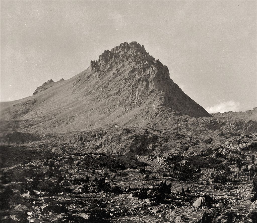
Mount Ericsson is a 13,589-foot (4,142 m) summit on the Kings-Kern Divide, an offshoot of the Great Western Divide. It marks the boundary between Sequoia National Park and Kings Canyon National Park. Water falling on the north slopes flow into the Kings River by way of Bubbs Creek while the southern slopes form the headwaters of the Kern River.
The summit was first reached in 1896 by Bolton and Lucy Brown who climbed the easy west ridge from Lucy's Foot Pass, a class 2 col, west of the summit. They named it Crag Ericsson "in honor of Captn John Ericsson … in recognition of its extremely craggy character." John Ericsson was the engineer and inventor who designed and built the Monitor. The name was submitted to the U.S. Geographic Board by the National Park Service. The Board accepted the name Mount Ericsson in 1928. The name Ericsson Crags did appear on the 15 minute Mount Whitney map and the name Crag Ericsson appears on the Mount Ericsson GNIS page. as a variant name.
On the ridge that extends to the north from the main summit, there a number craggy sub-peaks known as the Ericsson Crags. Most of the climbing routes here are class 4 or better.
By elevation Mount Ericsson is
# 57 out of 7926 in California # 22 out of 183 in Kings Canyon National Park # 29 out of 120 in Sequoia National Park # 32 out of 349 in Tulare County # 54 out of 2492 in the Sierra Nevada
By prominence Mount Ericsson is
# 26 out of 183 in Kings Canyon National Park # 14 out of 120 in Sequoia National Park # 44 out of 349 in Tulare County
We use GPS information embedded into the photo when it is available.
3D mountains overlay
Adjust mountain panorama to perfectly match your photos because recorded by camera photo position might be imprecise.
Move tool
Rotate tool
Zoom
More customization
Choose which peak labels should make into the final photo and what photo title should be.
Next
Photo Location
Satellitte
Flat map
Relief map
Latitude
Longitude
Altitude
OR
Latitude
°'''
Longitude
°'''
Apply
Register Peak
Peak Name
Latitude
Longitude
Altitude
Register
Teleport
PeakVisor
This 3D model of Sagarmatha National Park in Nepal was made using the PeakVisor app topographic data. The mobile app features higher precision models worldwide, more topographic details, and works offline. Download PeakVisor maps today.
Download OBJ model
PeakVisor
The download should start shortly. If you find it useful please consider supporting the PeakVisor app.
PeakVisor for iOS and Android
Be a superhero of outdoor navigation with state-of-the-art 3D maps and mountain identification in the palm of your hand!