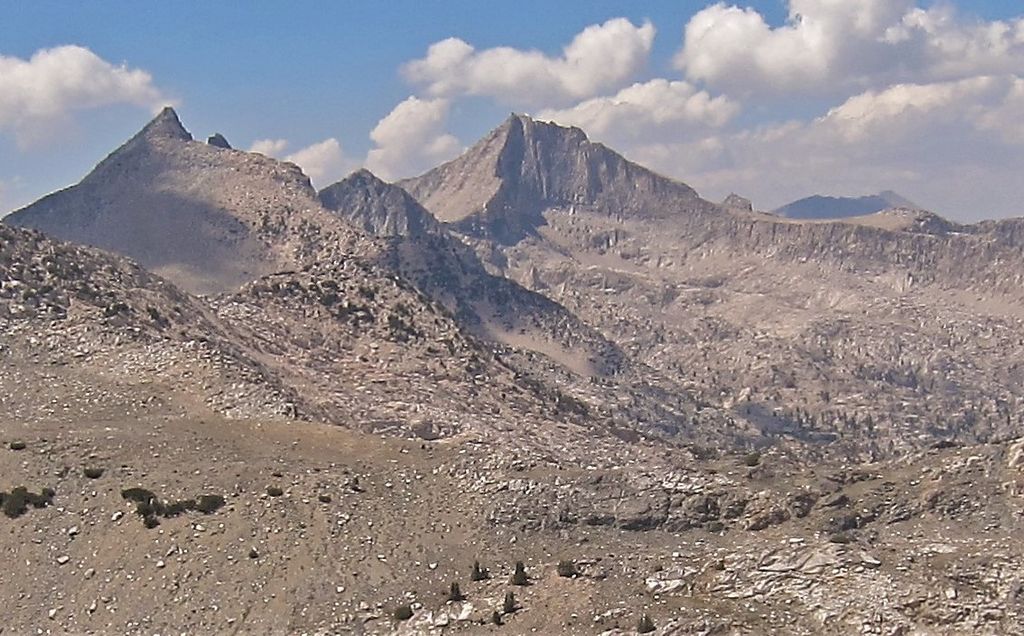
Mount Clarence King, located in the Kings Canyon National Park, is named for Clarence King, who worked on the Whitney Survey, the first geological survey of California. King later became the first chief of the United States Geological Survey.
The Peak is located along King Spur, a sub-range of the California's Sierra Nevada. It is north of Mount Cotter, northeast of Gardiner Basin, and west of Sixty Lakes Basin and the John Muir Trail. The first ascent was recorded by painter and lithographer Bolton Brown.
By elevation Mount Clarence King is
# 78 out of 183 in Kings Canyon National Park # 68 out of 372 in Fresno County
We use GPS information embedded into the photo when it is available.
3D mountains overlay
Adjust mountain panorama to perfectly match your photos because recorded by camera photo position might be imprecise.
Move tool
Rotate tool
Zoom
More customization
Choose which peak labels should make into the final photo and what photo title should be.
Next
Photo Location
Satellitte
Flat map
Relief map
Latitude
Longitude
Altitude
OR
Latitude
°'''
Longitude
°'''
Apply
Register Peak
Peak Name
Latitude
Longitude
Altitude
Register
Teleport
PeakVisor
This 3D model of Sagarmatha National Park in Nepal was made using the PeakVisor app topographic data. The mobile app features higher precision models worldwide, more topographic details, and works offline. Download PeakVisor maps today.
Download OBJ model
PeakVisor
The download should start shortly. If you find it useful please consider supporting the PeakVisor app.
PeakVisor for iOS and Android
Be a superhero of outdoor navigation with state-of-the-art 3D maps and mountain identification in the palm of your hand!