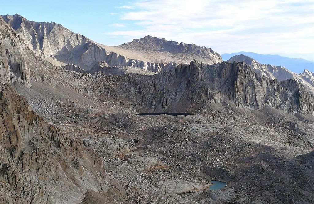
Mount Carillon is a 13,559-foot-elevation (4,133-meter) mountain summit located on the crest of the Sierra Nevada mountain range in California. It is situated on the common border of Tulare County with Inyo County, as well as the shared boundary of Sequoia National Park and John Muir Wilderness. It is set above the south shore of Tulainyo Lake, 12.5 miles (20.1 km) west of the community of Lone Pine, 1.25 miles (2.01 km) northeast of Mount Whitney, and 0.7 miles (1.1 km) east-northeast of Mount Russell, the nearest higher neighbor. Topographic relief is significant as it rises approximately 5,180 feet (1,580 meters) above Whitney Portal in approximately two miles. Carillon has subpeaks, unofficially called "The Cleaver" (13,383 ft (4,079 m), 0.4 mile to the northeast, and "Impala" (12,073+ ft/3,680+ m), on the southeast ridge.
By elevation Mount Carillon is
# 64 out of 7926 in California # 31 out of 120 in Sequoia National Park # 36 out of 349 in Tulare County # 44 out of 258 in Inyo County # 45 out of 205 in John Muir Wilderness # 61 out of 2492 in the Sierra Nevada
We use GPS information embedded into the photo when it is available.
3D mountains overlay
Adjust mountain panorama to perfectly match your photos because recorded by camera photo position might be imprecise.
Move tool
Rotate tool
Zoom
More customization
Choose which peak labels should make into the final photo and what photo title should be.
Next
Photo Location
Satellitte
Flat map
Relief map
Latitude
Longitude
Altitude
OR
Latitude
°'''
Longitude
°'''
Apply
Register Peak
Peak Name
Latitude
Longitude
Altitude
Register
Teleport
PeakVisor
This 3D model of Sagarmatha National Park in Nepal was made using the PeakVisor app topographic data. The mobile app features higher precision models worldwide, more topographic details, and works offline. Download PeakVisor maps today.
Download OBJ model
PeakVisor
The download should start shortly. If you find it useful please consider supporting the PeakVisor app.
PeakVisor for iOS and Android
Be a superhero of outdoor navigation with state-of-the-art 3D maps and mountain identification in the palm of your hand!