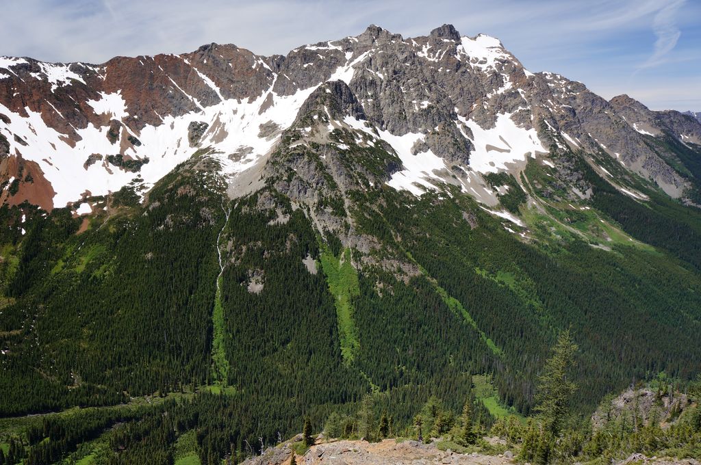
Mount Ballard is an 8,371-foot (2,551-metre) double-summit mountain located in eastern Whatcom County of Washington state. It is part of the Okanogan Range which is a sub-range of the North Cascades Range, and the mountain is situated on land administered by the Okanogan–Wenatchee National Forest. Ballard ranks 84th on Washington's highest 100 peaks. The nearest higher neighbor is Azurite Peak, 2.04 miles (3.28 km) to the south. Precipitation runoff from Mount Ballard drains into Mill Creek and Slate Creek, both tributaries of the Skagit River. Topographic relief is significant as the summit rises approximately 4,000 feet (1,219 meters) above Mill Creek in one mile (1.6 km).
By elevation Mount Ballard is
# 35 out of 273 in the Okanogan Range # 22 out of 227 in Whatcom County # 73 out of 760 in Okanogan-Wenatchee National Forest
By prominence Mount Ballard is
# 98 out of 273 in the Okanogan Range # 89 out of 227 in Whatcom County
We use GPS information embedded into the photo when it is available.
3D mountains overlay
Adjust mountain panorama to perfectly match your photos because recorded by camera photo position might be imprecise.
Move tool
Rotate tool
Zoom
More customization
Choose which peak labels should make into the final photo and what photo title should be.
Next
Photo Location
Satellitte
Flat map
Relief map
Latitude
Longitude
Altitude
OR
Latitude
°'''
Longitude
°'''
Apply
Register Peak
Peak Name
Latitude
Longitude
Altitude
Register
Teleport
PeakVisor
This 3D model of Sagarmatha National Park in Nepal was made using the PeakVisor app topographic data. The mobile app features higher precision models worldwide, more topographic details, and works offline. Download PeakVisor maps today.
Download OBJ model
PeakVisor
The download should start shortly. If you find it useful please consider supporting the PeakVisor app.
PeakVisor for iOS and Android
Be a superhero of outdoor navigation with state-of-the-art 3D maps and mountain identification in the palm of your hand!