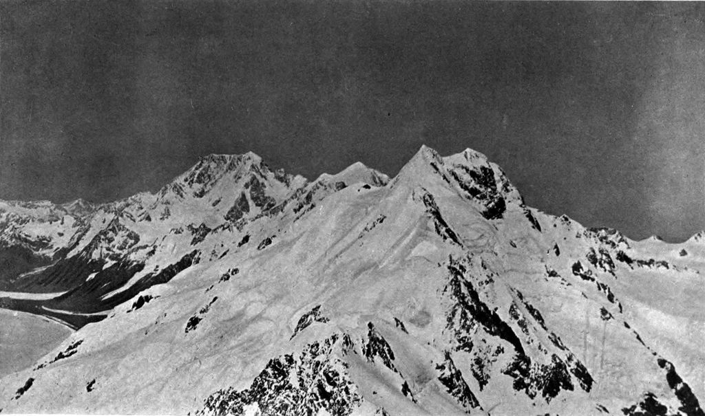
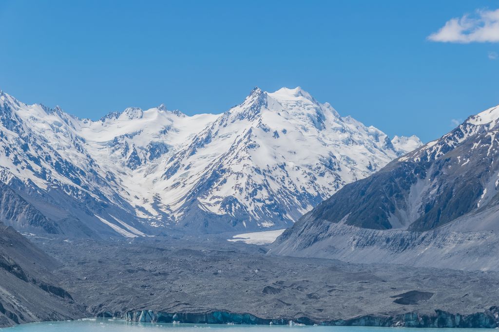
The Minarets are two peaks of the Southern Alps approximately 180 metres (590 ft) apart, located in Westland Tai Poutini National Park in the South Island of New Zealand. Its southeastern and northwestern peaks have heights of 3,040 metres (9,970 ft) and 3,031 metres (9,944 ft), respectively. After the 3,109 metres (10,200 ft) Mount Elie de Beaumont, they are the northernmost three-thousand-metre peaks in the country and are a few kilometres away from the highest mountains in New Zealand. Most of the other three-thousand-metre peaks in the country are located in the immediate vicinity.
The first ascent was made by Tom Fyfe and Malcolm Ross in 1895.
By elevation Minarets is
# 23 out of 2121 in the Southern Alps # 19 out of 1041 in West Coast # 20 out of 1363 in Canterbury # 19 out of 826 in Westland District # 20 out of 301 in Mackenzie District # 23 out of 8795 in New Zealand # 20 out of 168 in Mount Cook National Park (New Zealand) # 19 out of 169 in Westland Tai Poutini National Park
By prominence Minarets is
# 76 out of 168 in Mount Cook National Park (New Zealand) # 62 out of 169 in Westland Tai Poutini National Park
We use GPS information embedded into the photo when it is available.
3D mountains overlay
Adjust mountain panorama to perfectly match your photos because recorded by camera photo position might be imprecise.
Move tool
Rotate tool
Zoom
More customization
Choose which peak labels should make into the final photo and what photo title should be.
Next
Photo Location
Satellitte
Flat map
Relief map
Latitude
Longitude
Altitude
OR
Latitude
°'''
Longitude
°'''
Apply
Register Peak
Peak Name
Latitude
Longitude
Altitude
Register
Teleport
PeakVisor
This 3D model of Sagarmatha National Park in Nepal was made using the PeakVisor app topographic data. The mobile app features higher precision models worldwide, more topographic details, and works offline. Download PeakVisor maps today.
Download OBJ model
PeakVisor
The download should start shortly. If you find it useful please consider supporting the PeakVisor app.
PeakVisor for iOS and Android
Be a superhero of outdoor navigation with state-of-the-art 3D maps and mountain identification in the palm of your hand!