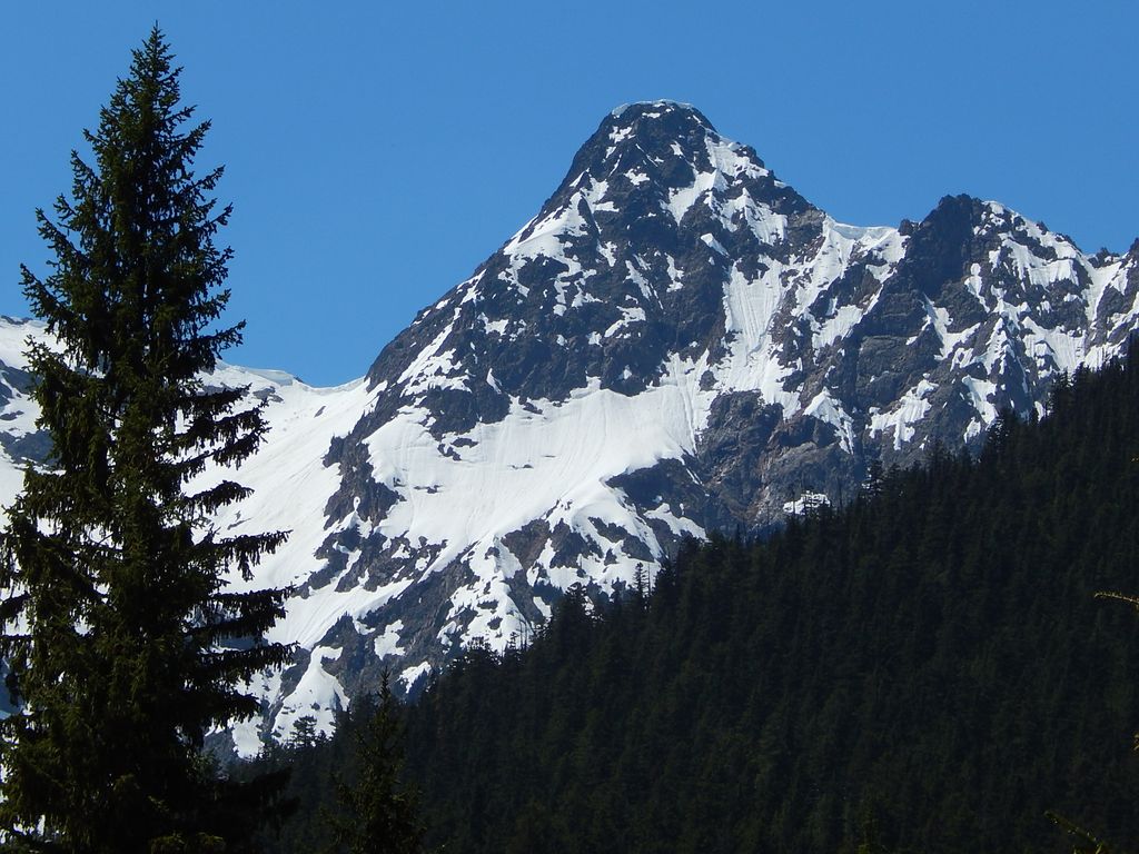
Kitling Peak is an 8,003-foot (2,439-metre) mountain summit in the North Cascades in the U.S. state of Washington. It is located one mile northwest of Easy Pass on the borders of the Stephen Mather Wilderness and North Cascades National Park. Kitling Peak is situated at the east end of Ragged Ridge. Other peaks on Ragged Ridge include Mesahchie Peak, Kimtah Peak, Katsuk Peak, and Graybeard Peak. The nearest higher peak is Mesahchie Peak, 0.95 miles (1.53 km) to the south. The Mesahchie Glacier on Kitling's northwest slope forms the headwaters of Panther Creek. Precipitation runoff on the east side of the mountain drains into Ross Lake via Granite Creek, whereas the west side of the peak drains into Diablo Lake via Panther Creek and Fisher Creek. Topographic relief is significant as the summit rises 3,000 feet (910 meters) above Fisher Creek in one mile (1.6 km) and the northeast slope rises 3,400 feet (1,000 meters) above Kitling Creek in 0.75 mile (1.2 km). The mountain's name "Kitling" derives from Chinook Jargon "ketling" which means kettle. The mountain takes its name from Kitling Lake which is one mile north of the peak. The toponym was officially adopted in 1969 by the U.S. Board on Geographic Names.
By elevation Kitling Peak is
# 37 out of 137 in Skagit County # 54 out of 123 in North Cascades National Park
By prominence Kitling Peak is
# 79 out of 137 in Skagit County # 82 out of 123 in North Cascades National Park
We use GPS information embedded into the photo when it is available.
3D mountains overlay
Adjust mountain panorama to perfectly match your photos because recorded by camera photo position might be imprecise.
Move tool
Rotate tool
Zoom
More customization
Choose which peak labels should make into the final photo and what photo title should be.
Next
Photo Location
Satellitte
Flat map
Relief map
Latitude
Longitude
Altitude
OR
Latitude
°'''
Longitude
°'''
Apply
Register Peak
Peak Name
Latitude
Longitude
Altitude
Register
Teleport
PeakVisor
This 3D model of Sagarmatha National Park in Nepal was made using the PeakVisor app topographic data. The mobile app features higher precision models worldwide, more topographic details, and works offline. Download PeakVisor maps today.
Download OBJ model
PeakVisor
The download should start shortly. If you find it useful please consider supporting the PeakVisor app.
PeakVisor for iOS and Android
Be a superhero of outdoor navigation with state-of-the-art 3D maps and mountain identification in the palm of your hand!