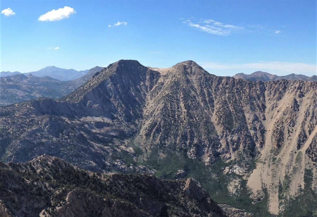
Hunewill Peak is a mountain with a summit elevation of 11,713 feet (3,570 m) located in the Sierra Nevada mountain range, in Mono County of northern California, United States. The summit is set in Hoover Wilderness on land managed by Humboldt–Toiyabe National Forest. The peak is situated approximately four miles west of Twin Lakes, 1.3 mile southwest of Victoria Peak, and 2.4 miles southwest of line parent Eagle Peak. Precipitation runoff from this mountain drains into tributaries of Robinson and Buckeye Creeks, which are within the Walker River drainage basin. Topographic relief is significant as the summit rises over 3,500 feet (1,100 meters) above Robinson Creek in approximately one mile (1.6 km).
By elevation Hunewill Peak is
# 57 out of 197 in Mono County # 23 out of 55 in Hoover Wilderness
By prominence Hunewill Peak is
# 64 out of 197 in Mono County # 20 out of 55 in Hoover Wilderness
We use GPS information embedded into the photo when it is available.
3D mountains overlay
Adjust mountain panorama to perfectly match your photos because recorded by camera photo position might be imprecise.
Move tool
Rotate tool
Zoom
More customization
Choose which peak labels should make into the final photo and what photo title should be.
Next
Photo Location
Satellitte
Flat map
Relief map
Latitude
Longitude
Altitude
OR
Latitude
°'''
Longitude
°'''
Apply
Register Peak
Peak Name
Latitude
Longitude
Altitude
Register
Teleport
PeakVisor
This 3D model of Sagarmatha National Park in Nepal was made using the PeakVisor app topographic data. The mobile app features higher precision models worldwide, more topographic details, and works offline. Download PeakVisor maps today.
Download OBJ model
PeakVisor
The download should start shortly. If you find it useful please consider supporting the PeakVisor app.
PeakVisor for iOS and Android
Be a superhero of outdoor navigation with state-of-the-art 3D maps and mountain identification in the palm of your hand!