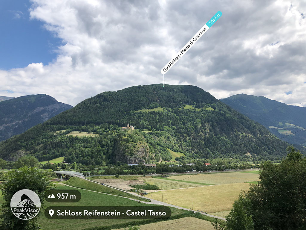
At an elevation of 1,667 m (5,469 ft.), and with a prominence of 51 m (167 ft.), Gschließegg, or Monte di Casaclusa, forms part of the Western Tauern Alps. It is situated in Trentino-Alto Adige/Südtirol, in the province of South Tyrol, Italy.
The starting point of this hike is the historic pilgrimage site of Maria Trens. The area is rocky and well-forested. The weather is pleasant most of the year, with light rain and temperatures between 10°C and 20°C. Of course, during the winter months between November and January, light to heavy snowfall is expected, and appropriate clothing is recommended.
Many visitors combine the hike up the Monte di Casaclusa with a visit to the Sanctuary of Maria Trens. The church was constructed in 1470 and has a central wooden sculpture of the Madonna with Child.
There's a trail leading to the summit. Gschließegg is one of the 10 peaks along the multi-day Pfunderer Höhenweg - Alta Via di Fundres.
We use GPS information embedded into the photo when it is available.
3D mountains overlay
Adjust mountain panorama to perfectly match your photos because recorded by camera photo position might be imprecise.
Move tool
Rotate tool
Zoom
More customization
Choose which peak labels should make into the final photo and what photo title should be.
Next
Photo Location
Satellitte
Flat map
Relief map
Latitude
Longitude
Altitude
OR
Latitude
°'''
Longitude
°'''
Apply
Register Peak
Peak Name
Latitude
Longitude
Altitude
Register
Teleport
PeakVisor
This 3D model of Sagarmatha National Park in Nepal was made using the PeakVisor app topographic data. The mobile app features higher precision models worldwide, more topographic details, and works offline. Download PeakVisor maps today.
Download OBJ model
PeakVisor
The download should start shortly. If you find it useful please consider supporting the PeakVisor app.
PeakVisor for iOS and Android
Be a superhero of outdoor navigation with state-of-the-art 3D maps and mountain identification in the palm of your hand!