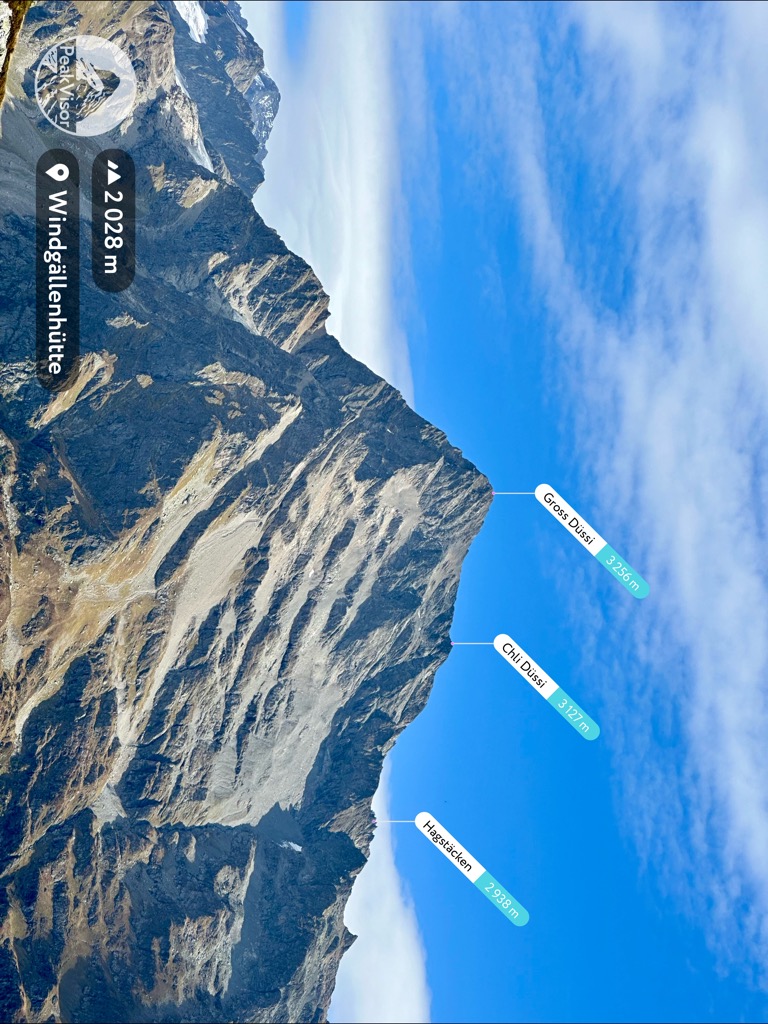
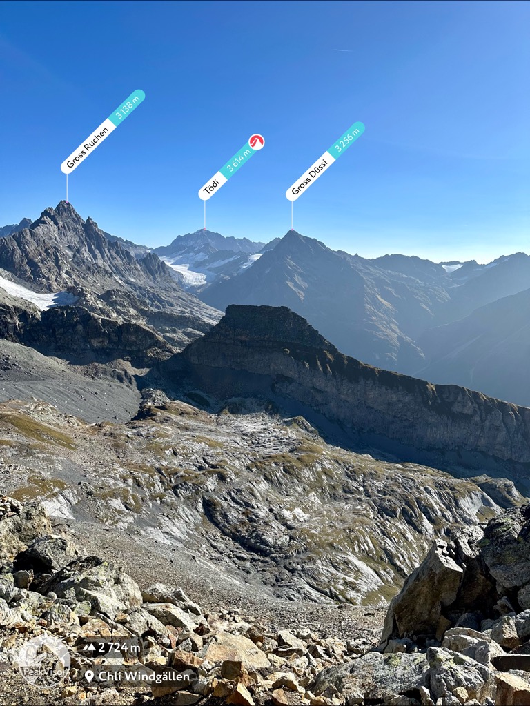
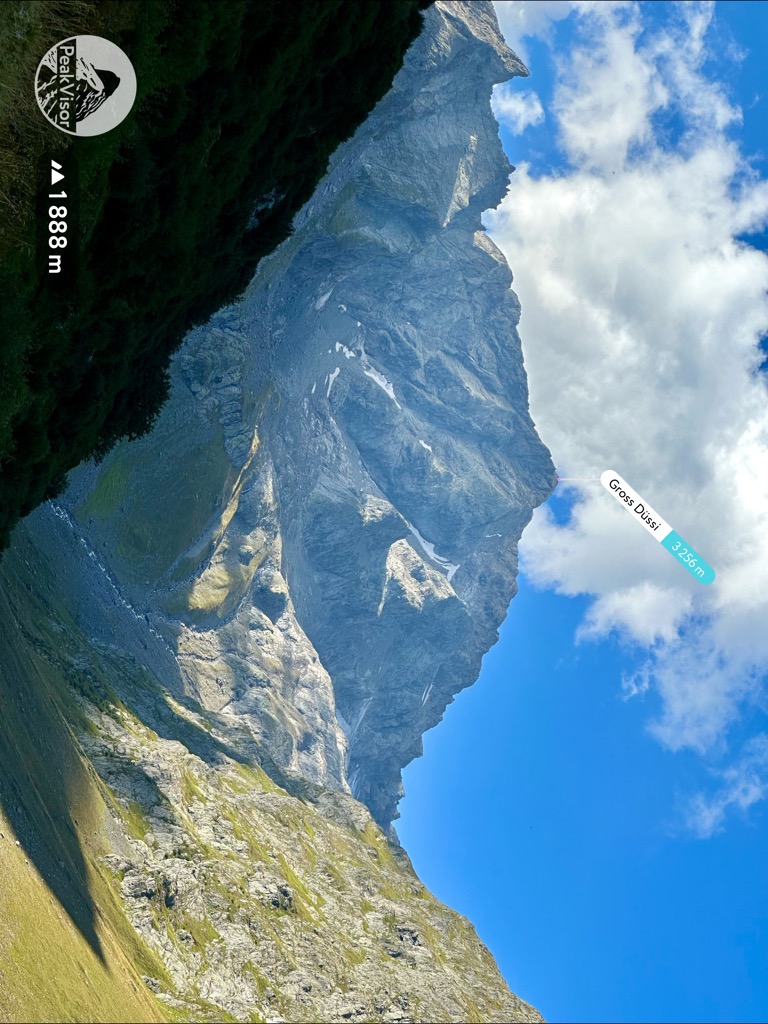
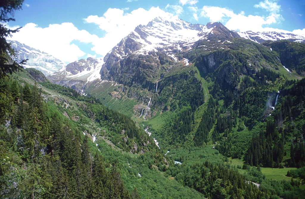
The Düssi (or Piz Git) is a mountain in the Glarus Alps in central Switzerland, located on the border between the cantons of Uri and Graubünden. Its massif separates the valleys of Maderanertal (Uri) and Val Russein (Graubünden). The summit (3,256 metres) is also named Gross Düssi to distinguish it from a lower summit to the south named Chli Düssi (3,125 metres) .
The Düssi is surrounded by glaciers, the Ober Hüfifirn on its northern side. The largest on its south-eastern side (in Graubünden) is the Glatscher da Cavrein.
The nearest mountain hut is Hüfihütte located 1 318m/4 323ft NW of the summit.
By elevation Gross Düssi is
# 14 out of 812 in the Glarus Alps # 22 out of 594 in Uri # 13 out of 412 in Surselva
By prominence Gross Düssi is
# 19 out of 812 in the Glarus Alps # 86 out of 2367 in Grisons # 18 out of 594 in Uri # 17 out of 412 in Surselva
We use GPS information embedded into the photo when it is available.
3D mountains overlay
Adjust mountain panorama to perfectly match your photos because recorded by camera photo position might be imprecise.
Move tool
Rotate tool
Zoom
More customization
Choose which peak labels should make into the final photo and what photo title should be.
Next
Photo Location
Satellitte
Flat map
Relief map
Latitude
Longitude
Altitude
OR
Latitude
°'''
Longitude
°'''
Apply
Register Peak
Peak Name
Latitude
Longitude
Altitude
Register
Teleport
PeakVisor
This 3D model of Sagarmatha National Park in Nepal was made using the PeakVisor app topographic data. The mobile app features higher precision models worldwide, more topographic details, and works offline. Download PeakVisor maps today.
Download OBJ model
PeakVisor
The download should start shortly. If you find it useful please consider supporting the PeakVisor app.
PeakVisor for iOS and Android
Be a superhero of outdoor navigation with state-of-the-art 3D maps and mountain identification in the palm of your hand!