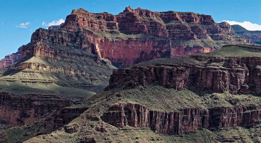
Grand Scenic Divide is a 5,667-foot-elevation (1,727-meter) ridge located in the Grand Canyon, in Coconino County of northern Arizona, Southwestern United States. It is situated immediately north of Fossil Mountain, and 1.5 mile east of Mount Huethawali. Surrounded by Bass and Serpentine Canyons, topographic relief is significant as it rises over 3,400 feet (1,000 meters) above the nearby Colorado River in 1.5 mile. It is composed of strata of the Pennsylvanian-Permian Supai Group. Further down are strata of the cliff-forming Mississippian Redwall Limestone, and Cambrian Tonto Group. According to the Köppen climate classification system, Grand Scenic Divide is located in a cold semi-arid climate zone. The normal approach to the ridge is made via the South Bass Trail, and from the top the view includes Masonic Temple, Holy Grail Temple, Dox Castle, King Arthur Castle, Evans Butte, Sagittarius Ridge, and Scorpion Ridge.
We use GPS information embedded into the photo when it is available.
3D mountains overlay
Adjust mountain panorama to perfectly match your photos because recorded by camera photo position might be imprecise.
Move tool
Rotate tool
Zoom
More customization
Choose which peak labels should make into the final photo and what photo title should be.
Next
Photo Location
Satellitte
Flat map
Relief map
Latitude
Longitude
Altitude
OR
Latitude
°'''
Longitude
°'''
Apply
Register Peak
Peak Name
Latitude
Longitude
Altitude
Register
Teleport
PeakVisor
This 3D model of Sagarmatha National Park in Nepal was made using the PeakVisor app topographic data. The mobile app features higher precision models worldwide, more topographic details, and works offline. Download PeakVisor maps today.
Download OBJ model
PeakVisor
The download should start shortly. If you find it useful please consider supporting the PeakVisor app.
PeakVisor for iOS and Android
Be a superhero of outdoor navigation with state-of-the-art 3D maps and mountain identification in the palm of your hand!