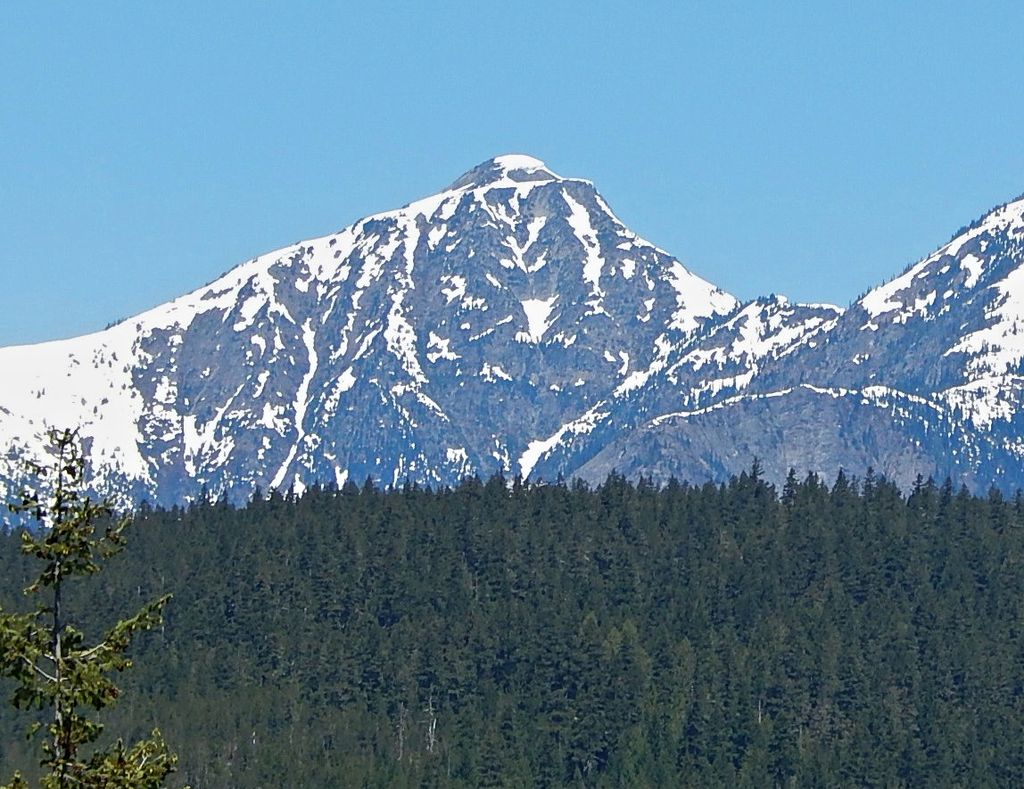
Genesis Peak is a 7,244-foot (2,208-metre) mountain summit located in the North Cascades, in Whatcom County of Washington, United States. It is situated within North Cascades National Park and Stephen Mather Wilderness. The nearest higher neighbor is Mount Prophet, 2.22 miles (3.57 km) to the northwest. Like many North Cascade peaks, Genesis Peak is more notable for its large, steep rise above local terrain than for its absolute elevation. Topographic relief is significant since the southern aspect of the mountain rises 5,400 feet above the Big Beaver Valley in approximately two miles (3.2 km), and the eastern aspect of the mountain rises 5,600 feet above Ross Lake in approximately three miles (4.8 km). Precipitation runoff from the mountain drains into Ross Lake via Skymo, No Name, and Big Beaver Creeks. The first ascent of this peak was made September 13, 1975, by Norman Burke, Cliff Lawson, Ed Lebert, and Dan Sjolseth.
We use GPS information embedded into the photo when it is available.
3D mountains overlay
Adjust mountain panorama to perfectly match your photos because recorded by camera photo position might be imprecise.
Move tool
Rotate tool
Zoom
More customization
Choose which peak labels should make into the final photo and what photo title should be.
Next
Photo Location
Satellitte
Flat map
Relief map
Latitude
Longitude
Altitude
OR
Latitude
°'''
Longitude
°'''
Apply
Register Peak
Peak Name
Latitude
Longitude
Altitude
Register
Teleport
PeakVisor
This 3D model of Sagarmatha National Park in Nepal was made using the PeakVisor app topographic data. The mobile app features higher precision models worldwide, more topographic details, and works offline. Download PeakVisor maps today.
Download OBJ model
PeakVisor
The download should start shortly. If you find it useful please consider supporting the PeakVisor app.
PeakVisor for iOS and Android
Be a superhero of outdoor navigation with state-of-the-art 3D maps and mountain identification in the palm of your hand!