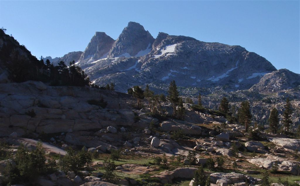
Finger Peaks is a granitic mountain summit with an elevation of 11,498 feet (3,505 m) located in the Sierra Nevada mountain range, in northern California, United States. The three peaks are situated in Yosemite National Park and Tuolumne County. The landform is set immediately west of Burro Pass, 1.5 mile south of Eocene Peak, and 1.4 mile southwest of Matterhorn Peak. Topographic relief is significant as the summit rises 1,700 feet (520 meters) above Piute Creek in one-half mile. The first ascent of the summit was made July 19, 1931, by Jules Eichorn, Glen Dawson, and Walter Brem. This landform's toponym has been in publications since at least 1925, and was officially adopted by the U.S. Board on Geographic Names in 1932.
By elevation Finger Peaks is
# 43 out of 215 in Yosemite National Park # 33 out of 226 in Tuolumne County
By prominence Finger Peaks is
# 34 out of 215 in Yosemite National Park # 36 out of 226 in Tuolumne County
We use GPS information embedded into the photo when it is available.
3D mountains overlay
Adjust mountain panorama to perfectly match your photos because recorded by camera photo position might be imprecise.
Move tool
Rotate tool
Zoom
More customization
Choose which peak labels should make into the final photo and what photo title should be.
Next
Photo Location
Satellitte
Flat map
Relief map
Latitude
Longitude
Altitude
OR
Latitude
°'''
Longitude
°'''
Apply
Register Peak
Peak Name
Latitude
Longitude
Altitude
Register
Teleport
PeakVisor
This 3D model of Sagarmatha National Park in Nepal was made using the PeakVisor app topographic data. The mobile app features higher precision models worldwide, more topographic details, and works offline. Download PeakVisor maps today.
Download OBJ model
PeakVisor
The download should start shortly. If you find it useful please consider supporting the PeakVisor app.
PeakVisor for iOS and Android
Be a superhero of outdoor navigation with state-of-the-art 3D maps and mountain identification in the palm of your hand!