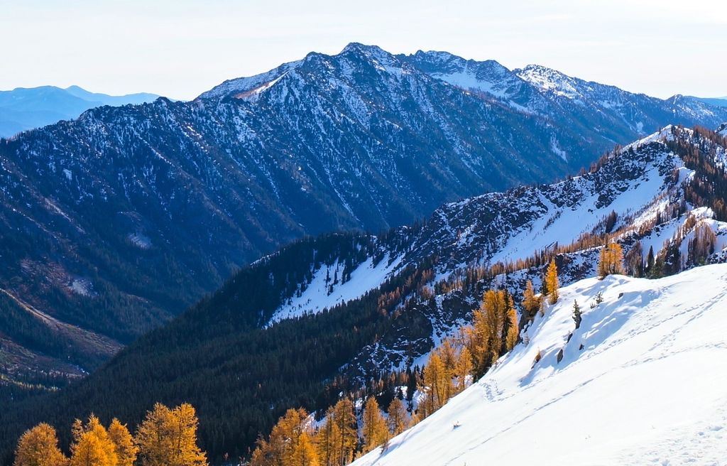
Fifth of July Mountain is a 7,696 ft (2,350 m) mountain summit located in the Entiat Mountains, a sub-range of the North Cascades, in Chelan County of Washington state. Fifth of July Mountain is situated in the Glacier Peak Wilderness, on land managed by the Okanogan–Wenatchee National Forest. Its nearest higher neighbor is Chilly Peak, 3.8 miles (6.1 km) to the north-northwest, and Carne Mountain is set 4 miles (6.4 km) to the northwest. Precipitation runoff from the mountain drains west into Rock Creek which is a tributary of the Chiwawa River, or east into Cow Creek, a tributary of the Entiat River. This geographical feature was named by surveyor Albert Hale Sylvester for the day he visited it.
By elevation Fifth of July Mountain is
# 58 out of 128 in Glacier Peak Wilderness
By prominence Fifth of July Mountain is
# 49 out of 362 in Chelan County # 27 out of 128 in Glacier Peak Wilderness
We use GPS information embedded into the photo when it is available.
3D mountains overlay
Adjust mountain panorama to perfectly match your photos because recorded by camera photo position might be imprecise.
Move tool
Rotate tool
Zoom
More customization
Choose which peak labels should make into the final photo and what photo title should be.
Next
Photo Location
Satellitte
Flat map
Relief map
Latitude
Longitude
Altitude
OR
Latitude
°'''
Longitude
°'''
Apply
Register Peak
Peak Name
Latitude
Longitude
Altitude
Register
Teleport
PeakVisor
This 3D model of Sagarmatha National Park in Nepal was made using the PeakVisor app topographic data. The mobile app features higher precision models worldwide, more topographic details, and works offline. Download PeakVisor maps today.
Download OBJ model
PeakVisor
The download should start shortly. If you find it useful please consider supporting the PeakVisor app.
PeakVisor for iOS and Android
Be a superhero of outdoor navigation with state-of-the-art 3D maps and mountain identification in the palm of your hand!