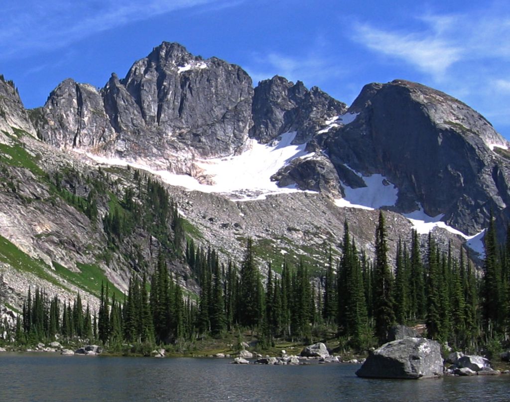
Drinnan Peak is a 2,584-metre (8,478-foot) mountain summit located in the Valhalla Ranges of the Selkirk Mountains in southeast British Columbia, Canada. It is situated on the southwestern border of Valhalla Provincial Park, 2.8 km (1.7 mi) southeast of Gregorio Peak, and 18 km (11 mi) west of Slocan and Slocan Lake. The mountain is named for Bill Drinnan who trapped in the vicinity in the 1920s and 1930s. Drinnon Peak was adopted in 1976 in association with Drinnon Lake. To conform with the correct spelling of the family name, the spelling was changed to Drinnan Peak, and officially adopted February 3, 1986, by the Geographical Names Board of Canada.
Based on the Köppen climate classification, Drinnan Peak has a subarctic climate with cold, snowy winters, and mild summers. Temperatures can drop below −20 °C with wind chill factors below −30 °C. Precipitation runoff from the mountain drains into Gwillim Creek and Hoder Creek, both tributaries of the Slocan River. Its nearest higher peak is Mount Prestley, 2 km (1.2 mi) to the southeast. The first ascent of the peak was made August 19, 1974, by Bob Dean, Janice Isaac, Kim Kratky, and Peter Wood.
We use GPS information embedded into the photo when it is available.
3D mountains overlay
Adjust mountain panorama to perfectly match your photos because recorded by camera photo position might be imprecise.
Move tool
Rotate tool
Zoom
More customization
Choose which peak labels should make into the final photo and what photo title should be.
Next
Photo Location
Satellitte
Flat map
Relief map
Latitude
Longitude
Altitude
OR
Latitude
°'''
Longitude
°'''
Apply
Register Peak
Peak Name
Latitude
Longitude
Altitude
Register
Teleport
PeakVisor
This 3D model of Sagarmatha National Park in Nepal was made using the PeakVisor app topographic data. The mobile app features higher precision models worldwide, more topographic details, and works offline. Download PeakVisor maps today.
Download OBJ model
PeakVisor
The download should start shortly. If you find it useful please consider supporting the PeakVisor app.
PeakVisor for iOS and Android
Be a superhero of outdoor navigation with state-of-the-art 3D maps and mountain identification in the palm of your hand!