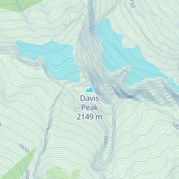
Davis Peak is a mountain just north of Gorge Lake in North Cascades National Park, in the US state of Washington. It is located just south of the Picket Range. While not of particularly high elevation, even for the North Cascades, it is notable for its large, steep local relief, and in particular for its huge Northeast Face, which drops 5,250 ft (1,600 m) in one horizontal mile (1.6 km). This is one of the two largest vertical drops in one horizontal mile in the contiguous United States, the other being the North Face of Kinnerly Peak.
Davis Peak had been known as Stetattle Peak until the Reaburn climbing party of 1904 renamed it in honor of the early homesteading family of Lucinda Davis. The Davis family had built and ran a roadhouse for trappers, miners and other travelers at the base of the peak, near present-day Diablo, prior to the arrival of roads or rail, circa 1900.
By elevation Davis Peak is
# 91 out of 227 in Whatcom County # 87 out of 269 in the Skagit Range
By prominence Davis Peak is
# 28 out of 227 in Whatcom County # 19 out of 123 in North Cascades National Park # 32 out of 269 in the Skagit Range
We use GPS information embedded into the photo when it is available.
3D mountains overlay
Adjust mountain panorama to perfectly match your photos because recorded by camera photo position might be imprecise.
Move tool
Rotate tool
Zoom
More customization
Choose which peak labels should make into the final photo and what photo title should be.
Next
Photo Location
Satellitte
Flat map
Relief map
Latitude
Longitude
Altitude
OR
Latitude
°'''
Longitude
°'''
Apply
Register Peak
Peak Name
Latitude
Longitude
Altitude
Register
Teleport
PeakVisor
This 3D model of Sagarmatha National Park in Nepal was made using the PeakVisor app topographic data. The mobile app features higher precision models worldwide, more topographic details, and works offline. Download PeakVisor maps today.
Download OBJ model
PeakVisor
The download should start shortly. If you find it useful please consider supporting the PeakVisor app.
PeakVisor for iOS and Android
Be a superhero of outdoor navigation with state-of-the-art 3D maps and mountain identification in the palm of your hand!


.jpg)