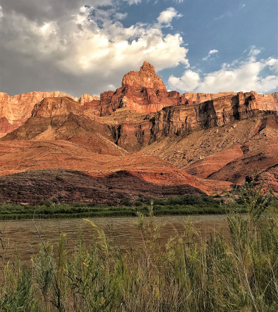
Comanche Point is a 7,073-foot-elevation (2,156-meter) summit located in the Grand Canyon, in Coconino County of northern Arizona, US. Part of the Palisades of the Desert, Comanche Point is the high point on the canyon's less-visited East Rim, and is four miles north-northeast of Desert View Point, its nearest higher neighbor. Topographic relief is significant as it towers 4,400 feet (1,300 meters) above the Colorado River in 1.5 mile. Comanche Point was named in 1900 by George Wharton James for the Comanche, a Native-American nation from the Great Plains, in keeping with a practice of naming the points on the canyon's South Rim for Native American nations. This geographical feature's name was officially adopted in 1906 by the U.S. Board on Geographic Names. According to the Köppen climate classification system, Comanche Point is located in a Cold semi-arid climate zone. On September 27, 1994, the tabloid Weekly World News ran an outlandish cover story that wreckage of a 4000-year-old UFO had been found in limestone rubble near the base of Comanche Point.
By elevation Comanche Point is
# 83 out of 280 in Grand Canyon National Park # 20 out of 144 in the Coconino Plateau
By prominence Comanche Point is
# 65 out of 280 in Grand Canyon National Park # 20 out of 144 in the Coconino Plateau
We use GPS information embedded into the photo when it is available.
3D mountains overlay
Adjust mountain panorama to perfectly match your photos because recorded by camera photo position might be imprecise.
Move tool
Rotate tool
Zoom
More customization
Choose which peak labels should make into the final photo and what photo title should be.
Next
Photo Location
Satellitte
Flat map
Relief map
Latitude
Longitude
Altitude
OR
Latitude
°'''
Longitude
°'''
Apply
Register Peak
Peak Name
Latitude
Longitude
Altitude
Register
Teleport
PeakVisor
This 3D model of Sagarmatha National Park in Nepal was made using the PeakVisor app topographic data. The mobile app features higher precision models worldwide, more topographic details, and works offline. Download PeakVisor maps today.
Download OBJ model
PeakVisor
The download should start shortly. If you find it useful please consider supporting the PeakVisor app.
PeakVisor for iOS and Android
Be a superhero of outdoor navigation with state-of-the-art 3D maps and mountain identification in the palm of your hand!