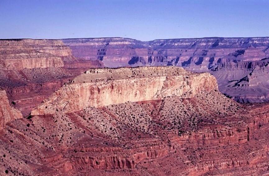
Castor is a 6,221-foot-elevation (1,896-meter) summit located in the Grand Canyon, in Coconino County of northern Arizona, United States. It is situated 11 miles west-northwest of Grand Canyon Village, and less than one mile north of Piute Point. Pollux Temple is one mile southeast, and Geikie Peak is three miles to the east. Topographic relief is significant as Castor Temple rises over 3,800 feet (1,200 meters) above the Colorado River in two miles.
Castor Temple is named for Castor, the twin half-brother of Pollux according to Greek mythology. In ancient Rome, the Temple of Castor and Pollux was in close proximity to the Temple of Vesta, and in the Grand Canyon, Vesta Temple is situated less than four miles to the southeast. Clarence Dutton began the tradition of naming geographical features in the Grand Canyon after mythological deities. This geographical feature's name was officially adopted in 1964 by the U.S. Board on Geographic Names.
According to the Köppen climate classification system, Castor Temple is located in a Cold semi-arid climate zone. Access to this feature is via the Tonto Trail, and the first ascent of the summit was made April 19, 1971, by Donald Davis and Alan Doty.
By elevation Castor Temple is
# 75 out of 144 in the Coconino Plateau
By prominence Castor Temple is
# 56 out of 280 in Grand Canyon National Park # 16 out of 144 in the Coconino Plateau
We use GPS information embedded into the photo when it is available.
3D mountains overlay
Adjust mountain panorama to perfectly match your photos because recorded by camera photo position might be imprecise.
Move tool
Rotate tool
Zoom
More customization
Choose which peak labels should make into the final photo and what photo title should be.
Next
Photo Location
Satellitte
Flat map
Relief map
Latitude
Longitude
Altitude
OR
Latitude
°'''
Longitude
°'''
Apply
Register Peak
Peak Name
Latitude
Longitude
Altitude
Register
Teleport
PeakVisor
This 3D model of Sagarmatha National Park in Nepal was made using the PeakVisor app topographic data. The mobile app features higher precision models worldwide, more topographic details, and works offline. Download PeakVisor maps today.
Download OBJ model
PeakVisor
The download should start shortly. If you find it useful please consider supporting the PeakVisor app.
PeakVisor for iOS and Android
Be a superhero of outdoor navigation with state-of-the-art 3D maps and mountain identification in the palm of your hand!