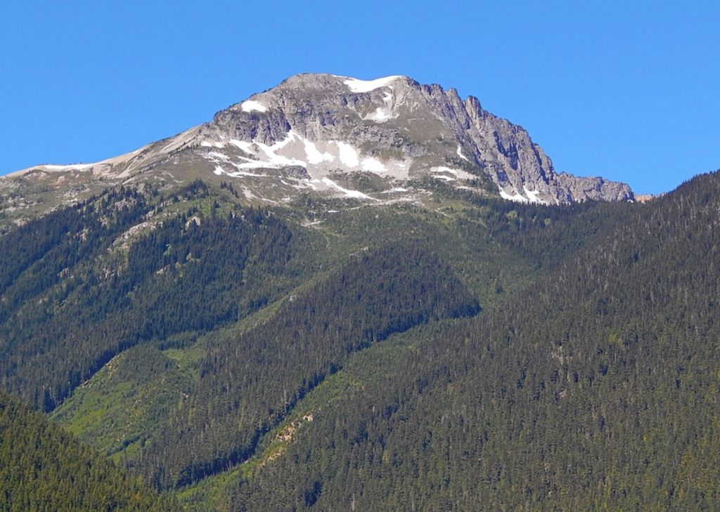
Beebe Mountain is a 7,416-foot (2,260-metre) mountain summit located in the Cascade Range in the U.S. state of Washington. It is situated on the border of North Cascades National Park. Its nearest higher neighbor is Elija Ridge, 1.86 miles (2.99 km) to the southwest, and McKay Ridge is set 4 miles (6.4 km) to the northeast on the opposite side of the North Cascades Highway. The mountain's name honors Frank Beebe who worked for the Forest Service and maintained a cabin near the base of the mountain in the 1920s. Precipitation runoff on the mountain drains into Ross Lake via Granite Creek and Panther Creek.
By elevation Beebe Mountain is
# 64 out of 227 in Whatcom County # 84 out of 123 in North Cascades National Park
By prominence Beebe Mountain is
# 65 out of 227 in Whatcom County # 47 out of 123 in North Cascades National Park
We use GPS information embedded into the photo when it is available.
3D mountains overlay
Adjust mountain panorama to perfectly match your photos because recorded by camera photo position might be imprecise.
Move tool
Rotate tool
Zoom
More customization
Choose which peak labels should make into the final photo and what photo title should be.
Next
Photo Location
Satellitte
Flat map
Relief map
Latitude
Longitude
Altitude
OR
Latitude
°'''
Longitude
°'''
Apply
Register Peak
Peak Name
Latitude
Longitude
Altitude
Register
Teleport
PeakVisor
This 3D model of Sagarmatha National Park in Nepal was made using the PeakVisor app topographic data. The mobile app features higher precision models worldwide, more topographic details, and works offline. Download PeakVisor maps today.
Download OBJ model
PeakVisor
The download should start shortly. If you find it useful please consider supporting the PeakVisor app.
PeakVisor for iOS and Android
Be a superhero of outdoor navigation with state-of-the-art 3D maps and mountain identification in the palm of your hand!