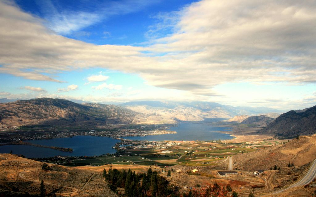
Anarchist Mountain is a mountain in British Columbia, Canada, which rises 1,491 metres (4,892 ft) above sea level. Its summit is located 9.6 kilometres (6.0 mi) east of Osoyoos and 4.0 kilometres (2.5 mi) north of the United States border with Washington state. The term is used primarily to refer to the rural district around the summit and its communities, and also to the Crowsnest Highway with its long climb up the mountainside from the floor of the Okanagan Valley at Osoyoos, just below.
The name was officially adopted 6 June 1922 to refer to the plateau between Osoyoos, the town of Rock Creek, and the town of Sidley. Anarchist Mountain and Sidley were both named by Richard G. Sidley, a settler from Ontario who arrived in 1885, was appointed the first postmaster of Sidley in 1895, and was later made Justice of the Peace and Customs Officer. He named the mountain after prospector John Haywood, who called himself an Anarchist, and carried a stick of dynamite in his boot. Before Sidley, English speaking settlers called this summit Larch Tree Hill.
On July 16, 2003, a wildfire was sparked scorching 1,230 hectares along the mountain. Two structures were lost in the fire. It was believed to have originated from a car driving on the highway.
By elevation Anarchist Mountain is
# 59 out of 132 in the Okanogan Highlands
By prominence Anarchist Mountain is
# 75 out of 144 in Regional District of Okanagan-Similkameen # 71 out of 132 in the Okanogan Highlands
We use GPS information embedded into the photo when it is available.
3D mountains overlay
Adjust mountain panorama to perfectly match your photos because recorded by camera photo position might be imprecise.
Move tool
Rotate tool
Zoom
More customization
Choose which peak labels should make into the final photo and what photo title should be.
Next
Photo Location
Satellitte
Flat map
Relief map
Latitude
Longitude
Altitude
OR
Latitude
°'''
Longitude
°'''
Apply
Register Peak
Peak Name
Latitude
Longitude
Altitude
Register
Teleport
PeakVisor
This 3D model of Sagarmatha National Park in Nepal was made using the PeakVisor app topographic data. The mobile app features higher precision models worldwide, more topographic details, and works offline. Download PeakVisor maps today.
Download OBJ model
PeakVisor
The download should start shortly. If you find it useful please consider supporting the PeakVisor app.
PeakVisor for iOS and Android
Be a superhero of outdoor navigation with state-of-the-art 3D maps and mountain identification in the palm of your hand!