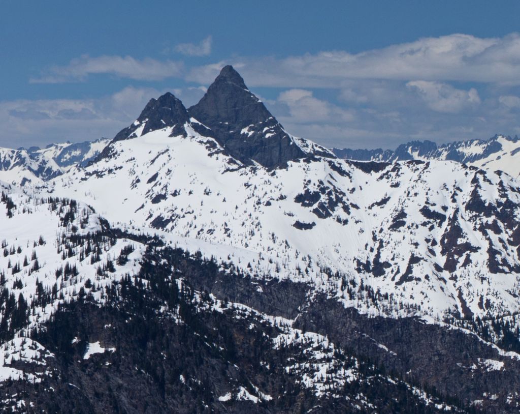
Agnes Mountain is a dramatic, but relatively unknown, peak in the North Cascades of the US state of Washington. It is not of regionally high elevation, but it rises steeply from low footings; Beckey calls it "an immense Matterhorn-shaped massif." For example, its north face drops 1,800 feet (549 m) from the summit to Agnes Creek in only 1.5 miles (2.4 km).
Agnes Mountain was climbed first in 1936, by W. Ronald Frazier and Dan O'Brien. They ascended from the West Fork of Agnes Creek. The second ascent was not until 1969. The recommended route in Beckey's guide first follows the Northeast Ridge of nearby Asa Peak, then traverses to the south ridge of Agnes, which involves some short technical sections (up to class 5.6).
Due to its location deep in the North Cascades, its difficult approaches, and the fact that it is not particularly high, Agnes is seldom climbed. Beckey notes that "only fourteen parties succeeded by 1987."
By elevation Agnes Mountain is
# 67 out of 362 in Chelan County # 37 out of 128 in Glacier Peak Wilderness
By prominence Agnes Mountain is
# 42 out of 362 in Chelan County # 98 out of 760 in Okanogan-Wenatchee National Forest # 22 out of 128 in Glacier Peak Wilderness
We use GPS information embedded into the photo when it is available.
3D mountains overlay
Adjust mountain panorama to perfectly match your photos because recorded by camera photo position might be imprecise.
Move tool
Rotate tool
Zoom
More customization
Choose which peak labels should make into the final photo and what photo title should be.
Next
Photo Location
Satellitte
Flat map
Relief map
Latitude
Longitude
Altitude
OR
Latitude
°'''
Longitude
°'''
Apply
Register Peak
Peak Name
Latitude
Longitude
Altitude
Register
Teleport
PeakVisor
This 3D model of Sagarmatha National Park in Nepal was made using the PeakVisor app topographic data. The mobile app features higher precision models worldwide, more topographic details, and works offline. Download PeakVisor maps today.
Download OBJ model
PeakVisor
The download should start shortly. If you find it useful please consider supporting the PeakVisor app.
PeakVisor for iOS and Android
Be a superhero of outdoor navigation with state-of-the-art 3D maps and mountain identification in the palm of your hand!