
Scan the QR code and open PeakVisor on your phone
Superior National Forest has 36 named peaks. The highest is Eagle Mountain at 701 m. Other notable peaks include Peak 2266, Misquah Hills, highest Peak and Misquah Hills.
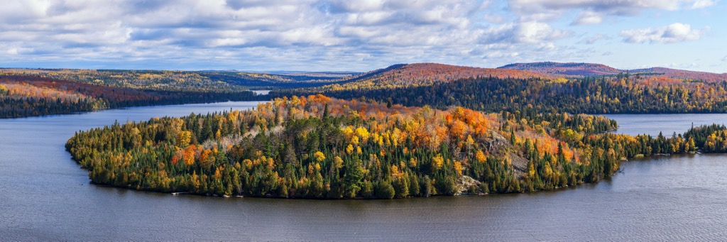
Superior National Forest is located in the northern part of the US state of Minnesota. Covering close to 4 million acres (1.6 million hectares) of terrain, the national forest includes over 1,500 mi (2,400 km) of canoe routes in the Boundary Waters Canoe Area Wilderness and 36 named mountains. The highest and most prominent mountain in the forest is Eagle Mountain (2,300 ft/701 m), which is also the tallest point in the state.

Superior National Forest is located in the Arrowhead Region of northern Minnesota. It also happens to be the largest national forest in the US that’s situated to the east of the Mississippi River.
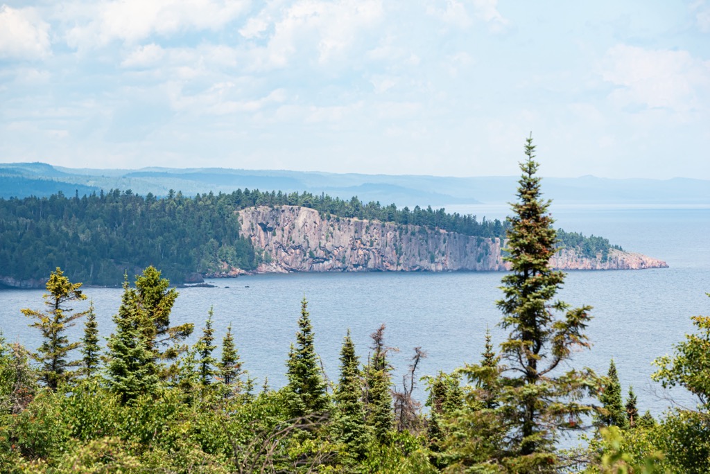
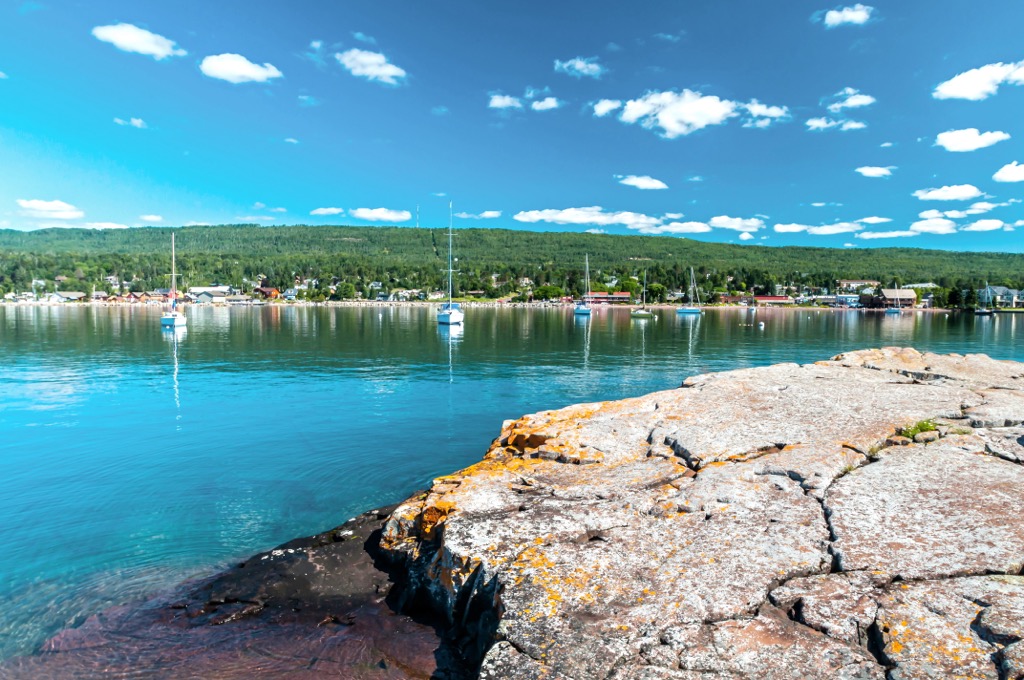
The Canadian province of Ontario borders the national forest to the north. Lake Superior runs along the eastern boundary of the national forest and Voyageurs National Park lies to the northwest.
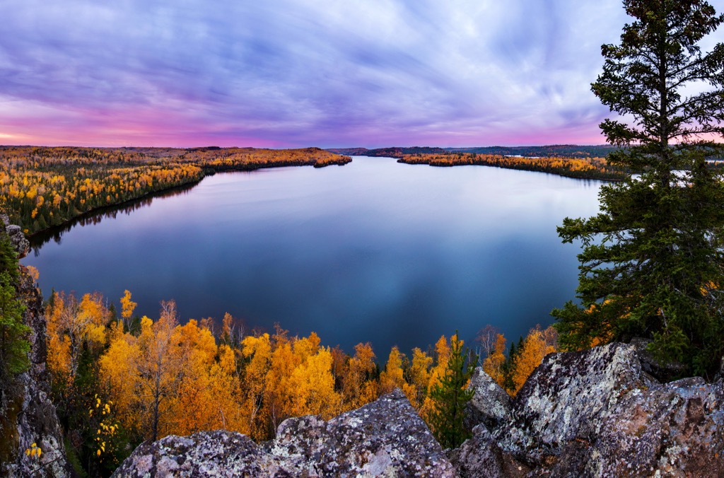
Established in 1909, the national forest covers nearly 4 million acres (1.6 million hectares) of terrain and encompasses the 1-million acre (400,000-hectare) Boundary Waters Canoe Area Wilderness. Voted by National Geographic Traveler as one of the “50 Places of a Lifetime,” the wilderness area is home to around 1,500 miles (2,400 km) of canoe routes and it sees nearly 200,000 visitors each year.
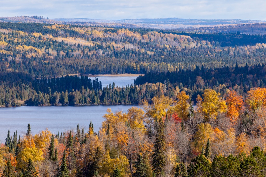
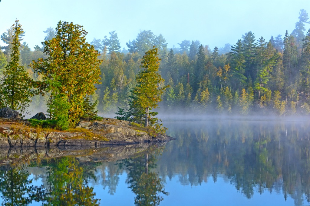
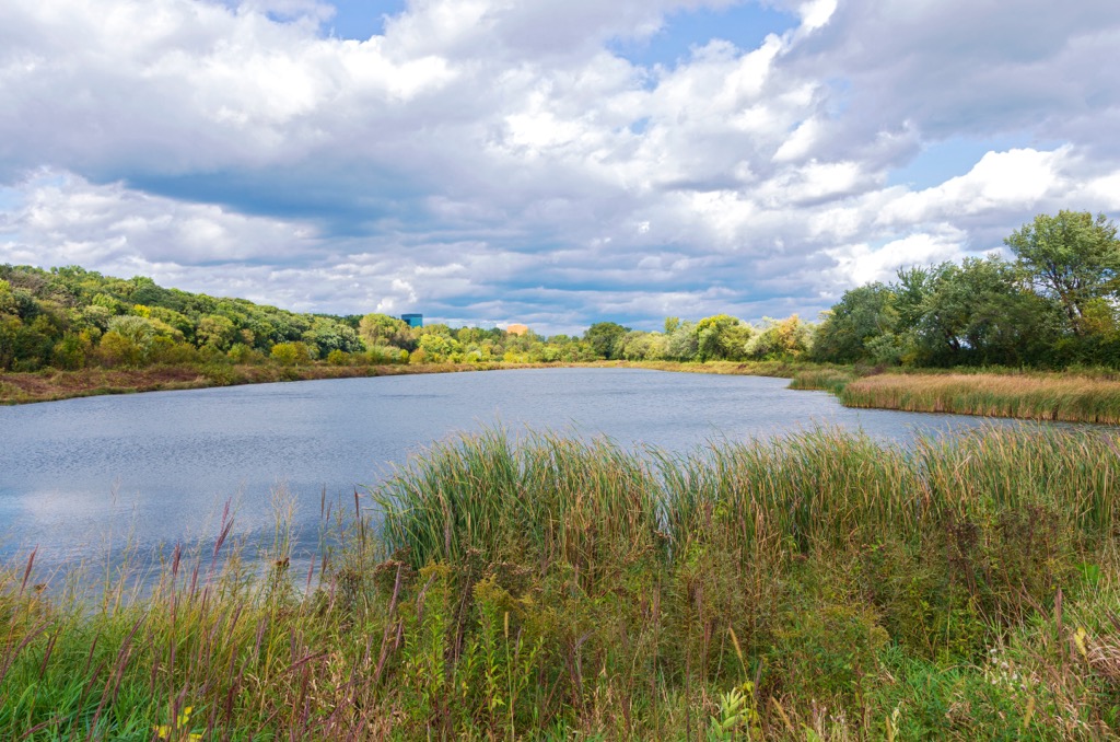
The forest contains more than 2,000 lakes and streams as well as the Sawtooth Mountains and the Misquah Hills where Eagle Mountain is located. It is divided into five ranger districts—Gunflint, Tofte, Kawishiwi, Laurentian, and LaCroix—and its headquarters are located in Duluth.
The landscape of Superior National Forest is part of the Canadian Shield (Laurentian Shield), a large, U-shaped region with extensive exposed Precambrian rock that extends from Lake Superior to the Arctic Islands.
Granites make up the central parts of the forest while basalts and rhyolites form the shore of Lake Superior and the Sawtooth Mountains. Iron ore, stromatolites, and breccias that originated from a meteor strike in Sudbury, Ontario, are also present in the region.
The area’s numerous lakes developed in depressions made in eroded bedrock. During the last glacial maximum, as glaciers scraped away the softer rock in the region, they left behind indentations as well as exposed ancient bedrock that is often overlaid by thin, gravelly soil.
In 2008, legislation was drafted to sell 6,700 acres (2,700 hectares) of the national forest to a Canadian mining company interested in mining copper, nickel, platinum, and palladium. However, the bill was met with strong opposition from environmental groups and was not passed.
Superior National Forest is covered primarily by boreal forest, also known as taiga, and mixed conifer-hardwood forests, especially in the northern parts of its territory. You can also find some deciduous forests in the southern part of the area.
The primary conifer species found in the national forest include pine, fir, and spruce. Common deciduous trees in the region include mountain ash, maple, aspen, oak, and paper birch. Water lilies and wild rice grow abundantly in the ponds and lakes of the national forest, too.
Walleye, northern pike, smallmouth bass, and four types of trout (lake, brook, rainbow, and brown) live in the lakes and streams of Superior National Forest.
Meanwhile, white-tailed deer, moose, Canadian lynx, black bears, and gray wolves are key mammal species that live in the national forest. Minnesota also has the highest population of gray wolves in the lower 48, and researchers estimate that there are between 300 and 400 gray wolves living in the national forest.
Superior National Forest also supports 163 species of nesting birds. Bald eagles, the common loon, and several species of raptors and waterfowl are commonly spotted in the national forest.

Humans have lived in the region that is now Superior National Forest since the end of the last glacial maximum about 11,000 years ago.
Over the course of prehistory in the region, the Paleo Indians hunted big game, the Archaic peoples used tools made of native copper while adapting to a warming climate, and the people of the Woodland culture developed the use of pottery, new arrow point styles, dugout canoes, and wild rice as a dietary staple.
The area that is now part of the national forest is also part of the traditional territory of many tribal nations. In particular, the Assiniboine, Eastern Sioux, Cree, and Ojibwe have ancestral ties to this region.
The fur trade ushered in two eras of European involvement in the area. The French came first and traded in the region from 1680 to 1761. In exchange for animal pelts, winter foods, canoes, and snowshoes from local tribes, the French traded guns, cloth, kettles, and tobacco.
The British took over the fur trade in the region from 1765 to 1870. After 1870, the fur trade declined and other industries like fishing, mining, shipping, and lumber grew more dominant in the region.
In 1854 and 1866, bands of Ojibwe ceded large pieces of land to the US government in exchange for reservations and hunting and gathering rights. In the late 1800s, the passage of the Dawes Act led to the forced assimilation of Indigenous people across the US. As part of the Dawes Act and other subsequent measures, Indigenous people were only given US citizenship if they agreed to give up their lands in exchange for smaller (often agriculturally infertile) land plots.
Around this same time, many Indigenous children were forcibly removed from their families and communities and sent to residential schools. At these schools, young children were forcibly assimilated into European-American culture and were not allowed to practice their own cultures and traditions or speak their own languages.
As Indigenous people were forcibly removed from the region, many homesteaders started to arrive in the area that’s now part of Superior National Forest. Homesteading claims started to peter out by about 1900, at which point big pine timber logging became a major industry in the region.
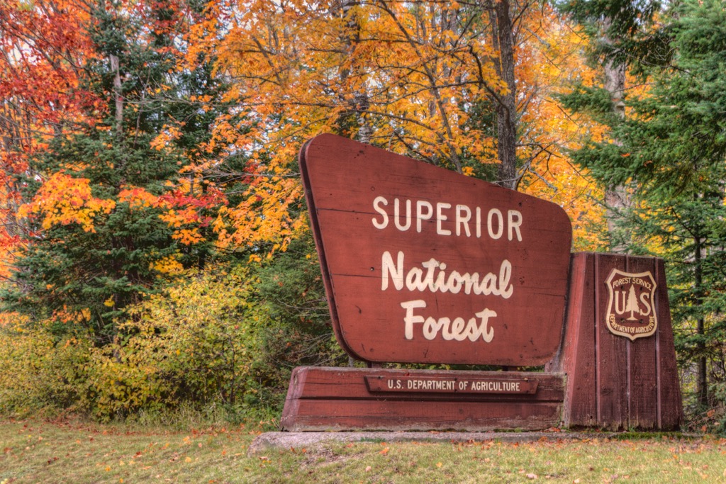
Superior National Forest was established in 1909 as part of a presidential proclamation by Theodore Roosevelt. Originally, the forest covered an area of 644,114 acres (260,664 hectares), most of which was heavily logged or burned and was unwanted by the general public. Since then, the forest has nearly quadrupled in size to reach the acreage that it has to this day.
Boating, canoeing, and fishing are easily the most popular activities in Superior National Forest, so there aren’t as many hiking trails in the region as you might find in other similar areas of public land.
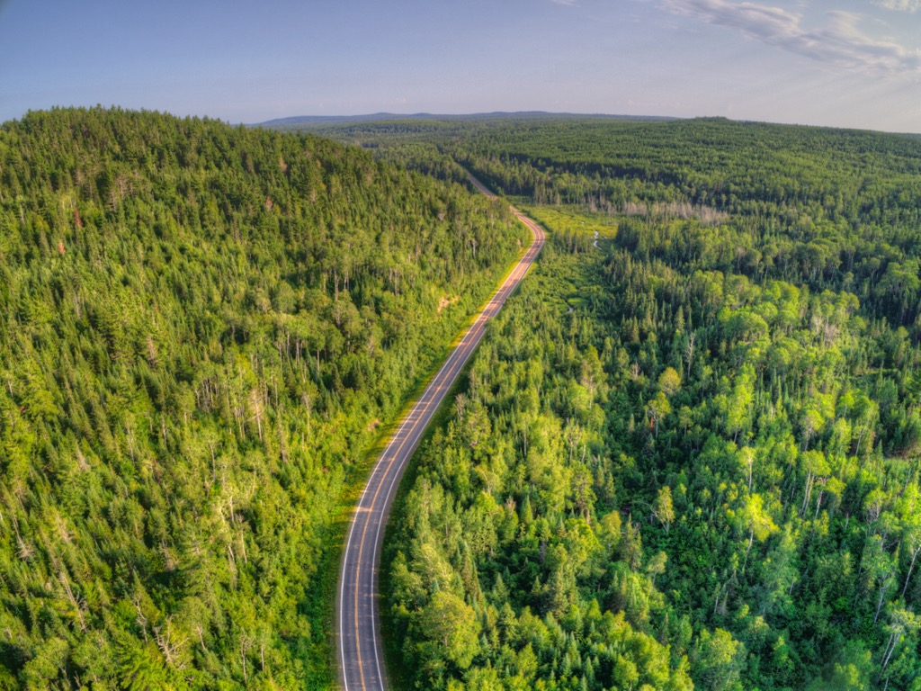
However, recreationists can still enjoy more than 400 miles (645 km) of trails for hiking, hunting, biking, and riding in Superior National Forest. There are also three national scenic byways in the national forest that are perfect for those looking to take in the region’s beauty from the comfort of their car.
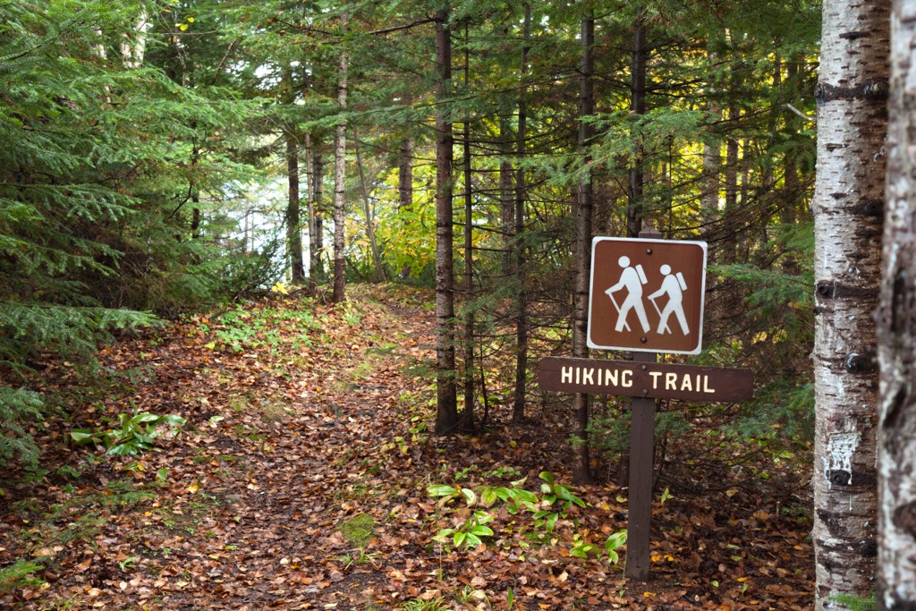
You can find a complete list of day hikes and backpacking trails on the Forest Service’s website. Here’s a quick look at some of the most popular trails in the region to get you started.
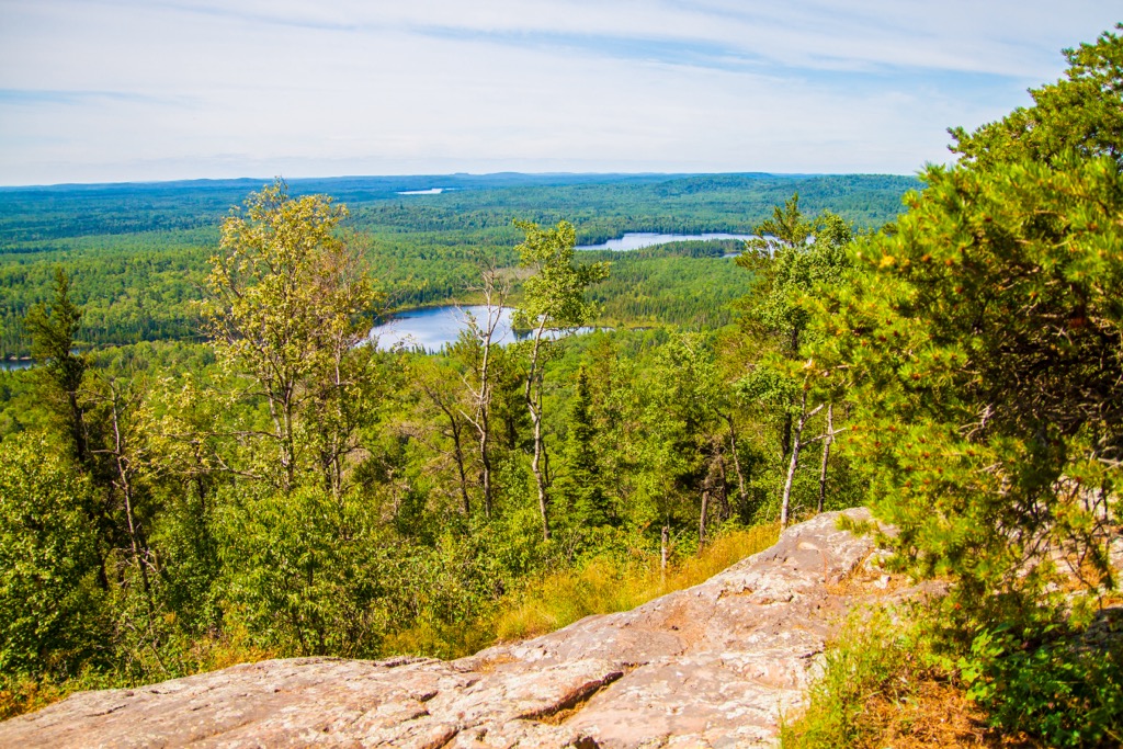
The aptly named Eagle Mountain Trail is a 3.5 (5.6 km) route that leads to the top of Eagle Mountain. The summit measures 2,300 ft (701 m) in elevation, making it the highest point in Minnesota.
Most of the trail lies within the Boundary Waters Canoe Area Wilderness and is maintained as a wilderness trail (meaning it has narrower paths with more rocks and roots). It is remote and doesn’t have easy access for medical teams in the event of an emergency, so it is only suitable for experienced hikers.
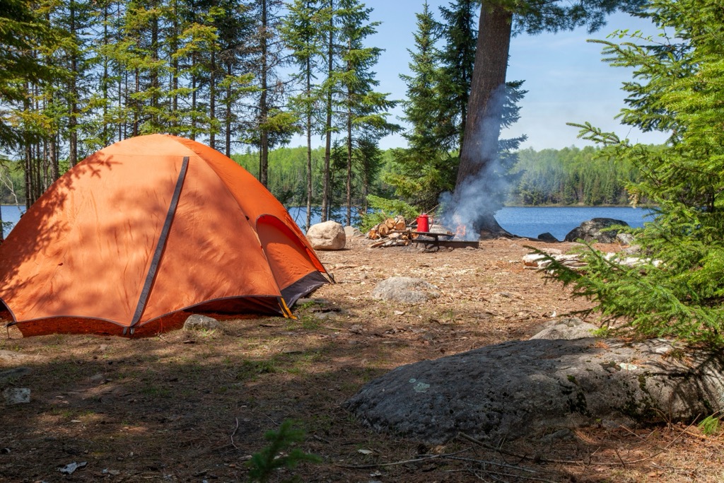
If you are only day-hiking in the wilderness area, you can typically fill out a self-issue permit at the trailhead kiosk. Those planning to camp in the wilderness will usually need to get an overnight permit depending on the season. You can get more up-to-date information about the permits you need for a hike in the wilderness area at Recreation.gov.
The Hogback Lake Area includes a 5 mi (8 km) trail that passes by six lakes and is fairly popular among hikers. In the area, there are options for both day hikes and short backpacking trips as there are five backcountry campsites located along the trail system.
Additionally, the area is home to a rustic campground with three sites as well as a boat launch and fishing pier. Note that there are no services available at the campground and all of the lake water should be treated before consumption.
You can get more information about the Hogback Lake Area at the Forest Service’s website.
The Carleton Peak Trail is a 2 mi (3.2 km) one-way hike to the summit of Carleton Peak. At the summit, you can often get great views of Lake Superior if the weather cooperates.
The trail begins with a gradual incline but becomes steep as you near the summit. There are some steep cliffs near the top, too, so people traveling with small children should take care and should perhaps seek out other hiking opportunities instead.
There are many campsites located within Superior National Forest, but there are also a number of major cities that are located relatively close by, too. For example, Duluth is situated about 80 mi (130 km) away from the forest and the Twin Cities are located around 235 mi (380 km) from the national forest, too.
Here’s a quick look at some of the main cities and towns in the area around Superior National Forest.
Duluth is a city with a population of around 85,000 people. This charming city is located on the banks of Lake Superior, and it offers incredible opportunities for fishing, boating, and canoeing.

The city itself is vibrant as it boasts many museums, galleries, and live music venues for visitors to explore. Diners can choose from a diverse array of restaurants, and those looking to spend the night in the city can enjoy a selection of hotels, B&Bs, rentals, and campsites.
The neighboring urban areas of Minneapolis and St. Paul make up the so-called Twin Cities, which have a combined population of around 3.5 million people. Visitors can explore the cities’ many food halls and live music venues.

For those who like shopping, the Twin Cities is home to Mall of America, the nation’s largest mall. The cities also boast a large zoo and many museums. Just outside the city, you can also find a plethora of opportunities for kayaking, hiking, and biking.
Plus, the Twin Cities are home to Minnesota’s largest airport (Minneapolis–Saint Paul International Airport), so it’s a good place to fly into if you’re traveling from further afield. In the Twin Cities, you can also find an array of dining and accommodation options to suit nearly any budget.


The highest peak in Superior National Forest is Eagle Mountain, at 701 m.
Notable peaks in Superior National Forest include Eagle Mountain, Peak 2266, Misquah Hills, highest Peak, Misquah Hills and Lima Mountain.


