Scan the QR code and open PeakVisor on your phone
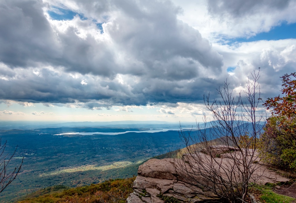
The Sundown Wild Forest is an outdoor recreation destination situated in the southern region of the US state of New York. The wild forest is located in the southern portion of Catskill Park. The tallest mountain and most prominent mountain in the wild forest is Ashokan High Point at 3,081 feet (939 m) tall with 1,407 feet (429 m) of prominence.
The Sundown Wild Forest is located in the southern region of Catskill Park in New York. The terrain is marked by rolling forested hills, ridgelines, valleys, and various bodies of water.
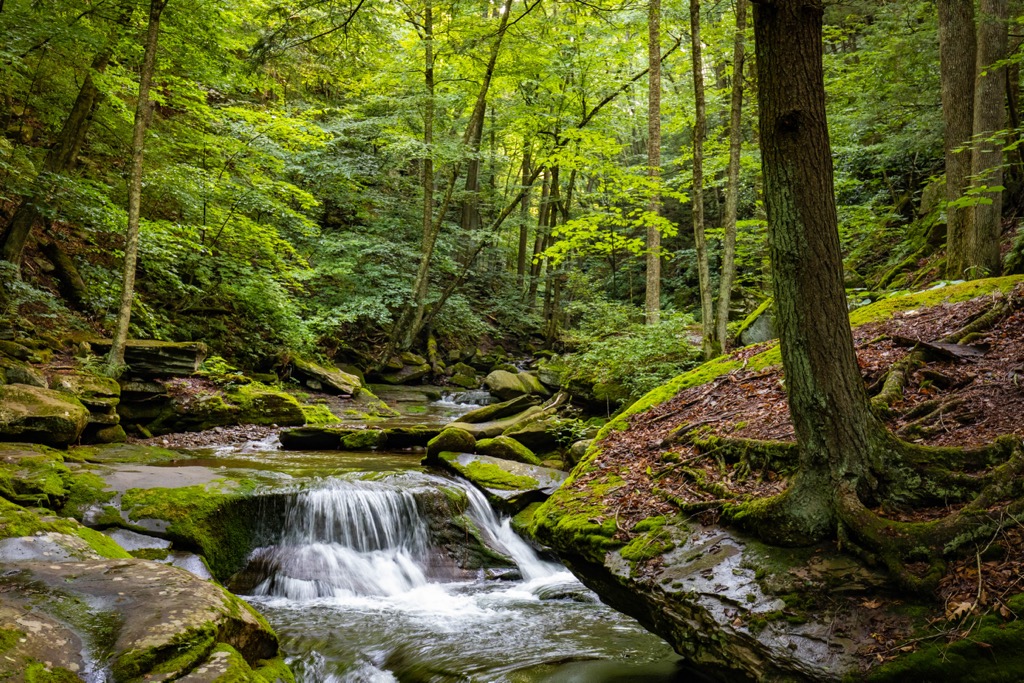
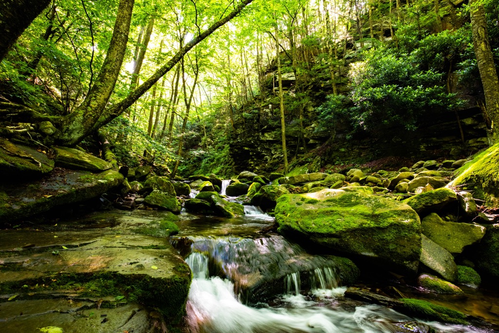
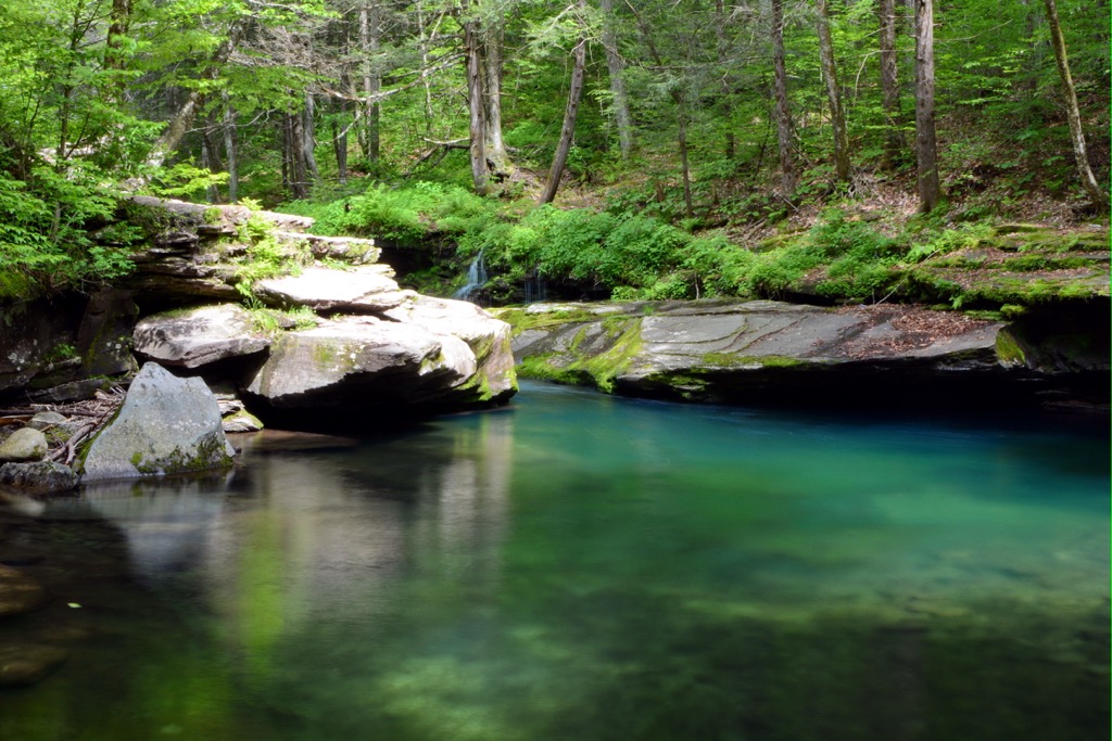
The noncontinuous wild forest encompasses 30,100 acres (12,181 ha) of land within the Catskill Mountains. Amidst the forested landscape lie numerous waterfalls, streams, and viewpoints, making the region ideal for hiking.
This protected region covers land in both Ulster and Sullivan counties. The Ashokan Reservoir lies along the eastern edge of the forest with the Hudson River located further east. The Rondout Reservoir and Neversink Reservoir are both situated in the southern stretches of the wild forest.
Prominent bodies of water in the region include Rondout Creek, Sundown Creek, Peekamoose Lake, Vernooy Kill, Trout Creek, and Sugarloaf Brook. While a majority of the landscape is densely forested, some peaks feature fire towers that provide views of the surrounding region.
Land directly north of the wild forest features a series of rugged ridgelines and peaks, primarily trending in a north to south direction. Terrain south of Sundown Wild Forest is relatively flat, featuring low rolling hills, wetlands, and creeks.
Additionally, the Sundown Wild Forest is located near a number of other parks and destinations for outdoor recreation. Directly south lies Vernooy State Forest and the Wurtsboro Ridge State Forest. Sections of Catskill Park extend to the northwest along with Willowemoc Wild Forest. Both Slide Mountain and Big Indian Wildernesses are situated to the north while the Phoenicia - Mount Tobias Wild Forest is to the northeast.
The Sundown Wild Forest is located within Catskill Park, which spans roughly 700,000 acres (283,280 ha) across the surrounding region. The park boundaries are roughly defined by the Catskill Mountains.
Though these ridgelines are often compared to the nearby Adirondack Mountains, the two are not geologically related. Despite their name, the Catskill Mountains are not even a mountain range but rather an eroded plateau. This geologic province is part of the Allegheny Plateau, a subsection of the larger Appalachian Mountains.
Roughly 350 million years ago, this region was part of a vast river delta. The ancient Acadian Mountains once laid to the east of this river delta, with the various bodies of water slowly eroding them, carrying mineral deposits throughout the region.
These layers of mineral deposits eventually folded and compacted to form the layers of rock throughout the region. The Catskill Mountains, or rather the plateau of the region, were eventually uplifted through tectonic forces and were slowly eroded over the course of millions of years.
Terrain visible today showcases the vast amounts of erosion that have taken place. The various streams, rivers, and creeks continue to erode the landscape, leaving behind the rolling ridgelines and hills.
Major peaks that are located in the Sundown Wild Forest include Ashokan High Point, Little Rocky, Denman Mountain, Samson Mountain, and Red Hill.
Flora and fauna found in the Sundown Wild Forest is similar to that found throughout the surrounding Catskill Park.
Larger animals in the region include bobcat, cougar, coyote, deer, black bear, and fisher. Other animals in the region include rattlesnake, squirrel, chipmunk, and rabbits. Waterways in the region support populations of various species of trout.
Some of the native tree species in the region include red maple, striped maple, sugar maple, yellow birch, and balsam fir. Low growing plants include wild strawberry, starflowers, trout lilies, early saxifrage, Eastern red columbine, and flowering dogwood among various other species.
The land within and surrounding the Sundown Wild Forest has been inhabited for thousands of years. Many tribes historically lived throughout the region, though the Mahican and Esopus are the most prominent peoples with ancestral ties to this land.
The protected region marks some of the western stretches of the Mohicans ancestral lands while the Esopus people lived throughout present day New York and New Jersey. The first recorded contact between these Indigenous peoples and the European colonizers was in 1609.
In 1652 the Esopus sold land to the Europeans though battle between the two groups broke out shortly after, with the Esopus Wars lasting from 1659 to 1663. Increased presence of Dutch and French settlers drastically affected the tribes of the region.
Besides the increased population, the settlers also brought infectious diseases, such as smallpox and measles. These diseases decimated the Indigenous peoples who had no natural immunity to the sicknesses.
During the 1680s, the Mohicans began to retreat southeast to avoid conflict with the powerful Mohawk tribe during the Beaver Wars. Many of the Mohican tribal members ended up in present-day Wisconsin. After the American Revolutionary War, many Mohican returned to join the Iroquois Oneida whose reservation was located in central New York, where the Oneida granted them roughly 22,000 acres.
The Indian Removal Act of 1830 forcibly removed both the Mochicans and Esopus peoples from the region, forcing them onto reservations in present-day Wisconsin. The reservation was deemed as “inhospitable land” and was far away from the ancestral lands of both peoples.
Today, descendants of these tribes are part of the Stockbridge-Munsee Band of Mohican Indians and Munsee-Delaware Nation, while some are part of the various Oneida Tribes and Nations.
Widespread logging, quarrying, harvesting, hunting, and trapping, drastically reduced the biodiversity of the land surrounding Sundown Wild Forest. Catskill Park was eventually established in 1885.
Over the following decades, numerous reservoirs were constructed throughout the region to help address the growing water needs of the surrounding population. Construction of trails, along with opportunities for fishing, camping, and hunting, helped grow the tourism industry throughout the region.
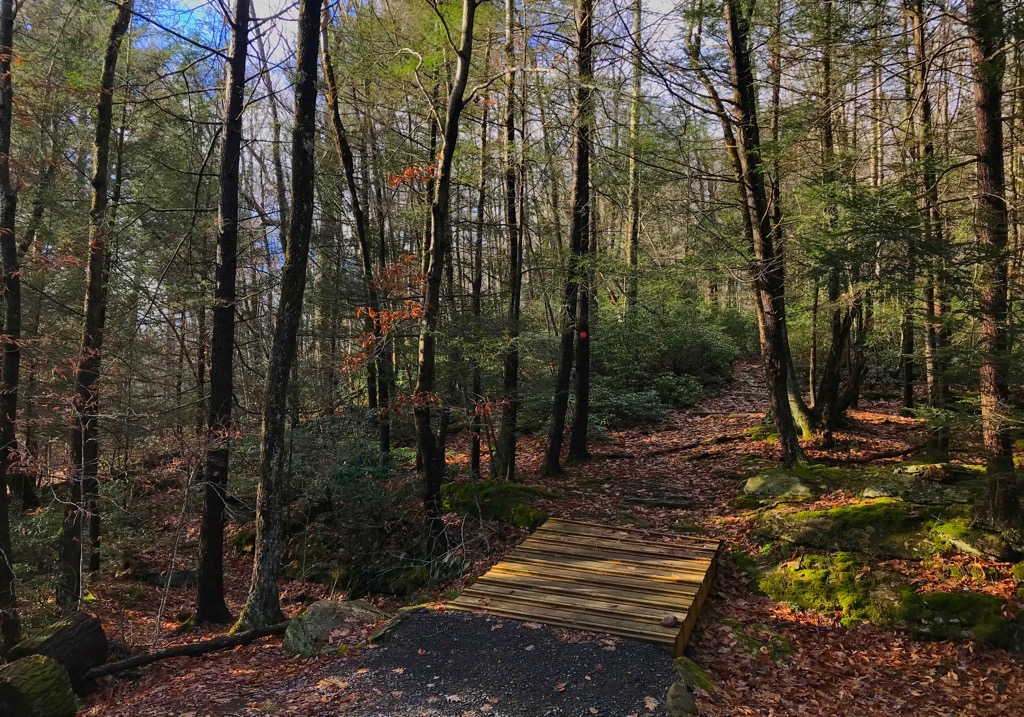
The Sundown Wild Forest is home to a number of wonderful trails for outdoor recreation. Here are a few of the trails in the forest that are worth checking out during your next visit.
This out and back trail is located in the northern section of the wild forest. The route climbs steadily through the forested landscape and is accessible throughout a majority of the year. Once hikers reach the summit, they have the option to climb up the Red Hill Fire Tower for unobstructed views of the surrounding peaks, ridgelines, and hillsides. The out and back trail is 3.6 miles (5.8 km) long and features 1,020 feet (311 m) of elevation gain.
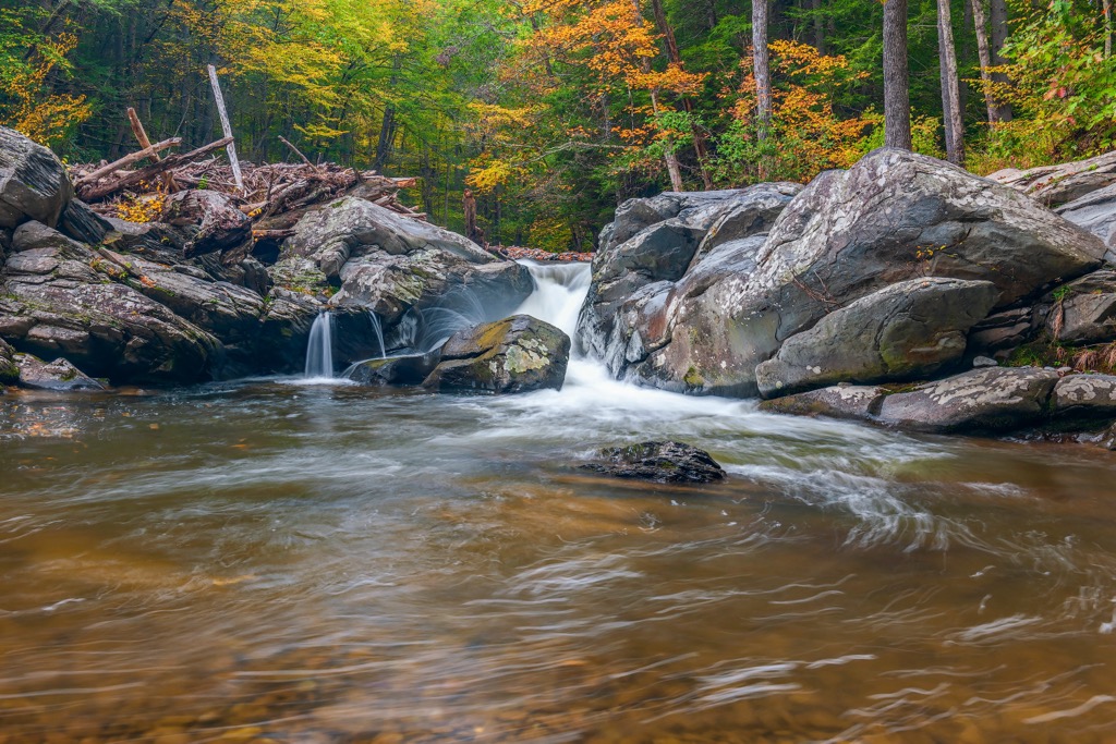
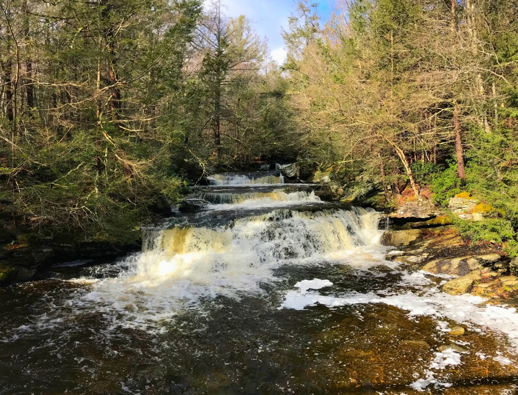
This hiking route showcases one of the most stunning falls in the region. The trail climbs through the forested landscape and is quite rocky throughout. Near the falls, the route begins to flatten out, opening up to the series of falls cascading down the rocky terrain. During the winter months hikers can witness the falls while portions are frozen with ice. Round trip this route is 3.5 miles (5.6 km) long and features 656 feet (200 m) of elevation gain.
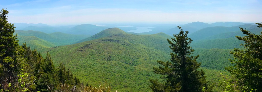
Ashokan High Point marks the tallest and most prominent peak in the Sundown Wild Forest. This popular route follows along the Kanape Brook, climbing gently throughout. From the summit, hikers have views of the surrounding forested hillsides and nearby ridgelines. The route then loops around the summit before descending back to the trailhead. The loop trail is 9.1 miles (14.6 km) long and features 2,148 feet (655 m) of elevation gain.
Looking for a place to stay near the Sundown Wild Forest? Here are some of the best cities and towns to check out in the region.
The city of Kingston lies east of the wild forest, along the eastern edge of Catskill Park. Situated along the western banks of the Hudson River, the city is home to 24,000 residents. Kingston is rich with history, marking the first capital of New York in 1777 before it was burned by the British following the Battles of Saratoga.
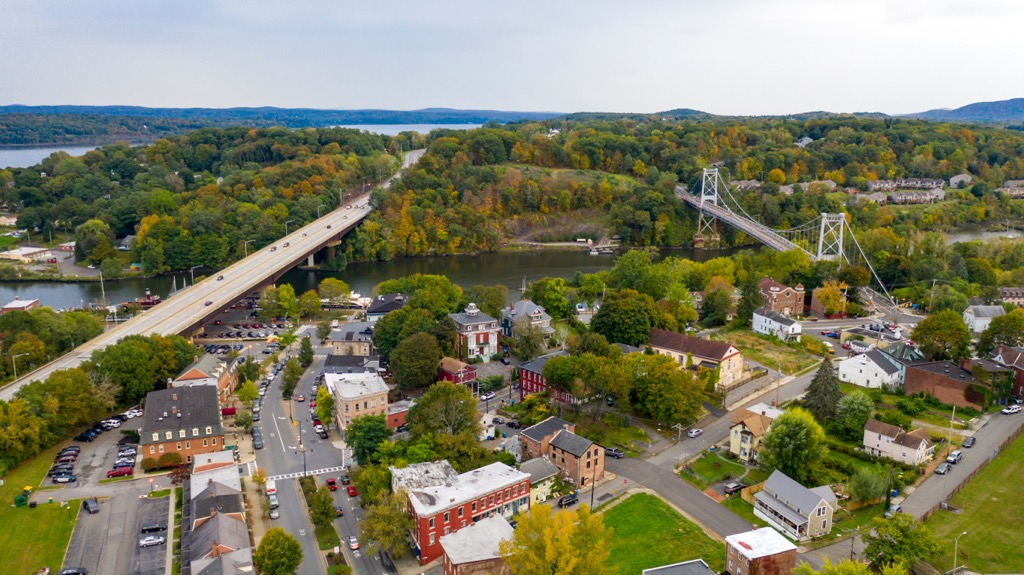
Besides its close proximity to Catskill Park, Kingston is known for its historical significance, architecture, and a thriving arts scene. Local shops and restaurants line the quaint downtown streets while both Esopus and Rondout Creeks cut through the city.
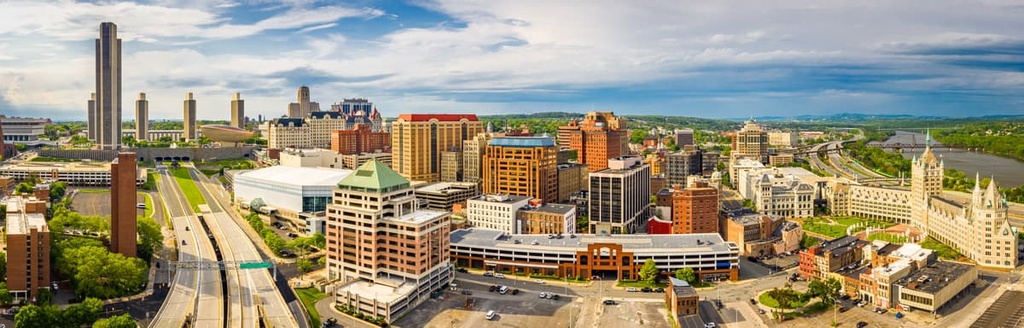
Albany lies northeast of the wild forest, marking the closest major city. Founded over four centuries ago, Albany marks one of the oldest cities in the region. Home to roughly 100,000 residents, Albany marks the capital city of New York.
The long history of the region can be seen through the numerous historical sites, districts, and buildings of the region. The city is home to the New York State Museum, Albany Institute of History and Art, 57 National Register of Historic Places, and five National Historic Landmarks.
Amidst this historic city lies a thriving arts scene, craft breweries, local restaurants, and an emerging tech industry. The city provides easy access for exploring both Catskill Park and Adirondack Park.