Scan the QR code and open PeakVisor on your phone
Located in central Spain, just north of Madrid, Parque Nacional de la Sierra de Guadarrama (English: Sierra de Guadarrama National Park) is a swath of protected land that contains 115 named mountains, the highest and most prominent of which is Pico de Peñalara (2,428m/7,966ft). Sierra de Guadarrama National Park is located within the autonomous communities of Madrid and Castilla y León as well as the provinces of Segovia and Áliva.
With a total area of 340 square kilometers (131.3 sq. mi), Sierra de Guadarrama National Park is the fifth-largest national park in all of Spain. Guadarrama was officially designated a national park on June 26, 2013, making it one of the newest parks in the country.
The park was originally created to help protect the eleven different ecosystems contained within its boundaries. Sierra de Guadarrama National Park is also home to the only example of a high Mediterranean mountain ecosystem with harsh, cold winters and cool, dry summers in either Spain or Portugal.
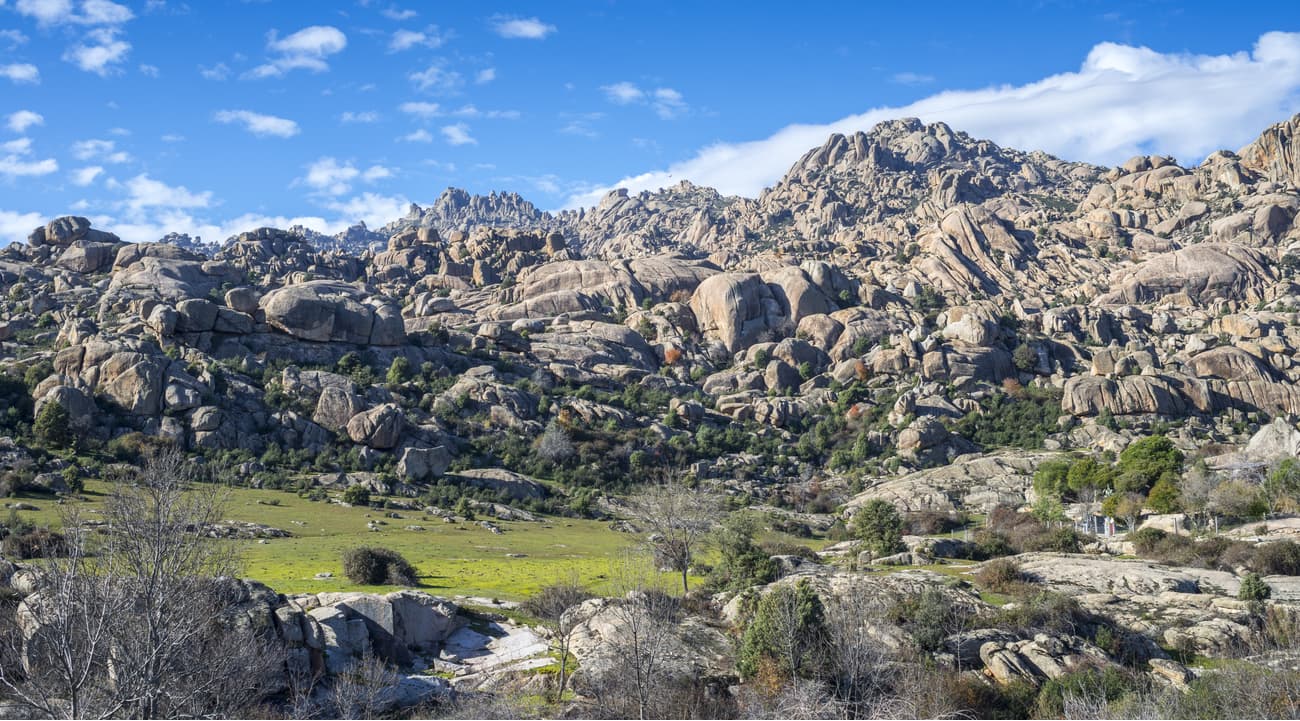
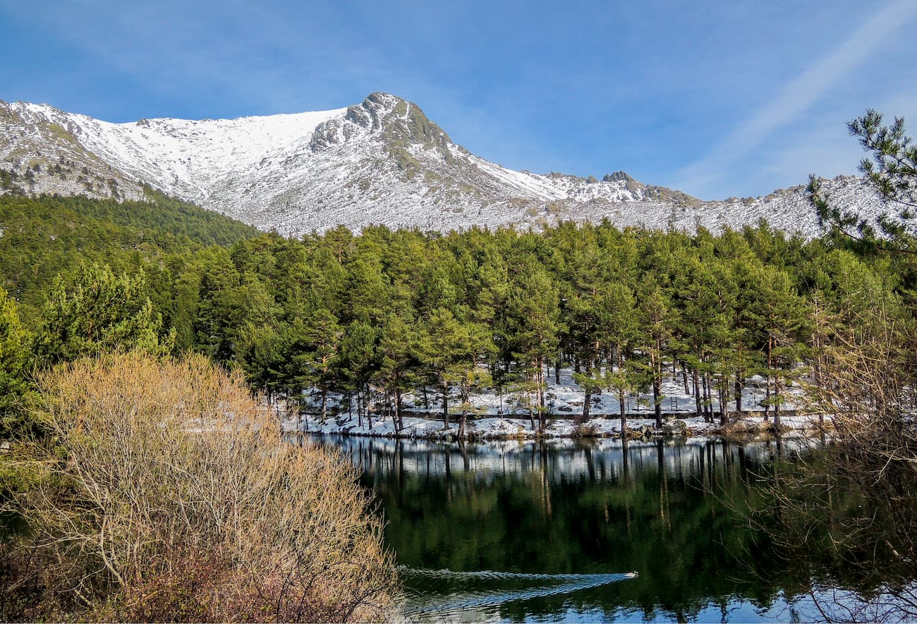
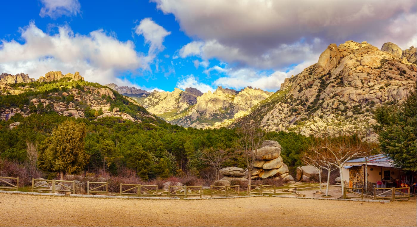
At lower elevations in the park, visitors can see thick Holm oak forests that transition into Pyrenean oak forests as you make your way into the mountains. In the alpine regions, Sierra de Guadarrama National Park is dominated by rocky slopes, montane grasslands, alpine meadows, fringed juniper, and Spanish broom shrubs.
Within the park, there are over 1,200 different species of animals, 13 of which are endangered. Guadarrama is home to at least 135 species of birds, including the Spanish imperial eagle and the Eurasian black vulture, as well as an abundance of mammals, such as wildcats, European roe deer, wild boar, and the European badger. There are also dozens of reptiles and amphibians within the park that are endemic to the Iberian peninsula and are found nowhere else on Earth.
Geologically, the mountains of Sierra de Guadarrama National Park are part of the larger Castille Ranges (Spanish/Portuguese: Sistema Central/Cordillera Central), which divide the drainage basins of the Tagus and Douro Rivers in Central Spain and Portugal. The mountains themselves were mostly built during the Alpine orogeny, which also built the Alps, Caucasus, the Karakoram, the Hindu Kush, and the Himalaya some 80-25 million years ago.
However, the rocks in Sierra de Guadarrama National Park are of diverse origins. Some of the metamorphic rocks (including gneisses and metamorphosed granites) in the region date back at least 500 million years to the Hercynian orogeny while the sedimentary rocks in the park are much younger - about 252-72 million years old.
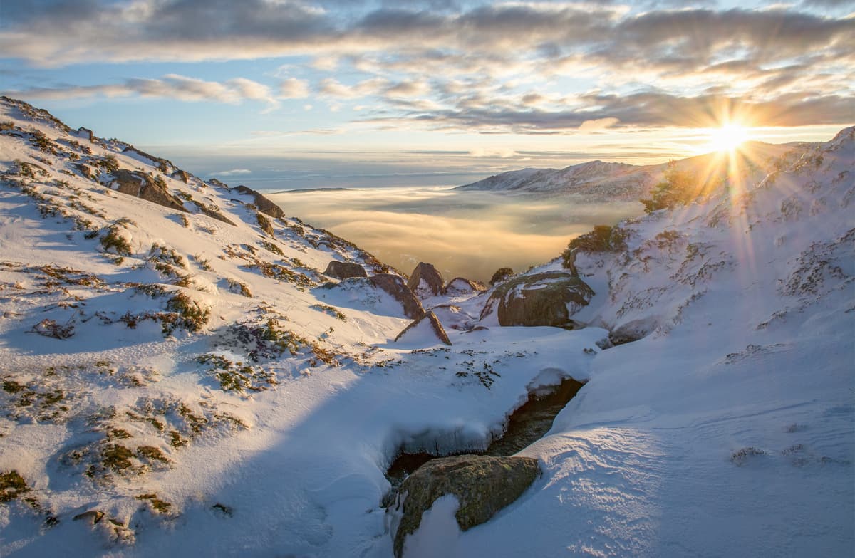
Additionally, the mountains in the park owe much of their current shape to the glaciers that covered their slopes for millions of years during the Pleistocene glaciation that began 2.5 million years ago. Although the glaciers themselves are long gone, the mountains of Guadarrama still show evidence of their icy past, thanks to the many cirques and rounded peaks in the area.
Due to its proximity to Madrid, Sierra de Guadarrama National Park is exceptionally popular. The park is surrounded by large cities and has many small villages near its borders. Plus, since the mountains in the region form a natural barrier between the southern and northern Iberian peninsula, there are many roads and railways that pass through the range.
Thankfully, both Sierra de Guadarrama National Park and the nearby High River Basin Regional Park of the Manzanares (Spanish: Parque Regional de la Cuenca Alta del Manzanares) are both formally protected from any significant further development. To this day, both parks remain highly popular among locals and tourists, alike, who flock to the mountains for adventure and respite from the hustle and bustle of city life.
Sierra de Guadarrama National Park has dozens of hiking trails that are perfect for visitors of different ages and abilities. Here are some of the most popular options:
Starting at Puerto de Navacerrada (Navacerrada Pass), this difficult 18.2km (11.3mi) out-and-back trail begins near the alpine ski desk hut in the Valdesquí ski resort and takes you on a steady climb to the Alto de las Guarramillas. As you walk along this ridge above 2,000m (6,560ft), you crest the top of rolling summits and get great views of the Lozoya valley and Madrid below.
From the ridge on the side of Cerro de Valdemartín, you make your way down toward Loma de Pandasco and then onward to the col on La Najarra. After this high point, you make your final descent to La Morcuera Pass before returning along the same route to the trailhead.

This 5km (3.1mi) one-way trail takes you to the summit of the highest peak in Sierra de Guadarrama National Park - Pico de Peñalara. Starting out at the Peñalara Visitor’s Center (Centro de Visitantes de Peñalara), the path starts off with an ascent to the La Gitana viewpoint (Mirador de la Gitana).
You’ll then climb up a series of switchbacks until you reach a fork in the trail. To the right, you can make your way to the Zabala Refuge but to the left is the path toward the summit. As you keep climbing, you’ll make your way to Dos Hermanas peaks (Hermana Mayor and Hermana Menor) before following the trail to the top of Peñalara.

This 5.6km (3.4mi) trail is perfect for a casual walk in Guadarrama. The trail starts 1km away from the parking lot at Canto Cochino near Manzanares El Real and takes you on a nice walk near the Manzanares river.
Along the way, you can enjoy a forest of mixed pine trees, including European black pines, as you hike through a stunning low-elevation section of the park. However, the trail gets very hot a midday in the middle of the summer, so is best hiked in the morning or evening.

Looking for a place to stay before or after a trip to Sierra de Guadarrama National Park? Check out these major cities:
Located just 30 minutes east of Sierra de Guadarrama National Park, the city of Segovia is the capital of the province of Segovia and is home to over 50,000 people. Segovia is situated at the foothills of the Castille Ranges and is famous for its many historic buildings, including a Roman aqueduct and a Gothic cathedral. The city is just a 1-hour drive or a 2-hour train from Madrid, so it’s easy to access for visitors from outside Spain.

Ávila is the capital and most populated city of the province of Ávila with over 57,000 residents. The city is located 1 hour south-west of Sierra de Guadarrama National Park and is just a 1-hour drive or 2-hour train ride from Madrid. Ávila is famous for its still-standing medieval town walls, which were declared a UNESCO world heritage site in 1985.

Madrid is the capital city of Spain and its largest city. Located to the southeast of Sierra de Guadarrama National Park, Madrid is just a 1-hour drive from the mountains, so it’s a great place to start your adventure. The city has a major international airport with connections all over the world, so you can easily fly into Madrid, rent a car, and head into Sierra de Guadarrama National Park in just a few hours after landing.