Scan the QR code and open PeakVisor on your phone
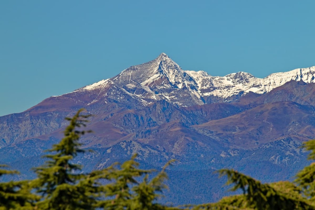
Rocciamelone is a site of community interest in the northern Italian region of Piedmont that’s recognized for its biodiversity and interesting geology. There are 10 named mountains in the area, the highest and the most prominent of which is Rocciamelone (3,538 m/11,608 ft).
Located in the administrative region of Piedmont in northwestern Italy, Rocciamelone is a protected area set along the southeastern slopes of Rocciamelone, one of the highest peaks in the Graian Alps.
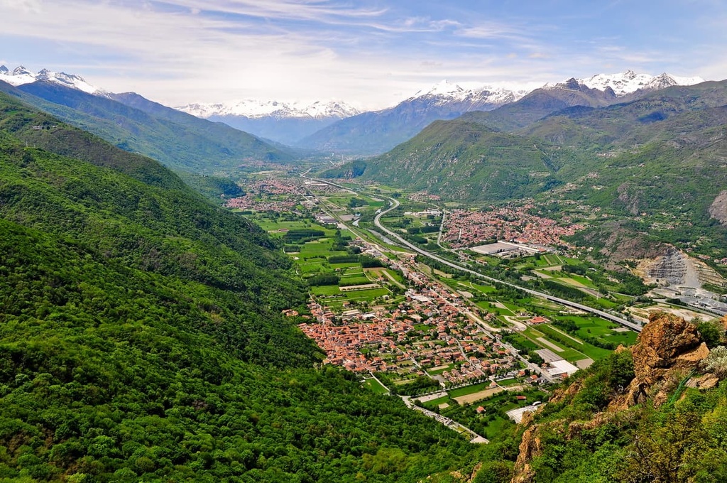
The site is located in the province of Turin and in the municipalities of Bussoleno, Mompantero, Novalesa, and Usseglio. It’s situated in the Susa Valley near the watershed that separates the Susa Valley from the Lanzo Valley. The site is also located a short distance from Italy’s border with France.
The protected area of Rocciamelone is part of the European Commission’s Natura 2000 network, which is designed to ensure the survival of Europe’s rarest and most threatened species and habitats.
Rocciamelone is located near a number of other protected areas, including Riserva naturale dell’Orrido di Chianocco, Zona Speciale di Conservazione Boscaglie di Tasso di Giaglione, and Parco naturale del Gran Bosco di Salbertrand.
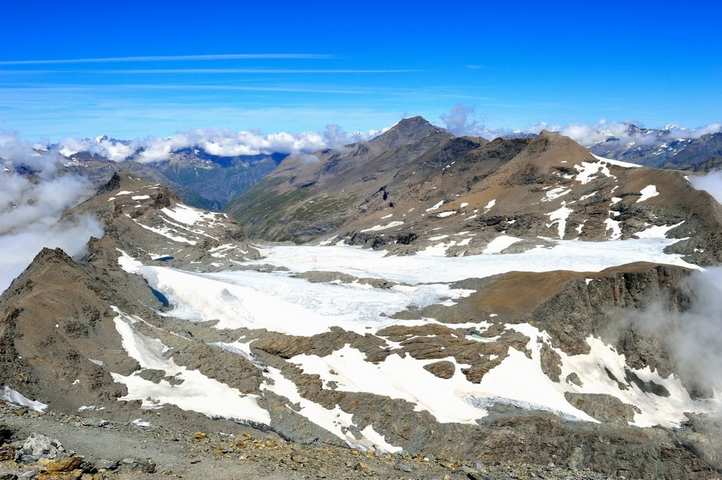
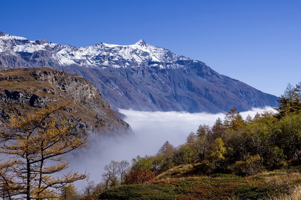
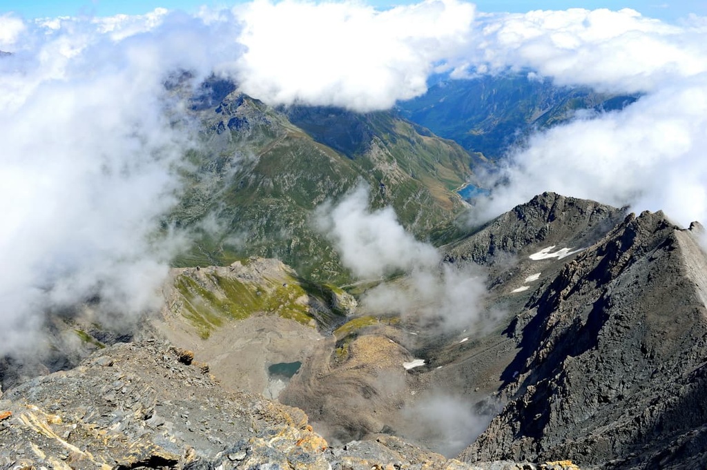
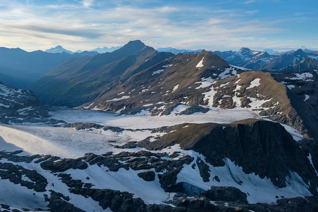
The mountain massif of Rocciamelone is characterized by the steep slopes that lead into its sharp, jagged peaks. This formation is largely the result of the glaciers of the Quaternary period, which shaped the immediate area to give it the topography that we see today.
The site has considerable elevation gain, from 500 m (1,640 ft) at the bottom to over 3,500 m (11,480 ft) at the summit of Rocciamelone.
There is a mix of rock formations in the area, though most of the region is dominated by calcareous rocks such as dolomite and limestone. There are also outcrops of greenstone and gneisses that are found in the lower elevation parts of the region.
Furthermore, dolomite and limestone appear in the area at the massif’s point of contact with the Chianocco and Foresto gorges, close to a region that’s classified as a xerothermic oasis.
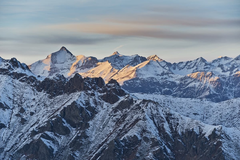
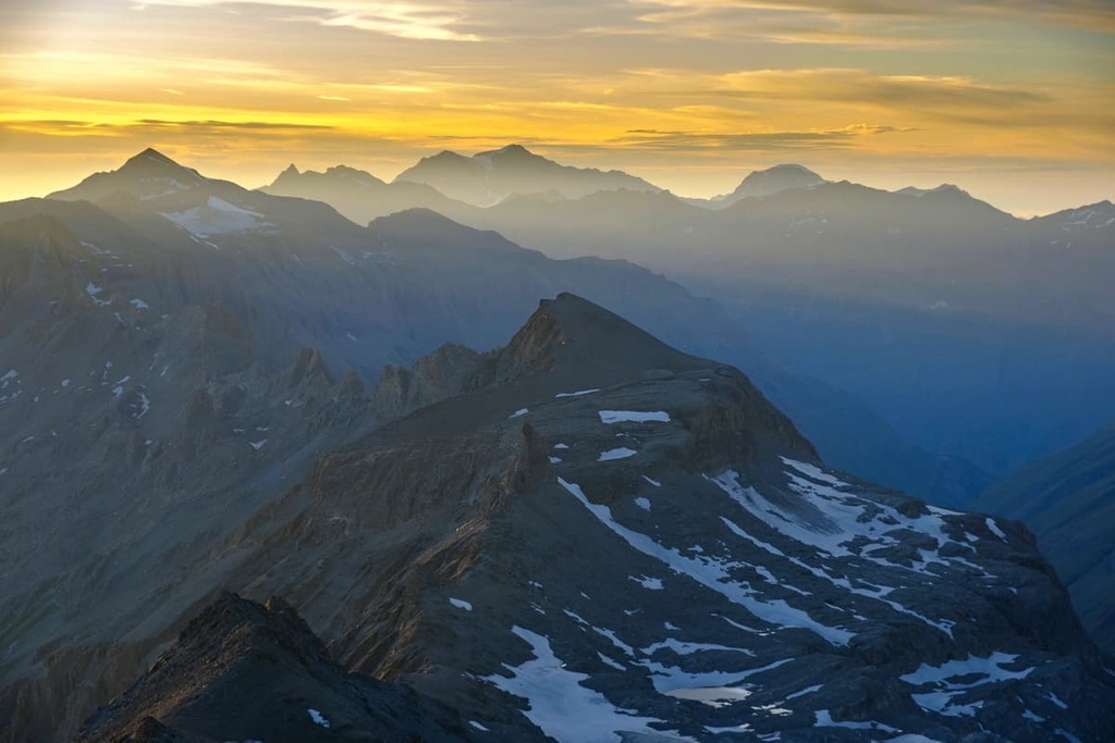
Rocciamelone is part of the Graian Alps, a section of the Western Alps that crosses Italy, France, and Switzerland and is home to Mont Blanc—the Alps’ highest peak.
The sizable differences in elevation that are present in Rocciamelone’s protected area have led a huge variety of vegetation and environments to form in the region, from sub-Mediterranean broadleaf trees to alpine meadows.
Along the lower valleys in the region, there are mixed forests of oak, beech, maple, hornbeam, ash, Scots pine, larch, and alder. Past the treeline, the site is covered in alpine and subalpine grasslands, which transition into boulders and rocks as you approach the ridgeline.
Habitats of priority interest in the area include woody grasslands with meadow brome. These areas host a rich variety of orchids and calcareous screes. Other areas of community interest in the region include larch, chestnut, and beech woodlands.
The Rocciamelone massif is also home to several species that are endemic to the Western Alps, such as the Saussurea alpina subsp. depressa, Alyssum alpestre, and Alpine speedwell (Veronica allionii). Lower in the valley, there is also an area classified as a xerothermic oasis that is home to Mediterranean species.
Typical mountain fauna such as chamois and marmots are found in the area, along with some species of community interest such as the green lizard and wall lizard. The region is also home to a few rare species, such as the weevil beetle, which is endemic to the Graian Alps, and a butterfly that’s endemic to the Susa Valley.
There are several threats to the local environment in the area in the form of fires, as well as unregulated motocross and trail activities. The Monte Rocciamelone complex is also located within the area of a much-discussed proposed tunnel for a Turin–Lyon railway line, which could cause some disruption to the region’s ecosystems.
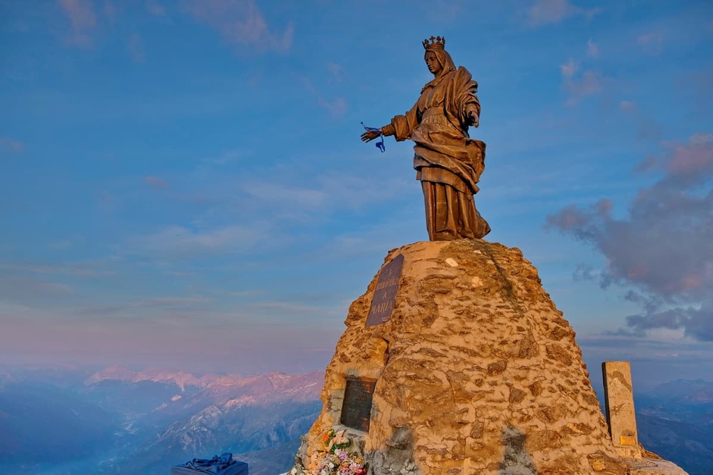
Rocciamelone is allegedly the first mountain in the world with a recorded first ascent where both the date of the first ascent and the name of the first ascensionist is documented in written texts.
The summit of the massif was first reached by Bonifacio Rotario d’Asti, a local nobleman, on September 1, 1358. He brought with him a small bronze Catholic image of the Virgin Mary as part of a vow that, if he were able to return from imprisonment by the Turks during the crusades, he would climb the highest mountain in the Alps.
The summit of Rocciamelone had in fact long been considered the highest peak in the Alps due to its prominence. We of course now know that Roccimelone is not the tallest mountain in the range (that distinction belongs to Mont Blanc), but we also have the power of modern technology to get more accurate topographical information.
That said, d’Asti’s first ascent wasn’t the first attempt to climb Rocciamelone as many knights and monks had previously tried to climb the mountain without success.
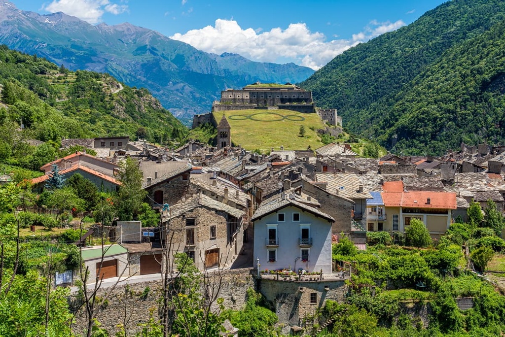
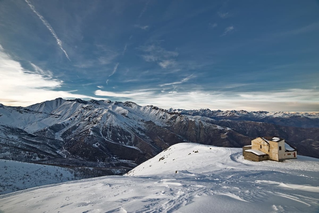
Nowadays, the Sanctuary of the Lady of Rocciamelone sits atop the summit of the massif, making it the highest sanctuary in Europe. The sanctuary was first carved into the rock on the mountain in the late nineteenth century, but it was rebuilt a number of times over the years. A pilgrimage takes place every year on August 5th and travels to the sanctuary.
There are many hikes of varying levels of difficulty in the Susa Valley and on Rocciamelone. Here are some of the best hikes in the Rocciamelone area to check out during your next trip to the region.
The best starting point to the summit of Rocciamelone is at rifugio La Riposa (2,205 m/7,234 ft). From here, you'll head for about an hour and a half toward rifugio Ca d’Asti (2,854 m/9,363 ft). This rifugio is a great place to stay as you’ll need to get up early the next day to make the three-hour trek to the summit of Rocciamelone.
The summit route on Rocciamelone isn’t particularly difficult, other than the last part where it is upgraded from an E route (Escursionisti/Hikers) to EE (Escursionisti Esperti/Experienced Hikers) and is aided by built-in ropes.
There’s a bivouac at the summit where you can sleep if necessary, but you would need to bring your own sleeping gear to keep you warm in the mountain’s typical cold nighttime temperatures.
This route can also be walked as an out-and-back day trip from rifugio La Riposa and takes around five and a half hours to complete. The best time to try this hike is from mid-June to August so you can avoid any ice on the paths.
The name for Il Sentiero Balcone translates as “The Balcony Path,” which gives you an indication of the sweeping views that you can encounter along this route. This hike is based in the Upper Susa Valley and is broken down into ten stages:
You can hike all or part of this route, making it a versatile option for visitors to the area.
Starting in Canterbury, England, the via Francigena crosses the Alps and finishes in Rome.
The second stage of this trek goes from the Monginevro Pass and travels the Susa Valley. This stage starts in Oulx and follows the route for 27 km (16 mi) before it ends in Susa, so it’s a nice multi-day trip choice for hikers in Rocciamelone.
The Grande Traversata delle Alpi (GTA) crosses the Alpine arc of Piedmont. The whole route covers 1,000 km (621 mi) over the course of 120 stages.
There are two stages that pass through the Susa Valley from Località Malciaussia di Usseglio to Susa: Stages 43 and 44. You can hike just these stages if you want to stay in the Rocciamelone area or you can travel through the region as part of a longer thru-hike on the GTA.
There are many small towns, mountain huts, and B&Bs in the area around the Rocciamelone if you’re looking for an authentic mountain experience during your travels in northern Italy. Here are some of the main towns and cities located near the massif to check out before your next trip to the region.
As it is located within easy reach of Rocciamelone, Turin is a great base to experience the Susa Valley and the wider area.
From Turin, you can reach the Rocciamelone area in a little under an hour and a half by car. Turin is also well connected to Milan via train and bus. Plus, Turin even has its own airport, so it’s easy to reach from across the world.
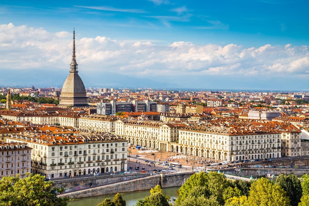
Turin is the regional capital of Piedmont, and it has many interesting sites for visitors to check out. The city has numerous restaurants and bars that cater to tourists, as well as beautiful baroque architecture for you to enjoy as you stroll around Turin’s historic downtown area.
Susa is the closest town to Rocciamelone. As a result, the town of Susa is a great point of access if you’re looking to travel to the beautiful landscapes of the Susa Valley and enjoy its many hiking paths.
In town, you’ll find remnants of an ancient Roman amphitheater, aqueduct, and baths. There’s also a wealth of historical buildings to check out in Susa, including its cathedral, churches, and historic town center.