Scan the QR code and open PeakVisor on your phone
Take a stroll across vibrant heaths, along ancient cliffs, and through lush combes at England's the Quantock Hills Area of Outstanding Natural Beauty (AONB). There are 32 named points in the Quantock Hills AONB. The highest and the most prominent hill is Wills Neck (384 m/1,259 ft).
The Quantock Hills AONB is an area of protected countryside located in South West England in the United Kingdom. The AONB covers an area of 38 sq. mi (98 sq. km) in the county of Somerset. It is commonly referred to as the Quantocks.
The main feature of this AONB is the Quantock Hills, a range of minor hills which run for 15 mi (24 km) across West Somerset. The range stretches from the Vale of Taunton Deane to Kilve and West Quantoxhead on the coast overlooking the Bristol Channel. It runs in a northwesterly direction.
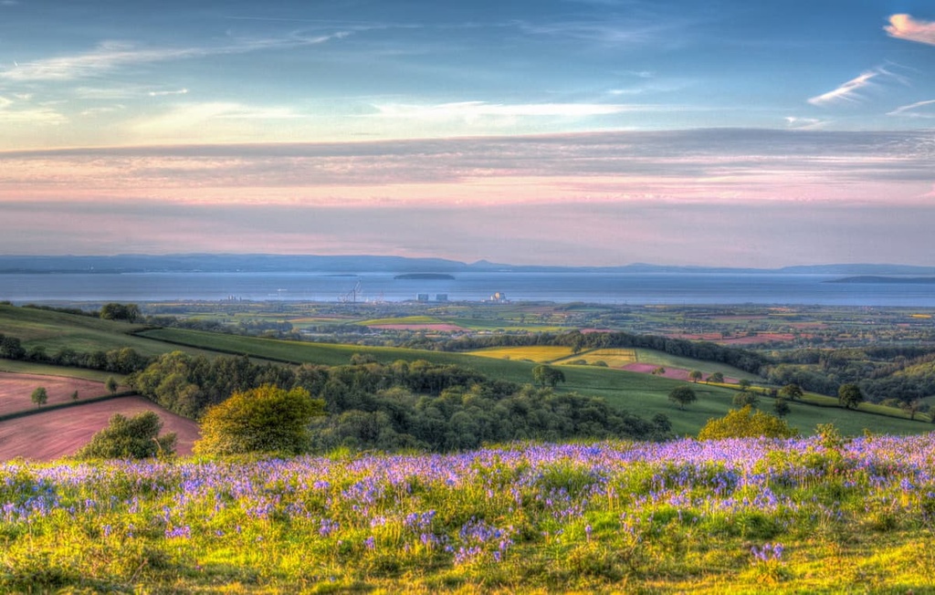
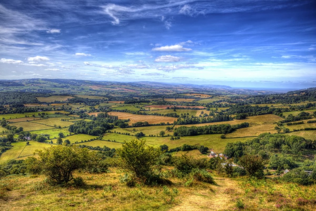
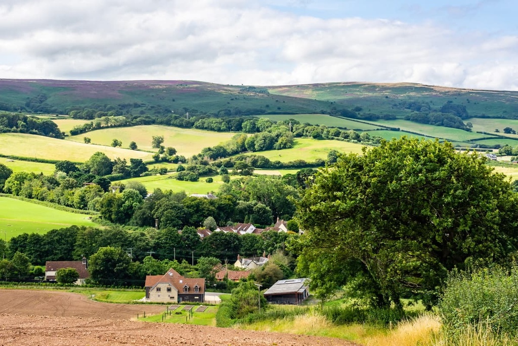
The Quantock Hills form the western border of two low-lying, flat areas of Somerset, the Somerset Levels and Sedgemoor. Thanks to these large flat areas, the park’s hills provide sweeping views of the surrounding countryside, despite their modest height.
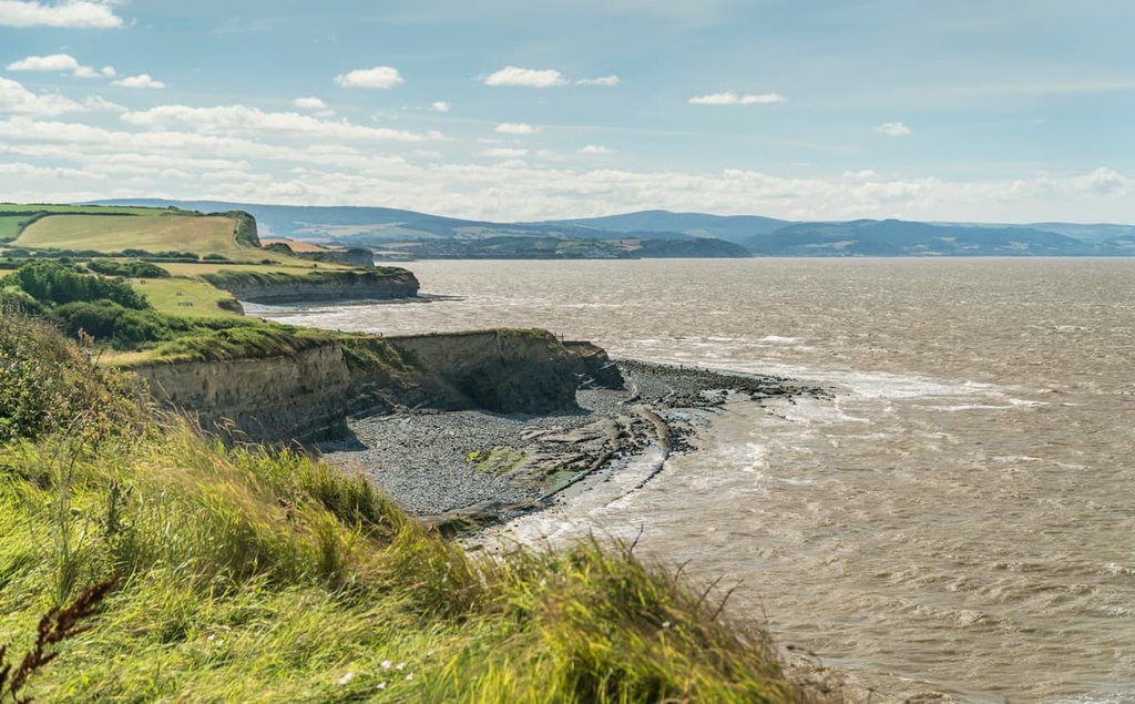
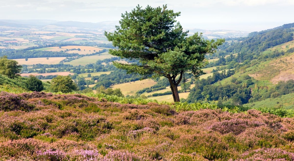
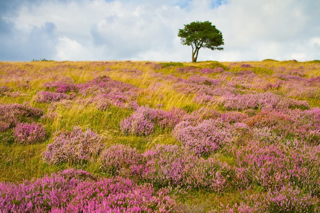
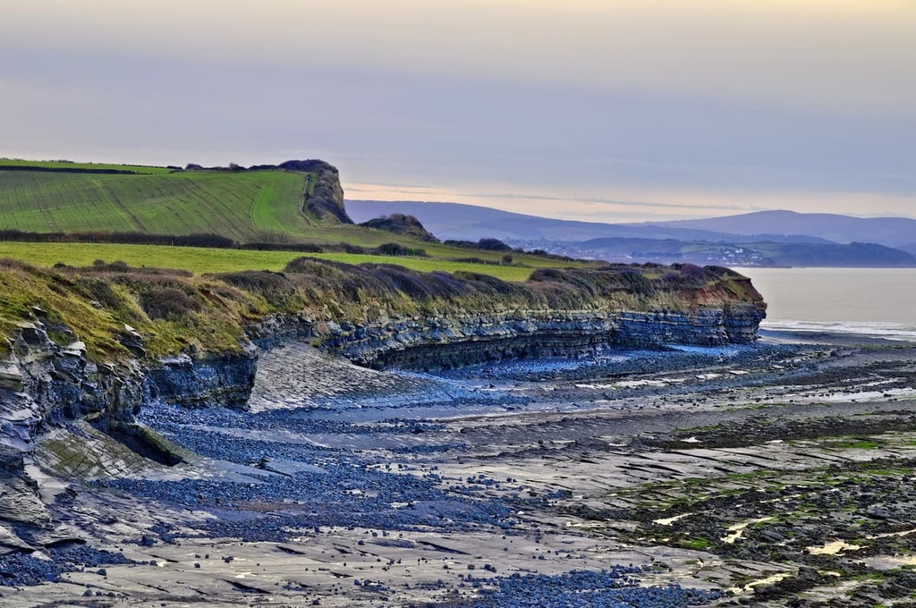
The Quantock Hills are very popular with hikers due to the beautiful heathlands, which cover the hills in a rich tapestry of colors. The AONB also contains a 3 mi (5 km) stretch of coastline along the Bristol Channel, known for its cliffs, fossils, and fauna.
Another notable feature of the Quantock Hills AONB is its combes. Combes are narrow wooded valleys found in southern England.
The Quantock Hills AONB is located close to several other parks and nature preserves. The Quantock Hills AONB is situated approximately 25 mi (40 km) to the east of Exmoor National Park, 35 mi (56 km) to the southwest of the Mendip Hills AONB, and 27 mi (43 km) to the north of the Blackdown Hills AONB.
Due to the area's size and the number of small villages in the Quantocks, you're never further than 1.7 mi (2.7 km) from a pub. You'll find several notable villages in the Quantock Hills AONB, including Kilve, West Bagborough, and Aisholt.
The county town of Somerset, Taunton, is located 15 mi (24 km) to the south of the Quantock Hills AONB. England's capital city, London, is located approximately 150 mi (240 km) to the east of the Quantock Hills AONB.
The Quantock Hills formed during the Devonian period approximately 380 to 400 million years ago. The park is part of the Exmoor Group, a sequence of rock strata that stretches across North Devon and West Somerset.
The Quantocks are composed of sedimentary rocks, primarily sandstones, siltstones, and limestones. These rocks formed when the area lay under a shallow sea and sediments, including deceased sea creatures, were compressed into solid rock.
Geologically, the Quantocks can be split into three different areas: northern, mid-range, and southern.
The northern hills located between West Quantoxhead and Triscombe are composed of Hangman Grits, a series of sandstones which were essentially compressed into quartzites. Notable hills where Hangman Grits are present include Thorncombe Hill (342 m/1,122 ft), Hurley Beacon (354 m/1,161 ft), and Great Hill (339 m/1,112 ft).
The mid-range hills between Holford and Cothelstone are composed of Ilfracombe slates. This area features the park's most diverse geology, with a mixture of volcanic tuffs and limestones. The area has a varied topography, complete with many combes.
The southern hills of the Quantocks are located around Broomfield and Kingston St. Mary. These hills are composed of Morte slate, which is less resistant to erosion than the range's limestone, giving the area a sloping topography.
Today, the Quantocks are a range of gently rolling hills that rarely exceed 350 m (1,148 ft) in height. The park's highest and prominent point is Wills Neck (384 m/1,259 ft). It’s also the range's only Marilyn (a peak with a prominence of over 150 m/492 ft). Other notable hills include Lydeard Hill (365 m/1,197 ft), Bagborough Hill (360 m/1,181 ft), and Black Hill (358 m/1,174 ft).
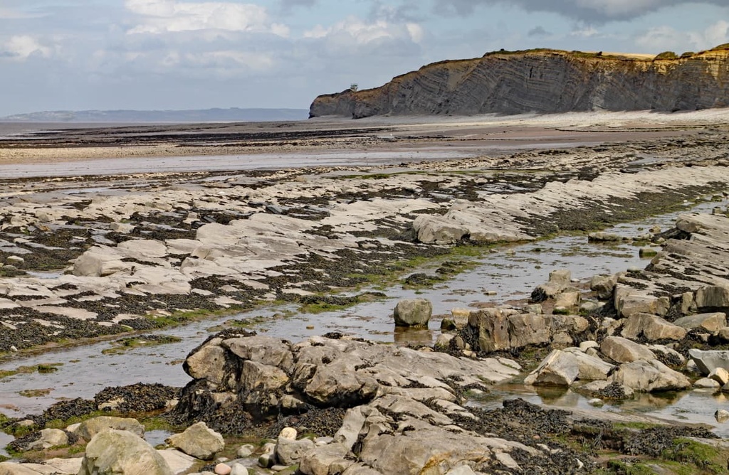
As well as its diverse hill rock formations, the Quantock Hills AONB features a stretch of Jurassic coastline. Somerset's Jurassic coast is located between Blue Anchor and Lilstock, with a large portion running along the AONB's coastline.
Somerset's Jurassic coast formed during the Triassic and early Jurassic periods, approximately 190 to 200 million years ago. The coastline was formed when sediment and dead marine life were deposited on the seafloor and compressed into limestone.
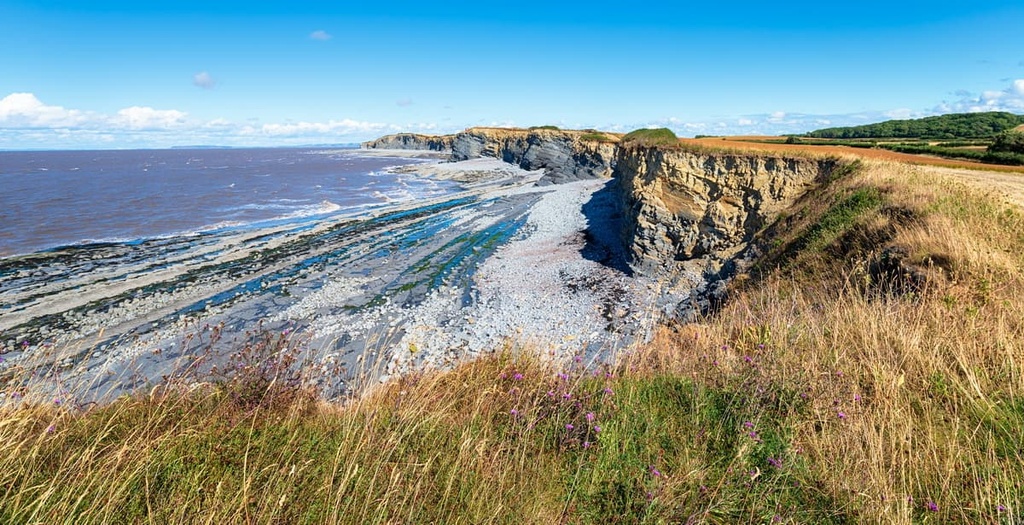
The coast is considered internationally important to geology. The exposed cliffs near East Quantoxhead are used as world reference points for determining divisions in the "Lower Lias" section of the Jurassic period.
The Jurassic Coast is a big draw for tourists as it's a great place to hunt for fossils. Visitors can find several different fossil types around East Quantoxhead and Kilve, including ammonites, bivalves, and brachiopods.
In 1970, approximately 6,194 acres (2,506 ha) of heathland in the Quantocks was designated as a Biological Site of Special Scientific Interest (SSSI). This designation was due to the number of rare species of flora and fauna which inhabit the area.
While exploring the Quantock Hills, you may encounter some large mammals, including ponies, cattle, and sheep. The area is also considered an important habitat for red deer, the largest deer species in Britain.
The heathlands and bracken of the Quantock Hills are recognized as internationally important habitats for several bird species. Notable small bird species include chaffinches, yellowhammers, redstarts, and Dartford warblers. Keen observers may get lucky and spot some of the park's rare birds of prey, including sparrowhawks, buzzards, and hen harriers.

Several amphibian and reptile species inhabit the Quantock Hills. Early in the morning, you may spot adders, grass snakes, and slowworms warming up in the sunshine. In the park's wetland areas, common frogs, common toads, and palmate newts are present.
The park's heathlands and forests also support rare insect and butterfly species, notably silver fritillaries, gray heaths, and graylings.
The Quantock Hills are dominated by high-quality heathlands that are home to dozens of rare plant species. The area's uplands heaths feature ling heather, whortleberry, bell heather, cross-leaved heath, and western gorse. The western heaths feature mainly bell heather and western gorse.
There are large swathes of bracken containing whortleberry and wavy-hair grass on the lower slopes of Quantocks, where the soil is deeper.
Woodlands are another prominent environment in the Quantock Hills, with several wooded combes across the area. There are four types of wood found in the AONB: ash-hazel woodlands, coniferous plantations, western sessile oak woodlands, and small farm woodlands.
Of these woodlands, the sessile oak woodlands are considered the most important. They are designated as a Special Area of Conservation at European Level and a Site of Special Scientific Interest (SSSI). Across the oak woodlands, the soil quality is poor, producing twisted trunks that add to the area's beauty.
Humans have inhabited the Quantocks since at least the Mesolithic period, which took place between 5,000 and 15,000 years ago. Archeologists have discovered Mesolithic flints in Broomfield and North Petherton. Over 100 Bronze Age barrows and cairns have been found across the Quantock Hills, too, dating back approximately 4,000 years.
By the Iron Age and the Roman period, a number of hillforts had been set up across the Quantocks. These forts served not only for protection but as a display of power. The earthwork remains of some hillforts can be seen at Dowsborough Camp and Ruborough Camp.
Evidence suggests that the southern areas of Quantocks around Broomfield and Kingston St. Mary were well-populated by the first millennium BCE. Large areas of earthworks and crop marks are visible from above, indicating the presence of farms and settlements.
A study by the University of Winchester on the presence of Roman settlements in the Quantocks uncovered the remnants of a Roman villa with a mosaic floor. It's believed to be one of the most westerly Roman villas in Britain. They also discovered an extensive collection of Roman silver coins dating back to the fourth century CE.
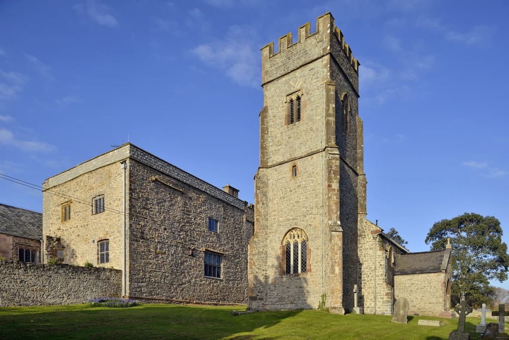
By medieval times, manor houses were common across the Quantocks, especially in coastal areas around East Quantoxhead, Kilve, and Kilton. During this period, humans used the land in a similar way they do today. The heathlands were common-use areas, with settlements near the combes providing access to a range of landscapes.
The Quantock Hills became increasingly industrialized following the medieval period, with copper mines, coppicing of woods, and textile manufacturing popping up across the area.
During the late eighteenth century, two of England's most famous poets lived in the Quantock Hills: Samuel Coleridge and William Wordsworth.
Samuel Coleridge lived in Nether Stowey from 1797 to 1799. He wrote some of his best-known works during this period, including The Rime of the Ancient Mariner and Frost at Midnight.
William Wordsworth also lived in the Quantocks in Alfoxton during this period. Coleridge, Wordsworth, and Wordsworth's sister Dorothy frequently took walks through the hills. These walks inspired the Coleridge Way hiking trail, and undoubtedly played a role in the development of Romanticism.
During the twentieth century, the Quantocks served as an overseas base for North American troops during World War II. One notable feature of this base was a tank training range at West Kilton. Additionally, there were large prisoner of war camps for Germans and Italians at Crowcombe Heathfield and Goathurst.
The Quantock Hills were designated as an AONB in 1956. It was the first AONB in England to be created under the National Parks and Access to the Countryside Act 1949. The AONB is managed by The Quantock Hills Joint Advisory Committee, which includes local councils and Natural England.
The Quantock Hills are amongst the most popular hiking areas in South West England, with rewarding hikes that afford sweeping views of Wales, Exmoor, the Mendips, and more. Read on to learn about some of the best hiking areas and trails in the Quantock Hills AONB.
Wills Neck (384 m/1,259 ft) and Lydeard Hill (365 m/1,197 ft) are the tallest and second-tallest hills in the Quantocks, respectively. While there are separate hiking paths on each hill, you can combine the two for a more challenging trek. As the hills are only a mile (1.6 km) apart, combining the two doesn't involve a long trek between summits.
The Wills Neck and Lydeard Hill hike is 5.5 mi (9 km) long and takes around 3 hours to complete. This is a loop trail that starts and ends at the Lydeard Hill car park. The route follows well-defined paths but is not waymarked, so ensure that you map your route beforehand.
From the car park, you'll first scale Lydeard Hill. A crossroads marks the summit, with sweeping views of the Bristol Channel. You'll then walk by the edge of some woodlands with views of the Bagborough Plantation, before scaling Wills Neck.
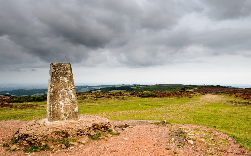
On a clear day, the views from Wills Neck are far-reaching, with the Brecon Beacons in Wales and Dunkery Beacon (519 m/1,702 ft) in Exmoor National Park visible from the summit. The summit of Wills Neck is marked with a trig point.
During your descent, you'll have views of the Hinkley power station. On your way back, you'll pass the Triscombe Stone, a meeting place that dates back to the Bronze Age. You can then loop back to Bagborough and put your feet up at the Rising Sun Inn.
Both Wills Neck and Lydeard Hill are very accessible, with multiple paths that zigzag across the hillsides. If you want to make your walk shorter and give Lydeard Hill a miss, you can climb Wills Neck on its own from the Triscombe Stone car park to the north.
Although not one of the tallest hills in the Quantocks, Cothelstone Hill (332 m/1,089 ft) is very popular with hikers. There are several reasons hikers flock to Cothelstone Hill.
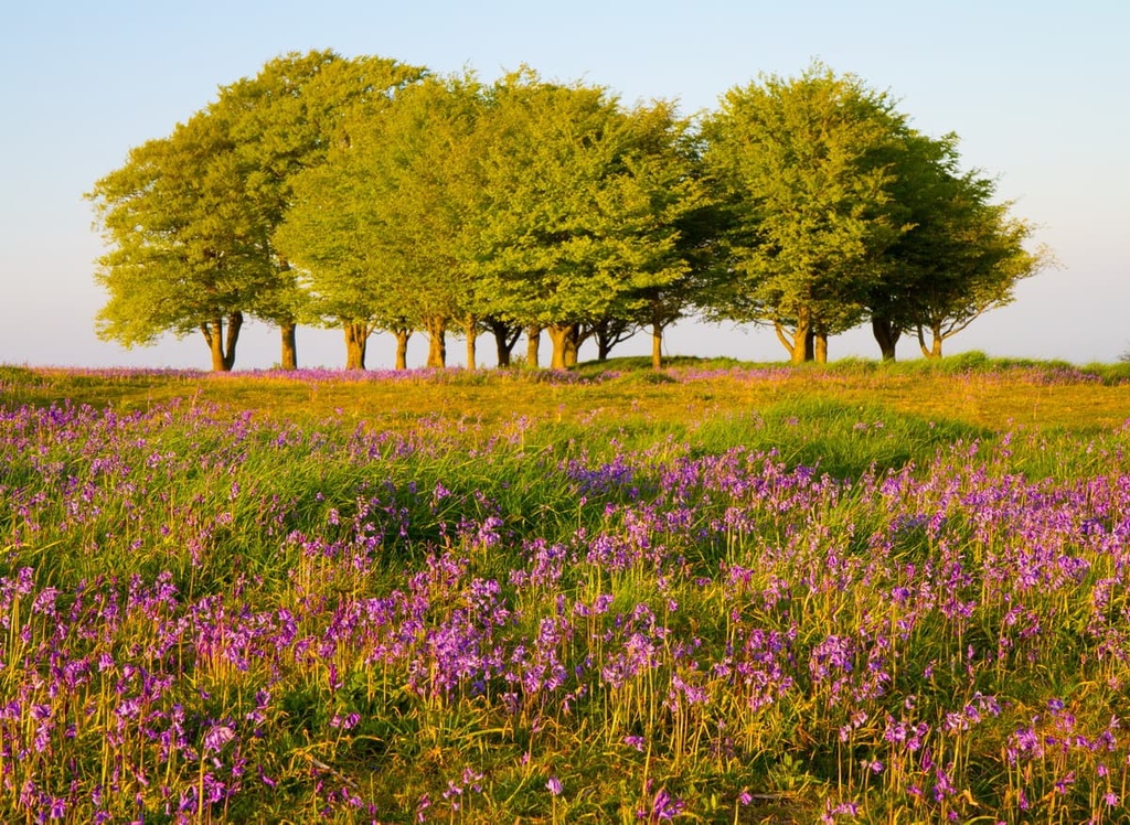
The hill offers uninterrupted panoramic views of the surrounding area and is considered one of the best viewpoints in the range. Atop the hill is a cluster of beech trees, known as the Seven Sisters, which add to the hill's charm. You're also nearly guaranteed to see a few Exmoor ponies on the way to the summit.
The hike up Cothelstone Hill is 2.5 mi (4 km) long and takes 1 to 2 hours to complete. This is a loop trail that starts and ends at the Cothelstone Hill car park. The route is easy to follow with arrow waymarkers along the whole trail. Along the way, you'll also get to see the remains of an old folly tower and three Bronze Age burial mounds.
It's well-worth exploring one of the Quantocks’ combes during your visit, and one of the best ways is to follow the National Trust's Staple Plains Trail. On this trail, you'll get to hike into the beautiful Weacombe Combe and walk to the summit of one of the AONB's most popular hills, Beacon Hill (313 m/1,026 ft).
This walk is straightforward, with a few steep sections in Weacombe Combe and on Beacon Hill. This circular walk is 2 mi (3.2 km) long and takes about an hour to complete. You can pick up the trail from the Staple Plain car park.
The walk starts by taking you steadily downhill to the bottom of Weacombe Combe. The path follows a stream before climbing uphill to Bicknoller Post (308 m/1,010 ft). From this marker, you'll be able to spot many of the hills in Exmoor National Park, including Dunkery Beacon (519 m/1,702 ft).
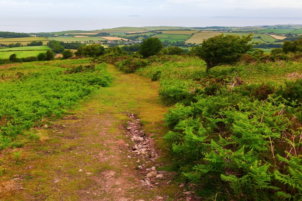
You'll then continue to climb gently uphill with some stunning views along the way until you reach the top of Beacon Hill. The top of Beacon Hill provides some of the best views in the Quantocks, with Wales visible across the Bristol Channel and toward Exmoor.
The top of Beacon Hill is marked with a trig point and cairn. There is a path by the trig point, which can be followed back to your starting point.
Hikers looking for a change of scenery might want to plan a seaside stroll between the villages of Kilve and East Quantoxhead. This waymarked, circular trail takes hikers along the cliffs of Somerset's Jurassic Coast and through the charming village of East Quantoxhead.
This coastal walk is 3 mi (5 km) long and takes 1 to 2 hours to complete. You'll start by parking Kilve before walking along the coast, where you can go hunting for 200-million-year-old ammonites.
You'll then loop back around through East Quantoxhead, passing a medieval manor on the way. You'll also get to see the brick oil retort at Kilve Pill, which was built to burn the area's oil-rich shale beds. The path then loops back to Kilve.
Literary fans looking for a long-distance hike in South West England won't want to miss the Coleridge Way. This 52-mi (83 km) trail follows in the footsteps of famed poet Samuel Taylor Coleridge, taking hikers across the best of the Quantock Hills and Exmoor.
The trail can be followed from east to west or vice versa, with each direction offering a different experience. If walking from east to west, the walk starts at Nether Stowey on the eastern boundary of the Quantock Hills AONB and finishes at Lynmouth in Devon.
If you want to stay in the Quantocks and don't fancy completing the entire route, you can complete the first two legs from Nether Stowey to Alfoxton and then Alfoxton to Bicknoller.

This walk is around 10 mi (16 km) long and takes about 5 hours to complete, depending on how often you stop. The Coleridge Way has waymarkers, which feature pictures of quill pens. There are also yellow arrow markers.
Stage 1: Nether Stowey to Alfoxton
From Coleridge Cottage, you'll climb steadily uphill, passing Nether Stowey Castle. Once you reach a section of woods, it's possible to take a detour to the Dowsborough Iron Age Hillfort. The walk then passes near Holford Combe before climbing to the top of Woodlands Hill (258 m/846 ft).
After descending Woodlands Hill, you can pay a visit to the village of Holford, which is home to a thirteenth-century churchyard and the site of an old Huguenot silk mill. You'll then follow the bridle path out of Holford, around Alfoxton Wood, and into Alfoxton. This section of the walk is approximately 4.75 mi (7.5 km) long.
Stage 2: Alfoxton to Bicknoller
From Alfoxton, you'll walk down Padlestone Lane, which was once frequented by former Poet Laureate of the United Kingdom, William Wordsworth. After a signpost for Perry, you'll descend to a stream which you need to ford. Onto open moorland, you'll see Longstone Hill (318 m/1,043 ft) to your left and the A39 to your right.
Continue straight ahead, and descend into Smith's Combe. Upon exiting Smith's Combe, you'll then drop into Perry Combe. After Perry Combe, ensure you stop to admire the nineteenth-century Church of St Etheldreda. The path then weaves along country lanes and past the Staple Plantation.
The end of the walk takes you across Bicknoller Hill (288 m/944 ft), which affords superb views towards Exmoor’s and Somerset's countrysides. You can end your walk with a cup of tea in the village of Bicknoller. This section of the Coleridge Way is approximately 5 mi (8 km) long.
The Quantocks have been a popular vacation destination for centuries, with people flocking from across England to hike through the area’s combes and heaths. Read on to find out about the main settlements in and around the Quantock Hills AONB.
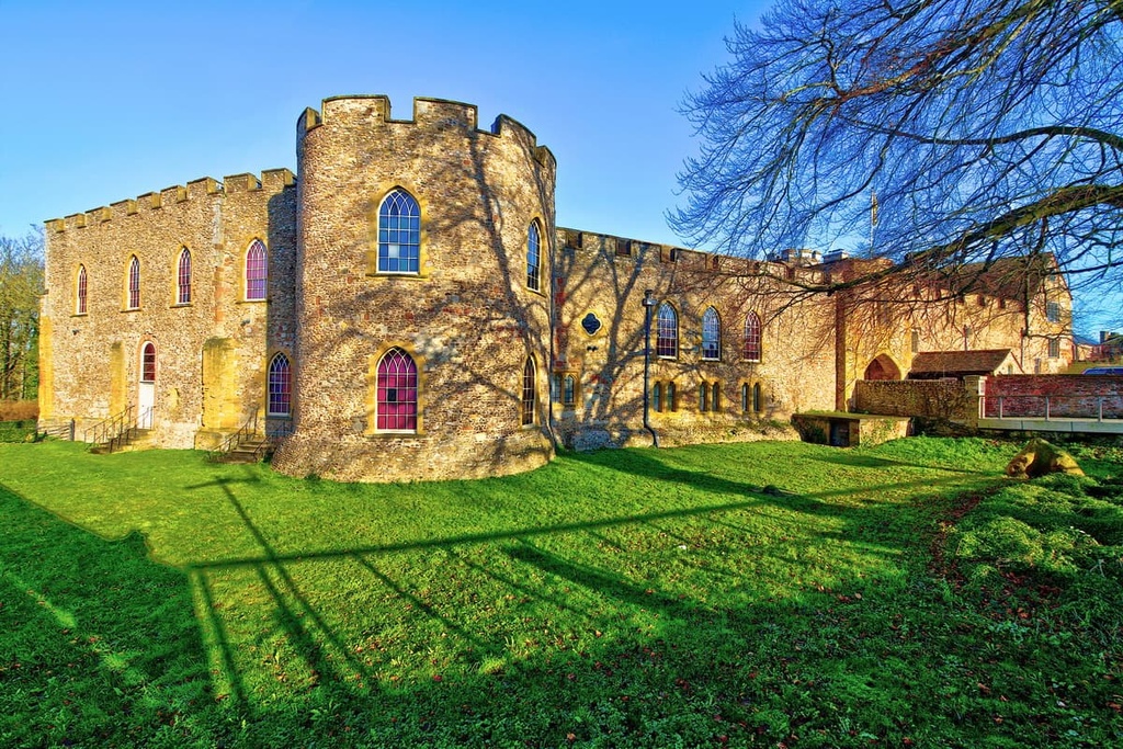
Situated roughly 10 mi (16 km) to the south of the Quantock Hills AONB is Taunton. The county town of Somerset, Taunton is over a thousand years old. It's believed to have been founded by the Anglo-Saxon king, King Ine of Wessex, around 680 CE. As a result, Taunton has some fascinating historical attractions, like the twelfth-century Taunton Castle.
Taunton is also ideal for hikers as it offers easy access to the southern Quantocks near Fyne Court, like Cothelstone Hill (332 m/1,089 ft). Hotels in Taunton include the Castle Hotel, the Meryan House Hotel, and the Corner House Hotel.
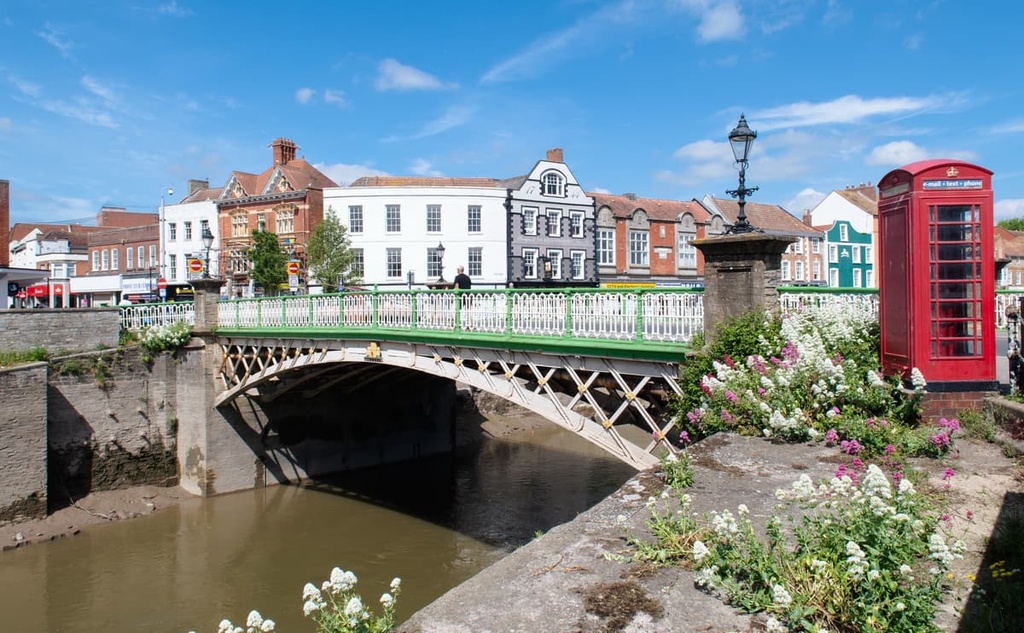
Another large town within 15 mi (24 km) of the Quantock Hills AONB is Bridgwater. Like Taunton, Bridgwater is a historic town and was mentioned in the Domesday Book of 1086.
The town is home to some interesting museums, like the sixteenth-century Black Museum. If you're looking for something to do, plan a scenic cycle along the canal between Taunton and Bridgwater. Hotels in Bridgwater include the Mercure, the Ibis, and the Tudor Hotel.
Lovers of literature will want to spend the night in Nether Stowey. This charming village was once home to Samuel Taylor Coleridge and where he penned some of his best-known works, including The Rime of the Ancient Mariner.
Nether Stowey rests right on the eastern boundary of the Quantock Hills AONB. It is close to popular hills like Dowsborough (337 m/1,105 ft). Hotels in Nether Stowey include The Ancient Mariner, the Apple Tree Hotel, and the Castle of Comfort Hotel.
If you're looking to spend most of your hiking adventure searching for fossils along Somerset's Jurassic coast, spend the night in Kilve or East Quantoxhead. These two tiny villages are less than 2 mi (3.2 km) apart and offer easy access to the northern Quantocks.
While in town, spend your days hunting for fossils at Kilve Beach, or hike to the top of Beacon Hill (313 m/1,026 ft). Hotels nearby include the Hood Arms and the Combe House Hotel.