Scan the QR code and open PeakVisor on your phone
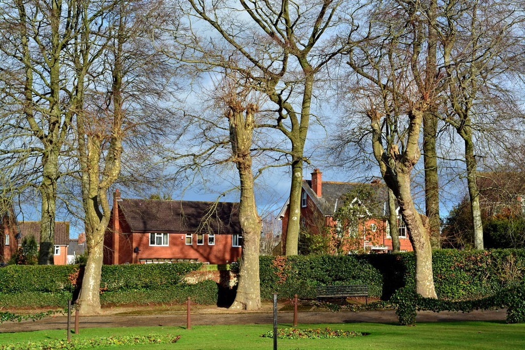
Peaceful strolls through charming villages and across rolling ridges await visitors to England’s Blackdown Hills Area of Outstanding Natural Beauty (AONB). There are 55 named points in Blackdown Hills AONB. The highest and the most prominent hill in the area is Staple Hill (322 m/1,056 ft).
The Blackdown Hills AONB is an area of protected countryside located in South West England. It rests on the border of Somerset and Devon, covering an area of approximately 140 sq. mi (370 sq. km). The Blackdown Hills AONB is one of 42 AONBs in England, Wales, and Northern Ireland.
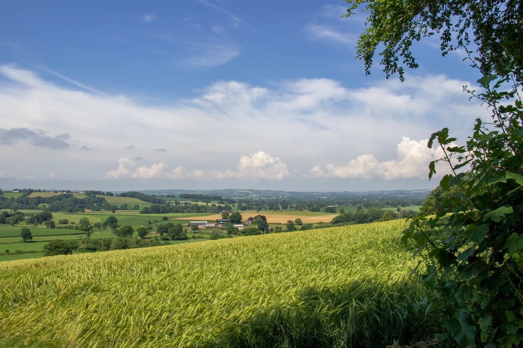
The AONB centers around the Blackdown Hills, a hill range famed for its unspoiled nature, steep valleys, and ancient hill forts.
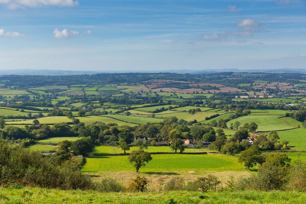
The landscape of the Blackdown Hills is distinctive, with a steep north-facing escarpment giving way to a flat-topped plateau to the south. Abrupt valleys cut through the hills between the southern plateau and northern ridge in the AONB.
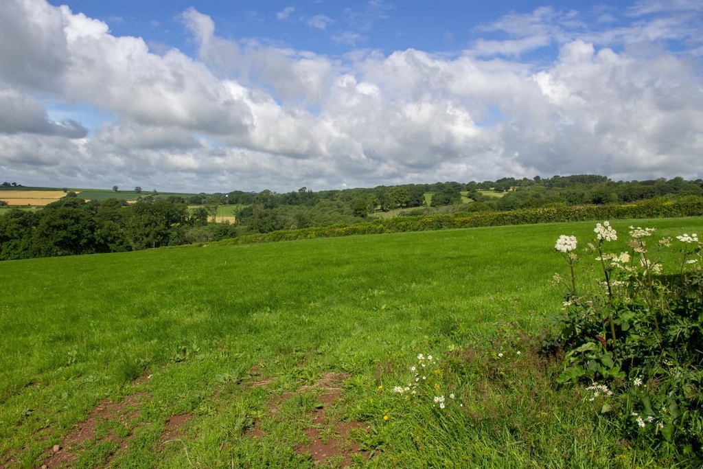
The scarp to the north of the Blackdown Hills is heavily wooded and is approximately 12.5 mi (20 km) in length. Most of the hilltops in the area are exposed, providing sweeping views of Somerset and Devon, especially across the Vale of Taunton.
Three significant rivers snake across the Blackdown Hills. The River Culm begins in the north of the park near Culmhead and is the longest tributary of the River Exe. The 27-mi (44-km) River Otter starts near Otterford and supplies drinking water for over 200,000 Devonians. The source of the 16-mi (26-km) long River Yarty is located on the AONB’s highest hill, Staple Hill (322 m/1,056 ft).
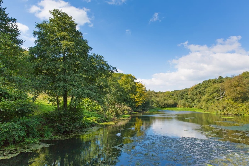
The AONB is home to twin reservoirs that are called the Otterhead Lakes. They are a Local Nature Reserve and are fed by the River Otter.
Many national parks and other AONBs are located close to the Blackdown Hills. For example, the East Devon AONB borders Blackdown Hills to the south and the Dorset AONB is located less than 5 mi (8 km) to the east.
Meanwhile, Exmoor National Park is located approximately 10 mi (16 km) to the northwest of the AONB and Dartmoor National Park is situated approximately 20 mi (30 km) to the southwest.
No towns lie within the boundaries of the Blackdown Hills AONB, though there are a handful of small farming villages. Notable settlements within the Blackdown AONB include Hemyock, Staple Fitzpaine, and Dunkeswell. Taunton, the county town of Somerset, is located less than 5 mi (8 km) to the north of the AONB.
The Blackdown Hills AONB's geology is unlike anywhere else in Britain. Together with the East Devon AONB, the Blackdown Hills features Britain's only significant outcrop of Upper Greensand sandstone.
These non-calcareous rocks formed over 100 million years ago during the Albian age and give the area its varied topography and unique ecology. The range's plateau also contains bands of quartz-like chert and chalk.
The western area of the Upper Greensand is devoid of chalk and other calcareous rocks, lending to its more dramatic topography. Despite the fact that the area lacks calcareous rocks, fossils are still present in the region. In particular, there are fossilized remains of small bivalves and marine creatures preserved by silica in the AONB.
Mercia mudstones are found throughout much of the range’s central areas, especially around Clayhidon. Mercia mudstones were laid down in estuaries over 200 million years ago, and they give the range its rolling ridgelands.
That said, due to the fact that the Blackdown Hills mostly consist of sand and clay, the area is prone to landslides, especially along the northern escarpment.
Today, the Blackdown Hills is a modest hill range that rarely exceeds 300 m (984 ft) in elevation. The highest hill in the Blackdown Hills is Staple Hill (322 m/1,056 ft). Staple Hill is also the range's only Marilyn (a hill or mountain that exceeds 150 m/490 ft in prominence).
Other notable hills within the Blackdown Hills AONB include North Hill (303 m/994 ft), Culmstock Beacon (252 m/826 ft), and Horner Hill (224 m/734 ft).
Due partly to the area's unique geology, the Blackdown Hills are home to some important landscapes. There are 16 Sites of Special Scientific Interest (SSSIs) in the AONB that cover 2 percent of its total area. The habitats of the AONB are extremely varied, ranging from ancient broad-leaved woodlands to hay meadows to lowland heaths.
Many fascinating mammals inhabit the Blackdown Hills. The dairy industry thrives across the Blackdown Hills, making cows a common sight in the AONB. One of the most interesting and elusive bovine breeds found within the AONB are longhorn cattle.
The aptly named River Otter is home to a healthy population of otters due to the river's high water quality. However, the famous local beaver population often overshadows these otters in the eyes of visitors.
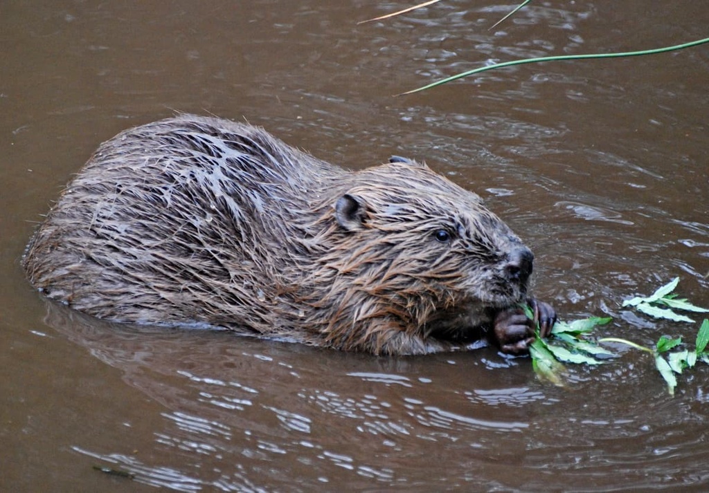
Approximately nine beavers live in the lower stretches of the River Otter, and they have established a breeding population, which is the first of its kind in England for over 400 years. One of the smallest mammals in the area is the endangered hazel dormouse, which lives in the woodlands and hedgerows.
The Blackdown Hills are frequented by dozens of bird species, including stonechats, meadow pipits, and wrens. Cuckoos live in the area and will lay their eggs in the nests of these small woodland birds. Birds of prey are also present, including kestrels, buzzards, and red kites.
The area's meadows and woodlands support a number of butterfly species, including green hairstreaks, marsh fritillaries, and Duke of Burgundies. Common reptile species in the region include common lizards, slowworms, and adders.
Woodlands and hedgerows are one of the main habitats in the Black Hills AONB, and they cover the entire northern ridge. These habitats consist mainly of trees like ash, gray willow, hazel, maple, and European oak. These are semi-natural woodlands that have been in England since at least the seventeenth century.
Heathlands are one of the rarest habitats in the Blackdown Hills and in England as a whole. They sustain a number of heather species, including ling heather and cross-leaved heath. They are not very diverse when compared to some other habitat types, but they support important insect and bird species that are rarely found in other environments.
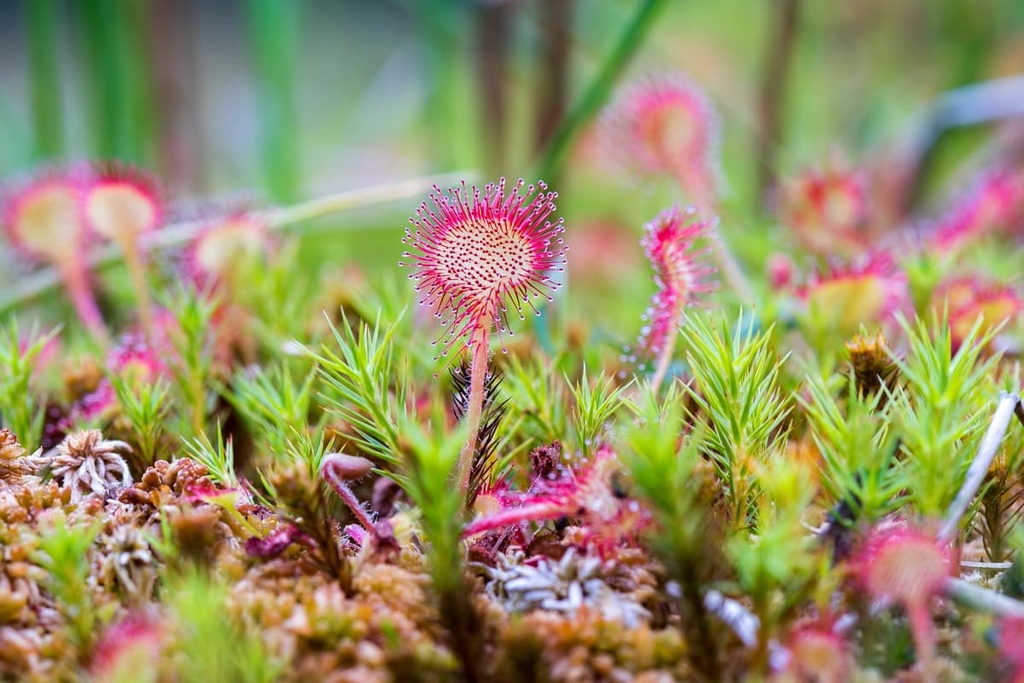
The mire and moorlands of the Blackdown Hills are much more ecologically diverse and are home to meadow thistles, star sedges, louseworts, heath spotted-orchids, and sundews.
Other notable plant species found within the Blackdown Hills AONB include bird's-foot trefoil, tussock sedges, corky fruited water dropworts, and green-winged orchids.
The history of the Blackdown Hills is well-preserved thanks to the peat deposits that are found within the area's springline mires.
Archeological findings from these peat deposits show that the hills were once an essential source of food during the Mesolithic period. Archeologists have also since found flints dating back to the Neolithic period in the area. Near Whitestaunton, archeologists also uncovered remnants of a Roman villa with a bathhouse.
![]()
Hillforts feature prominently in the history of the Blackdown Hills, as there are many Iron Age fortifications dotted across the landscape. One example is Hembury Hillfort, one of the finest hillforts in Devon, which sits atop Hembury Hill (273 m/895 ft). The hillfort is significant as some of the oldest Neolithic pottery in southern Britain was uncovered at the site.
One of the oldest standing structures within the Blackdown Hills is Culmstock Beacon. Standing on the range's southwestern edge, this beacon would've been lit to warn locals of an incoming invasion, likely from the Spanish Armada. The original flint structure had to be rebuilt in 1870, but it’s still regarded as one of the best viewpoints in the Blackdown Hills.
Another prominent historic structure is the Wellington Monument, a 53 m (175 ft) tall memorial to the Duke of Wellington's victory at the Battle of Waterloo. It's believed to be the tallest three-sided obelisk in the world.
The Blackdown Hills are a good source of whetstone, and, historically, mining was one of the primary industries in the area. Most mining in the area occurred between the seventeenth and nineteenth centuries, with 10,000 stones produced a day at the industry’s peak. Today, farming is the leading industry in the Blackdown Hills.
During the Second World War, the Blackdown Hills hosted several important airfields. For example, RAF Dunkeswell was one of the only US Navy bases in Europe at the time and is still in use today.
Today, the Blackdown Hills are much more peaceful. The AONB was established in 1991 and is managed by the Blackdown Hills AONB Partnership.
Often overlooked in favor of the Quantocks or Dartmoor, the Blackdown Hills AONB is the perfect spot for a quiet walk through classic English countryside. Read on to find out about some of the best walks in the Blackdown Hills.
Additional info on each walk can be found on the AONB's website.
Staple Hill (322 m/1,056 ft) is the highest hill and the only Marilyn within the Blackdown Hills AONB. The hill is among the most popular destinations in the Blackdown Hills.
Several trails that range in difficulty lead to the summit, including the Staple Fitzpaine Herepath and the Channel to Channel walk. The summit provides views across the Vale of Taunton, and Wales is even visible on a clear day.
The quickest way to explore Staple Hill is on the Staple Hill Easy Access Trail. This 800 m (2,624 ft) trail leads from the car park atop the hill through woodlands, passing two viewpoints. There are several picnic tables and benches along the way, and the trail is accessible for wheelchair users.
If you're searching for a long-distance trek up Staple Hill, follow the 12-mi (19-km) Valleyheads Way. The walk starts in the village of Hemyock and is marked with green arrow waypoints. It follows quiet country lanes along the edge of the Culm, Otter, and Yarty river valleys. The Valleyheads Way takes six hours on average to complete, and good hiking boots or wellies are recommended for the trek.
Located high on Blackdown Commons is the historic Culmstock Beacon ((252 m/827 ft). Dating back as far as the sixteenth century, Culmstock Beacon affords one of the best views in the AONB and is the perfect place for wildlife watchers to see bell-heather blooms in the summer.
One of the most enjoyable hikes to Culmstock Beacon is on the circular walk from Millhayes just outside Hemyock. The original walk is 7 mi (11 km) long but can be shortened to 4.5 mi (7 km) if you start in the hamlet of Whitehall instead.
You'll pass through several picturesque settlements along this walk, including the hamlet of Culm Davy, which is known for its Elizabethan chapel. The trail then leads uphill through heathlands and onto Blackdown Common. From the beacon, you'll get to enjoy one of the best views of the Culm Valley.
Rising out of the thick woodlands high on Blackdown Common is the Wellington Monument. This world-record-holding obelisk is one of the most interesting human-made features of the Blackdown Hills and is well-worth visiting.
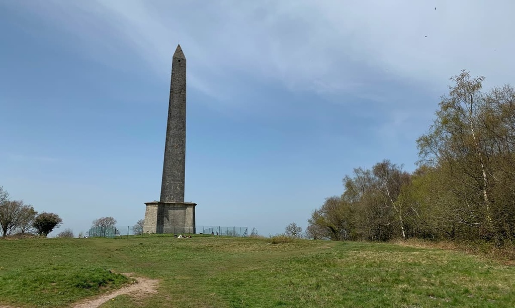
The route up to the Wellington Monument is steep and is considered one of the most challenging walks in the AONB. This 5.5 mi (9 km) loop trail starts from Lower Millhayes in Hemyock and leads through picturesque fields and woodlands. Most of the walk follows bridleways, and hikers should take care crossing the busy main road on Blackdown Common.
Upon reaching the Wellington Monument, hikers will be treated to views of Taunton Vale, with the Quantocks and Exmoor National Park visible in the distance.
North Hill (303 m/994 ft) is the second-highest hill in the Blackdown Hills and one of only two hills to exceed 300 m (984 ft) in elevation in the AONB. It sits overlooking the Broadhembury, a charming and beautifully preserved thirteenth-century estate village.
There's a circular trail that leads up North Hill from Broadhembury. You’ll find parking in the village center. This 4.5-mi (7-km) hike initially follows the River Tale before passing the ancient Hembury Fort. On your way up North Hill, you'll be able to spot the sea at Sidmouth, which is located just 10 mi (16 km) to the south.
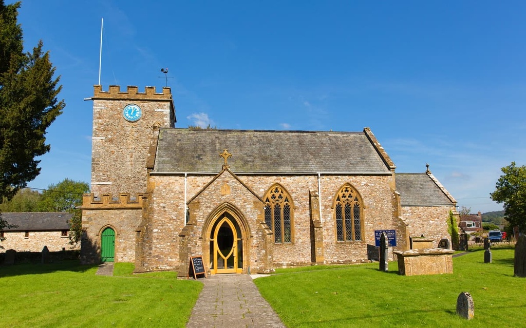
You'll return to the village by walking briefly down Stafford Hill. The end of the walk takes you by the village church, and it gives you a chance to explore the churchyard.
If you're searching for views of the English Channel during your adventure in the Blackdown Hills AONB, ensure you climb Horner Hill (224 m/735 ft). Perched on the park's southern boundary near Dalwood, Horner Hill is a challenging walk with some interesting and varied sights along the way.
You can scale Horner Hill on a 4-mi (6.5 km) loop trail that starts in Dalwood. The walk has a couple of steep ascents and can be muddy, so bring hiking boots.
After leaving Dalwood and passing farms and fields, you'll have the opportunity to take a detour to Backford Bridge, a medieval packhorse bridge that spans the River Yarty. This diversion adds roughly 1 mile (1.6 km) to the journey.
After an ascent past Lower East Horner Farm, there are vistas of the Yarty Valley towards Dorset. After passing some woodlands, you'll reach Bomb Field, where a German bomber dumped its leftover bombs during the Second World War.
The finest view from Horner Hill is towards the English Channel near the mouth of the River Axe. On the return route, you'll pass the old Baggaton Inn, which was once frequented by cider smugglers.
As the region is composed of charming hamlets, civil parishes, and farming villages, the settlements of the Blackdown Hills are ideal for a sleepy getaway in southern England. Read on to find out about the Blackdown Hills AONB's main settlements.
If you're looking to stay in a sizable town with lots of amenities during your visit to the Blackdown Hills AONB, consider a trip to Wellington. Located less than a mile from the AONB's northern boundary, Wellington offers easy access to two of the top attractions in the Blackdown Hills: the Wellington Monument and Culmstock Beacon.
The town has plenty of historical significance and is where Arthur Wellesley, the first Duke of Wellington, took his title. Therefore, the town is also the namesake of New Zealand's capital city, Wellington.
Popular accommodation options in Wellington include The Cleve and The Blue Mantle Guesthouse.
The gorgeous village of Staple Fitzpaine serves as the northeastern gateway to the Blackdown Hills. Staple Fitzpaine is home to several historic buildings, including the Norman-era Church of St. Peter and the nineteenth-century Staple Fitzpaine manor house.
Anyone visiting Staple Fitzpaine should take a stroll to Castle Neroche, a Norman motte-and-bailey castle sat atop a 276 m (905 ft) high hill. Staple Fitzpaine is also one of the closest settlements to Staple Hill.
If you're looking to stay in Staple Fitzpaine, book a room at The Greyhound Inn or the Farmers Arms.
The village of Hemyock is the largest village in the Blackdown Hills AONB. Many of the best hiking trails in the AONB start from Hemyock, including the Valleyheads Way and trails to the Wellington Monument and Culmstock Beacon.
During your visit to Hemyock, ensure you explore the remnants of the fourteenth-century Hemyock Castle, which was sieged during the English Civil War in the seventeenth century.
You'll find several charming guest houses around Hemyock, including Ploversfield Bed and Breakfast and Regency House Bed and Breakfast.
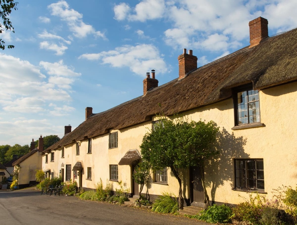
At the center of a horseshoe valley on the AONB's southwestern edge is the village of Broadhembury. Broadhembury is a traditional English village, with the appearance of many of the village's cob and thatch cottages going unchanged since the sixteenth century.
There's no better place to stay than Broadhembury if you're planning to scale North Hill and visit the 5,000-year-old Hembury Fort. While there are no hotels directly in Broadhembury, the nearby town of Honiton is home to a Premier Inn and the Bridge House B&B.