
Scan the QR code and open PeakVisor on your phone
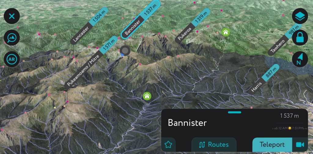
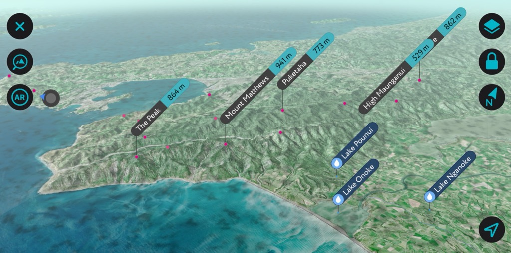
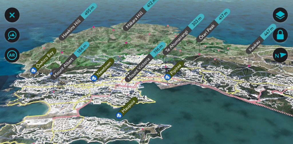
Wellington is home to 480 named mountains. The highest is Bannister at 1,573 m.
The Wellington region, known in the Māori language as Te Pane Matua Taiao, occupies the southern tip of New Zealand’s North Island. The Wellington region covers 813,500 ha (2,010,200 acres), encompassing the city center, the districts of Kapiti and Wairarapa, and several other towns. Regionally, there are 480 named mountains; the highest and most prominent is Bannister (1,537 m / 5,043 ft).
The Wellington region spans 813,500 ha (2,010,200 acres) across the southern portion of New Zealand’s North Island. It includes four main cities – the capital city Wellington, Lower Hutt, Upper Hutt, and Porirua; the Kapiti and Wairarapa districts; and more than 35,000 ha (86,487 acres) of regional parks and forests.
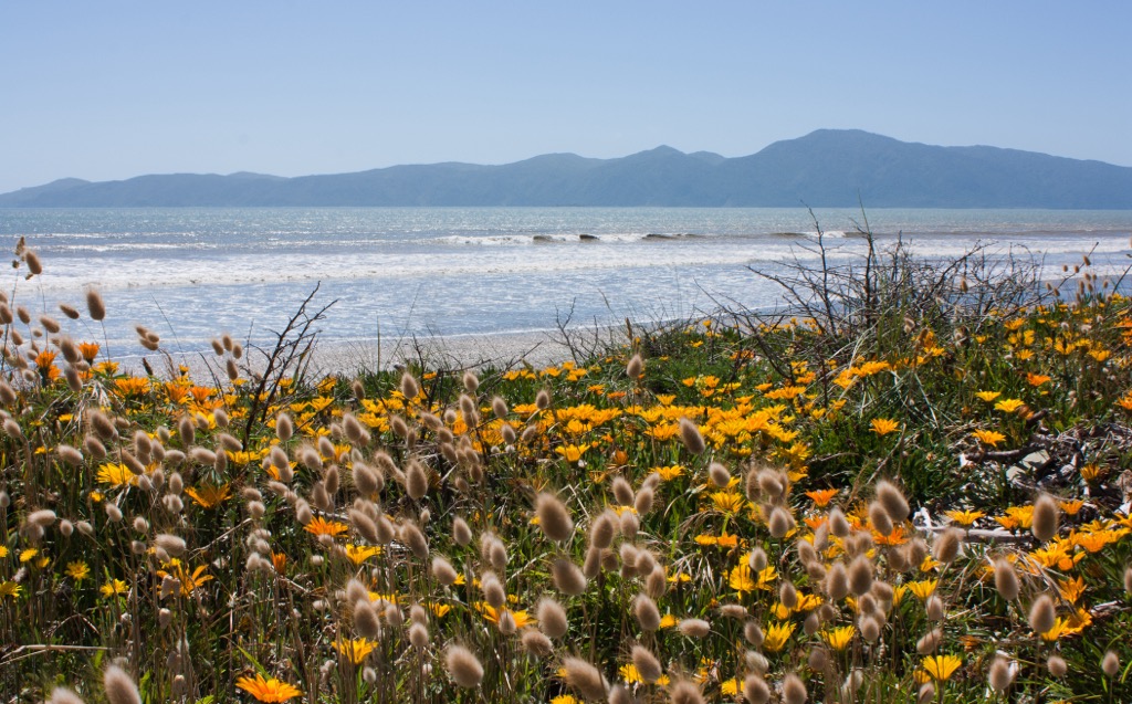
In total, Wellington contains just shy of 500 km (310 mi) of coastline. Among the coastal and marine areas are the Kapiti Island Nature Reserve, the Kapiti Island Marine Reserve, the Mana Island Scientific Reserve, Matiu/Somes Island, and the Taputeranga Marine Reserve.
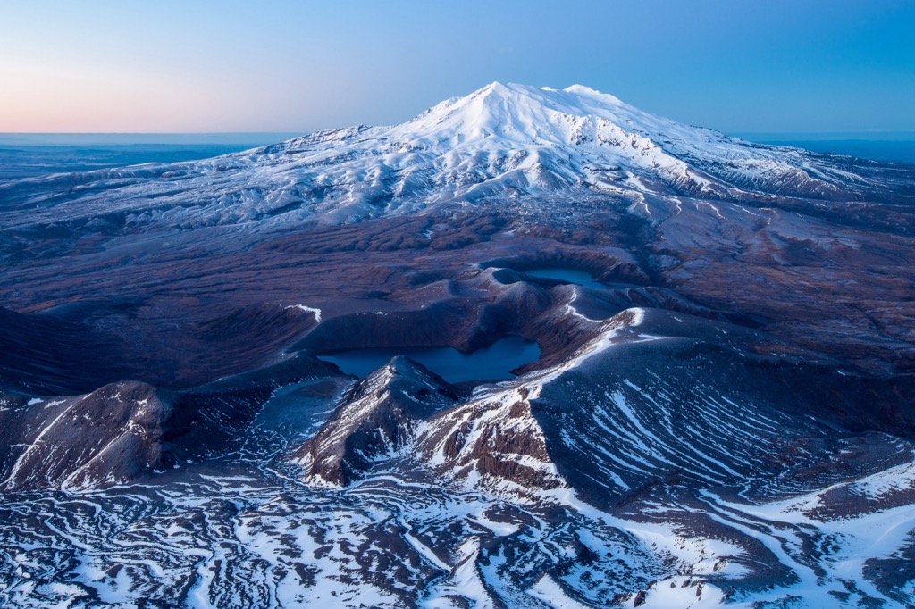
Other protected areas of interest are the 22,000 ha (54,363 acres) Rimutaka Forest Park, the Ōrongorongo Valley, the Ōtaki Forks area, the Pāuatahanui Wildlife Reserve, and the Waikanae area. The main ranges in the region are the Tararua Range and Rimutaka Range.
Several rivers flow through the Wellington region, including the Hutt River, which flows through the Hutt Valley and into Wellington Harbor, and the Ruamahanga River, which meanders through the Wairarapa Valley.
The Wellington region is well-connected by road and rail, with State Highway 1 providing access to the North and South Islands. Although smaller than Auckland Airport, Wellington International Airport is a transportation hub connecting the region to domestic and international destinations.
Wellington rests primarily on greywacke dating back to the Mesozoic. Some areas have overlying alluvial, colluvial, and marine sediments from the Quaternary era. The main mountains in the region are part of the Tararua Range and the Rimutaka Range.
The region is near several geological fault lines, including the Wellington and Wairarapa Faults. It’s also near the Taranaki and Ruapehu volcanoes.
The geology of present-day New Zealand began around 540 million years ago as the landmass formed along the edge of Gondwana. Over time, silt, mud, and ash from rivers and volcanoes near the edge of the supercontinent hardened, making up what is today the greywacke basement rock.
New Zealand sits near the boundary between the Australian and Pacific plates. Around 100 million years ago, magma welled up and caused volcanic eruptions and splits along faults. By 85 million years ago, the Zealandia land mass separated from Gondwana and the Australian mainland and began to drift across the Pacific Ocean.
Twenty-five million years ago, Zealandia split, and sections of the continent were uplifted. There has been further uplift in the last 1.8 million years, such as the Southern Alps on the South Island and volcanic eruptions, which continue in the present. During the Ice Age, glaciers carved out valleys and shifted rocks and sediment. Massive ice flows, such as the Tasman and Fox glaciers, continue to alter the landscape today.
From offshore marine habitats to alpine zones, Wellington is home to 45 ecosystems. The region’s coastal marine area is more than 500 km (310 mi) long, extends 22 km (12 nautical miles) from land, and contains zones ranging from dunes to biogenic reefs to methane seeps.
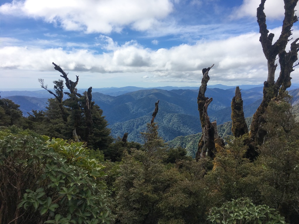
Forests make up a large part of the terrestrial ecosystems. One of the most significant forests in the region is the Remutaka Forest Park, dominated by beech and podocarps at lower elevations. Other tree species include rimu, rata, miro, hinau, rewarewa, and maire. Fire once damaged a large swath of the range’s lower section, now covered with manuka, tahini, rangiora, and heketara shrub forests.
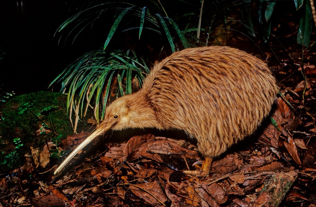
Common birds found in the forest include bellbirds, tui, kaka, kereru, and ruru. Eight moa species once lived here, though they have since been extirpated. Conservation efforts in 2006 orchestrated the release of North Island brown kiwi in the park.
The Pāuatahanui Wildlife Reserve is another fascinating ecological site. The large, mainly intact estuarine area has been home to Māori groups for 600 years. The reserve protects coastal wetlands of tidal flats, marsh vegetation, and numerous wading and wetland birds.
Māori oral history often describes the Polynesian explorer Kupe as the first to visit New Zealand around 950 AD. There are several legends tying his visits to various tribes and parts of the country before his return to Polynesia. Archeological evidence using radiocarbon dating only shows permanent settlement beginning around 1250 AD with the arrival of a Polynesian named Whatonga. Nevertheless his and his offsprings’ namesake lives on in some island and harbor names.
The second arrival in the region was by another Polynesian named Whatonga. His sons, Tara and Tautoko, and their descendants settled on the southern tip of the North Island and the northern tip of the South Island. Tribes descended from this group include the Ngai Tara, Rangitāne, Muaupoko, Ngāti Apa, and the Ngāti Ira.
The Tararua Mountains get their name from Whatonga’s son Tara. The mountains were called “ngā waewae e rua a Tara,” which means “the spanned legs of Tara” and refers to the fact that his people occupied both sides of the range.
The third wave of arrivals were the Ngāti Kahungunu. After this point, existing Māori groups shifted significantly through the region; some eras featured single groups occupying an area, while other times saw overlapping groups.
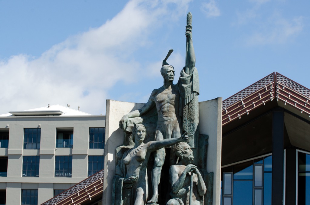
Turbulence in the region began before European settlers arrived in the 1840s. In the early 1800s, the Tainui and Taranaki tribes migrated west into the land of the Ngai Tara, Muaupoko, and Ringitāne people. The resulting inter-tribal conflict culminated in the departure of the Rangitāne and Kahungunu peoples. After several years and various exchanges, the tribes reached a peaceful agreement at Pitone (Petone) in 1840.
Abel Tasman was the first European to discover New Zealand in 1642. Captain Cook first landed in Wellington harbor in 1773. However, it was only in the 1840s that Europeans arrived intending to settle. They originally planned to build a settlement by present-day Petone. However, after a massive flood event along the Hutt River, the plan shifted to the area around Wellington. In 1865, the country’s capital moved from Auckland to Wellington because of its central location.
Many of the best hikes in Wellington are in the Tararua Range. Those looking for other outdoor activities will find their share of surfing and snorkeling along the coast, as well as shorter hikes and nature trails throughout the region’s parks and forests. Below are three of the most popular single and multi-day treks in Wellington. Huts for overnight stays may be ‘first come, first serve’ or require advance booking. It is best to check ahead of time before starting your trek.
The Mount Holdsworth Jumbo Circuit is in Tararua Forest Park. The circuit can be done as a long day hike at 22.2 km (13.8 mi) and just shy of 1,525 m (5,000 ft) elevation gain. However, many choose to do it as a short backpacking loop.
The trail cuts through a beech-podocarp forest before climbing into the alpine landscape, where it traverses ridgelines and takes in sweeping vistas. There are several huts for overnight stays – Jumbo Hut, Atiwhakatu Hut, and Powell Hut.
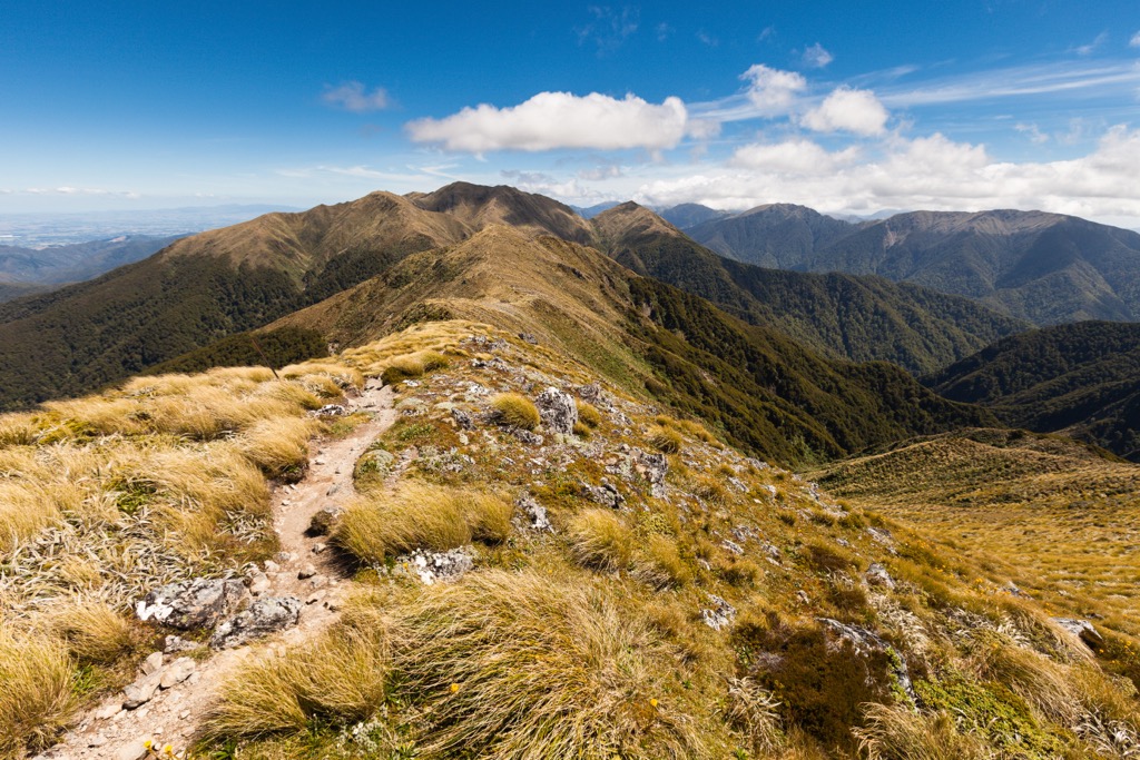
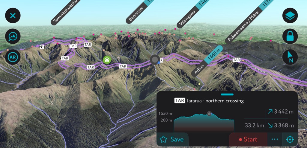
The Northern Crossing is around 37 km (23 mi) with 9,000 ft (2,745 m) of elevation gain. It takes three to five days to complete and follows an unmarked trail between Ōhau and Waingawa catchments. This challenging route is perfect for experienced hikers confident in their navigation skills.
Much of the route runs along exposed upper elevations of the range. Peaks along the way include Pekumatawai, Arete, Waiohine, Girdlestone, and Mitre. The main shelters for overnight stays at lower elevations are Te Matawai Hut and Mitre Flats Hut, and the two alpine huts are Arete Hut and Tarn Ridge Hut.
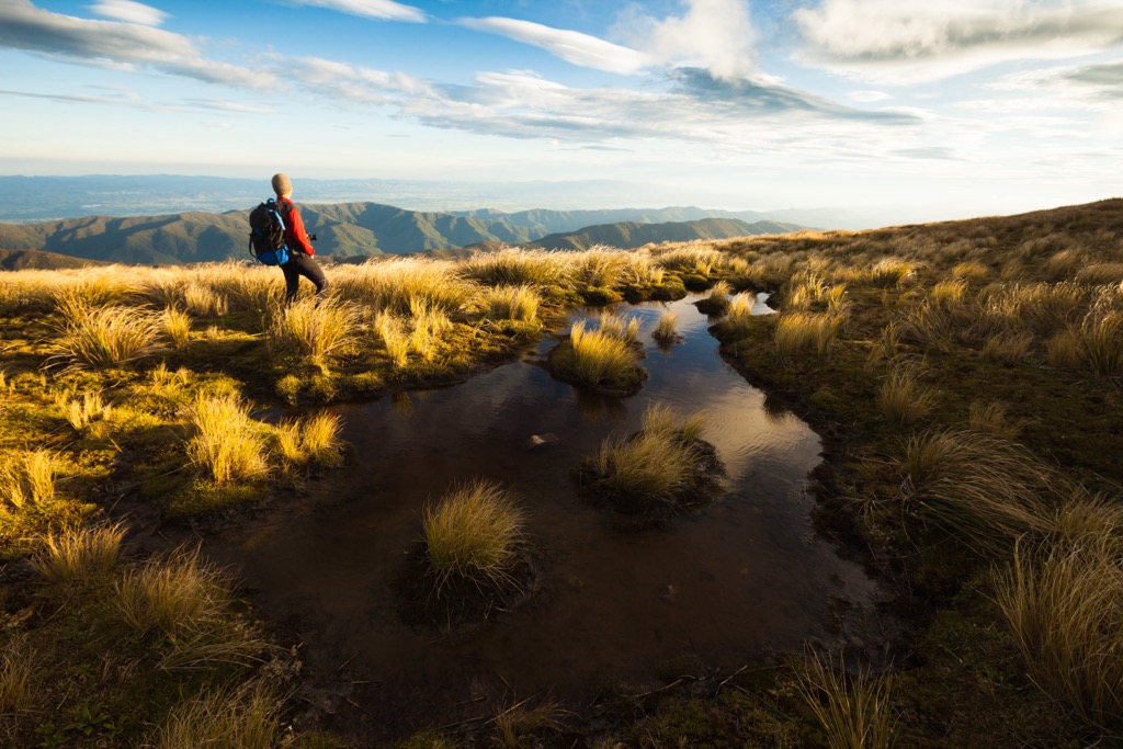
The Southern Crossing was historically the route from Otaki Forks to Wairarapa Plains and later to Kaitoke Basin. The route became popular in the 1920s and 1930s. It runs 35 km (22 mi) with about 2,375 m (7,800 ft) of elevation gain.
It typically takes three days; the upper section between Table Top and Mount Alphan takes six to eight hours. There are fantastic views of Wellington Harbor and the Kaikoura Mountains along the way.
Field Hut and Alpha Hut are below the treeline and are commonly used by through hikers. Kime Hut can be used as an alpine shelter in bad weather, but it is not ideal in winter as it does not have heating.
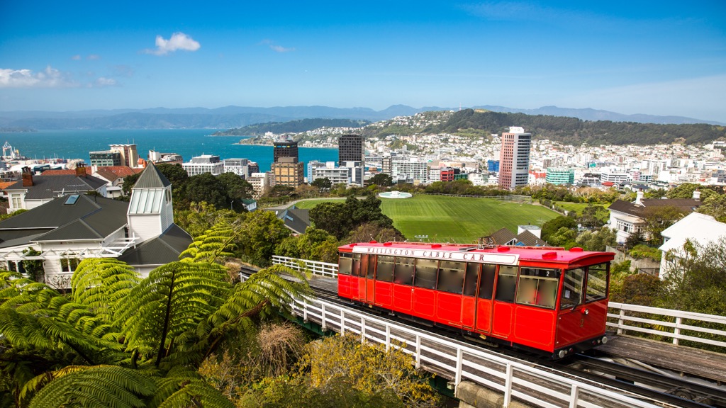
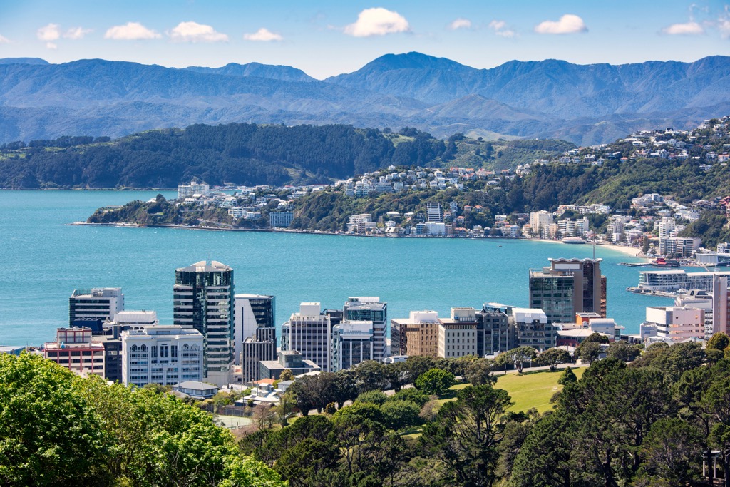
The biggest city in Wellington is the city of Wellington. It is the capital of New Zealand and is located 8.5 hours from Auckland by car and 1.5 hours flying. The South Island is a three-hour ferry ride away. Other large towns in the region include Lower Hutts, Upper Hutts, and Porirua.
Wellington is home to nearly 213,000 people and is nestled on a scenic harbor surrounded by verdant hills.
The Museum of New Zealand Te Papa Tongarewa houses an extensive collection of natural history and cultural artifacts, bringing the country’s rich bio- and cultural diversity to life. Those looking to explore the city can download self-guided tours on their phone or book a culinary tour that takes them through some of the city’s classic and traditionally inspired cuisines.
Riding up the city’s cable car provides scenic views across the city with the option to tour the botanic gardens at the top. Zealandia is a wildlife reserve near the city that allows visitors to walk through pristine habitats and spot rare and endangered wildlife.
The city has a range of accommodation available. Those roughing it can find a campsite outside the city or a cheap hostel, while those looking for more comfortable stays will have their choice of hotels.
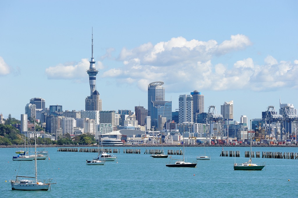
Auckland is the largest city in New Zealand, with a population of 1.66 million. The country’s main international airport is in Auckland. Those with a day or two to spare can explore Auckland’s numerous neighborhoods and suburbs, including Ponsonby with its galleries, restaurants, and boutique shops, and Takapuna, a scenic coastal spot with views of Rangitoto Island.
Visitors can kayak to Rangitoto Island or explore many hikes and surf spots outside the city limits. To learn more about the region’s culture and history, visit the Auckland Museum or the New Zealand Maritime Museum. The city has a diverse dining scene with influences from Polynesia, Southeast Asia, and traditional Māori dishes. Plenty of accommodation is available, ranging from budget hostels to seaside hotels.


Yes. Wellington has 480 named mountains. The highest is Bannister at 1,573 m.
The highest mountain in Wellington is Bannister, at 1,573 m.
Wellington has 480 named mountains.


