
Scan the QR code and open PeakVisor on your phone
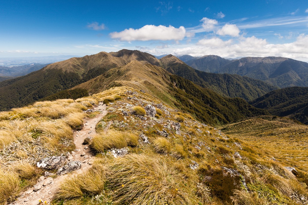
The Tararua Range include 614 named peaks. The highest is Bannister at 1,573 m. Other notable peaks include Pukeamoamo / Mitre, Girdlestone and Peggys Peak.
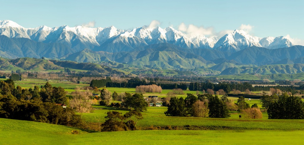
The Tararua Range is one of a series of ranges running north to south along the North Island of New Zealand. It is located in the Wellington region and is mostly protected within Tararua Forest Park. The range features approximately 614 named mountains; Bannister is the highest (1537 m / 5,043 ft) and most prominent (299 m / 981 ft).
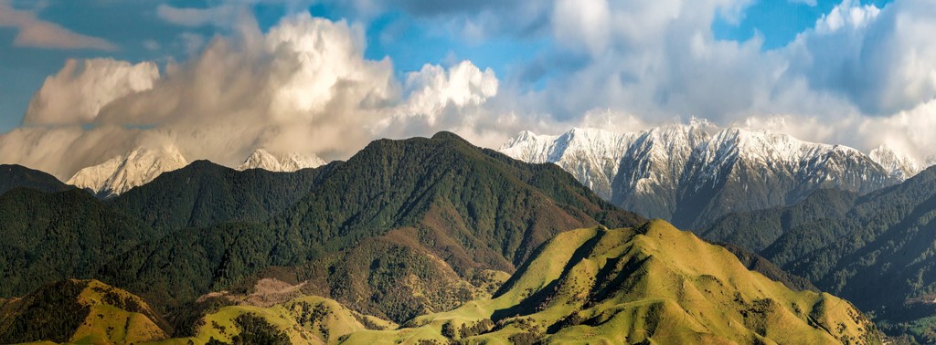
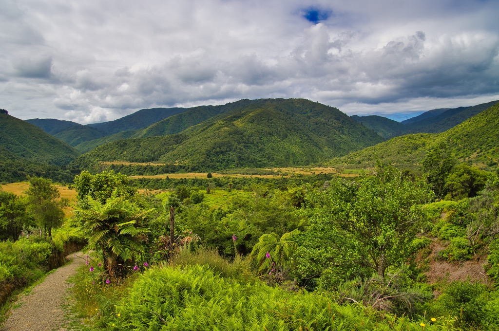
The Tararua Range on New Zealand’s North Island is one of several ranges that form a spine down the length of the island. It is characterized by highly faulted parallel ranges interspersed with river valleys.
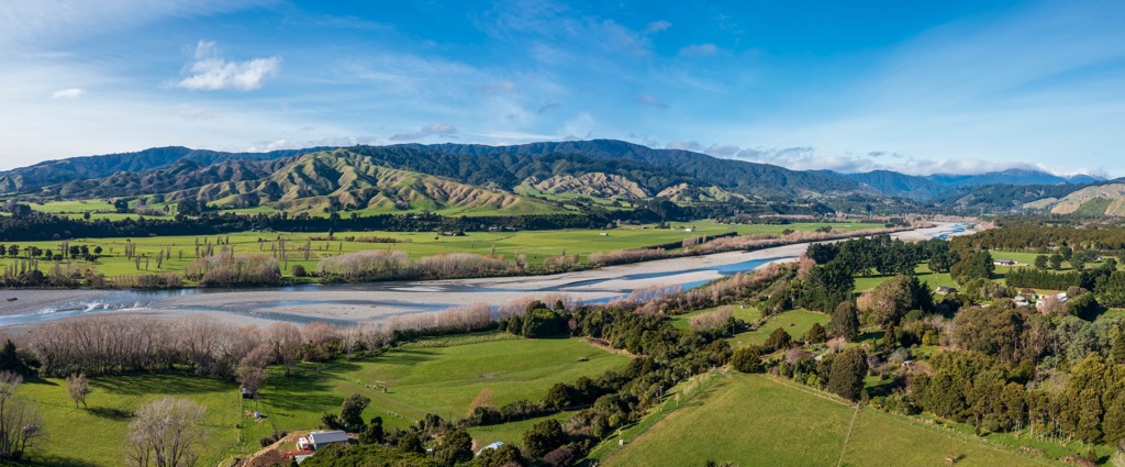
Tararua Forest Park covers around 116,535 hectares (288,000 acres) and protects most of the Tararua Range. It’s New Zealand’s oldest forest park, established in 1954, and is the largest park managed by the Department of Conservation on the North Island. The mountains run from Manawatū Gorge to Remutaka Range, approximately 100 km (62 mi) long. The Ruahine Range is their northern neighbor.
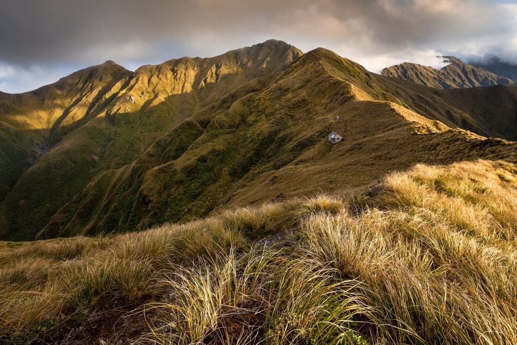
The Tararua Mountains have gained the reputation of being one of the most challenging hiking destinations in the country. With unpredictable weather and abundant rainfall, the exposed mountaintops often experience dangerous conditions for inexperienced hikers.
New Zealand’s geologic history dates back to the supercontinent Gondwana. Around 540 million years ago, New Zealand formed along the supercontinent’s perimeter. Rivers carried sediment, and underwater eruptions generated ash that hardened into the rocks, primarily greywacke, underlying most of the country today.
Around 100 million years ago, magma welled up and caused volcanic eruptions and splits along faults. By 85 million years ago, the Zealandia land mass separated from Gondwana and the Australian mainland and began to drift across the Pacific Ocean.
New Zealand sits near the boundary between the Australian and Pacific plates. Twenty-five million years ago, Zealandia split, and tectonic forces uplifted sections of the continent. There has been further uplift in the last 1.8 million years, such as the Southern Alps on the South Island and volcanic eruptions, which continue in the present.
The Tararua mountains uplifted as the Australian and Pacific tectonic plates collided. They have been heavily shaped by fault systems running southwest to northeast. Valleys along fault systems support grassy flats and low saddles, making easily navigable terrain, whereas valleys cutting across the faults typically have deep gorges and are hard to traverse.
The Southern Tararua mountains sit between the Wellington and Akatarawa faults. The Akatarawa River follows its namesake fault until it joins the Hutt River north of Upper Hutt.
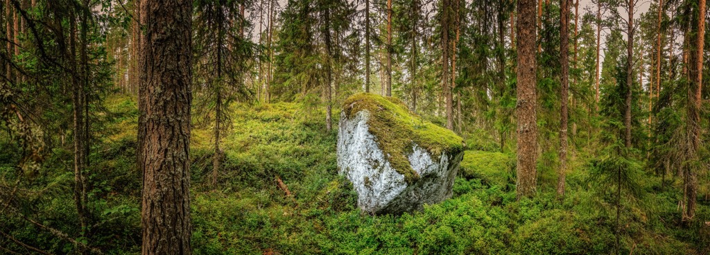
During the Ice Age, glaciers carved out valleys and shifted rocks and sediment. In the Tararua mountains, the impact of the most recent ice ages can be seen in hanging valleys, outwash terrace deposits, and boulders (glacial erratics) scattered throughout small valleys.
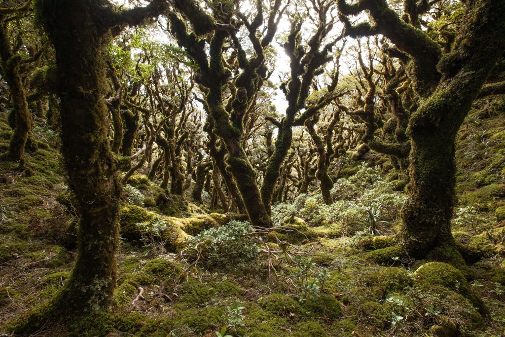
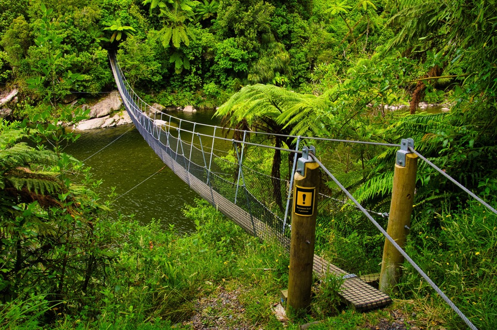
The Tararua Range is notorious for intense, unpredictable weather. Storms arriving across Cook Strait send massive amounts of precipitation towards the mountains. Some exposed western slopes are soaked in up to 500 cm (196 in) of rain annually, forming a large swath of rainforest across the lower slopes of the Tarahua.
Like many mountain ranges, the east and west sides of the mountains support different ecozones. The rainy western side grows thick with conifers, ferns, shrubs, and vines. The drier east features beech forest that grows less densely. Broadleaf-podocarp forests are typical across the North Island. Fifteen species of podocarps, trees from conifer families, grow in New Zealand; some of the most common are rimu, kahikatea, miro, mataī, and tōtara.
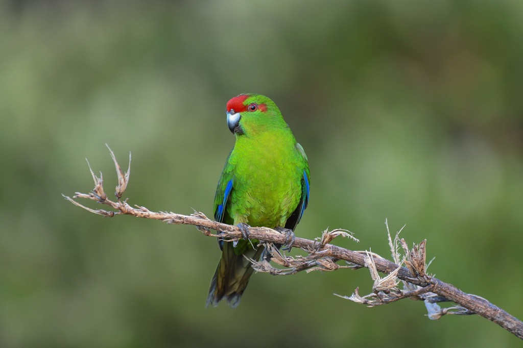
New Zealand has a unique composition of native fauna. The country has the highest number of flightless bird species in the world, and the only native mammals are bats and marine mammals. There are many invertebrates, some of the most noteworthy being the giant Powelliphanta snails that grow up to 9 cm (3.5 in) in diameter and the endemic wētā.
Native birds that thrive in the Tararua mountains include the bellbird, tūī, kākāriki, fantail, morepork, and kererū. Other species that live here include long- and short-tailed bats, tree wētās, skinks, geckos, and the Wainui snail. Non-native species like deer and possums damage the native ecosystem and require constant management.
The Tararua Range has long been linked to the Māori. The Māori first settled in New Zealand around 1250 with the arrival of Polynesian explorer Whātonga. Tribes descended from this initial arriving party and, over time, shifted through the North Island and down to the South Island.
The Ngāti Toa tribe called the Tararua Mountains “Te Tuarātapu-o-Te Rangihaeata” (the sacred back of Te Rangihaeata). This naming, a common practice in Māori tribes linking body parts with the land, marked a peace agreement between two tribes. The mountains served as a division between the Ngāti Toa on the west and the Ngāti Kahungunu on the east.
When European settlers arrived, they quickly began converting forests into farmland. Due to its intense weather and inhospitable terrain, the slopes of the Tararua Range escaped relatively unscathed. Tararua Forest Park was declared New Zealand’s first Forest Park in 1954. It was also home to New Zealand’s first tramping club, the Tararua Tramping Club (“tramping” is synonymous with hiking), which constructed one of the first tramping huts in the range in 1924.
The Tararua Range, open to hikers, trekkers, and hunters, is not for the faint of heart. The mountains are known for their foul weather, particularly along exposed ridges, and routes above treeline are best left to experienced hikers.
Hikers should check the weather before setting out and, regardless of the weather forecast, come prepared for rain. Even small streams can become impassable after rainfall, but it doesn’t take long for water levels to drop again.
The range has several long hikes, including the Northern Crossing and the Southern Crossing. Visitors must purchase a pass in advance to use huts in the park.
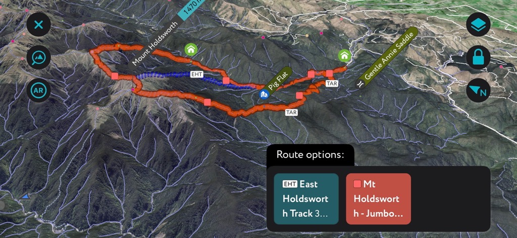
Considering how challenging many of the hikes in the Tararuas are, the Gentle Annie Track is an excellent option for hikers of all levels. The route departs from the Donnelly Flat Loop Walk and passes Rocky Outlook, which, as its name implies, is a great spot to enjoy the views. From there, the trail crosses Pig Flat before reaching Mountain House Shelter.
One of the advantages of this route is that it features a range of forest landscapes, perfect for varied hiking and a sampling of the different ecozones of the Tararua. The trail is about 9 km (5.5 mi) and typically takes three to four hours.
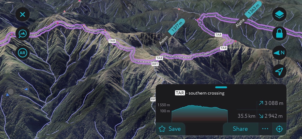
The Southern Crossing is around 35 km (22 mi) point to point with 2,377 m (7,800 ft) elevation gain. This route is best for experienced hikers. It passes three huts along the way – Alpha, Field, and Kime. There is no water along the ridges, so carry plenty of water bottles and refill at the huts.
The trail dates back to the early 1900s when a local committee spearheaded a project to link Otaki and the Wairarapa. From Otaki Forks, the path climbs through forest to Field Hut, ascends further to Kime Hut, and then summits Mount Hector (1,529 m / 5,016 ft) with sweeping views across Wellington and the Wairarapa.

The trail then crosses several lower, sub-alpine peaks to reach Alpha Hut. The original route ended at Walls Whare near Greytown, but many today walk to Kaitoke near Upper Hutt. It’s worth noting that the new version of the trail stays on the west side of the range.
The Mount Holdsworth Jumbo Circuit is a 22 km (13.8 mi) loop with around 1,525 m (5,000 ft) of elevation gain. The trail crosses through a beautiful beech-podocarp forest and runs along some of the best alpine zones in the park. It is a challenging hike but offers varied terrain and epic views from the top.

The trail begins along the Gentle Annie Trail, has the option for a spur trail to Rocky Outlook, and passes Mountain House Shelter before arriving at Powell Hut near the bush line. Day two climbs Mount Holdsworth (1,470 m / 4,823 ft) and follows the ridgeline to the top of Jumbo (1,457 m / 4,780 ft) before descending to Jumbo Hut. The third day descends to return to Holdsworth Lodge.
The Tararua Range is located near Wellington and Upper Hutt in the south and Palmerston North in the north. Holdsworth is the main eastern entrance, Waihohine Gorge is a common entrance from the southeast, and Otaki Forks is the primary western entrance.
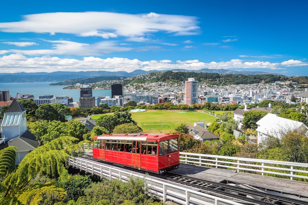
Wellington is New Zealand’s capital and is home to around 213,000 people. The city sits on a picturesque harbor on the southern tip of the North Island.
Stop by the Museum of New Zealand Te Papa Tongarewa for exhibits on Māori and Pacific history and artwork, or stroll the Wellington Writers Walk for a series of sculptures with quotes from the country’s famous writers. A top attraction is a ride on the cable car from Lambton Quay up Kelburn Hill with a visit to the Botanic Gardens at the top.
The city is highly walkable and home to many cafes and a diverse dining scene ranging from ethnic cuisines to local Māori dishes. People staying a few days will find accommodation for a range of budgets.
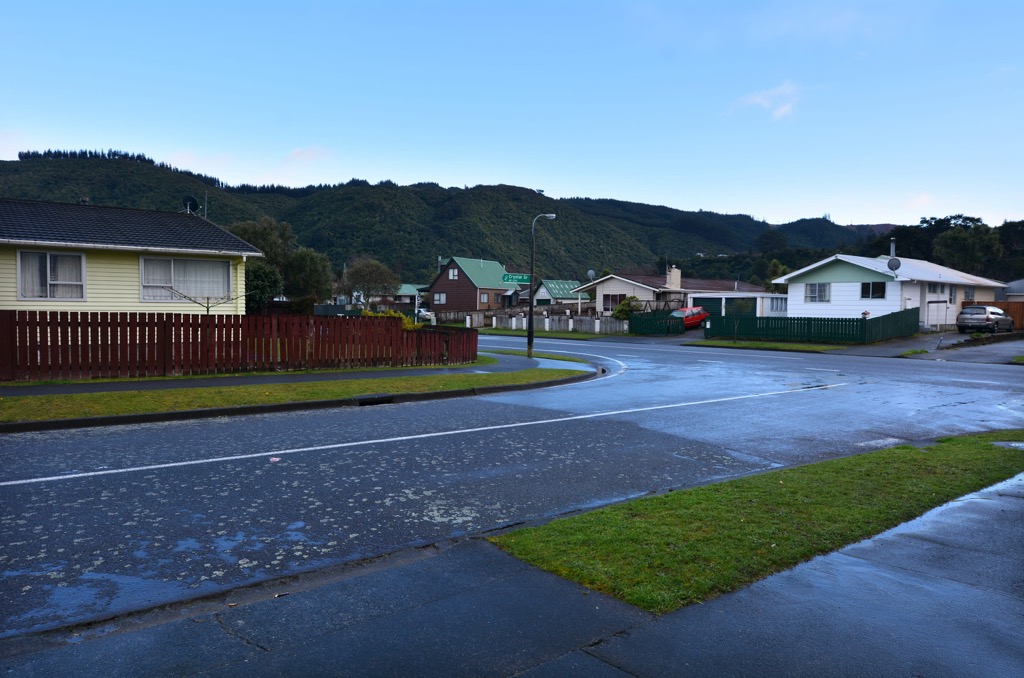
Upper Hutt has a population of 46,000 and is north of Wellington. The town isn’t exceptional by any means, but it offers ample opportunities for outdoor exploration in the Tararua. There are many trails for hiking and mountain biking near town, Staglands Wildlife Park for walks and animal observation, and the chance to white water raft on the Te Awa Kairangi.
You’ll also have a chance to visit Brewtown, a craft beer village. This one-of-a-kind village is a hub for breweries, a distillery, and assorted food and entertainment options. The town has backpacker hostels, motels, and more upscale lodging available.
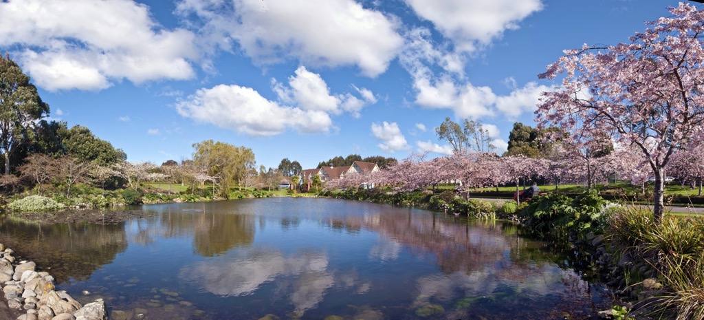
Palmerston North has a population of around 88,000 near the southern edge of the Ruahine mountains. It’s a small city with a bright cultural scene with art galleries, street art, and several venues for live music and theater. It is also the home to the New Zealand Rugby Museum.
The city’s dining scene is robust and varied, and visitors will find accommodation options ranging from camping and hostels to fancy hotels. From Palmerston North, it is easy to access the Ruahine and Tararua mountains and the dramatic Te Apiti - Manawatu Gorge that separates them.


The highest peak in the Tararua Range is Bannister, at 1,573 m.
The Tararua Range have 614 named peaks.


