
Scan the QR code and open PeakVisor on your phone
The Ruahine Range include 329 named peaks. The highest is Mangaweka at 1,732 m. Other notable peaks include Hikurangi, Rangioteatua and Iron Peg.
The Ruahine Range is part of the central dividing range on New Zealand’s North Island. The mountains are protected by the 94,000 ha (232,280 acre) Ruahine Forest Park in the Manawatu-Wanganui region. The Ruahine Range encompasses approximately 329 named mountains; Mangaweka is the highest (1,732 m / 5,682 ft) and most prominent (411 m / 1,348 ft).
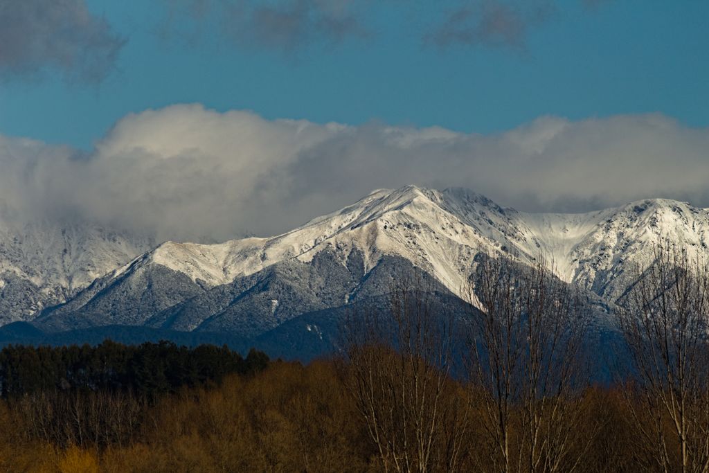
The Ruahine Range is located on New Zealand’s North Island in the Manawatu-Wanganui region. It is part of the main range dividing the island, and it spans from the Taruarau River in the north to the Manawatu Gorge in the south. The Ruahine Forest Park is a 94,000 ha (232,280 acres) protected area encompassing the mountains.
The range is about 24 km (15 mi) wide in the north and 8 km (5 mi) wide in the south. It extends approximately 100 km (62 mi) in length and declines in elevation as it moves south. The Ruahine Range borders the Tararua Range and Tararua Forest Park to the south and the Kaweka Range and Kaweka Forest Park to the north.
The range’s steep, narrow shape influences precipitation. Rain and snowfall vary throughout the range, but some regions boast significant rainfall; one weather station measures around 5 m (16 ft) of rain annually. Numerous rivers and streams cut through the mountains.

New Zealand’s geologic history dates back to the supercontinent Gondwana. Around 540 million years ago, New Zealand formed along the supercontinent’s perimeter. Rivers carried sediment, and underwater eruptions generated ash that hardened into the rocks underlying most of the country today.
New Zealand sits near the boundary between the Australian and Pacific plates. Around 100 million years ago, magma welled up and caused volcanic eruptions and splits along faults. By 85 million years ago, the Zealandia land mass separated from Gondwana and the Australian mainland and began to drift across the Pacific Ocean.
Twenty-five million years ago, Zealandia split, and tectonic forces uplifted sections of the continent. There has been further uplift in the last 1.8 million years, such as the Southern Alps on the South Island and volcanic eruptions, which continue in the present. During the Ice Age, glaciers carved out valleys and shifted rocks and sediment. Massive ice flows, such as the Tasman and Fox glaciers, continue to alter the landscape.

The Ruahine Range is part of the main dividing range on the North Island. At only one to two million years old, the mountains are comparatively young. The range sits on the fault line between the Australian and Pacific continental plates and continues to rise as the crust uplifts.
The range is composed primarily of greywacke from the Mesozoic era. In addition to uplift from the tectonic plates colliding, it’s shaped by erosive forces along fault lines and contains numerous waterways that drain through it. In the 1800s, copper was discovered in Coppermine Creek, which led to a brief period of mining.

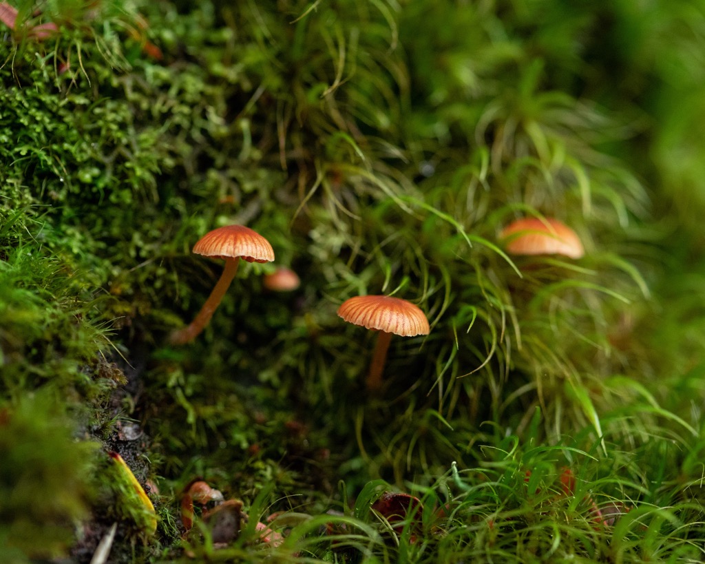
The ecosystems of the Ruahine Range shift with latitude and historical use. In the north, red beech, rimu, miro, matai, and mountain beech dominate the forests. Kahikatea grows in swampy areas. Higher elevations feature sup-alpine shrubland, tussock grassland, and wildflower fields that bloom in the summer.

In the south, the climate is wetter and more overcast. The range is home to the largest unfragmented Tupare (leatherwood) forest in New Zealand. Throughout the park, the understory comprises ferns, horopito, rangiora, and mahoe.
Many native birds make their home in the mountains. These include tui, kereru (wood pigeon), tom-tit (miromiro), fantail (piwakawaka), grey warbler (riroriro), bellbird (korimako), and kakariki (parakeet). The rare blue duck (whio) can be found in streams, and the New Zealand falcon (karearea) and North Island kaka live at higher elevations. Other animals include skinks, geckos (moko), bats (pekapeka), and giant land snails.
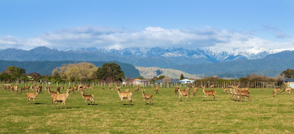
Non-native mammals such as red deer, pigs, goats, possums, and mustelids pose a threat to the native ecosystems. In some areas, hunting controls are in place to manage the populations of these introduced species.

In the 1930s, Hawke’s Timber Company arrived in the south and significantly altered the forest as they targeted large podocarp species like rimu and matai. Today, beech trees have filled in, and there is a notable lack of podocarps. The tōtara, rimu, and matai trees growing in reserves serve as a reminder of what the native, old-growth forests once looked like.
Early Māori were drawn to the abundant natural resources provided by the forest and waterways. The name itself is said to mean “wise woman,” in relation to the granddaughter of the leader of the Aotea waka. The tribes Ngai te Upokoiri and Hinemanu hapu built villages around the foothills in the northern and central parts of the range. The Rangitane and Kahungunu people utilized the southern portion.

The Maori laid the first trails across the mountains, creating routes that the first Europeans later followed. The missionary botanist William Colenso first attempted to cross the mountains in 1845; he later succeeded in 1847. In total, he made several trips in an attempt to convert tribes. Along the way, he documented plants and left behind the first written record of flora in the mountains.
European economic development began in the mid-1800s. Settlers cleared forests to make pasture, and fires spread across the north part of the range. The south developed more slowly; clearing and milling began only in the early 1900s.

In 1887, copper was discovered in Coppermine Creek. Today, the tramline, magazine shaft, and regenerating forest remain around the site. Other industrial pursuits include milling operations along the Makaroro River in the 1920s and a timber mill at the end of North Block Road in the 1930s.
Several recreational cabins exist in the Ruahine Range. For a brief period in the 1930s, the mountains housed a ski field; after the area was abandoned, it became the site of Rangiwahia Hut along the Rangiwahia Track. Shepherds and wild dog hunters originally built the Ruahine and Herrick Huts, while the Shutes Hut was built for rabbiters.
Red deer were released in northern Ruahine in 1883 and reached southern ranges by the 1920s. The conservation department employs hunting and conservation culling to manage the deer population. Ruahine Forest Park received its designation as a park in 1976 and is primarily used for recreation, conservation, and watershed protection.
There are several trails and huts in the Ruahine Forest Park that allow visitors to do day hikes and overnight trips. Some huts require advanced booking, and others are first-come, first-serve. Visitors should note the frequent cool, cloudy weather and episodes of heavy rain. It’s essential to check the weather before heading out and to exercise caution at river and stream crossings after rain.

The Sunrise Track is a popular trail in the Ruahine Mountains. It is about 12.5 km (8 mi) out and back with just under 915 m (3,000 ft) elevation gain. The trail leads from North Block Road to Armstrong Saddle, passing Sunrise Hut along the way. Those hoping to stay at the hut will have to book in advance.
The trail is well-maintained and great for new hikers and families. It is mostly shaded, offers excellent views, and is relatively easy.

The Knights Track to Pohangina Valley East Road is a two-night, three-day trek requiring 6 to 8 hours of walking per day. Day one starts on Knights Track and follows it to the top of Ngamoko. From here, the trail sticks to the ridge for a while before descending towards the Pohangina River. Leon Kinvig Hut sits near the river and operates on a first-come, first-serve basis.
Day two from Leon Kinvig Hut to Mid-Pohangina Hut (first-come, first-serve) follows the river for much of the day and includes multiple river crossings. Hikers should keep an eye out for the rare blue duck (whio) on this section of the route. The final day is another full day’s hike, following above the river most of the time to reach Pohangina Valley East Road.

The Rangiwahia Hut Track is 8 km (5 mi) out and back with a 670 m (2,200 ft) elevation gain. The trail goes from Renfrew Road to Rangiwahia Hut, located on the historic site of a short-lived ski hill. The hut requires advance booking to stay over. Along the way, the trail passes a waterfall, with one stream crossing. It’s well-maintained and offers views across the neighboring mountains on a clear day.

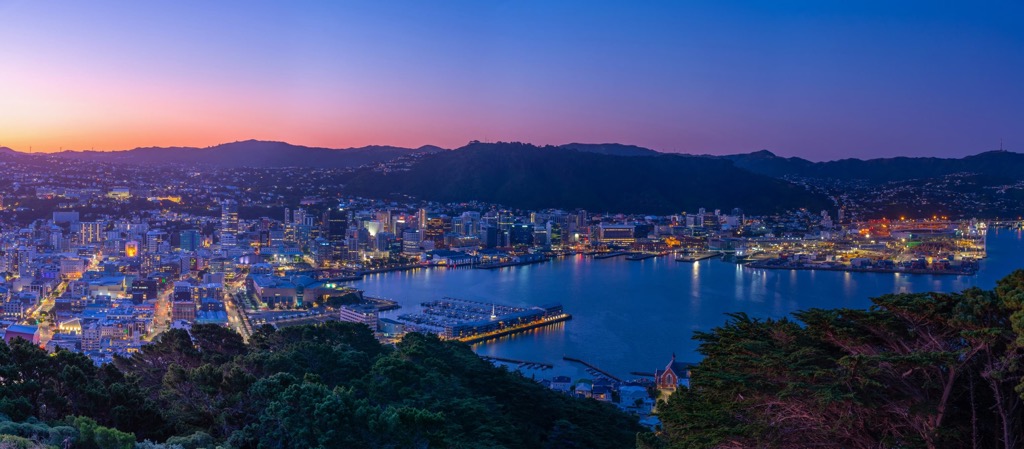
Located centrally on the North Island, the Ruahine Range is accessible from the capital city, Wellington, to the south or from Auckland to the north. Palmerston North and Hastings are smaller cities near the southern and northern tip, respectively.
Wellington is New Zealand’s capital and home to around 213,000 people. The city sits on a picturesque harbor on the southern tip of the North Island.
Stop by the Museum of New Zealand Te Papa Tongarewa for exhibits on Māori and Pacific history and artwork, or stroll the Wellington Writers Walk for a series of sculptures with quotes from the country’s famous writers. A top attraction is a ride on the cable car from Lambton Quay up Kelburn Hill with a visit to the Botanic Gardens at the top.
The city is highly walkable and home to many cafes and a diverse dining scene ranging from ethnic cuisines to local Māori dishes.
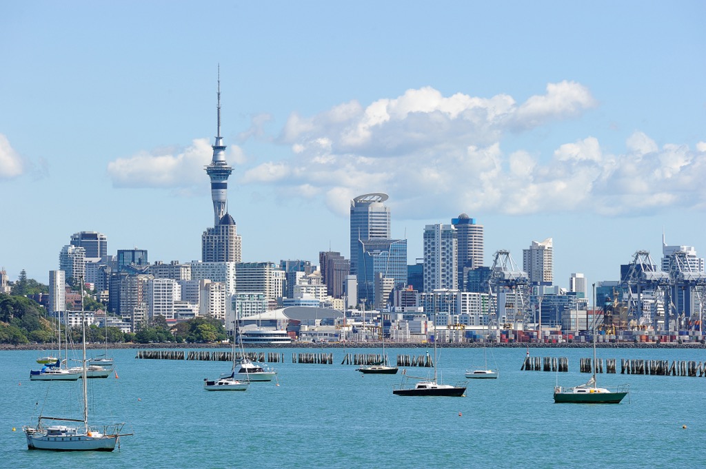
Auckland, New Zealand’s biggest city, has a population of 1.66 million and is the first destination for most people arriving on an international flight. The city is spread out; the neighborhoods around Newmarket, Ponsonby, Parnell, and Takapuna are worth a visit for their boutique shops, cafes, and beaches. The Auckland Art Gallery houses historical and contemporary works and highlights local artists.
A trip to Waiheke Island will fill a day or two with beaches, trails, and wineries. Other great spots are Goat Island for snorkeling, beaches on the west coast for surfing, and coastal hiking trails.
Palmerston North has a population of around 88,000 near the southern edge of the Ruahine mountains. It’s a small city with a bright cultural scene with art galleries, street art, and several venues for live music and theater. It is also the home to the New Zealand Rugby Museum.
From Palmerston North, it is easy to access the Ruahine and Tararua mountains and the dramatic Te Apiti - Manawatu Gorge that separates them.
Located east of the Ruahine mountains, Hastings is near Hawke’s Bay and has a population of 88,000. It’s an economic hub, with many new restaurants and cafes popping up. A sleek, modern design, with open spaces incorporated into the layout, defines this New Zealand town.
Of the public arts displayed in the city, one of the best known is Ngā Pou o Heretaunga. These 18 Māroi carvings represent important Māori ancestors from the Heretaunga district.
The surrounding area supports abundant orchards and vineyards. The weekly Hawke’s Bay Farmers Market features local produce and artisan goods, and visitors can take a day trip to local wineries. The Hasting iWay Loop is a route for urban cycling that connects to a broader trail system in Hawke’s Bay Trails.


The highest peak in the Ruahine Range is Mangaweka, at 1,732 m.
The Ruahine Range have 329 named peaks.


