Scan the QR code and open PeakVisor on your phone
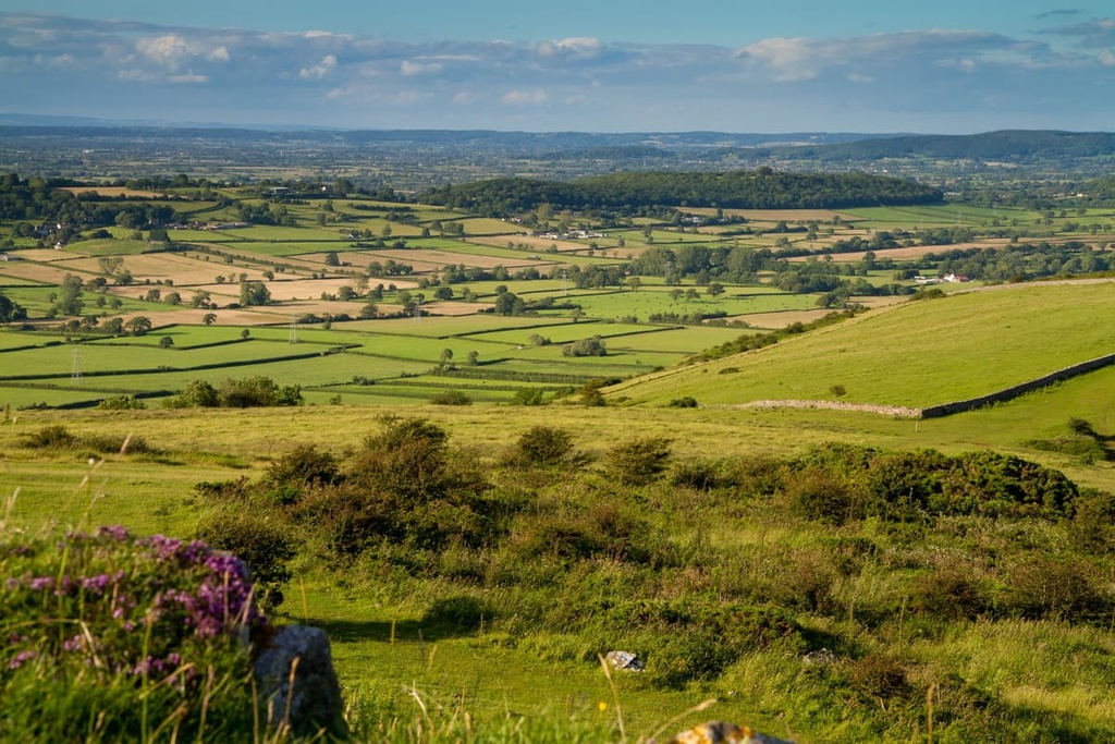
Stroll over one of the most beautiful hill ranges in England at the Mendip Hills AONB (Area of Outstanding Natural Beauty). There are 43 named points in Mendip Hills AONB. The highest and the most prominent hill in the AONB is Beacon Batch (325 m/1,066 ft).
The Mendip Hills AONB is an area of protected countryside in South West England in the UK. The AONB encompasses an area of approximately 76 sq mi (198 sq km) in the county of Somerset. It’s one of 46 AONBs across England, Wales, and Northern Ireland.
The Mendip Hills AONB takes its name from the Mendips, a limestone hill range some 19 mi (30 km) long and 6 mi (10 km) wide that runs across northern Somerset. The western half of the Mendip Hills forms most of the AONB.
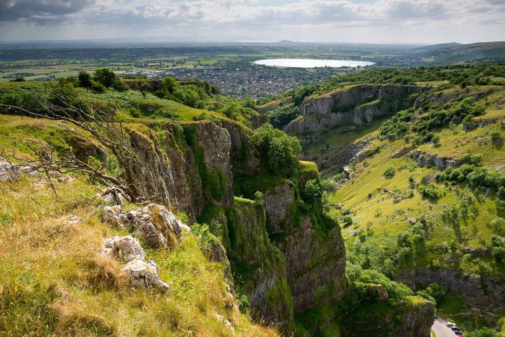
One of the most famous features of the Mendip Hills is Cheddar Gorge. Located on the southern edge of the AONB, Cheddar Gorge features the tallest inland limestone cliffs in the country at 137 m (449 ft).
The gorge is also home to several show caves and is considered the most famous karst landscape in the country. It's considered to be one of the natural wonders of England, and it attracts around 500,000 visitors each year.
Located on the northern boundary of the park is the Chew Valley. This area contains the Mendip Hills AONB's largest lake, Chew Valley Lake. The Chew Valley Lake is the fifth-largest artificial lake in the UK at 1.8 sq mi (4.9 sq km). It is an essential habitat for several bird species. The only other notable lake in the Mendip Hills AONB is Blagdon Lake.
There are no substantial rivers that run through the Mendip Hills as the majority of waterways in the park are minor streams and tributaries. The Yeo River, the Mells River and the River Chew are the most important rivers in the Mendips. The Cheddar Yeo in Gough's Cave is Britain's largest underground river system.
The Mendip Hills AONB is also located just a short drive away from many other parks and protected landscapes in South West England. These include:
There are no major cities or towns located in the Mendip Hills AONB. Notable small settlements in the AONB include Cheddar, Wells, and Winscombe.
The nearest major town is Weston-super-Mare, which is located less than 5 mi (8 km) to the northwest. Bristol, the most populous city in South West England, is located less than 20 mi (32 km) to the north of the Mendip Hills AONB.
The Mendips primarily consist of sedimentary rocks, with the exception of a small pocket of Silurian volcanic rocks. The primary rock type is Carboniferous limestone, which formed between the Late Devonian and Mid Jurassic periods (385 to 161 million years ago).
The Mendip Hills formed during the Variscan orogeny towards the end of the Carboniferous period around 300 million years ago. This mountain-building event shaped much of western Europe, including Sardinia in Italy and the Black Forest in Germany.
The Variscan Orogeny folded the Mendips into their distinguished whale-backed shape that we see today. This orogeny created at least four anticlinal folds trending from east to west across the Mendips. Notable hills that formed from these anticlinal folds include Black Down (325 m/1,066 ft) and Pen Hill (307 m/1,007 ft).
Approximately 200 million years ago, the Mendips were considerably higher than they are today, having once reached over 1,500 m (4,921 ft) in elevation. However, erosion has dramatically lowered the hills and formed many cave systems, gorges, and dry valleys across the range.
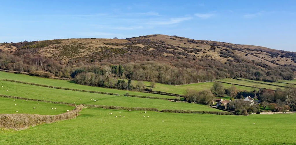
Today, the Mendips consist of low-lying limestone hills that rarely exceed 300 m above sea level. The highest point is Beacon Batch (325 m/1,066 ft), which is the name for the summit area of Black Down. Additionally, Black Down is the AONB's only Marilyn (a hill with a prominence of 150 m/492 ft or more).
Other notable hills in the Mendip Hills AONB include North Hill (313 m/1,026 ft), Wavering Down (211 m/692 ft), and Crook Peak (186 m/610 ft).
The Mendips are designated an Area of Outstanding Natural Beauty partly because of their rare habitats. There are three nationally important habitats located within the Mendip Hills AONB: ash–maple woodlands, calcareous grasslands, and mesotrophic grasslands.
The Mendips are home to nationally substantial populations of hazel dormice, common dormice, and horseshoe bats. Approximately 12 percent of the UK's greater horseshoe bat population lives within the Mendip Hills. The most common mammals in the area are sheep, cows, and rabbits.
Several rare bird species inhabit the Mendips, including Dartford warblers, which nest on the slopes of Black Down (325 m/1,066 ft). Other notable bird species include nightjars, long-eared owls, and peregrine falcons.
One of the most interesting amphibian species in the Mendips is great crested newts, which are often found in the park's flooded quarries. Nationally rare white-clawed crayfish live in the Mells River and the River Chew.
The Waldegrave Pool is an essential habitat for several dragonfly species, including four-spotted chasers and downy emeralds. A number of rare butterfly species are native to the Mendips, too, including Duke of Burgundys, pearl-bordered fritillaries, and white-letter hairstreaks.
The majority of the Mendip Hills AONB is grasslands, with a few sections of ancient woodlands. These woodlands are composed mainly of ashes, maples, and small-leaved limes.
The Mendips are ecologically vital due to their limestone habitats, which are located within the area's gorges and valleys.
The rugged and remote nature of these habitats mean they have managed to escape agricultural development, leading to meadows filled with rare flowers. Since 90 percent of England's limestone habitats have been lost over the last century, the limestone grasslands of the Mendips are very significant.
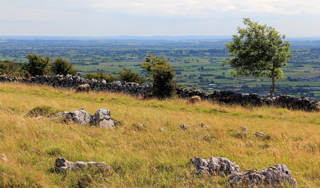
One interesting feature of the Mendips is its dry stone walls, which separate pastures. These walls have been allowed to disintegrate over time and now serve as a habitat for rare plant species, including wall whitlowgrass, white rock-rose, and purple gromwell.
Other rare native plants found in the Mendips include Cheddar pink, Somerset hair-grass, and starved wood-sedge.
The Mendips are one of England's most important archeological areas. Twenty Paleolithic sites have been uncovered across the hills, many of which were found in caves. There have also been 27 findings from the Mesolithic period, most of which are flints.
The caves of Cheddar Gorge are especially important to archeologists. This is because floodwaters have washed artifacts into the caves, where they've been preserved in silt. In 1903, in Gough's Cave, archeologists uncovered the Cheddar Man, Britain's oldest complete skeleton, dating back to around 7,000 BCE.
Dozens of Neolithic, Iron Age, and Bronze Age sites have been discovered across the Mendips, including barrows and forts. There is evidence of around 286 round barrows in the Mendips.
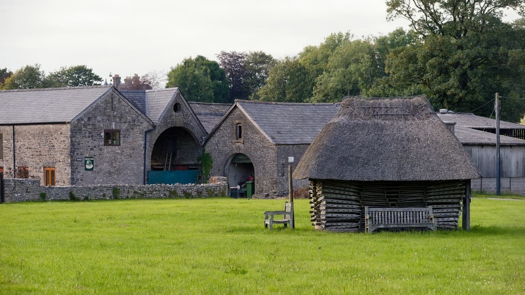
Settlements in the Mendips can be tracked through history, from small hamlets in the Neolithic and Bronze ages to large purpose-built settlements in the Iron Age and Roman Era. There are approximately 200 ancient monuments and 600 listed buildings in the Mendip Hills AONB.
Mining has been one of the Mendips' main industries since the Iron Age. There is evidence that the Roman mined for lead in the area from 49 CE until the fourth century.
Following the fall of the Roman Empire, the area's quarries were largely ignored, until the twelfth century when the Bishop of Bath was granted the right to mine in the hills. Mining was at its peak in the sixteenth and seventeenth centuries but had ceased by the twentieth century.
The Mendip Hills became an Area of Outstanding Natural Beauty in 1972. The Mendip Preservation Society, formed in 1965, is one of the main reasons the Mendips are protected today. They raised awareness about the area's natural importance, leading to its designation as an AONB. The Mendip Hills AONB Partnership manages the Mendip Hills AONB.
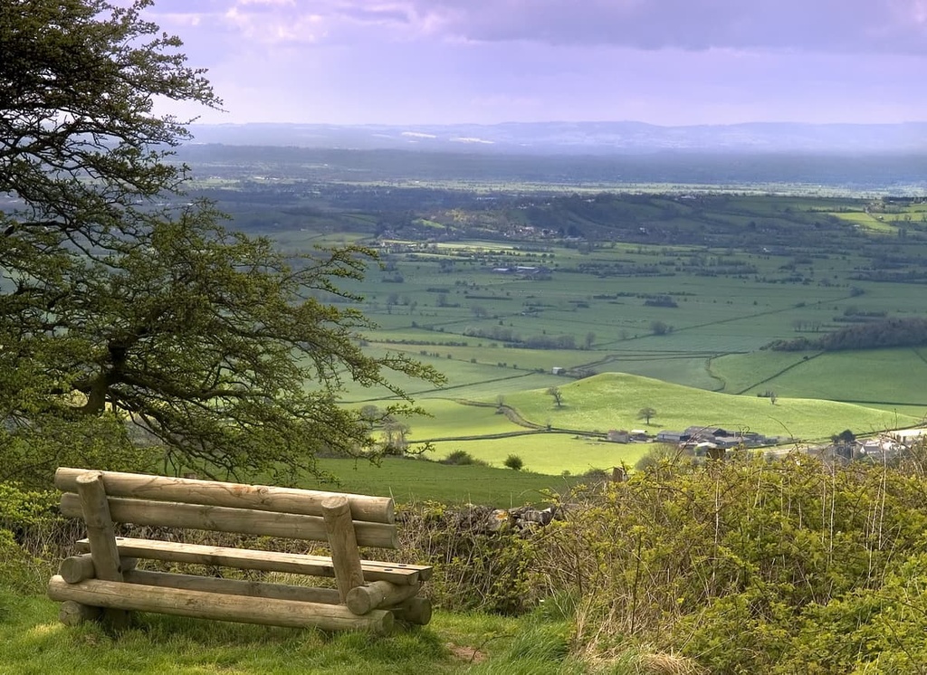
The Mendip Hills AONB is one of the most underrated walking destinations in the UK. You'll find over 270 miles (435 km) of trails to explore with fascinating archeological sites and some of the best views of Somerset to discover along the way.
Black Down (325 m/1,066 ft) is the tallest hill in the Mendip Hills AONB. Covered in waterlogged Old Red Sandstone heathlands, Black Down supports a variety of unusual and rare plants, including bilberry, heather orling, and European gorse. Black Down's main summit, Beacon Batch, features Bronze Age round barrows, which are thought to be around 2,000 years old.
The best way to climb Black Down is on the trail from the car park near the Charterhouse Centre. The walk is about 5 miles (8.5 km) in length. The walk is well marked and suitable for most hikers.
The route takes walkers steeply up Rains Batch Road and past several transmission masts to Beacon Batch's trig point. The trail then leads onto a bridleway, which loops back past the transmission masts to your starting point.
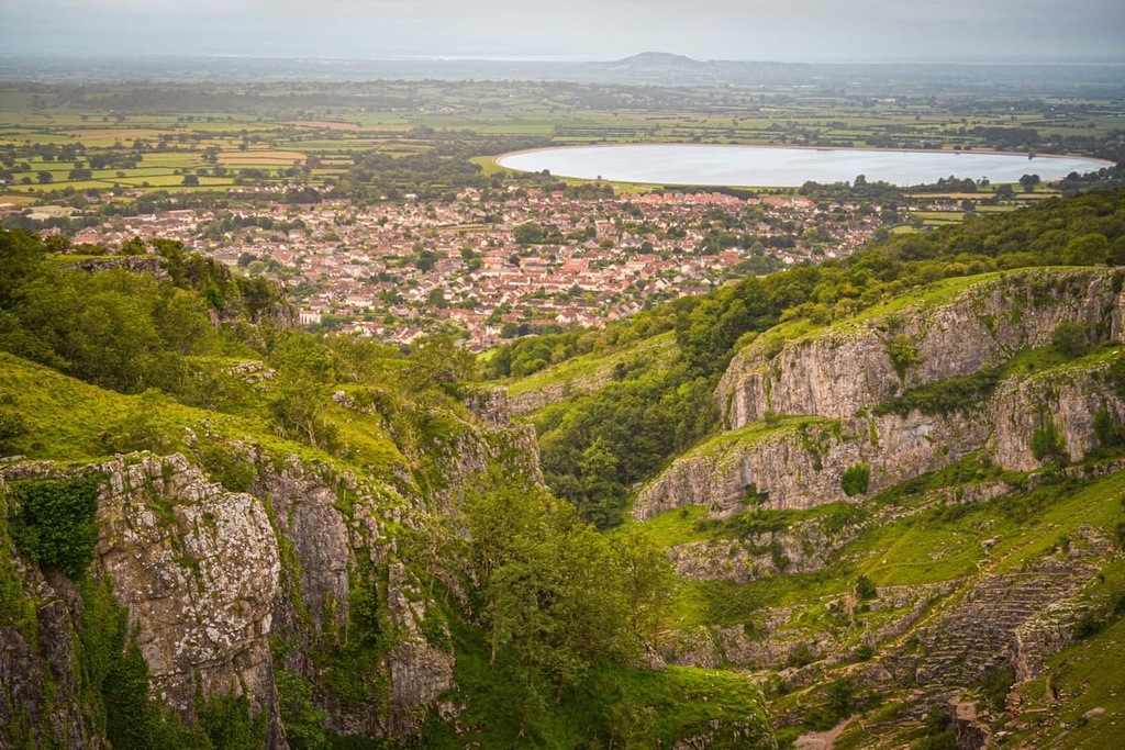
No trip to the Mendip Hills AONB is complete without visiting one of the UK's most famous karst landscapes, Cheddar Gorge. Measuring 3 mi (5 km) long and 137 m (449 ft) deep, Cheddar Gorge is the biggest gorge in England.
Additionally, Cheddar Gorge is a popular tourist destination thanks to its numerous show caves, including Gough's Cave and Wookey Hole. At the gorge's southern end is the village of Cheddar, where cheddar cheese gets its name.
The best way to explore the gorge is with a clifftop walk starting from Cheddar High Street. The trail is approximately 5 mi (8 km) in length. The path is challenging and shouldn't be attempted on foggy or windy days. For safety reasons, hikers should stay on the paths at all times.
From Cheddar High Street, walk up Cufic Lane and through the gate. The path continues steeply uphill through woodlands and up to another gate. After passing through this gate, hikers should take care as the cliff is exposed. Hikers should follow the stone wall, keeping it on the right at all times.
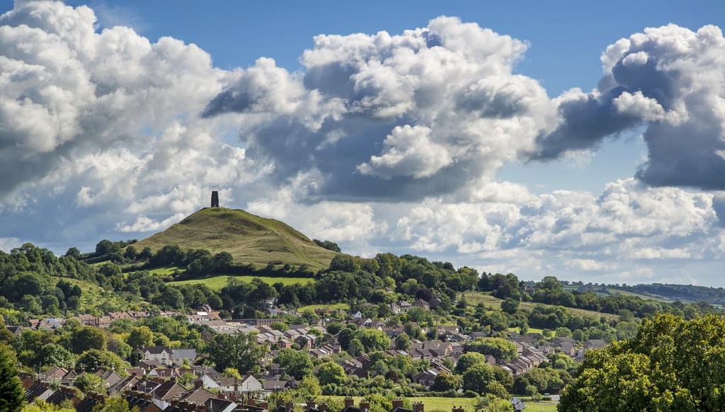
Eventually, you'll reach land owned by Cheddar Gorge; however, entrance to this area is free of charge. From the gorge's highest point, hikers will be treated to views to the south of Glastonbury Tor (156 m/512 ft) and the Somerset Levels.
The return leg leads past Jacob’s Ladder and Pavey’s Lookout Tower. You shouldn't walk down Jacob's Ladder (Jacob's Ladder is best saved for another time) but walk down the path to the left of the stairs instead. Once you arrive at Gough’s Craft Village, it's a short walk back to the heart of Cheddar.
Near the center of the Mendip Hills is the village of Priddy. The highest settlement in the Mendips, Priddy sits at over 250 m (800 ft) above sea level. Hikers can plan a walk through Westbury Combe to Deer Leap, which is regarded as one of the finest viewpoints in Somerset.
This is a moderate walk which is around 9 mi (14 km) in length. From Priddy, hikers should walk to the center of Westbury-sub-Mendip.
Follow the Westbury Combe bridleway to the Deer Leap car park. You can shorten this walk by parking at the Deer Leap car park instead of Priddy. From atop Deer Leap on a clear day, hikers will be able to spot the Quantocks, Glastonbury Tor (156 m/512 ft), and Wales across the Bristol Channel. In the gorge below is the Wookey Hole cave, which is also well worth visiting.
Draycott Sleights is a limestone escarpment located on the southern edge of the Mendip Hills AONB.
Like Deer Leap, Draycott Sleights is considered one of the finest viewpoints in the county, with sweeping views across the Somerset Levels to Glastonbury Tor (156 m/512 ft). On a clear day, you can see as far as Exmoor and Dorset.
Draycott Sleights’ grasslands are also popular with nature watchers and are home to a variety of animals, like badgers, muntjac deer, and several rare dragonfly species. In addition, several notable bird species frequent Draycott Sleights, including tawny owls and kestrels.
The best way to hike up Draycott Sleights is from the village of Draycott. This is a moderate walk which is approximately 3 mi (4.8 km) in length.
From the village center, follow the path towards Cheddar. Then turn onto the bridleway just past Batcombe Farm. The bridleway leads through Batcombe Hollow. At the first junction, turn right and follow the path into the Draycott Sleights Nature Reserve.
On the return leg, the trail joins the West Mendip Way, which leads downhill towards Draycott. Once you arrive at Sun Batch Road, you're just a short walk from the village.
Hikers looking for a long-distance trek that takes in the best of the Mendip Hills should walk the West Mendip Way. This 30-mi (49 km) trail runs from Uphill on the outskirts of Weston-super-Mare takes you on a walk in a southeasterly direction across the Mendip Hills AONB to England's smallest city, Wells.
The West Mendip Way takes about three days to complete. Hikers should bring a pair of hiking boots as well as plenty of water. They should also arrange accommodation before setting off. The West Mendip Way is easy to follow, with blue waymarkers along the entire route.
The first 6.5-mi (10.5 km) leg runs from Uphill to the village of Loxton. Along the way, you'll walk over Purn Hill (52 m/170.5 ft) and Hellenge Hill (136 m/446 ft). Just before reaching Oxton, you'll pass through Loxton Wood.
The second section is 5.5 mi (8.8 km) and leads from Loxton to Shipham. This is the best section of the West Mendip Way, as it leads to the summits of Crook Peak (186 m/610 ft) and Wavering Down (211 m/692 ft), two sweeping viewpoints. You will have to take a short detour to reach Crook Peak, but it's well worth the extra effort.
The third section from Shipham to Cheddar is also very popular. This 5.8-mi (9.3 km) leg begins with a walk through the undulating countryside of the Mendips before taking hikers along the top of Cheddar Gorge to the village of Cheddar.
The penultimate section is 5.5 mi (8.8 km) long and leads from Cheddar to Priddy, the highest village in the Mendips. The trail leads through the Draycott Sleights Nature Reserve, following a similar route to the circular Draycott Sleights walk mentioned previously.
The final section is 5.5 mi (8.8 km) and runs from Priddy to Wells. This is a worthwhile section of the West Mendip Way that leads through the Ebbor Gorge Nature Reserve and past the Wookey Hole show cave. The West Mendip Way ends at the Wells and Mendip Museum.
Hikers looking to extend their walk can add the 19-mi (30.5 km) East Mendip Way to their itinerary. This trail runs from Wells to Frome and passes over Cranmore Tower (298/977 ft), the highest point on the Mendip Way.
You won't be short of a place to stay during your visit to the Mendips, with picturesque villages and ancient cities a stone's throw from the hills. Read on to find out about some of the main cities and towns near the Mendips.
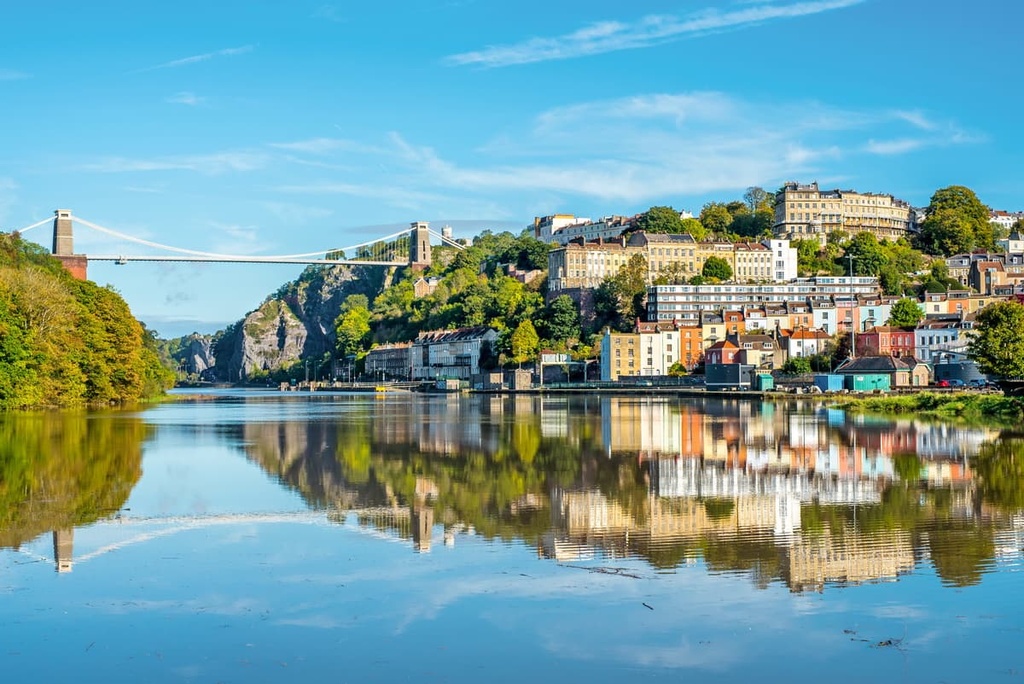
Located approximately 15 mi (24 km) to the north of the Mendip Hills AONB, Bristol is the largest city in South West England. Founded over a millennium ago, Bristol is famed for its maritime history and association with engineering pioneer Isambard Kingdom Brunel. Additionally, Bristol is a cultural hub, with over 30 art galleries.
Bristol is one of the top tourist destinations in the UK, attracting over 590,000 international visitors annually. Popular attractions include the twelfth-century Bristol Cathedral, the Clifton Suspension Bridge, and Brunel's SS Great Britain. If you're looking for a hotel in Bristol, consider the Bristol Harbour Hotel & Spa or the Mercure.
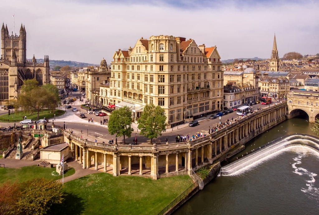
Bath is one of the oldest settlements in the UK and the largest city in Somerset. Founded by the Romans as Aquae Sulis, Bath dates back to approximately 60 CE. The city is famous for its well-preserved Roman Baths, which are as old as the city. Bath itself is a gorgeous spa city with unique attractions like Bath Abbey and Pulteney Bridge.
Bath is located roughly 20 mi (32 km) northeast of the Mendip Hills AONB. Popular hotels in Bath include the Roseate Villa and the DoubleTree.
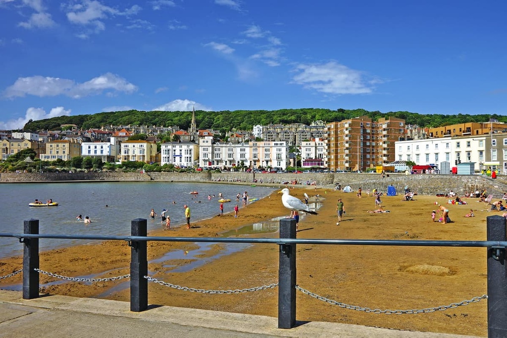
Sat overlooking the Bristol Channel is the town of Weston-super-Mare. With a population of over 75,000, Weston-super-Mare is the closest major settlement to the Mendip Hills. It's the perfect place to get a good night's sleep before hiking the West Mendip Way, which starts 2 mi (3.2 km) outside of town.
Weston-super-Mare is known for its sandy beach that’s ideal if you're looking to catch a bit of sun during your stay. If you get a chance, take a boat out to Steep Holm, a rugged island with hiking trails located 5 mi (9 km) off the coast. Popular hotels in Weston-super-Mare include the York Hotel and Beachlands Hotel.
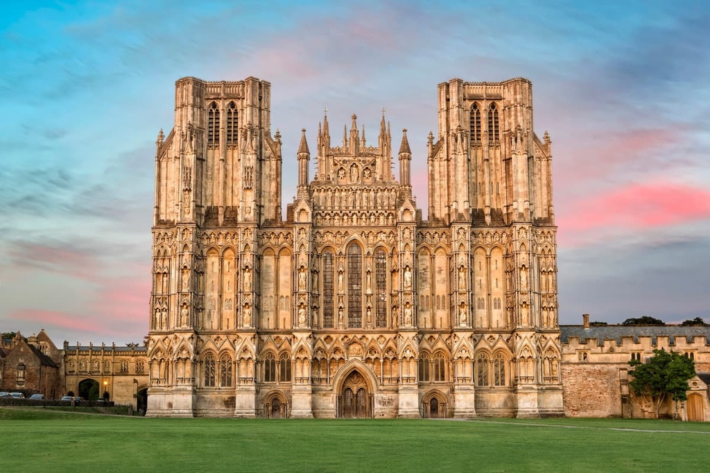
Resting on the southern boundary of the Mendip Hills AONB is the city of Wells. The smallest city in England, Wells is packed with fascinating attractions, like the fourteenth-century Wells Cathedral and the Wookey Hole show caves.
Due to its position just south of the Mendips, Wells provides easy access to several popular hiking areas, including the Ebbor Gorge Nature Reserve and Pen Hill (307 m/1,007 ft). Popular hotels in Wells include the Ancient Gate Hotel and White Hart Inn.
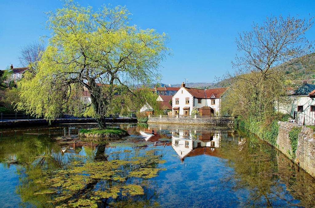
Hikers looking to explore as much of Cheddar Gorge as possible will want to spend a night in Cheddar. Tucked away at the southern end of Cheddar Gorge, Cheddar is famous for its cheese and show caves.
Cheese lovers will want to take a cheddar tour to learn the history of one of the world's most famous fromages. Don't forget to visit Gough's Cave, one of the most interesting show caves in the Mendips. If you're planning to spend the night in Cheddar, book a room at Gordons Hotel or the Bath Arms Hotel.
Glastonbury is arguably one of the most famous towns in England. The town has gained international recognition thanks to the Glastonbury Festival, a 5-day music festival that has been running for over 50 years. Outside of the festival season, Glastonbury has some fascinating attractions.
Anyone visiting the Mendips should plan a day excursion to Glastonbury to hike up Glastonbury Tor (156 m/512 ft). Rising from the Somerset Levels, Glastonbury Tor is heavily linked with Celtic mythology and is said to be the burial site of King Arthur. It also provides sweeping views of the Mendips. Popular hotels in Glastonbury include the George Hotel & Pilgrims' Inn and the Crown Hotel.