
Scan the QR code and open PeakVisor on your phone
Xueshankeng River Major Wildlife Habitat has 3 named peaks. The highest is Baizhixingbaoshanbeifeng at 2,302 m. Other notable peaks include Yonganshan and Yonganshanxibeifeng.
Situated southwest in Shei-Pa National Park (雪霸國家公園) is a protected area for primitive broadleaf forests and animal species. The Xueshankeng River Major Wildlife Habitat (雪山坑溪野生動物重要棲息環境) of central Taiwan holds three named mountains, the highest peak being Baizhixingbaoshanbeifeng (百志興保山北峰) which measures 2,302 meters (7,552 ft). While the most prominent hill is Yonganshan (永安山) at 1,744 meters (5,722 ft).
Xueshankeng River Major Wildlife Habitat lies at the intersection of Tai’an Township (泰安鄉) in Miaoli County (苗栗縣) and Taichung City’s (臺中市) Heping District (和平區). Covering an area of 680 ha (1,680 ac), Xueshankeng’s mountainous terrain rises from 815 to 2,302 meters (2,673 to 5,722 ft). Together with Baizhixingbaoshanbeifeng and Yonganshan, the other named mountain is Yongshanxibeifeng (永安山西北峰) which reaches 1,476 meters (4,843 ft) in this lofty hilly region.
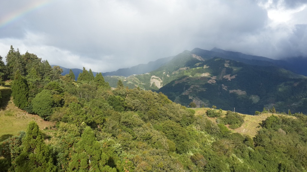
Lying in one of Taiwan’s precipitous zones, a constant stream of jagged terrain borders the Xueshankeng River Major Wildlife Habitat. The mighty Xueshan Range’s (雪山山脈) mountainous network extends north and south of the protected area. Taiwan’s second-highest peak, Xueshan (雪山), lies in the east, while to the northwest, the Da’an River (大安溪) flows, which branches off to form the Xueshankeng River.
Due to the high elevation, Xueshankeng River Major Wildlife Habitat enjoys a temperate climate, with an annual average temperate between 61 to 68°F (16 to 20°C). In addition, high rainfall moistens the area and nurtures the 541 plant species with a yearly precipitation average of 2,500 mm (98 in). Thus, as you ascend the mountains, you’ll notice the vegetation changing in the forest belts.
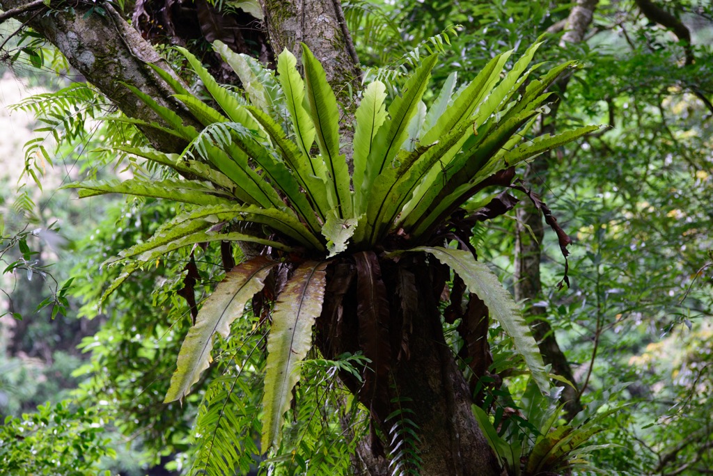
One notable plant species is camphor, as Xueshankeng River Major Wildlife Habitat holds the largest camphor cluster in Taiwan. As 343 wildlife groups inhabit Xuehsankeng’s fertile area, the Taiwan agricultural authorities protect the natural environment of camphor trees and other broadleaf arboreals.
Being in an area of mountainous backcountry and natural beauty, there are many forests and scenic areas that border the Xueshankeng River Major Wildlife Habitat. Daxueshan National Forest Recreation Area (大雪山國家森林遊樂區) lies south, and the Taiwan Sakura Salmon Ecological Reserve (台灣櫻花鈎吻鮭生態保護區) is east. Dongshi Forest Garden (東勢林場遊樂區) is west, while Tai’an Hot Spring (泰安溫泉) is north.
The geological composition of Xueshankeng’s peaks belongs to the Eocene to Oligocene epochs intermingling of slate, limestone, and quartzite. These hills form the southwestern branch of the Xueshan Range, Taiwan’s second-largest sierra of 1,233 peaks after the Central Mountain Range (中央山脈).
Xueshankeng’s forest comprises an afforestation growth area and primitive woodlands. Coniferous arboreals like fir, cedar, and red cypress are thriving afforested plants, while beech, camphor, and alder are natural to the environment. Out of the 541 plant species, there are 105 groups of fungi and 27 rare and endangered plants. The Taiwan Pleione, jewel orchids, and Ilex tugitakayamensis, also known as Snow Mountain Holly, are some examples of these scarce plants.
In terms of wildlife, the Formosan macaque, Taiwan serow and red-bellied squirrels comprise 3 of the 24 mammal groups in the Xueshankeng River Major Wildlife Habitat. Birdsong is ever present in the forest with 89 species of birdlife, such as the blue-bellied pheasant, crested goshawk, and the white-throated laughing thrush. While Xueshankeng holds 35% of Taiwan’s bat population, from the Taiwan tube-nosed bat to the broad-muzzled bat.
The hills of Xueshankeng River Major Wildlife Habitat and its surrounding areas are an Atayal stronghold. During the Japanese Occupation Era, the Taiwanese indigenous people were subject to oppression by the Japanese, who forcibly reigned control over the mountain-dwelling residents.
In an effort to access the thriving woodlands of this region, the Japanese coerced the Atayal people to move from their hillside residences to a surveillance road where they’d be under constant scrutiny. Atayal tribespeople living in the area decided to move away from the Japanese to the upper reaches of the Xueshankeng River. However, they were found and then moved further north to what is now the Taoshan Tribe.
As the mountainous setting is wonderfully picturesque, the now Taoshan Tribe planted peach trees to elevate the beauty even further. Thus, Taoshan is sometimes referred to as Peach Mountain.
These are the top hiking trails and areas to visit in and around the Xueshankeng River Major Wildlife Habitat:
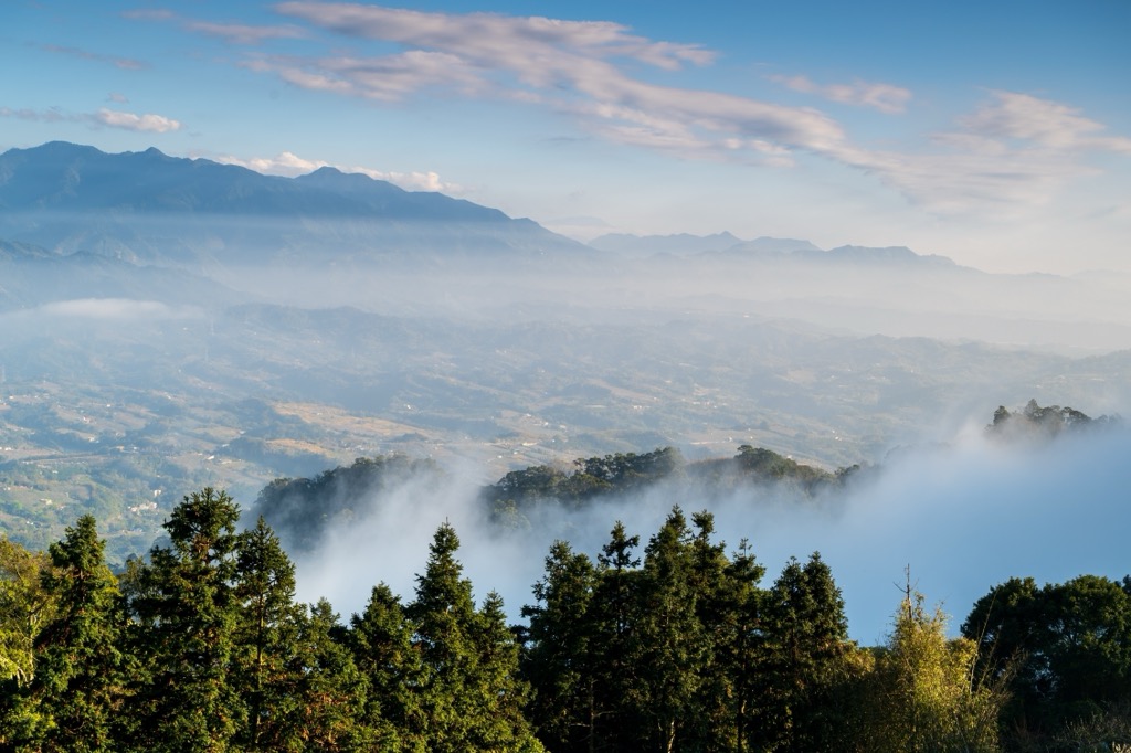
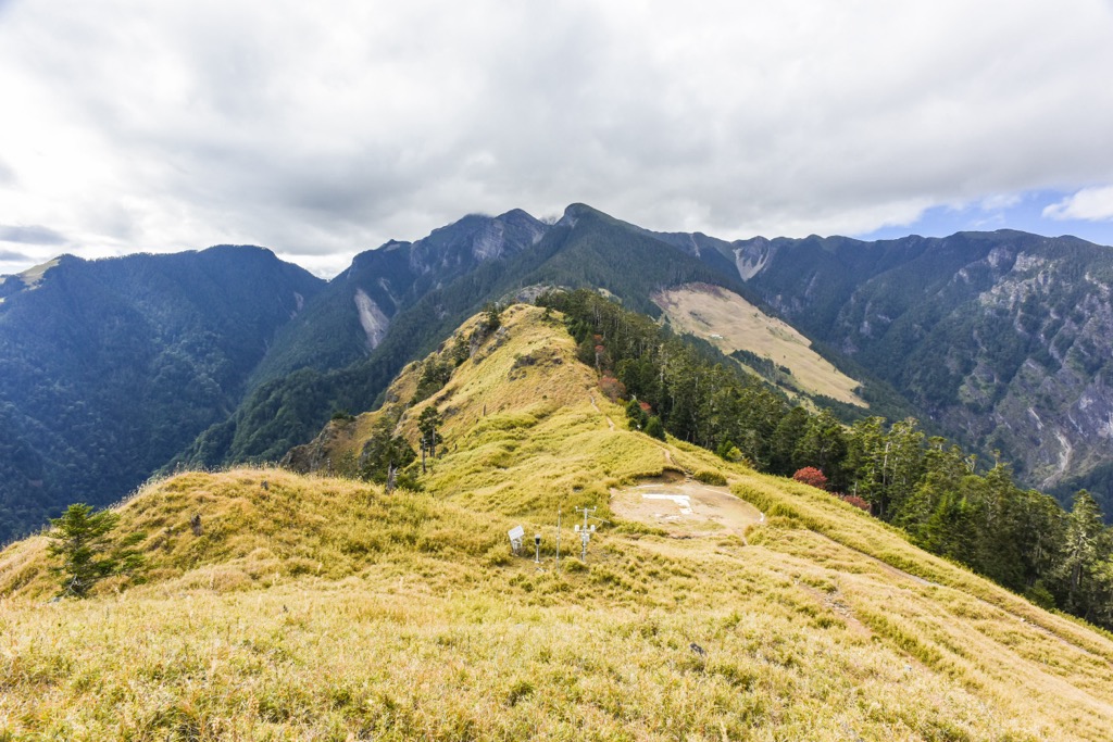
Devote the whole day to walking 25 km (16 mi) and summiting the three hills of Baizhixingbaoshanbeifeng, Baizhixingbaoshan (百志興保山), and Yonganshan. Witness the enchanting scenery of giant forest trees, a milky sea of clouds, and dense mountain fog flowing across the forest.
It’s a long walk to Baizhixingbaoshanbeifeng as you first trek 7 km (4 mi) of 540 Forest Road to start climbing Xueshankeng’s tallest hill. It’s along the misty Forest Road that you’ll start noticing towering camphor trees with a lingering presence on Baizhixingbaoshanbeifeng’s ascent. Tackle the swarms of miscanthus to climb to the overgrown summit, then make your way towards Baizhixingbaoshan, with a similar terrain of wild vegetation and shaded groves. In the clearings, you’ll see the oncoming hill, Yonganshan, in the near distance and a sea of clouds rolling across the jagged landscape.
Once again, you’ll walk the Forest Road to reach Yonganshan after descending Baizhixingbaoshan’s peak. A smaller hill than the previous two, it’s your last push up the verdant hill of dense camphor and countless fallen logs lain across the forest floor. Another leafy lined summit, you’ll take scenic breaks in the clearings where you can overlook the backcountry network of rippling sierras stretch right before you.
For a peaceful refuge out in nature, visit one of the filming locations of ‘Warriors of the Rainbow: Seediq Bale’ in Shansu Forest (山蘇森林). Engulfed in lofty mountain backdrops and surrounded by a vibrant growth of flourishing foliage against a bubbling creek, the old Atayal hunting ground is a mesmerizing sight.
Before you enter the emerald environment, you’ll encounter the beautifully crafted Giant Hand, a stone carving in honor of a farm worker who lost his life while working. The giant’s hand stretching towards the sky stands 9 meters (30 ft) tall in a grasping clasp. With the giant’s body half-submerged, only his head, arm, and leg appear above the surface. While you’re admiring this artwork, you’ll have a wide field of vision of the precipitous mountain network before you.
For adventurous hikers seeking to conquer Xueshan’s snow-capped summit without enduring West Xue’s demanding week-long journey, the East Xue Trail is the ultimate choice. As it leads towards the second tallest mountain in Taiwan, East Xue Hiking Trail is a popular and well-maintained route that packs a punch for alpine adventurers.
While the trail is challenging, hikers with physical fitness can easily scamper up this steep mountain without much hassle. The trail spans a breathtaking 22.5 km (14 mi), typically divided into three days of walking. As you pace the high mountain ridges, savor the natural beauty that encircles you.
Before reaching Xueshan, you’ll first pass Xueshan East Peak for a little taste of what's in store. From here, you’ll admire the stunning panoramic views of the surrounding sharp peaks and deep valleys. The Holy Ridge connecting Xueshan and Dabajianshan (大霸尖山) can also be viewed in its entirety.
After spending your first night on the mountain, rise early to witness the majestic alpine sunrise from Xueshan East Peak. You’ll encounter a forest filled with rhododendrons before reaching the summit, where you can appreciate the magnificent effects of glacial activity on this grand mountain.
The last scramble up Xueshan Main Peak is beyond the treeline, granting you pristine views of the woodlands, valleys, and lofty peaks that stand tall, circling the grand mountain.
For the bold and daring adventurer seeking an ultimate challenge, the Holy Ridge Trail is an intense and grueling hike that will test your limits. This demanding trail covers only a 10 km (6.2 mi) section of the main ridge in the park. You’ll find that the steep terrain makes it particularly arduous.
The Holy Ridge Trail got its name from a Japanese climber who described the ridgeline between Xueshan and Dabajianshan as ‘a holy ridge’ after summiting Dabajianshan in 1927. It’s no wonder why this trail is known by this name, as every step taken on this path is a spiritual journey in itself.
Despite its challenges, it's a must-do for those who are comfortable navigating steep and exposed terrain. As you trek along Xueshan and Dabajianshan’s ridgeline, you’ll have the opportunity to summit five peaks, all of which have an elevation of over 3,000 meters (9,842 ft).
Chryoushan (池有山), Pintianshan (品田山), Sumidashan (素密達山), Xueshan North Peak (雪山北峰), and Xueshan are all waiting to be conquered by those brave enough to tackle this challenge. Dabajianshan’s summit is unfortunately out of bounds for safety reasons.
Visit the highland forests and towering peaks of Daxueshan National Forest Recreation Area for an outdoor adventure in the leafy mountainous terrain. From forest bathing, summiting over 2,000-meter (6,562 ft) peaks and exploring the natural beauty of the flourishing alpine woodlands, there is much to see and do.
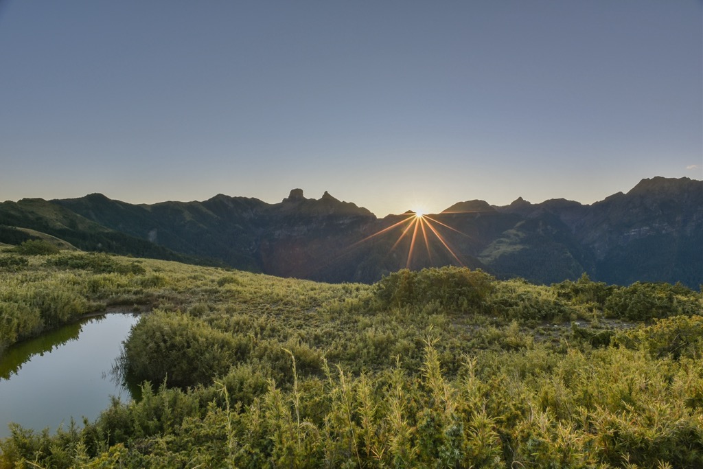
For a peaceful and awe-inspiring trek, explore the Snow Mountain Shenmu Trail, where you can witness a giant 1,400-year-old red cypress measuring a towering 49 meters (61 ft) in height. Along the way, marvel at the rugged high mountain scenery and the misty vapor hovering above the alpine pond, Tianchi, while admiring panoramic views of Taiwan's two tallest peaks, Xueshan and Yushan (玉山), from several observation decks.
For a more challenging workout, the Xiaoxue Shan Hiking Trail is perfect for those seeking an exhilarating trek that spans 15 km (9 mi) and summits four mountains. Climbing up the vertical cliff on Yuanzui Shan (鳶嘴山) using rope assists is an extreme sport and requires barrels of nerves. After facing your fears, the trail’s beautiful mix of coniferous vegetation, hemlock, and pine, intermixed with broadleaf maple that turns a golden in the autumn months is both stunning and wonderfully calming.
At lower elevations, the Daxueshan Forest Bathing Trail offers a refreshing experience, with sweetgum and maple trees emitting phytoncides that clear the mind and center the soul. Meanwhile, the Wooden Horse Trail provides a glimpse into history, with wide paths and bridges that once transported felled timber using wooden horse apparatus.
Situated south of Daxueshan National Forest lies Basianshan National Forest Recreation Area’s (八仙山國家森林遊樂區) bamboo and broadleaf dreamlike woodlands. One of Taiwan’s top three logging bases, Basianshan Forest holds history as well as numerous magnificent hiking trails for you to enjoy.
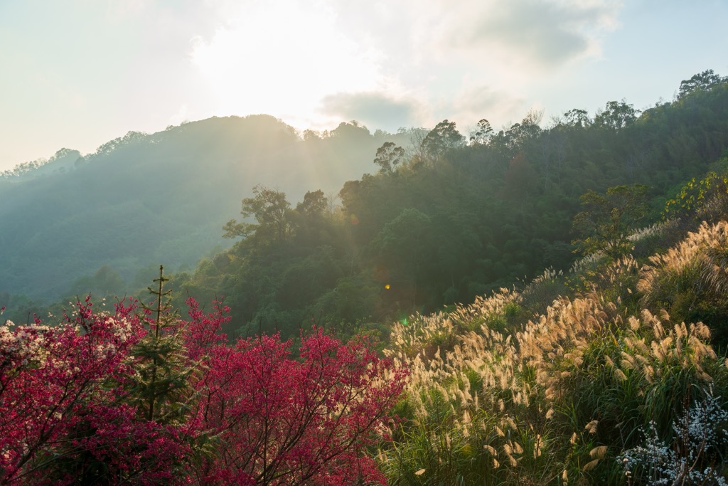
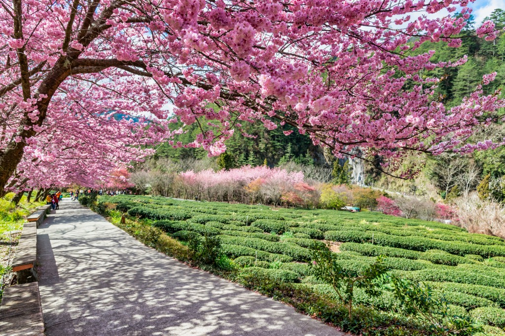
A beauty in every season, Basianshan Forest’s broadleaf wonderland changes its lush appearance every few months. Springtime is when cherry blossoms ripen, summer is peak firefly season, while autumn showers the scenery with deep burgundy when maple leaves change color. While winter is cold, the mountain air awakens your senses, and the quiet atmosphere is intoxicatingly peaceful.
A definite must-see is the Bamboo Forest Trail, where tall Moso bamboo poles tower above you and reach towards the heavens. You’ll feel enclosed in an emerald world as the sun hardly reaches through the dense grove of elongated shoots. Close your eyes and listen to the wind rustling against the bamboo as it creates a symphony of soothing sounds.
When visiting the Xueshankeng River Major Wildlife Habitat, you can stay nearby in Taichung City to experience Taiwan's buzzing urban life or opt for Wuling Farm (武陵農場) if a remote and quiet country environment is more what you’re after.
Home to 1 million residents, Taichung City is a bustling metropolis of pulsating energy. You’ll never run out of things to do here, and it strikes a perfect balance with the city slickers and nature lovers. Holding over one-fifth of Taiwan’s tallest mountains, venture into its mountainous backyard for astounding hikes amidst a rugged landscape of breathtaking beauty.
First up on the itinerary, make your way to the Fengjia Night Market (逢甲夜市) to savor some of the city's top street food offerings. Among the local favorites are the Fengjia sweet potato balls, which are a delectable blend of chewy and doughy textures. You can also try the popular hotdog-style fried sausages in bao buns and dan bing omelets which are both a must-try local delicacies at the night market.
After experiencing the hubbub of Taiwan’s night market culture, make your way to one of the most sought-after tourist destinations in Taichung City. Initially a military barracks, the aptly named Rainbow Village was given a new lease of life in recent decades when it was revamped as a vibrant celebration of colors. This remarkable transformation not only prevented the demolition of the former military installation but also elevated it to become a popular attraction among visitors.
Finally, make sure to pay a visit to the beloved Calligraphy Greenway (草悟道), another splendid outdoor space in the city. This 3.6 km (2.2 mi) green path links two of Taichung's popular galleries, the National Museum of Natural Science and the National Taiwan Museum of Fine Arts, each on opposite ends of the park. Spend some time unwinding amidst the tranquil surroundings of this pathway, admiring the unique abstract art sculptures showcased throughout the park.

Covering an extensive area of 700 ha (1,730 ac), Wuling Farm offers abundant lodging options for visitors to the region. What’s more, it is conveniently located near Taroko National Park (太魯閣國家公園 for those who wish to extend their mountain trekking. The cool climate at an elevation of 1,740 to 2,100 meters (5,709 to 6,890 ft) is perfect for growing high mountain fruit, such as pears, peaches, and apples which adds to the beautiful environment.
Marvel at the breathtaking beauty of Wuling Farm, renowned for its seasonal splendor of floral pastels. Spring welcomes the blooming of cherry blossoms, while autumn brings a burst of warm colors that signify the onset of cooler weather. Perched at a high elevation, the farm is often shrouded in mist during the mornings and evenings, which adds to the surreal charm of the landscape.
For those intrepid mountaineers, you can extend your high-elevation hikes into Taroko National Park. Nearby lofty mountains you can scale are Nanhudashan (南湖大山), Zhongyang Jianshan (中央尖山), and Hehuanshan (合歡山), or take a day trip to the marble canyons nearby Hualien City (花蓮市) for out-of-this-world scenery and jaw-dropping natural beauty.
Finally, visit the Huanshan tribe, an Atayal stronghold that’s nestled in a pristine valley and surrounded by breathtaking mountainous vistas. Not only can you admire the dreamy landscape, but you’ll also be met with the warm hospitality of the locals. Immerse yourself in the customs and traditions of the friendly indigenous people, watching traditional dances, learning their methods of pounding rice and weaving colorful fabrics.
To get to the Xueshankeng River Major Wildlife Habitat, take the Taiwan HIgh-Speed Rail (HSR) or local express train (TRA) from any of Taiwan’s major cities. As public transport to the Xueshankeng River Major Wildlife Habitat is severely limited due to the mountainous countryside, it is best to hire a car or scooter, or to take a taxi. Its a 68 km (42 mi) drive from Taichung City to the Xueshankeng River Major Wildlife Habitat.


The highest peak in Xueshankeng River Major Wildlife Habitat is Baizhixingbaoshanbeifeng, at 2,302 m.
Notable peaks in Xueshankeng River Major Wildlife Habitat include Baizhixingbaoshanbeifeng, Yonganshan and Yonganshanxibeifeng.


