
Scan the QR code and open PeakVisor on your phone
Park prirode Učka has 50 named peaks. The highest is Vojak at 1,401 m. Other notable peaks include Suhi vrh, Plas and Veliki Planik.
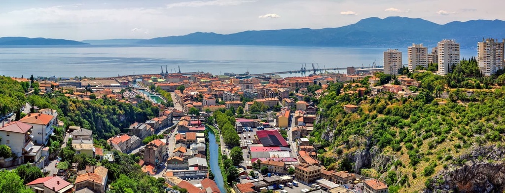
Učka Nature Park is a protected area located in the Istria region of northwestern Croatia. The park contains all of Učka and parts of Ćićarija, both of which are the highest mountains in the Istria region. Učka Nature Park is known for its breathtaking views, diverse wildlife, and living heritage, all of this only a few kilometers from the Adriatic Seaside. There are 50 named mountains in the park, the highest and the most prominent of which is Vojak (1,401 m/4,569 ft).

Učka Nature Park (Park prirode Učka) is located in the eastern part of the Istria Peninsula in northwestern Croatia. It contains the northernmost position in the Croatian Dinaric Alps as well as part of the country’s coastline along the Adriatic Sea.
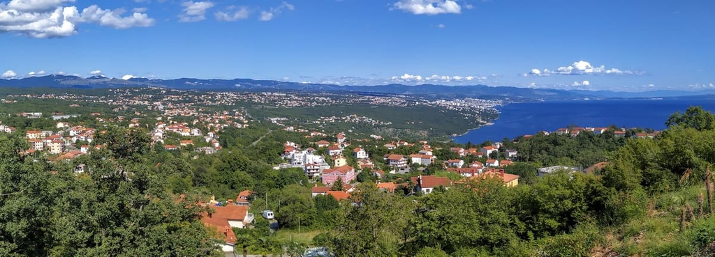
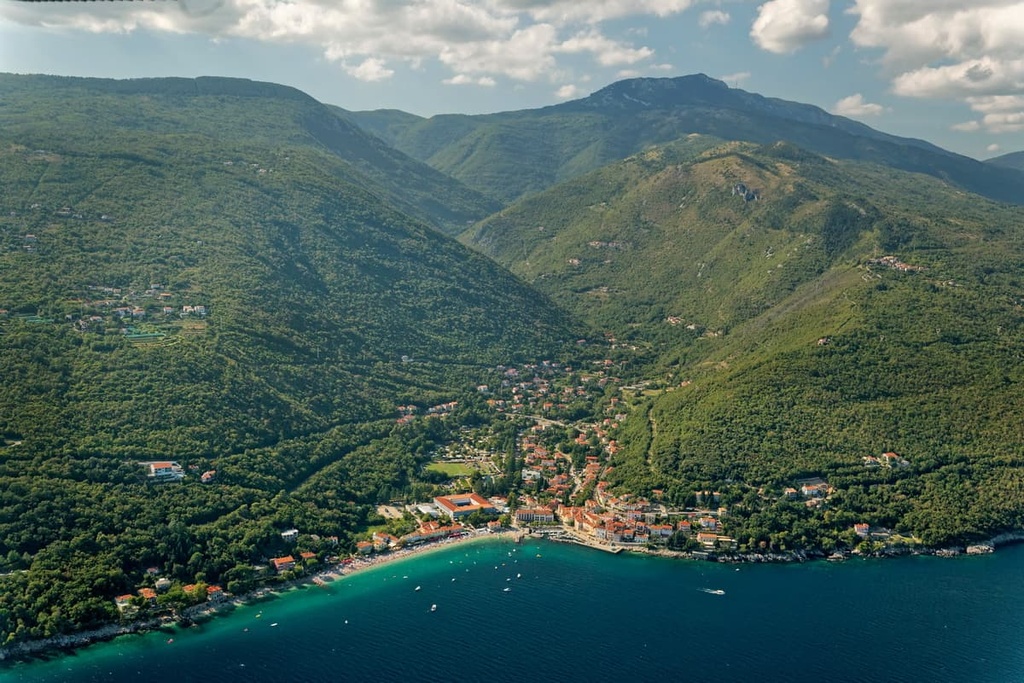
The nearest small town, Opatija, lies just to the east of the park along the coastline. Opatija is a popular tourist destination as it is well known for its shady beaches.
The park protects parts of two mountain massifs, which once presented a gateway into Istria:
While its secluded location might not give it away, Učka is part of the Dinaric Alps. What sets it apart from the rest of this mountain range is its low elevation and thick forests.
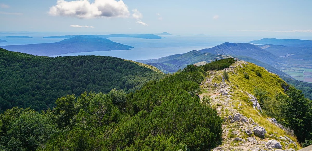
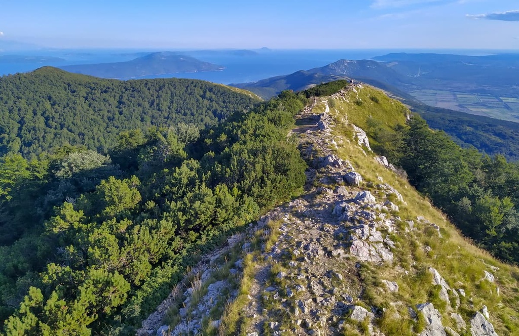
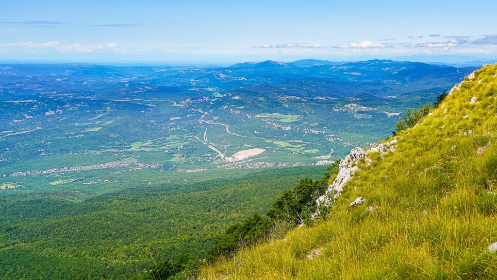
When you climb to the top of Učka, or its highest peak Vojak (1,401 m/4,569 ft), you can see the whole of Istria. You can also see the nearby islands of Cres and Krk, Trieste Bay, and even the Alps and Dolomites.
Ćićarija, on the other hand, should be characterized as an elevated mountain plateau with a small number of peaks rising above it. Together, they form a mountain ridge that flows from Rijeka to Trieste Bay in Italy.
Together the Učka and Ćićarija mountain massifs take up 310 sq. km (192 sq. mi) of land, and half of this land is managed by Učka Nature Park. This means the Učka Nature Park has a protected area of 160 sq. km (100 sq. mi). It stretches from Poklon Pass to Plomin Bay, making it some 20 km (12 mi) long and 4 to 9 km (2 to 5 mi) wide.
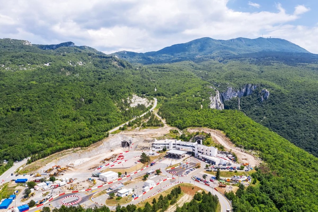
The mountains in the park have historically been difficult to travel across, so the local government built a tunnel in 1981 to aid communication with the rest of Istria. Therefore, the Učka Tunnel, which is 5,062 m (16,608 ft) long, is located underneath the national park.
Over time, the sea, human activity, and other natural weathering and erosive forces have carved out this beautiful and one-of-a-kind landscape.
Učka Nature Park contains many impressive sites. These include:
The history of Učka starts with its geological origin, some 140 million years ago. That is when the first limestones of the mountain formed, which stand strong even today.
During this period of tectonic activity where the European and African plates collided, the Alps and Dinarides formed, helping to create the Učka and Ćićarija that we know of today.
The rocks that formed this nature park formed from sediments deposited at the bottom of an ancient ocean known as the Tethys. Later, these sediments formed the limestones we see today on Učka and Ćićarija. Thanks to these sedimentary rocks, both mountains are home to a large collection of fossils.
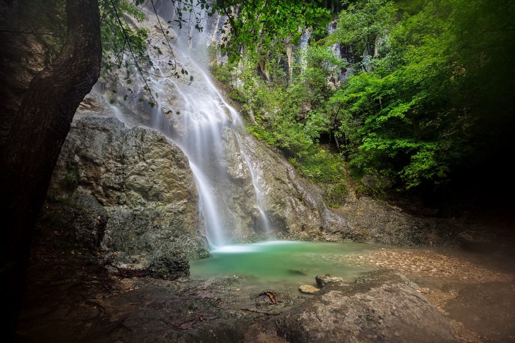
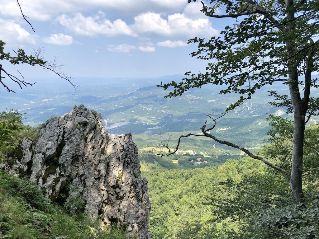
The Učka Massif is mostly made out of limestone and flysch rocks. Since limestone is porous and lets water easily drain, the mountain is scarce with surface water yet home to an abundance of caves and pits.
The amount of limestones in the area, as well as constant rains, sunny weather, stormy winds, and cultivation of the land, has resulted in the formation of karst topography throughout the region. The same goes for numerous other Dinaric mountains.
Karst topography is known for being full of caves, so it’s no surprise that Učka is a center for speleology in the region.. Today, there are around 200 known caves in the nature park, most of which are classified as pits.
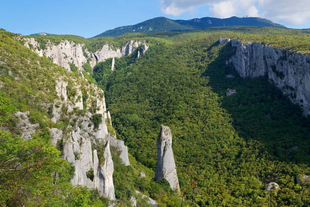
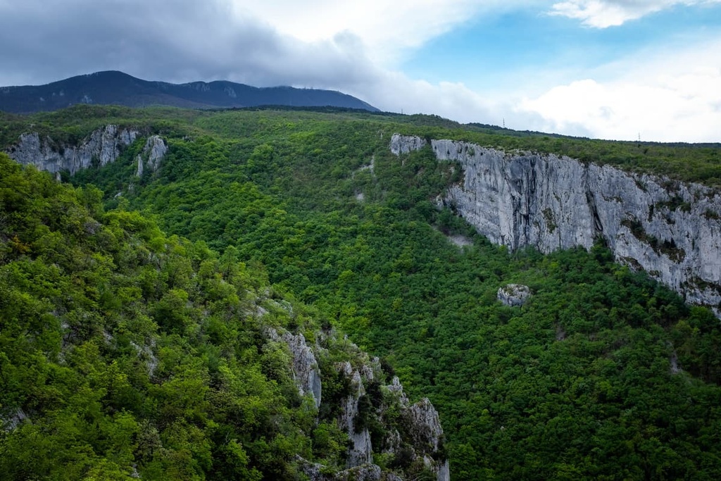
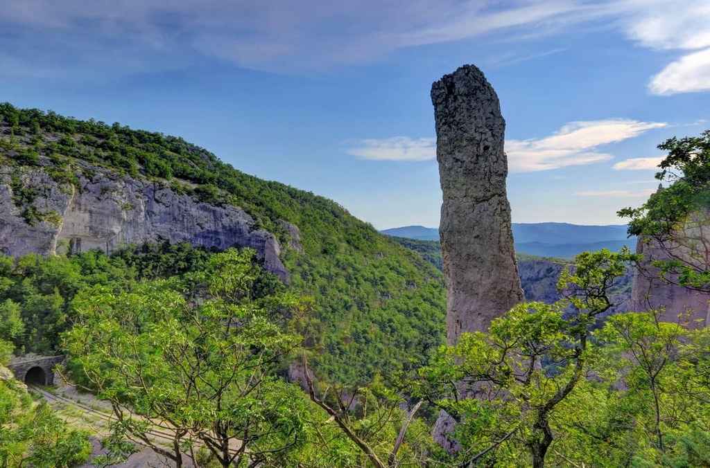
This topography forms as water dissolves limestone, creating distinct and interesting rock patterns in the process. A perfect example of this is two canyons located inside Učka Nature Park. One of them is Vela Draga Canyon, which formed under the constant flow of the Vela Draga River. With this canyon, numerous long limestone piers arose alongside the steep sides of the riverbed.
Even today, Učka Nature Park continues to transform under the pressure of water. As limestone is porous it chemically dissolves when subjected to a constant barrage of water. Therefore the rocks, canyons and caves in the nature park are still constantly forming, dissolving, and accumulating.
Hydrologically speaking, this canyon formed under constant erosion and flash flooding of the surrounding terrain. Even today, numerous fossilized remains are seen inside the rock formations. The only significant river in the park is Raša, which is situated in the western part of Učka Nature Park.
The two mountains in the Učka Nature Park form a crescent moon around the Istria Peninsula, dividing it from the continental part of Croatia.
These two mountain massifs are very different from each other. While their composition is mostly made of limestone and occasionally of flysch, they are in fact, very diverse. Between them lies Poklon Pass, as a frontier where these two mountain giants meet.
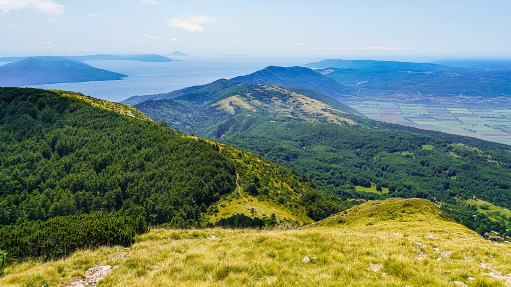
Učka Nature Park includes Vojak (1,401 m/4,569 ft), the highest point of the Istria Peninsula. Ćićarija borders the park in the north and Plomin Bay in the south. Its eastern border is the Bay of Rijeka and on the west, its borders are the Boljunsko and Čepićko Polje.
The ridge of Učka is characterized by karst fields and steep slopes carved by rocks. The highest peaks of Učka Nature Park include:
The other part of the Učka Nature Park is Ćićarija, which mostly consists of hills and mountainous fields below 1,200 m (3,937 ft) in elevation. Outside of the park, this is a 45 km (28 mi) long and up to 15 km (9 mi) wide plateau in northern and northeastern Istria, which also ventures into Slovenia.
The relief here consists mostly of karst fields, which are hard to farm. Therefore Ćićarija is sparsely populated. The highest peak in the massif, as mentioned, is Veli Planik (1,272 m/4,173 ft), which is also located inside the nature park.
Despite its relatively small area, Učka Nature Park is a particularly biodiverse place. There are many endemic species in the park that are found only on the Istria Peninsula.
Učka’s diversity in plant and animal life developed based on an equally diverse climate. In particular, Učka is a meeting point for the region’s Mediterranean and continental climates.
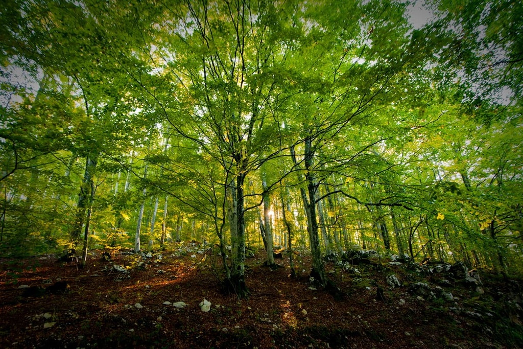
The park’s flora consists of at least 1,300 different plant species, which is an astounding number considering the park’s small area. The botany of the park has been studied since 1838, first by Habsburg King Friedrich August II. Even today, research is ongoing, and Učka still has so much to offer for biologists.
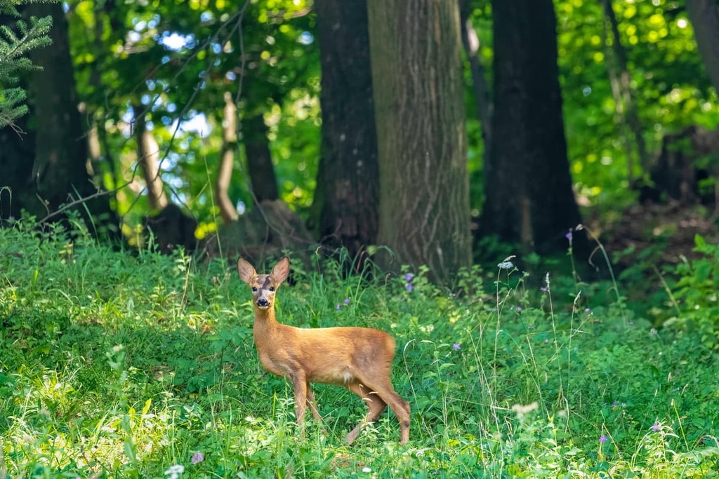
The park also has a vibrant collection of wildlife. Approximately 173 species of birds have been recorded in the park. Mammal species found in the park include wild boars (Sus scrofa), roe deer (Capreolus capreolus), and brown bears (Ursus arctos).
The endemic species found on the mountain include golden eagles (Aquilla chrysaetos) and Griffon vultures (Gyps fulvus). That said, the most interesting endemic species in the park is the Učka bellflower (Campanula tommasiniana), a type of flower that is only found on Učka and Ćićarija.
While one might expect only inland species of flora and fauna to live in Učka Nature Park, the park is actually home to a number of ecosystems. Here are some of the major ecosystems found in the park:
The climate of the Učka Nature Park is under the influence of multiple local geographical factors. The park has a mountainous terrain, with numerous karst fields, high rock formations, and peaks above 1,200 m (3,937 ft). On one side of the park, the karst plateau of Ćićarija dominates, while on the other, the park is bordered by the Adriatic Sea.
Even though the mountain towers above the seaside, snow is often seen on its highest peak. This snow can stay on the mountaintops for more than six months of the year. While hot during the day, the summers on the mountain can get relatively cold during the evening.
Another thing to consider when visiting Učka Nature Park is the precipitation. The park’s mountains receive much more rain than the seaside, and rain, hail, and snow are all sights often seen here. Therefore, do not be fooled by the temperatures in the lower elevations. When visiting Učka Nature Park, always pack a rain jacket and check the weather forecast.
The human hand largely influenced Učka Nature Park, molding it into the landscape that we see today.
The first farmers that settled here arrived in the Metal Age and were known as Illyrians. These people lived in hill forts that were often built on higher elevations and on hilltops with a dominant position. During the second century BCE, the area of Istria was taken over by the Romans and then became part of the Roman Republic. This was when the first maintained and paved roads were built on Učka and Ćićarija.
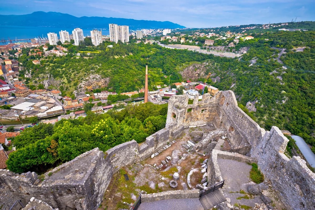
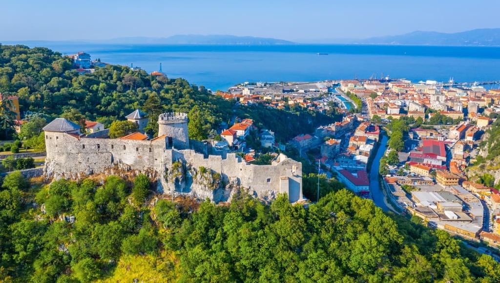
In the Middle Ages, numerous leaders and kingdoms tried to conquer Istria. One of the only remaining monuments from this time is the eleventh-century Kožjak fortress. Only later did Istria gain popularity during the Austria-Hungarian rule. During this time, local aristocrats visited Opatija on the sea and took field trips to Učka.
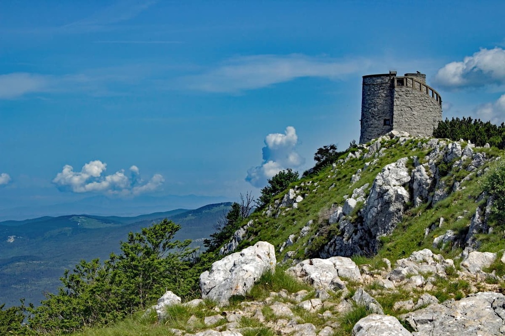
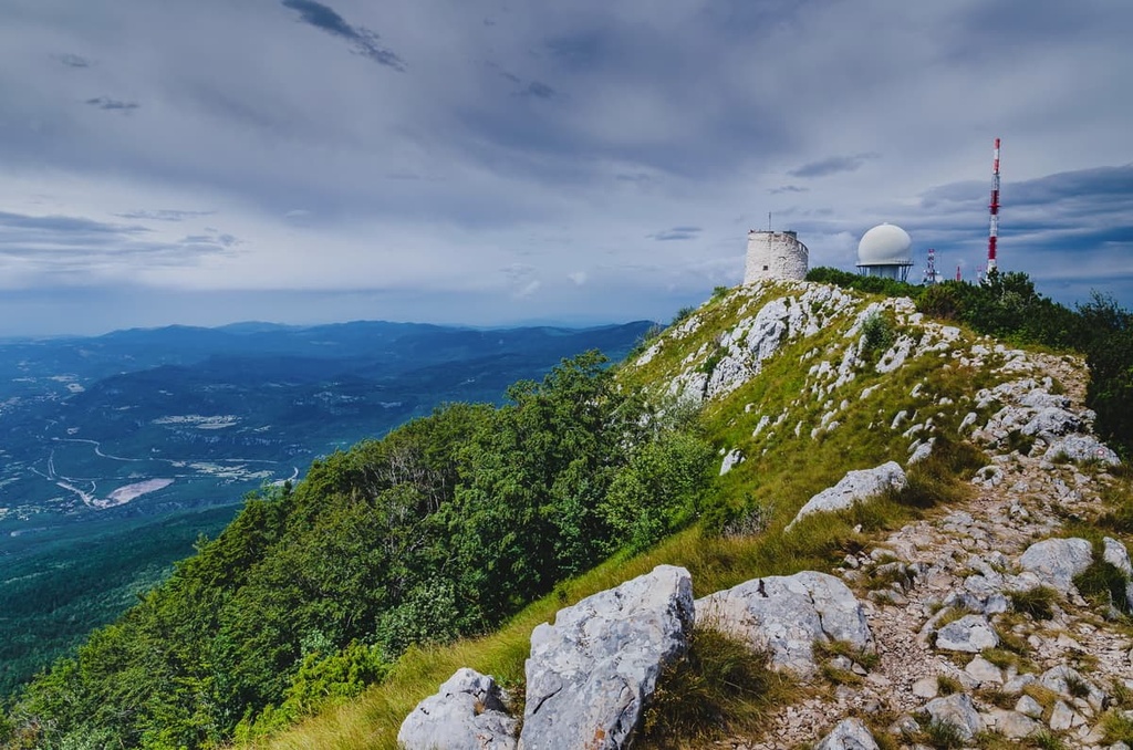
This jump in popularity brought with it numerous infrastructural projects. During this time, the tower on Vojak (1,401 m/4,569 ft) was built with fountains, stone roads, and inns, all of which are part of the Učka Nature Park to this day.
Učka and Ćićarija are home to rich cultural heritage. The traditional way of life on Učka that we see today is a result of centuries of coexistence between humans, animals, and the landscape. People here learned to use the karst relief for building, learned how to store water, and made the best of life in an otherwise harsh environment.
One unique cultural feature of the region is Učkarski Sir (lit. Učka cheese), which is the product of a cheesemaking tradition that dates back to Roman times. Učka also has its own type of tamburitza with only two strings called a cindra.
At the end of the Middle Ages, a tribe called Ćići arrived in Istria and settled in the area of what is today the Učka and Ćićarija mountains. These people brought their way of life with them, including their language, which is spoken until this day. That said, there are currently only 300 speakers of the Vlaški and Žejanski languages.
The end of the nineteenth century and the Habsburg rule over Istria brought with it a jump in tourism. The first tourists came to see Opatija as a sanatorium and visited the beautiful Učka Mountain above it. Tourists from Austria, Hungary, Germany, and Italy came to visit the seaside during this time.
The first recorded hike to the top of Vojak (1,401 m/4,569 ft) took place in 1852. In 1882, locals opened the first marked hiking trail from Poklon to Vojak Peak. The same year, on Poklon Pass, a mountain inn called the Mountain House of Queen Stefania was built and opened.
Most visitors take an interest in the tower on top of Vojak (1,401 m/4,569 ft), which was built by the Austro-Hungarian administration in 1911, and still stands to this day. During the Second World War, the region of Učka mountain was used as a guerilla resistance hideout. German forces burned many villages of the area and tried to oppress the locals, but without success.
After the war, Učka started rebuilding. However, this was difficult to achieve because almost all locals during the start of the twentieth century moved to the cities. That is when the authentic way of life in Učka stopped and the region turned to tourism as its main economic activity.
The whole Učka Mountain Massif, together with parts of the Ćićarija Mountain Plateau and Vela Draga Geomorphological Nature Monument, was proclaimed a nature park in 1999. The park started operating in September 2001.
Today, countless visitors come to see Učka Nature Park each year in order to partake in hiking tours, learn more about the region in the Poklon Visitor Center, or try sport climbing in Vela Draga Canyon.
As an area of rich biodiversity, beautiful views, and sunny weather throughout the year, Nature Park Učka is a true hiker’s paradise. In fact, the first organized hikes undertaken in Croatia were conducted here. Regardless of whether you want a strenuous hike or just an afternoon stroll with the family, Učka has so much to offer.
The hike from Poklon Pass to Vojak (1,401 m/4,569 ft) is one of the most popular hikes in the park. The hike starts near the inn and parking lot at Poklon and is maintained by the park rangers. This is a 7 km (4 mi) long hike round-trip and takes about 2 hours to complete. It has a total elevation gain of 400 m (1,312 ft).
This hike travels through the region’s beautiful birch forests. At the end of the hike, you will exit the forest and follow a paved road to the tower on top of Vojak.
The most interesting hiking trails in the park all lead to Vojak (1,401 m/4,569 ft) since it is the highest peak in the region. This trail from Lovran to Vojack starts in the small town of Lovran and follows a strenuous but fun path all the way to the summit,
This is an 18.5 km (11 mi) long hike, with an elevation gain of 1400 m (4,593 ft). Therefore, make sure you are prepared. The trail passes through birch forests and some karst fields, as well as Poklon Pass. After that, you will follow the classic hiking route to Vojak Peak.
A nice, family-friendly hike in the Učka Nature Park is the trail to Veli Planik (1,272 m/4,173 ft) on Ćićarija ridge. Since the trail is inside the park premises, it is well maintained.
This hike is relatively casual as it has only 400 m (1,312 ft) of elevation gain and is only about 8 km (5 mi) long. It starts next to the Poklon Visitor Center and passes through birch forests and karst fields before arriving at the summit.
Učka is located in the northern part of the Adriatic Sea in north-western Croatia. You can get to the park by first traveling to Opatija, Zagreb, Rijeka, or Pula.
Opatija was a luxury resort that used to be full of Habsburg villas. Even today, the Opatija skyline is shaped by these unique classical buildings.
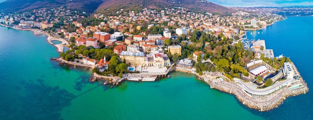
Nowadays, Opatija is a small coastal town located on the Kvarner Bay in Croatia. It is very popular as a tourist destination, not just for its shaded beaches but also because of its rich history and culture.
If you want to visit Učka Nature Park while still being able to rest in a luxurious setting each day, Opatija has plenty of hotels, hostels, campsites, inns, and bed and breakfasts to choose from. One can reach the town by catamaran, boat, car, or bus since Opatija does not have an airport or railway.
Located on Rijeka Bay, the city of Rijeka is the third-largest city in Croatia and the closest city to Učka Nature Park with an airport. Rijeka is located only 32 km (20 mi) away from the park.
The city has a rich historical background to offer to its visitors. The tumultuous past of the city is shown in its beautiful architecture, which is a result of the region’s past Habsburg, fascist, and communist rule. You can reach Rijeka by car, bus, boat, airplane, train, or catamaran.
Pula is the biggest city in the Istria Peninsula. It offers visitors a multitude of hotels, campsites, inns, apartments, bungalows, and other accommodation options. It is often regarded as the most beautiful city on the Adriatic Coast.
The city is home to 57,000 people and an important and well-protected harbor. The city of Pula and its harbor played a crucial role in numerous wars, from medieval wars to World War II in the fight against Italy.
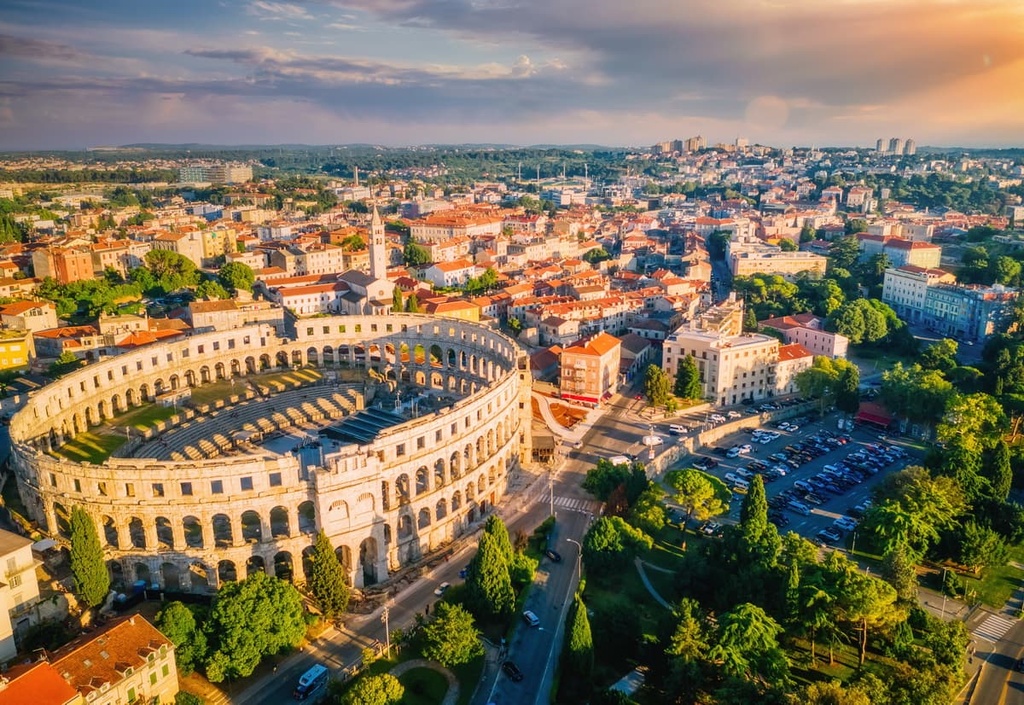
The center of Pula is dominated by an ancient Roman amphitheater. According to local legend, the Pula Arena in the center of the city was built overnight by fairies from Učka. One can reach Pula by inland road through the Učka Tunnel, sea, rail, and air.
The park’s main waypoint is Poklon Pass, where you can find a mountain hut (Planinarski dom Poklon), an inn, a parking lot, a visitor’s center, and any other amenities you might need. If you wish to spend a night near the mountain top and head for an early start, the hotel or mountain hut Poklon are great options.
You can reach Učka through Rijeka or Zagreb via the inland road. You will need to pass through the Učka Tunnel and head for the Veprinac exit. From there, you can easily enter the park.
If you’re visiting Učka Nature Park through the Istria Peninsula, or specifically Pula, head for Rijeka, and before entering the Učka Tunnel. Then take a right turn onto the local freeway near the INA gas station.
The easiest way to reach the park is through the nearest town, Opatija. The local government has enabled easy access to tourists from Opatija to Učka Nature Park. You can reach Poklon Pass via bus two times a day in the summer season.


The highest peak in Park prirode Učka is Vojak, at 1,401 m.
Notable peaks in Park prirode Učka include Vojak, Suhi vrh, Plas, Veliki Planik and Mali Planik.


