Scan the QR code and open PeakVisor on your phone
Set on the border between the Italian regions of Emilia-Romagna and Tuscany, Tuscan-Emilian Apennines National Park is where the Mediterranean coast and the Po Valley meet. There are 122 named mountains in Tuscan-Emilian Apennines National Park. The highest and the most prominent mountain in the park is Alpe di Succiso (2,016 m/6,614 ft).
Located across the regions of Emilia-Romagna and Tuscany, Tuscan-Emilian Apennines National Park (Parco Nazionale dell'Appennino Tosco-Emiliano) protects a striking stretch of Italy’s northern Apennine Mountains. The range forms a natural border between the two regions, and it separates the Po Valley from the Mediterranean Sea.
Tuscan-Emilian Apennines National Park spans the provinces of Reggio-Emilia and Parma in Emilia-Romagna, and Massa-Carrara and Lucca in Tuscany. It covers a total area of 260 sq. km (100 sq. mi).
Furthermore, Tuscan-Emilian Apennines National Park is one of Italy’s youngest national parks as it was established in 2001. The park consists of two regional parks and four state nature reserves.
There are a number of other protected areas located near Tuscan-Emilian Apennines National Park.
For example, Parco della Magra-Vara, Parco regionale Montemarcello-Magra, and Parco nazionale delle Cinque Terre are all located to the southwest of Tuscan-Emilian Apennines National Park along the coast. Meanwhile, Parco regionale dell’Antola and Parco naturale delle Capanne di Marcarolo are situated to the northwest of the park in the regions of Liguria and Piedmont.
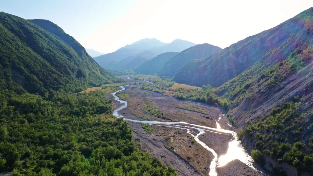
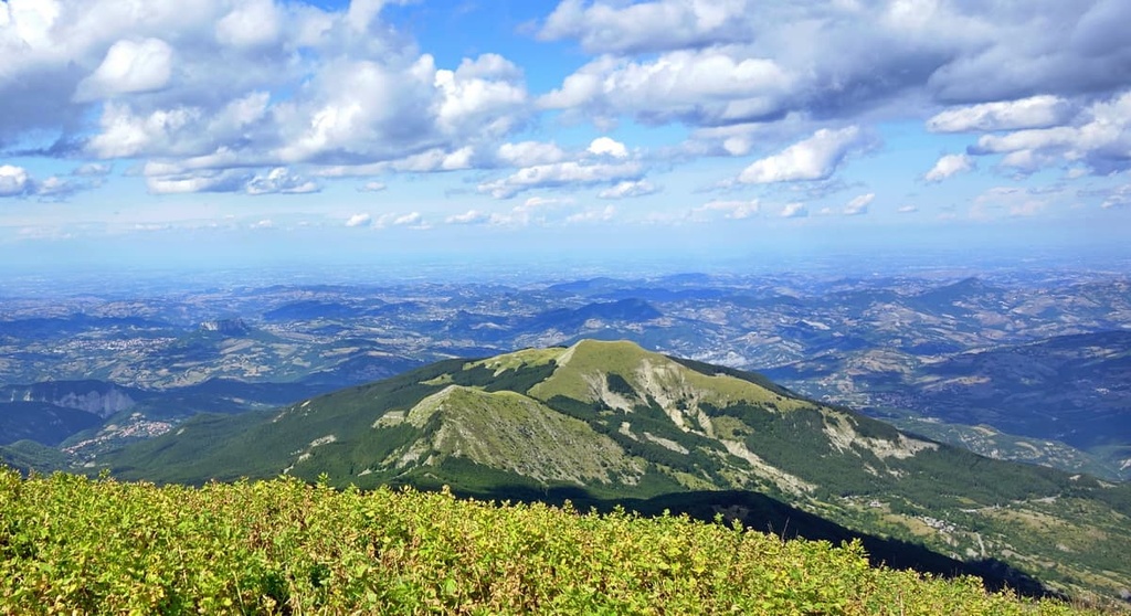
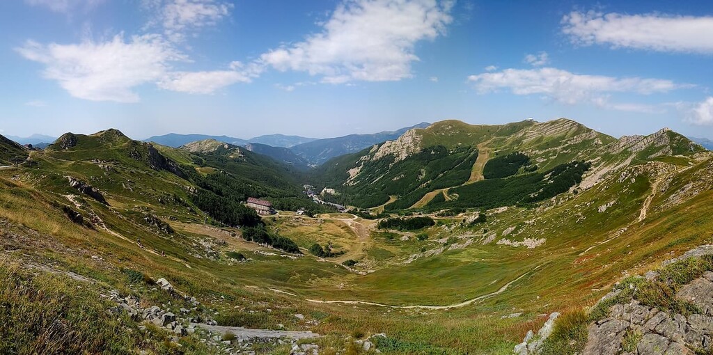
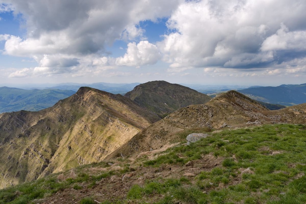
Tuscan-Emilian Apennines National Park is located between the passes of Cisa and Forbici in a mountainous locale that separates the regions of Tuscany and Emilia-Romagna. The topography of the region is dominated by its subtle mountains and fluctuating buttresses, which stand in contrast to the jagged peaks of the Apuan Alps.
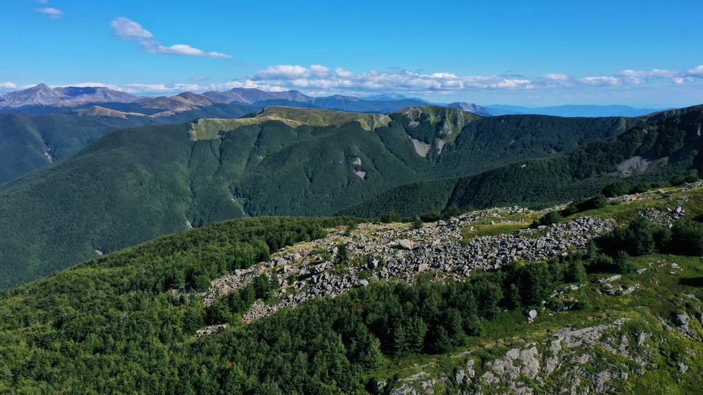
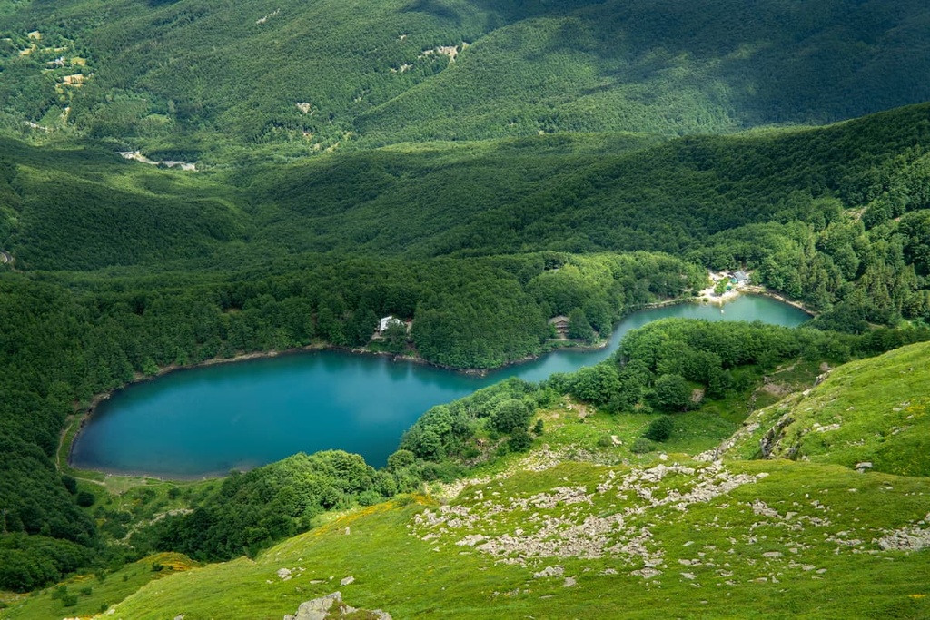
The mountains of the park are mostly composed of sandstone and limestone substrate, where features such as Triassic chalks, Jurassic ophiolites, and Cretaceous turbidites can be seen. The landscape has also been affected by Quaternary glaciation. The effects of glaciation in the region are most prominent on the park’s north-facing slopes, where glacial valleys, lakes, and peat bogs can be found.
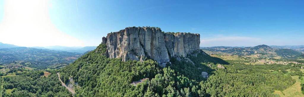
On the Emilian side of the park, the Pietra di Bismantova is the main feature of the landscape. This rocky massif has a length of 1 km (0.1 mi), a width of 240 m (787 ft), and a height of 300 m (984 ft).
The formation of Pietra di Bismantova dates back around 15 million years to the Miocene epoch when the region was located underneath the ancient Tethys sea.
We can still see evidence of the sea coverage in the many mollusk shells and fish teeth fossils that are found throughout the region. Additionally, the sediments that were deposited into the region during this time eventually became a large area of sandstone bedrock that has been partially dismantled and shaped by erosion over the course of millennia.
Another interesting geological feature in Tuscan-Emilian Apennines National Park is the Triassic Chalks (I gessi Triassici), which are ancient chalk outcrops that date back over 200 million years. They are located along the Secchia Valley and are composed of a variety of rocks such as limestones and dolomites. The slow movement of the tectonic plates in this area over the millennia is highlighted by the different stratification of the chalks in the park.
These chalks also boast a collection of underground and surface karst phenomena such as sinkholes, closed basins, and caves. One of the most interesting karst formations in the Secchia Valley is the Tanone Grande della Gacciolina, which is a large cave complex.
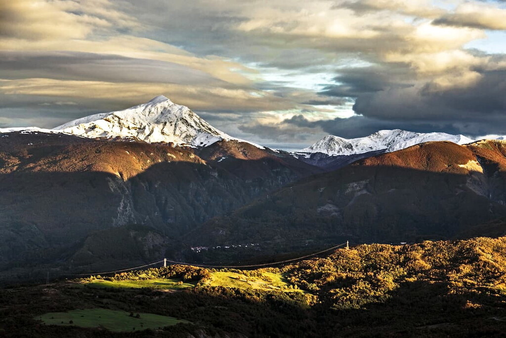
The highest peaks in the park are Alpe di Succiso, Monte Prado, and Monte Cusna, which all exceed 2,000 meters (6,560 ft) in elevation.
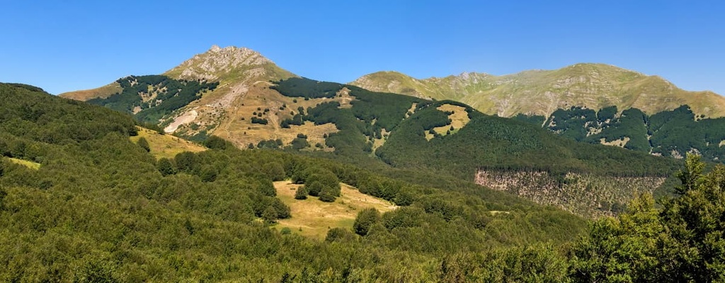
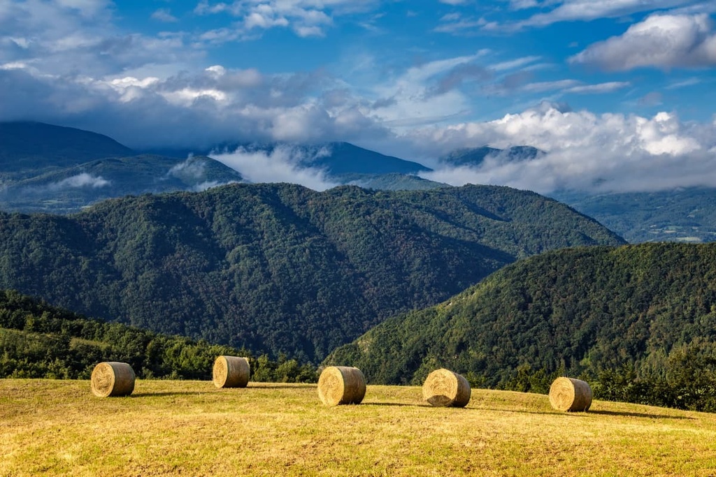
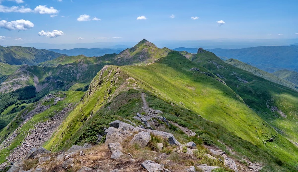
There’s a huge variety of different environments and landscapes in Tuscan-Emilian Apennines National Park from grasslands and moorlands to lakes, waterfalls, and vertical walls.
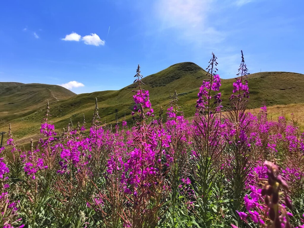
The flora in the park is diverse due to the wide variety of elevations and exposures that are found in the region. Oaks and chestnut woodlands dominate the lower valleys of the park up to 1,000 m (3,280 ft) in elevation. These forests then transition into beech and silver firs as you make your way toward elevations of around 1,700 m (5,577 ft). However, beyond the treeline in the park, you’ll primarily find meadows and shrubs, such as blueberries.
The high ridgelines in the park are characterized by meadows with ridge rushes, narcissus anemones, alpine asters, and purple gentians that are interrupted by rocky outcrops. You can also see a number of the rare and endemic species that live in the region at the Pania di Corfino Botanical Garden in the Orecchiella Nature Reserve in Garfagnana.
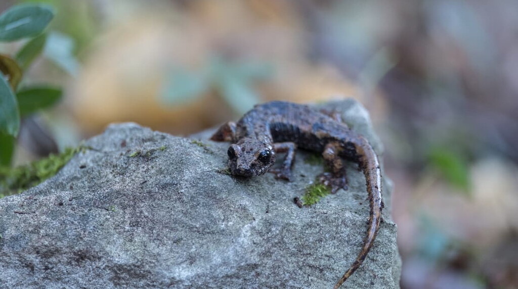
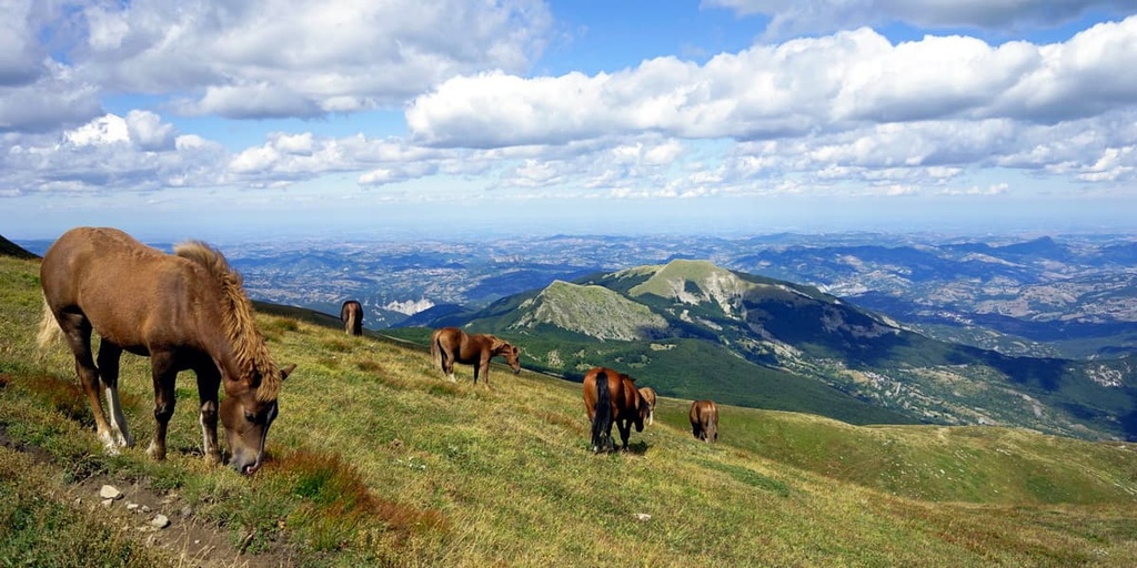
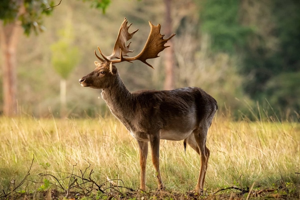
There’s plenty of wildlife to keep an eye out for in the park, too, including wolves, red deer, roe deer, European mouflon, snow voles, Alpine newts, bats, marmots, buzzards, peregrine falcons, and golden eagles.
Human activity in the area that is now Tuscan-Emilian Apennines National Park dates back thousands of years. This region has long been popular among humans due to its ample water supply and abundant resources.
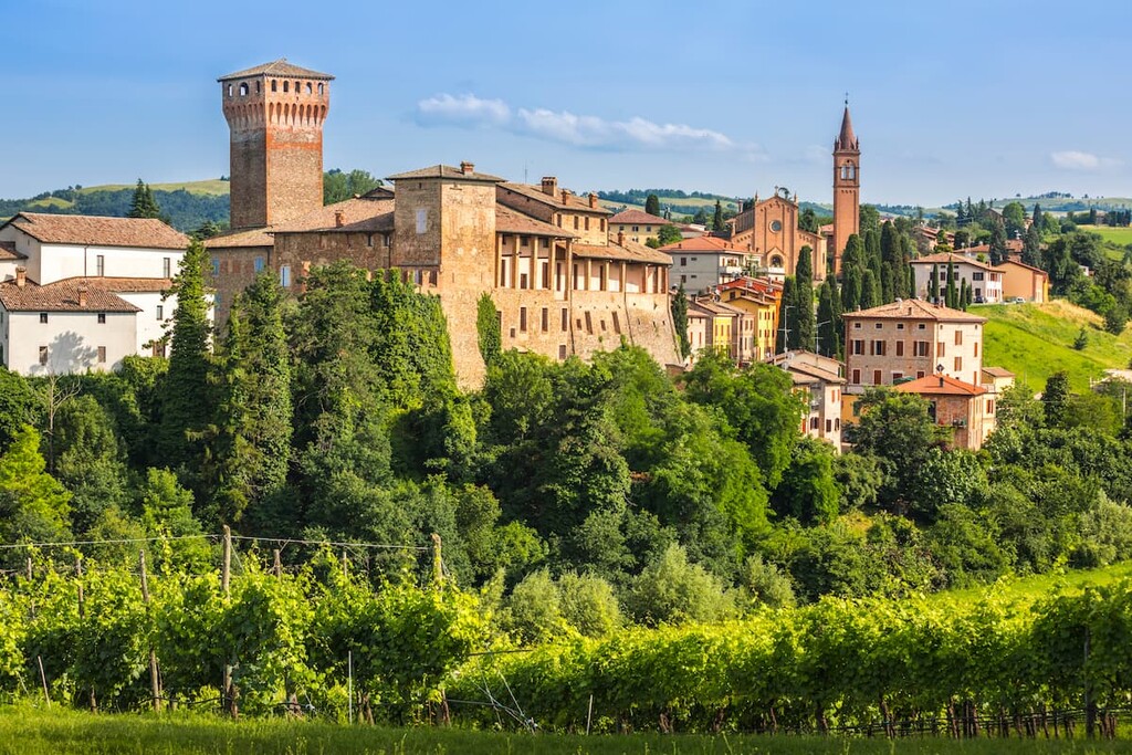
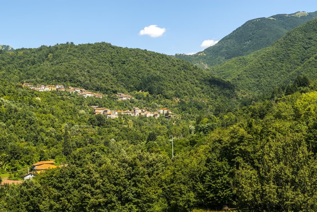
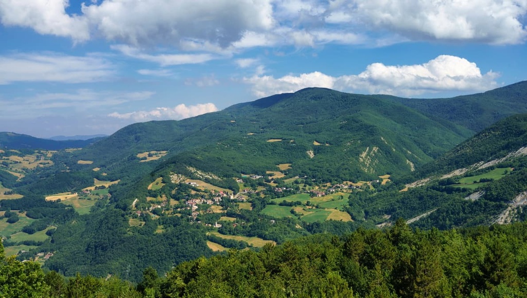
There are plenty of medieval fortresses, churches, ancient roads, and stone buildings located in and around the park. The large number of historic sites in the region is a testament to the importance of the roads that cross the Lagastrello, Cerreto, Pradarena, and Radici passes, which were trodden by merchants, pilgrims, and shepherds over the centuries.
The forests in the region were exploited in the past for timber and to make way for pastures and agricultural land. Due to dwindling pastoral and farming activity in the area, much of the vegetation that was once cleared for these activities has started to grow back in the area.
Battles were also fought in this part of the northern Apennine Mountains during the Second World War. During this time, Nazi Germany set up a defense line along the summits of the mountains in the region that would become known as the Gothic Line or Green Line. The line was breached by the Allies in April 1945 during the final Allied offensive of the Italian campaign.
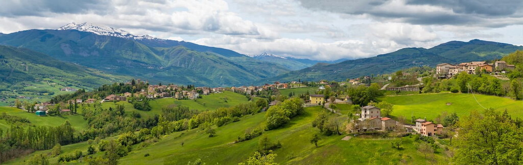
Nowadays, the hills of Emilia-Romagna are often used for dairy farming, which is an important part of the production of the region’s famous Parmigiano Reggiano cheese (also known as Parmesan). Many fields in the region are also cultivated with wheat, maize, and barley. On the Tuscan side of the park, there are many terraced hills that are cultivated with olive groves and vines for the production of oil and wine.
From rugged mountain trails and old shepherd paths to forests, meadows, and summits, there are hikes available for people of all experience levels in Tuscan-Emilian Apennines National Park.
Here, you can experience Tuscany’s coastline and enjoy views over the Mediterranean Sea. The park is also a great place to see the scenic countryside of Emilia-Romagna and the Po Valley.
The northern side of the park is best suited for hiking as the slopes are more gradual, allowing for easier access to the park's peaks and forests. Here are some of the best hikes in Tuscan-Emilian Apennines National Park to check out during your next trip to the region.
The Grande Escursione Appenninica (Great Apennine Excursion) is a 425 km (264 mi) long route that runs along the ridge of the Apennines.
This route starts at the border between Umbria and Marche and leads up through the Apennines to meet the Ligurian High Route (Alta Via dei Monti Liguri) at the Passo dei Due Santi in the province of Massa-Carrara in Tuscany.
The route is broken down into 28 stages and is marked by red and white flags with GEA written in black. There is always a mountain refuge (also known as a GEA stopover) at the end of each hiking stage.
You can access the GEA from several points throughout the park if you don’t want to complete the entire thru-hike. Some of the most popular access points for the trail are located at Passo del Cirone, Passo del Cerreto, Cerreto Laghi, and Febbio.
Expect breathtaking views along this route. In fact, on a clear day, you can get views over Tuscany and Emilia-Romagna as well as the Apuan Alps, Mediterranean Sea, Alps, and the Po Valley from the GEA!
The trail up to the summit of Monte Marmagna is usually climbed from the Emilia-Romagna side of the mountain as the Tuscan side is much steeper.
This route starts at rifugio Lagdei. From here, you can either take the panoramic route 723a, which is a bit longer but offers better views, or path 727, which is shorter but less scenic, to reach rifugio Mariotti. That said, the difference in length between these two routes is minimal as it normally only takes about 15 to 20 extra minutes to hike route 723a when compared to path 727.
From rifugio Mariotti, the path continues up to Capanna Schiaffino, an emergency cabin. You then have three options to reach the summit of Monte Marmagna:
One of the oldest pilgrim trails in Europe, the Via Francigena begins at the Canterbury Cathedral in Kent, England. It then crosses the Alps and Apennines before finishing in Rome.
This route passes through Tuscan-Emilian Apennines National Park on its twenty-second Italian leg. The section of the trail that traverses the park starts from Cisa Pass and heads to Pontremoli. It usually takes around 5 hours to complete this 19 km (11 mi) section of the via Francigena.
There are plenty of places to base yourself during your trip to Tuscan-Emilian Apennines National Park. Here are some of the best cities and towns to visit as you travel around the region.
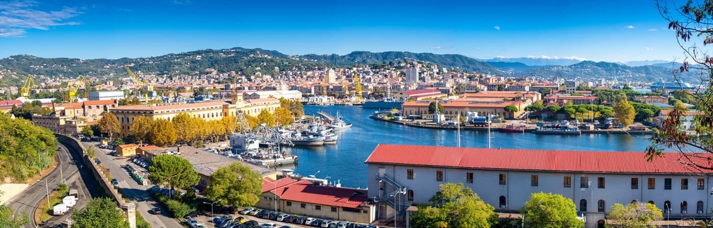
Although La Spezia is located in neighboring Liguria, it’s one of the easiest points of access for visits to Tuscan-Emilian Apennines National Park. In fact, the town is located just a little over an hour away from the park by car.
By staying in La Spezia, you can experience the best of the mountains and the sea. That’s because the town offers great access to both Tuscan-Emilian Apennines National Park and the nearby Cinque Terre National Park.
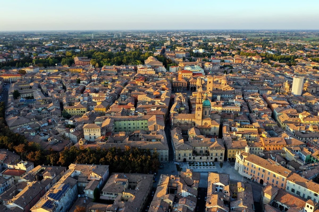
As one of the closest cities to the park on the Emilia-Romagna side of the Apennines, the city of Reggio Emilia is a great base for visitors to the area.
There are plenty of local restaurants and bars to check out in Reggio Emilia if you’re looking to enjoy the local food scene. Art and culture can be found within the walls of the city’s Valli Municipal Theater, where elaborate frescos are in abundance.
Biking is the preferred form of transportation here as the city of Reggio Emilia happens to have one of the most extensive networks of urban bike paths in Italy. Reggio Emilia is easy to get to by public transport, too, as it is located along the Milan–Bologna train line.
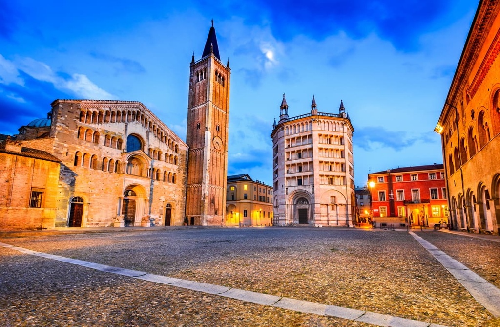
Along with Reggio Emilia, Parma is another great access point for travels to Tuscan-Emilian Apennines National Park. In fact, Parma is a great place to stay for foodies as it’s the home of both Parmigiano Reggiano cheese and Parma ham!
For a culture fix while in Parma, you can take the time to visit Parma’s Roman ruins as well as the Parma Cathedral, Parma Baptistery, and Teatro Regio opera house. You can also stroll through Piazza Garibaldi to enjoy city life in the historical center of Parma.