Scan the QR code and open PeakVisor on your phone
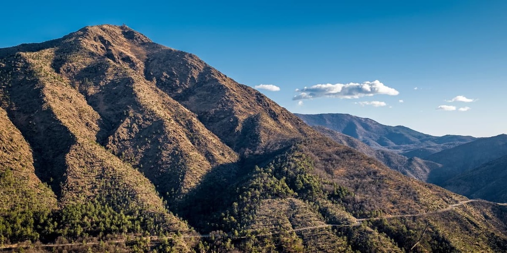
Located just a few kilometers from the Mediterranean Sea, Capanne di Marcarolo Natural Park is the oldest protected area in the region of Piedmont in the Apennines of Italy. There are 33 named mountains in Parco Naturale delle Capanne di Marcarolo, the highest and most prominent of which is Monte Figne (1,172 m/3,845 ft).
Capanne di Marcarolo Natural Park (Parco Naturale delle Capanne di Marcarolo) was established in 1979. It is located in the region of Piedmont in northwestern Italy.
The park is situated in the province of Alessandria, and it borders the Italian region of Liguria to the south. Within the park, you’ll find part or all of the municipalities of Bosio, Casaleggio Boiro, Lerma, Mornese, Tagliolo Monferrato, and Voltaggio.
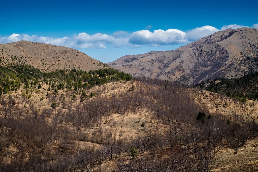
Capanne di Marcarolo covers a territory that’s 82 sq. km (32 sq. mi) in size. It is located in a scenic part of the Ligurian Apennines, which divide the Po Valley from the Ligurian Sea drainage basin.

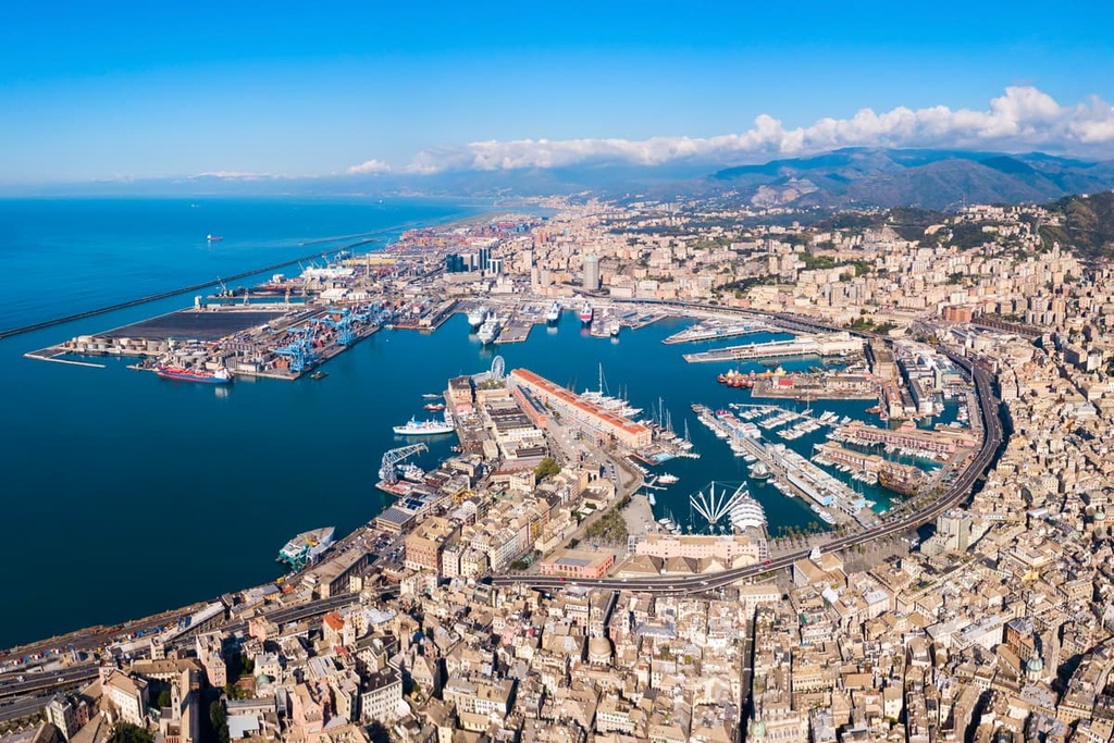
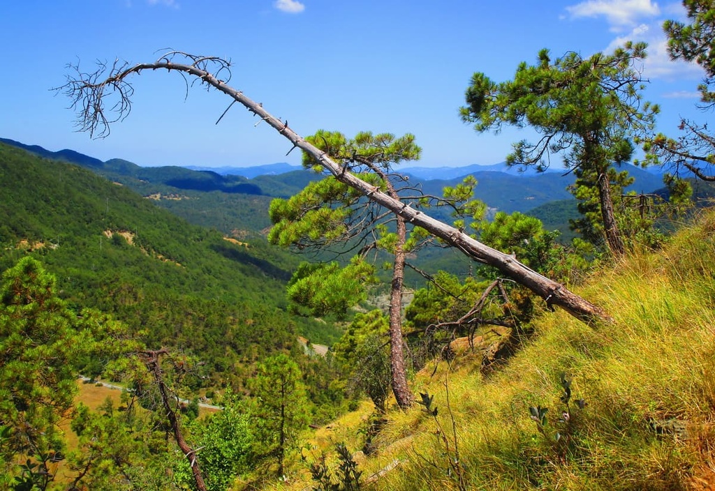
Capanne di Marcarolo Natural Park is home to the Marcarolo plateau, which is situated in the Gruppo Voltri of the Ligurian-Piedmontese Apennines. The park’s landscape is dominated by Monte Tobbio, and it offers a fantastic view over the Gulf of Genoa.
The most prevalent rocks in the park are peridotites and serpentines. Gold mining took place in the area where veins of auriferous quartz were found, however, the mines and their tunnels are no longer in use.
The highest summit in the park is Monte Figne (1,172 m/ 3,845 ft). Other high peaks in the park include Monte Leco (1,072 m/ 3,517 ft), Monte Tobbio (1,092 m/ 3,582 ft), and Monte Taccone (1,113 m/ 3,651 ft).
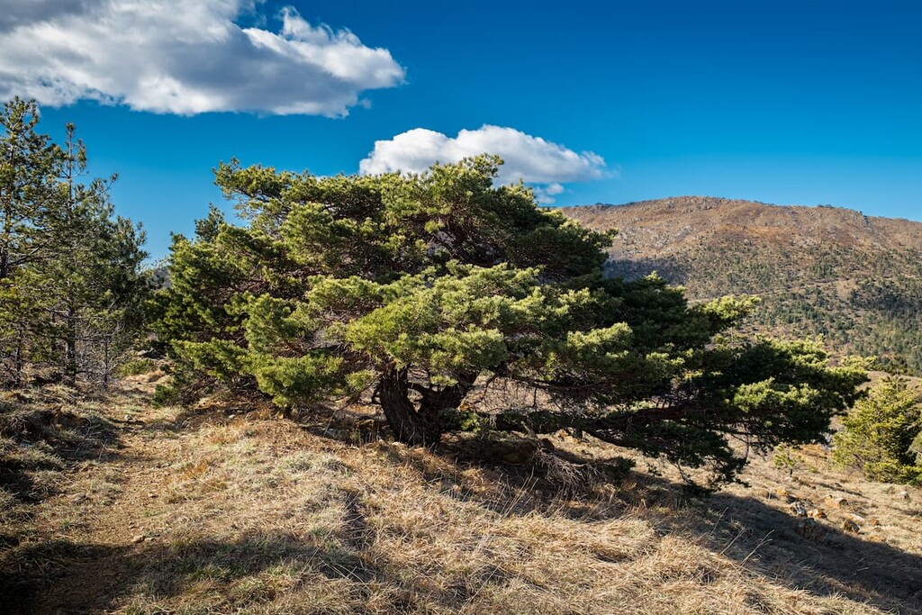
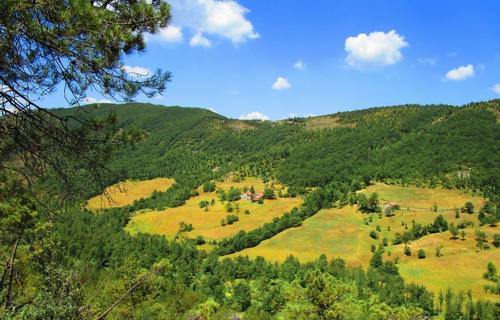
The environment in the Capanne di Marcarolo Natural Park is composed largely of grasslands, woods, and shrubs, with frequent bogs.
Signs of ancient chestnut cultivation can be found at the northern edge of the park. Meanwhile, recent reforestation of maritime pine has been carried out in the park due to the region's extensive history of timber production. Historically, the region’s timber provided lumber for the shipyards of Genoa.
The area in the park now consists primarily of broadleaf and coniferous woodland. But the park’s proximity to the Mediterranean Sea has meant that Alpine flora coexists with Mediterranean plants such as holm oak.
Micro-climates and habitats in the park have allowed for the presence of rare endemic plants such as Bertoloni’s pansy and Cerastium utriense, the latter of which is endemic to the Apennines.
The park is also particularly interesting due to its abundance of water and wetlands. In fact, the park is home to several lakes, streams, and rivers, including the Lemme and Gorzente tributaries.
The park is also an important location along a number of bird migratory routes. Some birds to keep an eye out for in the park include short-toed eagles, buzzards, kestrels, goshawks, hawks, and tawny owls. Thanks to the park’s reforestation efforts, the tufted titmouse and crossbill have also reappeared in the area.
Due to the copious wetlands in the park, salamanders, common toads, red frogs, alpine newts, and crested newts also call this area home. The Italian geotriton, which is a type of salamander, is also found in the old abandoned mines, where it lives in almost complete darkness.
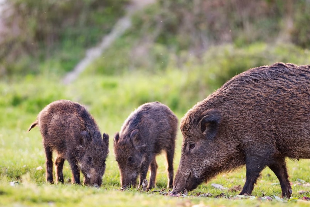
In the woodlands of Capanne di Marcarolo, animals such as wild boar, foxes, badgers, dormice, roe deer, hedgehogs, beech martens, and hares can be found. The park itself is even the site of a dedicated rewilding area for the Italian wolf.
The region that is now Capanne di Marcarolo Natural Park has been home to humans for thousands of years. Both the modern province of Alessandria (which contains the park) and the province of Asti are partially located within a historic region called Montferrat, which is a UNESCO World Heritage Site and a famous wine-producing region.
Montferrat’s human history goes back millennia. It was a margravate during the time of the Holy Roman Empire toward the end of the first millennium CE. It passed hands many times between the Holy Roman Empire and various Dukedoms in what is now Italy.
Part of the park can also be considered part of the historical region of Oltregiogo, which also has an extensive human history dating back thousands of years. The region of Oltregiogo passed hands between the Lombards and Franks before eventually becoming part of the Holy Roman Empire. It became part of the Kingdom of Sardinia after the 1815 Congress of Vienna.
Capanne di Marcarolo Natural Park is home to a number of artificial lakes (Laghi del Gorzente), which were built at the end of the nineteenth century to provide Genoa and its surroundings with fresh water and electricity.
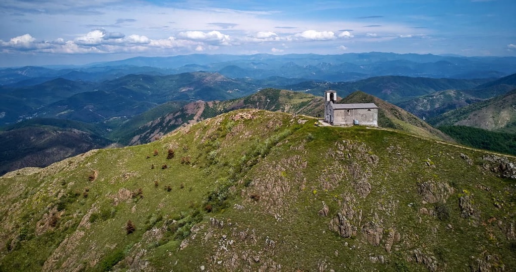
Within the park, there are several important historical monuments such as the shrine of Benedicta, which commemorates the massacre at Benedicta that took place in April 1944.
The ruins of a former abbey can also be found near the hamlet of Capanne di Marcarolo. There’s also an ecomuseum in the park where visitors can step back in time and discover the daily life of the local farmers who would have lived in the area.
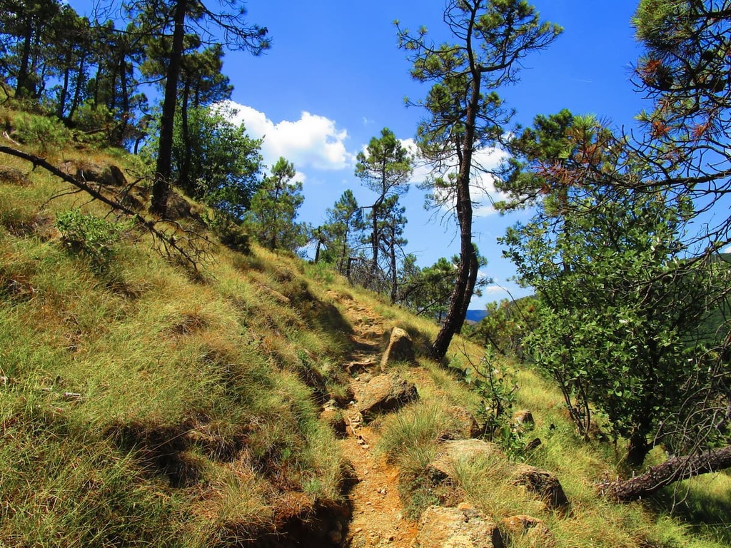
Capanne di Marcarolo Natural Park has several different points of entry that are accessible by car. The best time to visit the park is during the spring and autumn when the weather is relatively mild.
Here are some of the best hikes in Capanne di Marcarolo Natural Park to check out during your next trip to the region.
The Laghi del Gorzente Nature Trail is a 13 km (8 mi) loop route between Campomorone, Ceranesi, and Bosio that takes most hikers around 5 hours to complete. The route partially follows the Ligurian High Route (Alta Via dei Monti Liguri), and it offers a variety of landscapes for visitors to enjoy.
The Laghi del Gorzente Nature Trail follows along the Gorzente River until it meets the Gorzente Lakes (Laghi del Gorzente). Along the path, there are information boards describing different aspects of the local environments as well as points of historical and archeological interest.
L’Anello delle Cascine (The Farmstead Loop) is a 15 km (9 mi) long loop hike that passes through a mix of interesting environments as well as several farmsteads (cascine).
There is the option to extend this route if you want to climb either or both Monte Tobbio and Monte delle Figne. Keep in mind that extending your hike to include these peak ascents will add another hour or two to your adventure.
This trail starts and ends in the Ponte Nespolo car park. It then winds its way past waterfalls, natural lakes, as well as the artificial Gorzente Lakes. Along the way, you’ll also hike by Cascina Preadoga, Cascina Carrosina, Cascina Cian du Fó, and Cascina Nespolo.
Capanne di Marcarolo Natural Park is located a short distance inland from the Ligurian Sea. Although most of the region’s major cities are located along the coast, there are still plenty of great towns to check out in and around the park during your next visit. Here are some of the best places to stay when you next travel to the region.
Located close to Genoa along the western Ligurian Riviera, the town of Arenzano is situated within easy driving distance of Capanne di Marcarolo Natural Park. Arenzano is also located within the boundaries of Beigua Nature Park, which offers further hiking opportunities for the keen adventurer.
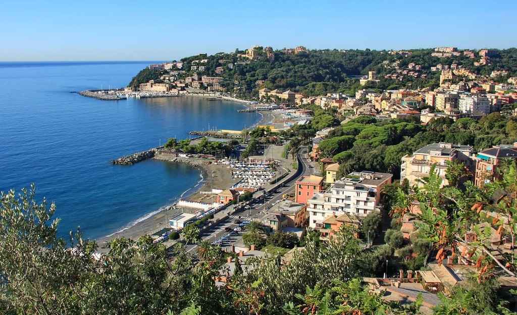
This scenic coastal town is home to plenty of shops, bars, and restaurants, as well as several beaches to enjoy during the summer months. You can get to Arenzano from Genoa in just over half an hour by either car or train.
The regional capital of Liguria, Genoa is a beautiful city that boasts historic buildings in a mix of different architectural styles from Medieval and Baroque to Gothic. Genoa offers visitors plenty of incredible places to check out, from the historic via Garibaldi (which happens to be a UNESCO World Heritage Site) to the largest aquarium in Europe.
The city is also the gateway to the Ligurian Riviera as both Portofino Natural Regional Park and Cinque Terre National Park are situated within driving distance of Genoa. From Genoa, you can even quickly get to many of the region’s beautiful beaches, which are well worth a visit during the summer months.