
Scan the QR code and open PeakVisor on your phone
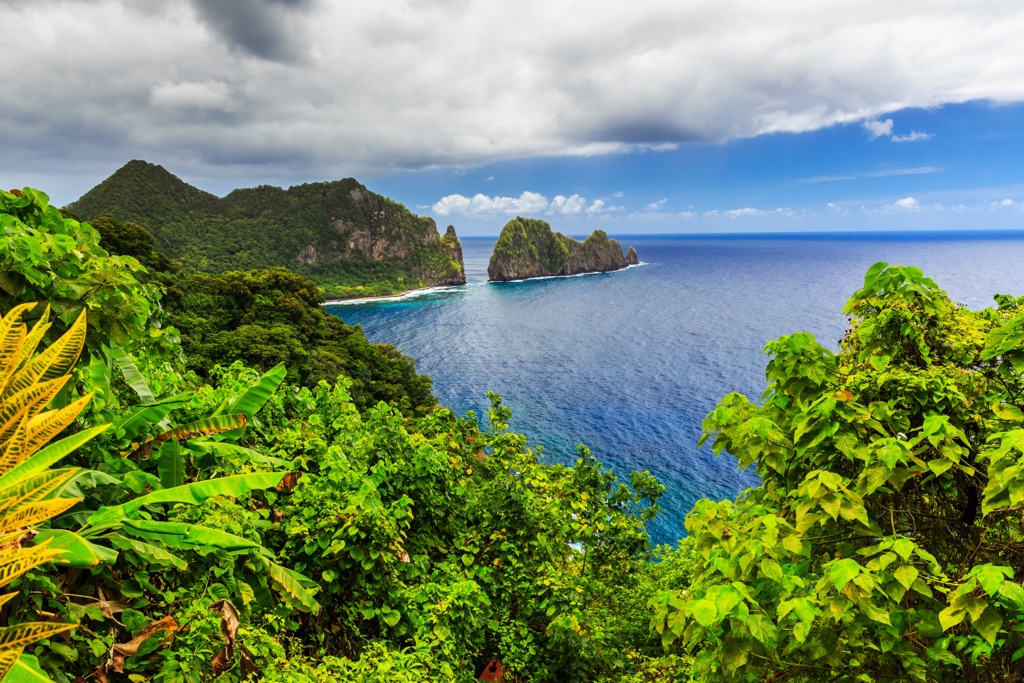
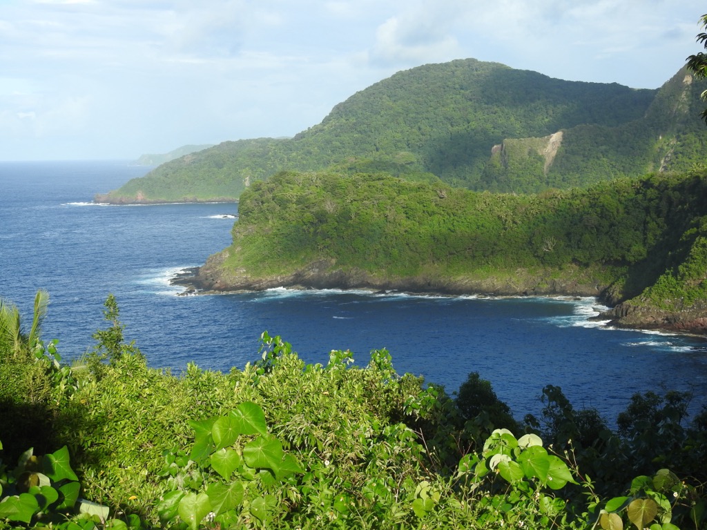
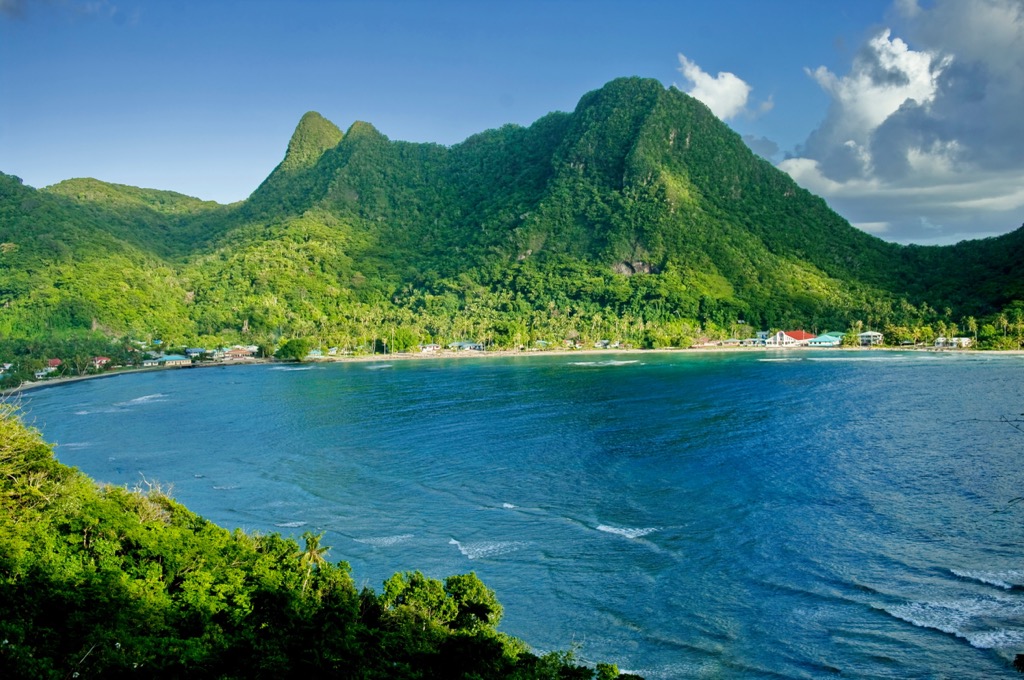
The National Park of American Samoa is located on three islands – Tutuila, Ta’u, and Ofu – of the five islands that make up American Samoa, a territory of the United States. Located over 2,500 mi (4,025 km) south of Hawaii and more than 2,000 mi (3,220 km) northeast of New Zealand, the remote national park protects tropical forests on steep volcanic slopes and thousands of acres of coral reefs. There are 19 named mountains in the park. The highest and most prominent is Lata Mountain, rising 3,176 ft (968 m) from sea level to summit.
The National Park of American Samoa encompasses 13,500 acres (5,465 ha) – 9,500 acres (3,845 ha) of it terrestrial and 4,000 acres (1,620 ha) marine, mainly coral reefs. It was first established in 1988. In 1993, the National Park Service signed a 50-year lease agreement with eight local villages. In 2002, another agreement expanded the park to include two more villages. The park sees an average of 5,000 visitors annually.
The national park is located on three islands (Tutuila, Ta’u, and Ofu) within the five islands that make up American Samoa. The Samoan Archipelago consists of 13 islands, nine of which are inhabited, and two atolls. It is divided into the independent country of Samoa and the US Territory of American Samoa. Samoa is about 15 times larger than American Samoa.
The national park includes one of American Samoa’s National Natural Landmarks, Vai’ava Strait. The park is located more than 2,500 mi (4,025 km) south of Hawaii and more than 2,000 mi (3,220 km) northeast of New Zealand. It is the only National Park site that falls south of the equator.
The tallest points in the national park are Lata Mountain (3,176 ft/968 m), Olamatimu Crater (2,602 ft/793 m), Olomanu Crater (2,244 ft/684 m), Judds Crater (1,650 ft/503 m), and Alava Mountain (1,624 ft/495 m).
The Samoan Archipelago is a classic example of a Pacific Ocean volcanic island arc. As the Pacific Plate moves westward, it passes over a stationary hotspot where molten rock from the Earth’s mantle breaks through the lithosphere. This forms volcanoes, some of which rise above the ocean’s surface and form islands. The last volcanic activity was in 1905.
The Pacific Plate moves west at a rate of about 3 in (7.6 cm) per year, meaning islands are progressively older the further west they fall in the chain.
In its westward movement, the Pacific Plate encounters the Australian Plate and splits. Part of the Pacific Plate continues moving towards China and the other section is pushed down into the 6 mi (9.5 km) deep Tongan Trench and then beneath the Australian Plate. The subduction and intense pressure between tectonic plates causes occasional earthquakes.
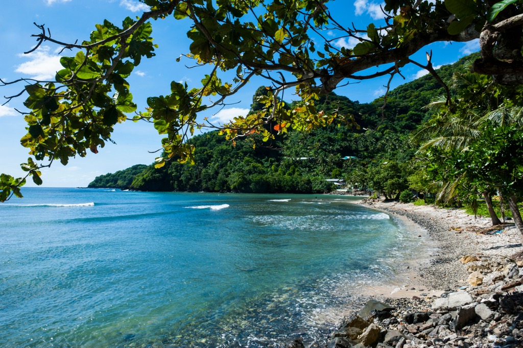
The environment in American Samoa is hot, humid, and rainy year round, although it can be divided into a hotter rainy season from October through May and a cooler, slightly drier rainy season from June through September. Annual rainfall around Tafuna Airport is 125 in (317.5 cm) but can exceed 200 in (508 cm) in mountainous areas.
The waters near shore are warm, between 82 and 86 Fahrenheit (28 and 30 Celsius). Hurricanes periodically hit the islands. The last significant ones took place in 1990, 2004, and 2005.
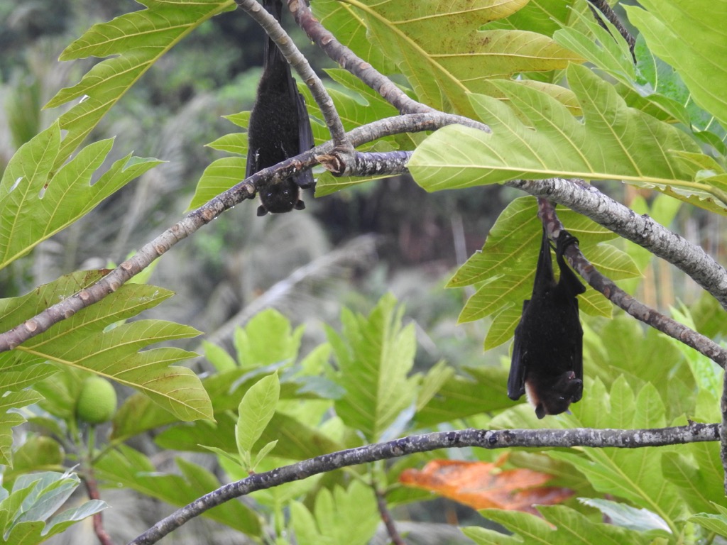
Much of the islands’ flora and fauna is related to that of Indonesia although the level of terrestrial biodiversity is lower given the remoteness and small size of the islands. There are approximately 343 flowering plants, 135 ferns, 25 land and water birds (both resident and migratory), 20 resident seabirds, three mammals (all bats, including fruit bats), three skinks, one gecko, and two sea turtles.
The tropical forests are lush and filled with epiphytes, lianas (woody vines), and stranglers that begin as epiphytes but upon reaching the ground, take root and ultimately strangle the host tree. Banyan trees, native trees in the fig family that support numerous wildlife species, are one example of stranglers.
The marine biodiversity is much higher around the islands. The surrounding waters and reefs are home to 961 coral reef fish, more than 250 corals, and several species of whales and dolphins. Giant clams, numerous sea stars, octopus, sharks, and surgeonfish are a few common marine species. Palolo, polychaete worms with an edible portion, rise to the surface once or twice a year, providing an abundant harvest.
The islands house a few endemic species. These include the Samoan starling, one stream fish, several terrestrial snails and about 30% of local plants. Federally listed threatened or endangered species that utilize habitat here include humpback and sperm whales, and green and hawksbill sea turtles.
The islands’ ecosystem is altered and threatened by invasive and non-native species such as rats, three species of birds, feral pigs, dogs, cats, toads, house geckos, tilapia, molly fishes, African snails, fire ants, and several hundred species of weeds. Unusually warm waters sometimes cause coral bleaching in the reefs.
Samoan culture is the oldest in Polynesia. The first people of the islands arrived by boat from southwest Asia about 3,000 years ago. The collective traditions, beliefs, and customs of this several thousand year old culture is referred to as fa’asamoa.
Some of the earliest artifacts have distinct designs belonging to the Lapita culture. This was the same people and culture to first settle places such as Vanuatu, New Caledonia, Fiji, Futuna, and Tonga. Artifacts from the next thousand years mainly consist of plain pottery left behind by the communities of Tutuila and Manu’a.
Signs of larger structures also date back to the earlier millennium of occupation. These include house foundations (fale), terraces (lau mafola), grinding stones (foaga), walls (pa), and platforms (tia).
For reasons not entirely known, very few artifacts have been recovered from the proceeding 800 years, even though this period is considered important in the development and continuation of Samoan culture.
One of the few archeological sites from this time reveals a coastal community with food remains of shellfish, and burial sites indicating a cultural shift as burials lay perpendicular to the beach rather than earlier sites with burials situated parallel to the beach.
Stone tools have been discovered from 700 years ago, mainly adzes used for carving wood. Star mounds are a prominent structural feature and some can be seen on hikes in the national park. The majority of star mounds were constructed within the last 500 years. They are elevated platforms, 2 to 15 ft ( 0.6 to 4.6 m) high, some with protruding sections like stars, and were used to snare pigeons as part of a ritual sport for chiefs.
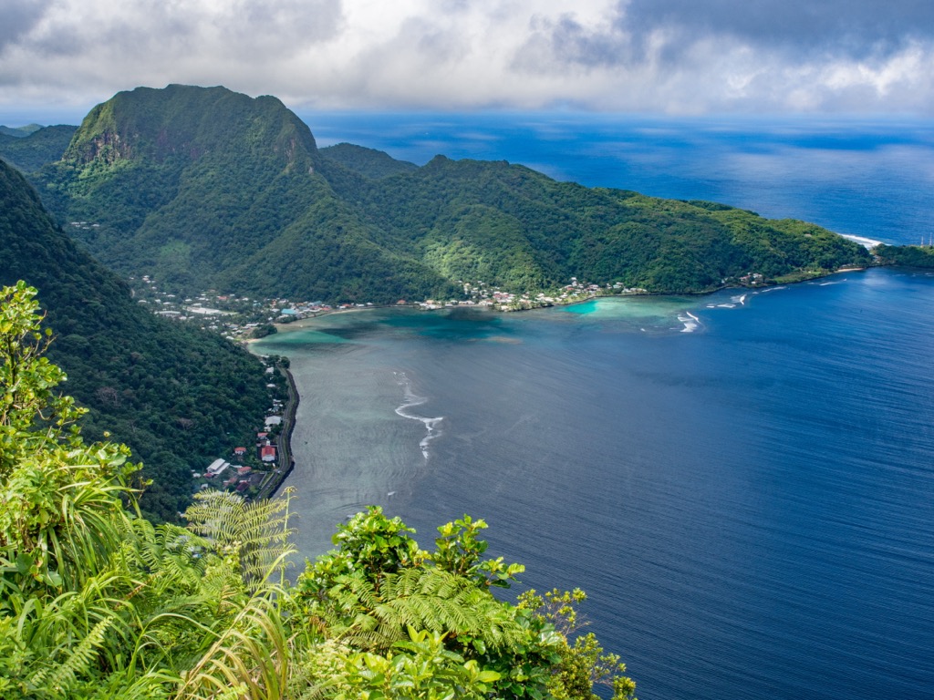
There is a big fishing culture on the island and traditional subsistence fishing is allowed within the national park. The park was established in 1988, and further expanded in 1993 and 2002 to incorporate land from 10 neighboring villages.
There are a number of day hikes and beach walks in the park. The park typically receives 5,000 visitors per year and most arrive for the day from cruise ships. Visitors hoping to snorkel or dive should know that there is not much tourist infrastructure so it is best to bring your own gear and plan only on renting air. Getting to more remote locations will require arranging a boat ride with a local fisherman. American Samoa has a more modest culture so visitors should not wear revealing bathing suits.
The Tuafanua Trail is considered a moderate route and is 2.2 mi (3.5 km) roundtrip. It traverses switchbacks through rainforest before ultimately arriving at a hidden coastline. From the ridge, one gets clear views across the ocean before descending with ladders and ropes to the rocky beach with views of Pola Island.
The trailhead leaves just before Vatia School. Don’t swim in the ocean along this trail as there are potentially dangerous waves and currents.
Considered a challenging route, the Mount ‘Alava Adventure Trail is 5.6 mi (9 km). It follows ridgelines with great vistas across the north and central parts of the national park and island. Ladders and steps with rope railings are used to ascend and descend – the trail has 56 ladders and 783 steps so come prepared for an active hike!
The trail summits Mount ‘Alava (1,624 ft/495 m) before descending along a steep trail to Vatia Village and then looping back along the road to return to the trailhead. The trailhead begins across the street from the national park faleo’o and the trailhead of the Lower Sauma Ridge Trail.
An alternative route to the summit of Mount ‘Alava departs from Fagasa Pass and is 7 mi (11.3 km) roundtrip. This trail leads through rainforest and offers the chance to spot fruit bats and birds. It passes by sites where the park is planting native species and removing invasive ones, and by a banana and coconut plantation. The trail up to the summit and from the top offer great panoramic views of the island.
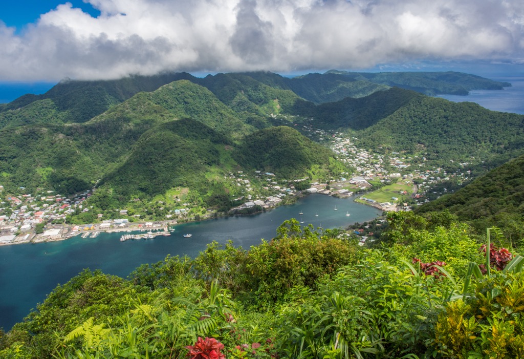
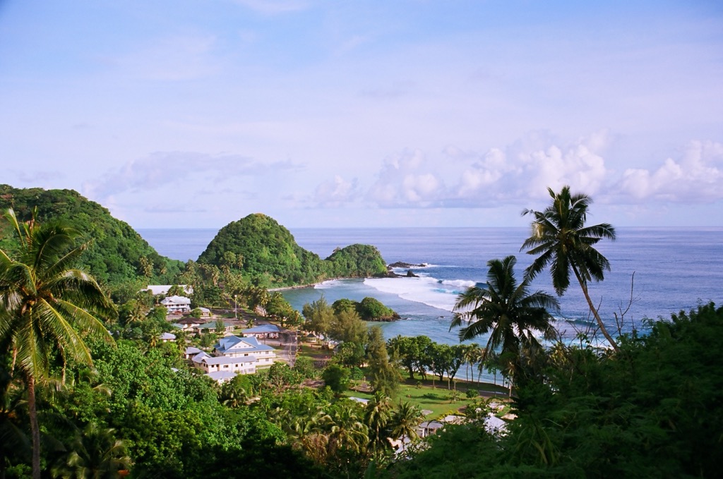
The island of Tutuila has a population of around 60,000 people and is home to Pago Pago, the capital of American Samoa, and the Pago Pago International Airport located in the nearby village of Tafuna.
Tutuila is the easiest island to get to, followed by Aunu’u. The three outlying islands of Ofu, Olosega, and Ta’u are collectively called the Manu’a Islands and are a bit trickier to get to, although it can be arranged.
Most visitors stop by for the day off of cruise ships but the island and national park are worth exploring for longer stays.
The capital of American Samoa, Pago Pago, is about 25 minutes away from Tafuna, a village where the international airport is located. Both towns are on Tutuila Island.
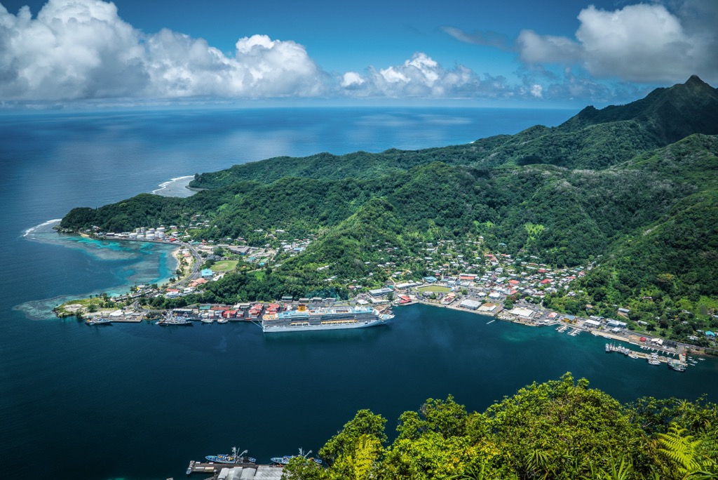
Pago Pago is considered the gateway to the National Park of American Samoa. Around the port and town, visitors can explore the National Marine Sanctuary and the Jean P. Hayden Museum. The museum highlights the islands’ history and culture with everything from woven mats to moon rocks explaining American Samoa’s involvement in the Apollo Space Missions.
Those interested can book marine charters for fishing and diving trips from Pago Pago. The town has a modest selection of cafes, diners, fast food joints, bakeries, and restaurants offering island-style, American, Chinese, and Mexican cuisine. Visitors can choose from a small range of hotels, inns, and lodges to stay over in.


