
Scan the QR code and open PeakVisor on your phone
Samoa is home to 116 named mountains. The highest is Mauga Silisili at 1,857 m.
Samoa, officially known as the Independent State of Samoa, is an island country situated in the South Pacific Ocean. The country marks one of the westernmost island countries of Polynesia and is home to 116 named peaks. The tallest and most prominent mountain is Mauga Silisili at 1,857 m tall (6,092 ft) and with 1,857 m (6,092 ft) of prominence.
Samoa is a Polynesian island country situated in the South Pacific Ocean. The country features two main islands, Savai’i and Upolu, two smaller islands, Manono and Apolima, along with various smaller uninhabited islands.
Together the islands of Samoa span 2,842 square kilometers (1,097 square miles) across the ocean. The two main islands comprise roughly 99% of the nation’s area. Situated south of the equator, Samoa lies roughly equidistant between the Hawaiian Islands and New Zealand.
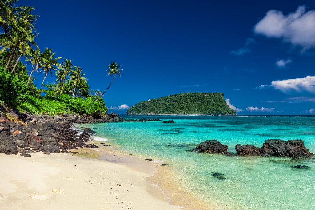
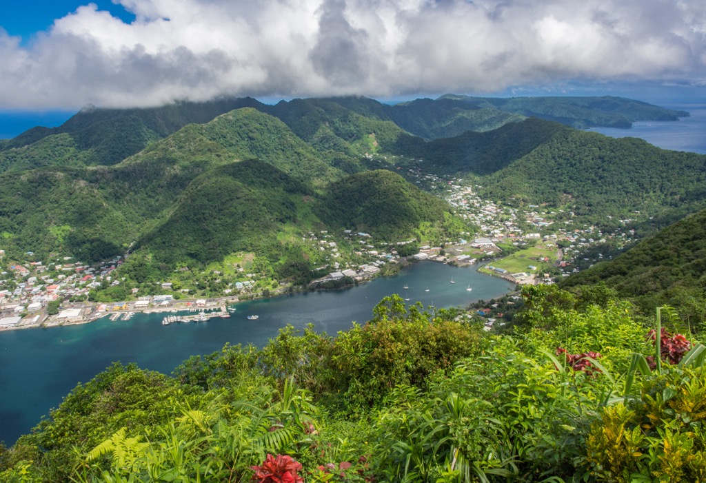
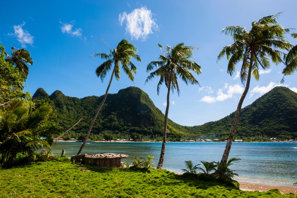
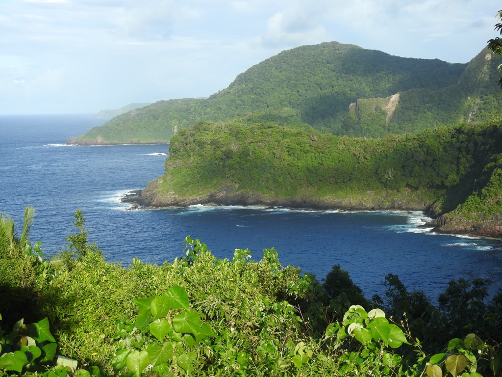
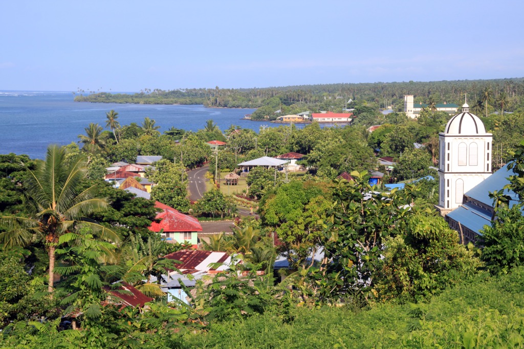
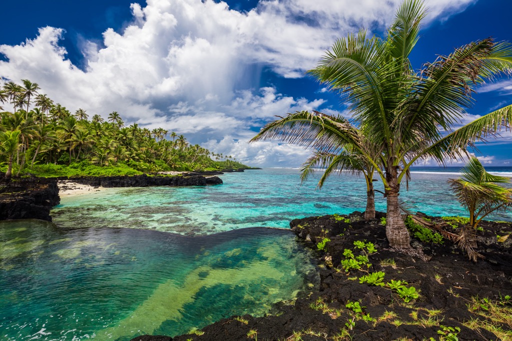
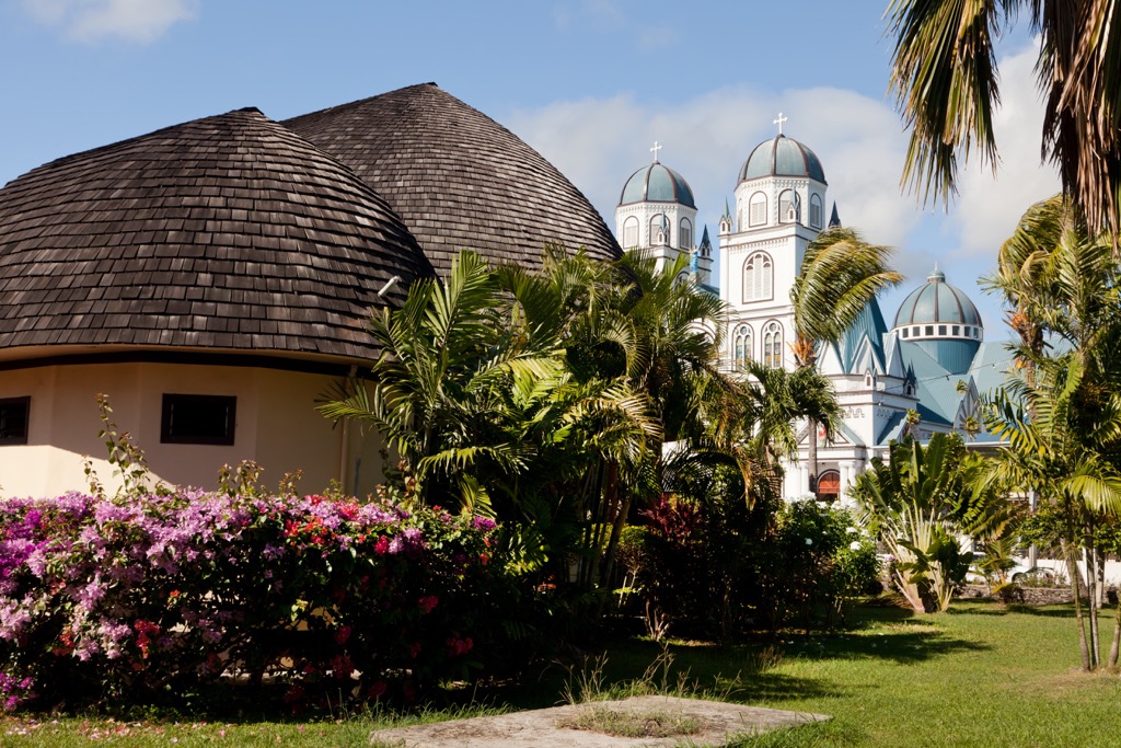
The capital city of Apia is situated on the north shore of the island of Upolu. The two major islands of Samoa feature sandy beaches which rise steeply into the volcanic mountains. The tropical terrain features densely forested hillsides and volcanic rock at its highest points.
The smaller islands of Samoa are drastically different, many having been heavily eroded. Today, these small islands showcase the remnants of once larger islands, featuring coral reefs and volcanic tuff rings.
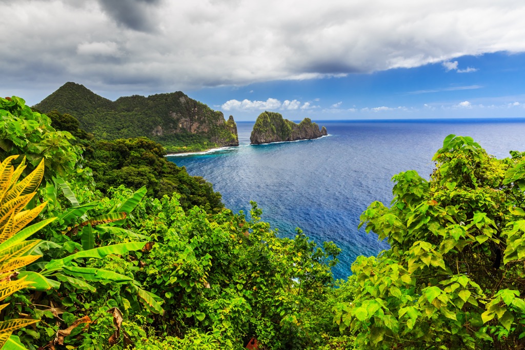
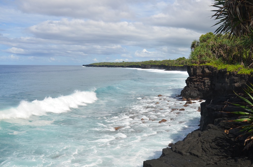
Steep and mountainous terrain defines the island nation with lush ridgelines and narrow valleys. Major bodies of water include the Lata River on the island of Savai’i, along with the Mulivaifagatola River on Upolu.
The Apolima Strait lies between the two major islands which feature three islets known as Manono Island, Apolima, and Nu’ulopa. The Aleipata Islands, which are part of Samoa, lie just east of the island of Upolu. The four Aleipata Islands are Nu’utele, Nu’ulua, Namua, and Fanuatapu. Off the southern coast of Upolu lies Nu’usafe’e, an island smaller than one ha.
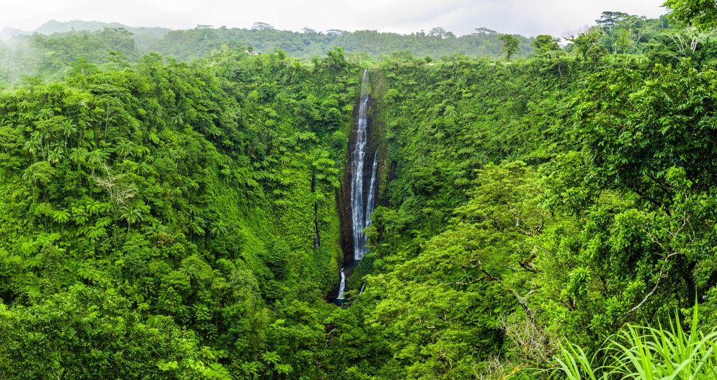
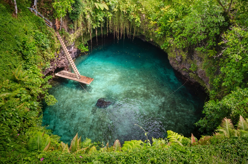
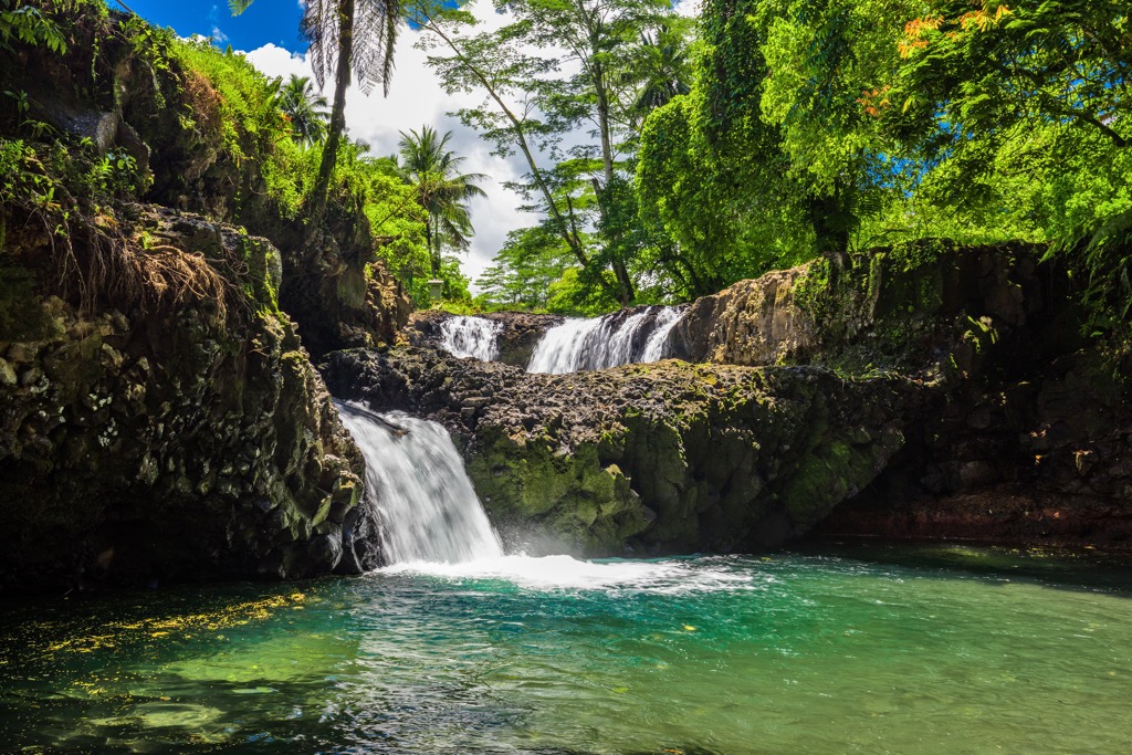
The steep ridgelines and mountains of the country, coupled with the immense amount of rainfall, results in a multitude of waterfalls throughout the islands. Major falls include Togitogiga Waterfall, Fuipisia Waterfall, and Papapapaitai Falls. Various other waterfalls can be spotted throughout the islands, especially after a heavy rain.
The nation of Samoa lies just 64 km (40 miles) west of American Samoa while the closest foregin country is Tonga, situated 889 km (552 miles) southwest. Samoa is 483 km (300 miles) east of Wallis and Futuna.
There are numerous reserves and protected regions located of the islands of Samoa including:
Additionally, the nation of Samoa is home to various national parks, including Lake Lanoto’o National Park, Lata National Park, O Le Pupu-Pu’e National Park, Mauga o Salafai National Park, and Masamasa-Falelima National Park.
Geologically the islands of Samoa were formed by volcanism. The Samoa hotspot is situated in the South Pacific Ocean and has shaped the land that is visible today.
Deep under the Samoan islands, the hotspot features an upwelling plume of magma coming through the Earth’s crust. As the Pacific Tectonic Plate travels over the hotspot the different islands have been formed.
Each of the islands was formed throughout volcanic activity though the only island that is currently an active volcano is Savai’i, the westernmost island. The islands closest to the active hotspot are the youngest while further islands are older.
Despite the knowledge of volcanic hotspots, parts of Samoa’s geological history still remain unknown. Over the past 150 years both the easternmost island of Taʻū and the westernmost island of Savaiʻi have erupted.
The multitude of recent eruptions has led scientists to conclude that the Pacific plate is splitting at the trench-transform boundary. Volcanic rock is found throughout all of the islands of Samoa with the newest rocks being located on Savai’i.
Major peaks within the country of Samoa include Mauga Silisili, Mauga Afi, Mauga Si’ope, Mount Fito, Mounts Fao, and Mauga Tele.
The lush landscape of Samoa has allowed for a variety of tropical plants and animals to thrive. There are 541 native flora species on the islands including 186 endemic species. Samoa is home to the second largest native vascular flora in Polynesia, following the Hawaiian Islands.
The inland terrain is classified as rainforests and cloud forests while the coastlines feature mangroves, hibiscus, and Barringtonia. Taro plantations and coconut groves are common for agricultural purposes.
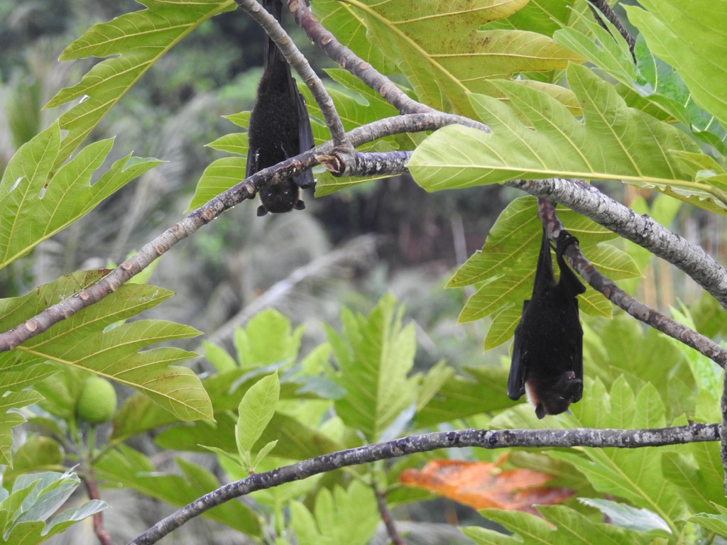
The only native mammals in Samoa are flying foxes, and other species of bats. The flying foxes are currently classified as endangered. More than 50 species of birds live in Samoa including the rare tooth-billed pigeon.
Though not native, species of wild cattle, rats, and pigs have been introduced to the region, brought over by colonizers. There are numerous species of lizards, centipedes, millipedes, spiders, and scorpions on the island along with a wide variety of insects.
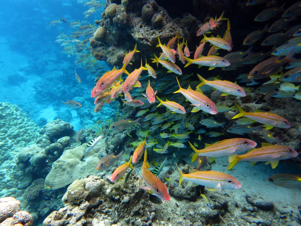
The waters surrounding Samoa are home to Humpback whales, Ginkgo-toothed beaked whales, Spinner dolphins, Fraser’s dolphins, and Bottlenose dolphins. The shallow waters are also home to coral and a plethora of tropical fish species.
The human history of Samoa dates back over 3,000 years. The series of islands was discovered and settled by the Samoans’ Lapita ancestors around 1,000 BCE.
The oldest known settlement is Mulifanua located on the island of Upolu. To this day, the region features remnants of stonework pyramids and mounds. Throughout the following centuries the people of Samoa would often travel between other islands in the South Pacific Ocean, primarily Tonga and Fiji. These journeys were made for trade deals, battles, and marriage unions.
Around 950 CE, warriors from Tonga arrived on the island of Savai’i and then tried to overthrow the people on Upolu. The Samoans defeated the Tongans, led by chief Malietoa Savea. Ongoing battles continued throughout many of the island nations into the 13th century.
The first colonizers, led by Reverend John Williams, arrived in Samoa in 1830 and drastically changed the traditional belief system. Williams, and other Western missionaries, converted much of Samoa to Christianity, disregarding their traditional belief system.
A civil war broke out between 1886 and 1894 as the two sides fought against who should be the king. During this time, the German military began intervening as both the US and Germany sought to take control of the islands. The Samoan Civil War came to an end in 1894 as Laupepa was declared king.
Following Laupepas’ death in 1898, a second civil war broke out while Germany, the US, and the UK continued to battle for control. This second civil war ended in 1899 and Samoa was divided, with Germany having control over the western island and the US gaining control over the eastern islands, now known as American Samoa.
Under German rule, infrastructure grew quickly throughout Samoa. People from Melanesia and China were brought to the islands to work on the growing plantations which were established by the Germans.
During World War I, New Zealand took over control of Samoa from Germany. Their administrative control lasted from 1918 until 1962. During the 1920s the people of Samoa formed the Mau resistance movement (Samoan: O le Mau a Samoa) which fought for independence from New Zealand.
Efforts for independence were set back by the Great Depression and World War II. Finally, on January 1st, 1962, Western Samoa declared independence under the rule of Samoan Prime Minister Fiame Mata’afa.
From 1962 to 1997 the nation was known as Western Samoa, eventually changing its official name to the Independent State of Samoa. In 2009 the nation experienced a devastating earthquake and tsunami that destroyed villages and killed numerous people.
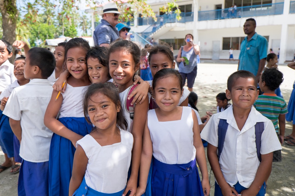
Today Samoa is home to around 202,00 residents with nearly three quarters of its residents living on the island of Upolu. The less populated island of Savai’i marks the sixth-largest Polynesian island.
There are numerous hikes throughout the islands of Samoa, ranging in difficulty. Access to many of the trailheads requires a 4WD vehicle. Visitors can also hire local guides to bring them to less traveled hiking routes and sites across the islands.
The O Le Pupu-Pu’e National Park is home to numerous hiking trails and nature excursions. The most popular hike in the park is the Coastal Walk. Hikers walk a few minutes from the parking lot before they are met with sweeping views of the dramatic coastline. The lush forest drops off abruptly giving way to lava rock cliffs and crashing waves down below.
Hikers can continue on past the first viewpoint and into the Pandanus forest. After walking through the forest the trail opens up to views of Nu'usafe'e, Nu'utele and the islands around Aleipata. This hiking route takes the average hiker an hour to complete. Much of the route is on lava rock so hikers should wear sturdy footwear.
Though the Coastal Walk offers stunning views of the dramatic cliffs, visitors to the region have ample opportunities to explore the beauty of the nation’s oldest national park. Popular excursions include hiking to and swimming in the pools of the Togitogiga Waterfalls or exploring the Pe’ape’a Caves. These lava tube caves were formed thousands of years ago and are home to the Samoan bird known as the Pe’ape’a.
Mauga Silisili (also referred to as Mount Silisili) is the tallest and most prominent peak in the nation of Samoa. The peak lies near the center of the island of Savai’i. The summit is often covered in clouds and requires a long trek through the rainforest in order to reach the crater.
Reaching the summit can often be completed in a 2-3 day hike with multiple companies offering guided tours. At the summit crater the flora changes from alpine grassy fields to white and orange moss scattered across the lava rock. The trail culminates at Mata o le Afi, which last erupted in 1902. From the edge of the crater, hikers can see the northern coast of Savai’i on a clear day.
Looking for a place to stay in Samoa? Here are some of the best cities and villages to check out in the region:
Apia is the capital city of Samoa and is located on the northern coast of the island of Upolu. Home to around 40,000 residents, Apia is situated just 40 km (25 miles) east of the international airport. The Samoa Tourism Information Fale lies in Apia and offers guests a comprehensive guide to the island and the nation as a whole.
The downtown streets feature local shops, restaurants, and cultural sites. Those visiting can check out the Rober Louis Stevenson’s Museum, Vailima National Reserve, and the Vailima Botanical Gardens.
The Museum of Samoa lies just a five minute drive from downtown Apia, showcasing cultural and historical artifacts of the country. The Marketi Fou is an outdoor market full of arts, crafts, fruit, vegetables, and local food vendors.
The village of Mulifanua lies on the northwestern tip of the island of Upolu. The area is home to the Mulifanua wharf, the main ferry terminal that connects the two main islands of the country. Located just a five minute drive from the international airport, the village is known for its turquoise clear waters.
Visitors to the region can enjoy world-class kayaking, paddle boarding, and snorkeling. There are both larger resorts and small beach bungalows in the region with a plethora of pristine beaches. Mulifanua acts as a great base for those wishing to explore the two main islands of Samoa.


Yes. Samoa has 116 named mountains. The highest is Mauga Silisili at 1,857 m.
The highest mountain in Samoa is Mauga Silisili, at 1,857 m.
Samoa has 116 named mountains.


