
Scan the QR code and open PeakVisor on your phone
Fiji Mountains is home to 895 named mountains. The highest is Voma at 1,382 m.
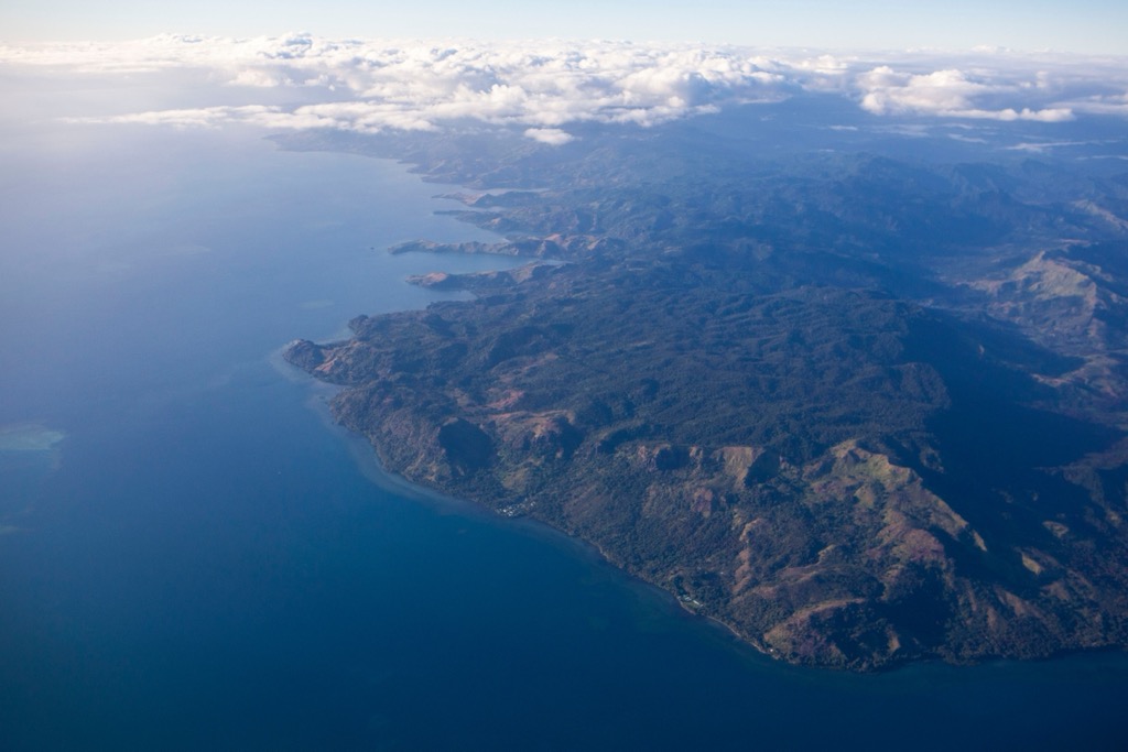
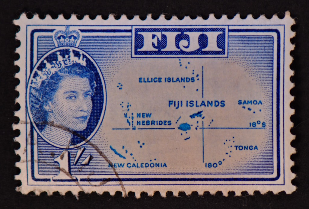
Fiji, or the Republic of Fiji, is an archipelago country in Oceania, in the southwest Pacific Ocean, with a population of 924,000 people. There are a colossal 895 named mountains in Fiji, most of which are volcanic and cloaked in dense, green rainforest, often rising spectacularly from the sea. The highest and most prominent mountain is Voma, found on Viti Levu, Fiji’s largest and most important island. The majestic peak reaches 1,382 m (4,534 ft) at its highest point.
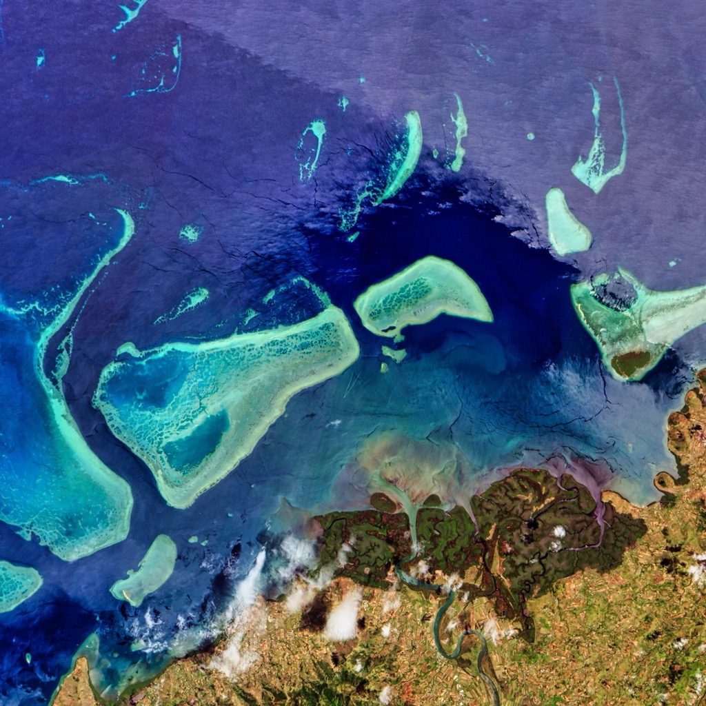
Fiji comprises 333 islands and roughly 540 smaller islets, atolls, and reefs, give or take, depending on one’s criteria. This far-flung paradise makes up the eastern outpost of the ancient volcanic chain of islands extending from Papua New Guinea to Vanuatu. Ninety-five of the islands are greater than 1 km sq (.62 mi sq) in area, and 108 are permanently inhabited. However, many smaller islands have only a few dozen permanent inhabitants.
While the total land mass of Fiji is somewhat limited at 18,272 sq km (7,055 sq mi), the Republic’s territorial waters stretch out to approximately 1,282,978 sq km (274,001 sq mi), giving the island access to valuable minerals, fishing, and trading routes, crucial to the economy.
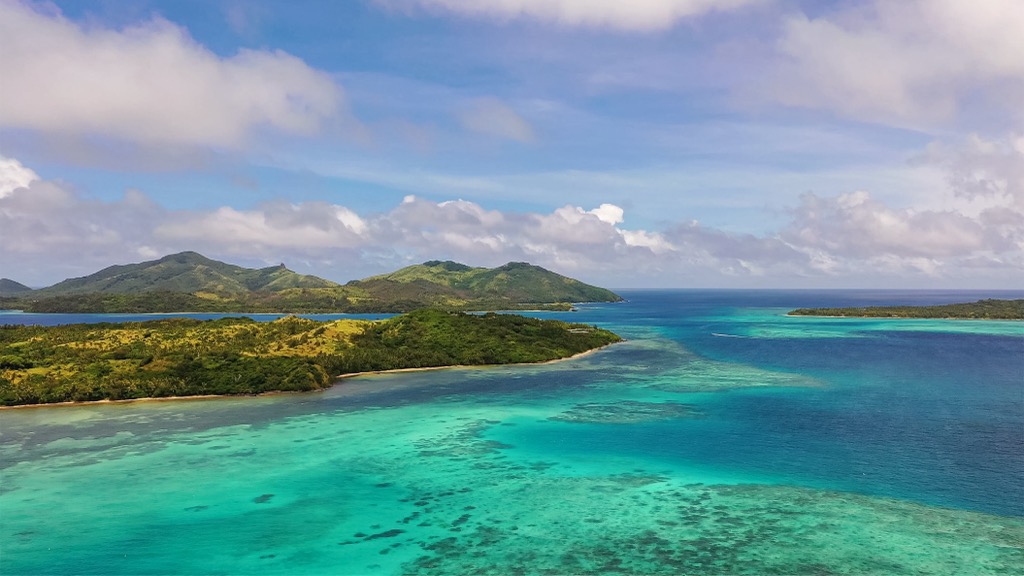
The Fiji island archipelago encompasses the Koro Sea, which spans about 35,405 sq km (22,000 sq mi). This inter-island sea is particularly nutrient-rich due to the amount of water cycling through it, offering a bountiful habitat to an array of underwater fauna, especially reef sharks, dolphins, trevally, barracuda, tuna, and sturgeon. It goes without saying that this is a world-class destination for underwater explorers.
Fiji is located between the equator and the Tropic of Capricorn, squarely within the Southern Tropics. The country shares a latitude similar to that of Zimbabwe, Northern Chile, and Tahiti.
The International Date Line, or 180° meridian, an imaginary line of demarcation that goes from the North to the South Pole, runs through Fiji’s Taveuni Island. For practical purposes, the border marks the dividing line between one calendar day and the next.
Fiji is remote, with its closest neighbor, Tonga, 804 km (497 mi) to the east and Vanuatu 1,211 km (807 miles) to the west. The distance to Sydney, Australia, is 3,191 km (1,983 mi), and about 2,133 km (1,325 mi) to Auckland, New Zealand.
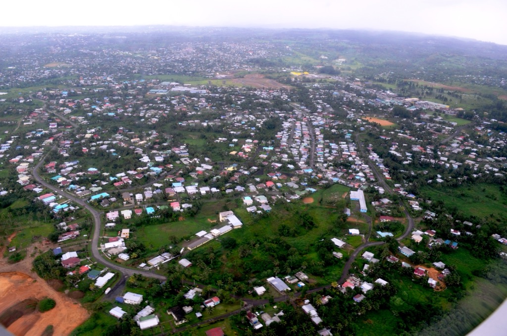
The largest island, Viti Levu, translated as “Great Fiji,” covers an area of about 10,429 sq km (4,026 sq mi), comprising 56% of Fiji’s total land area. Roughly one-third of the population resides here. The capital, Suva, is on the southeastern coast.
The second largest island, Vanua Levu, meaning “Big Land,” takes up 5,587.1 sq km (2,157.2 sq mi) or 30.3% of the nation’s total land mass.
The smaller islands are encompassed mainly in 4 recognized groups:
On the outskirts, Rotuma, a single, isolated island about 450 km (279 mi) north of Vanua Levu, is also a part of Fiji.
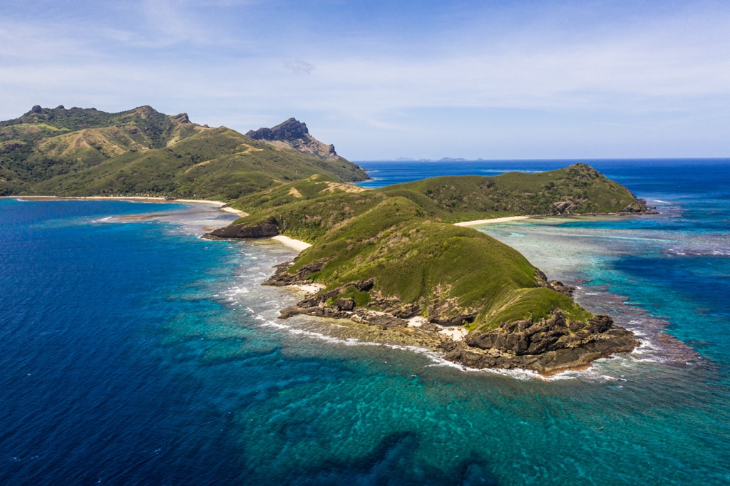
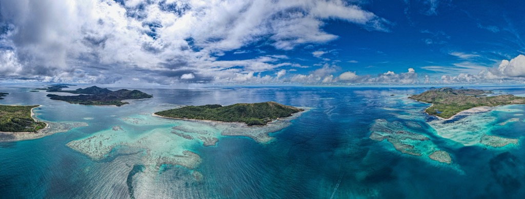
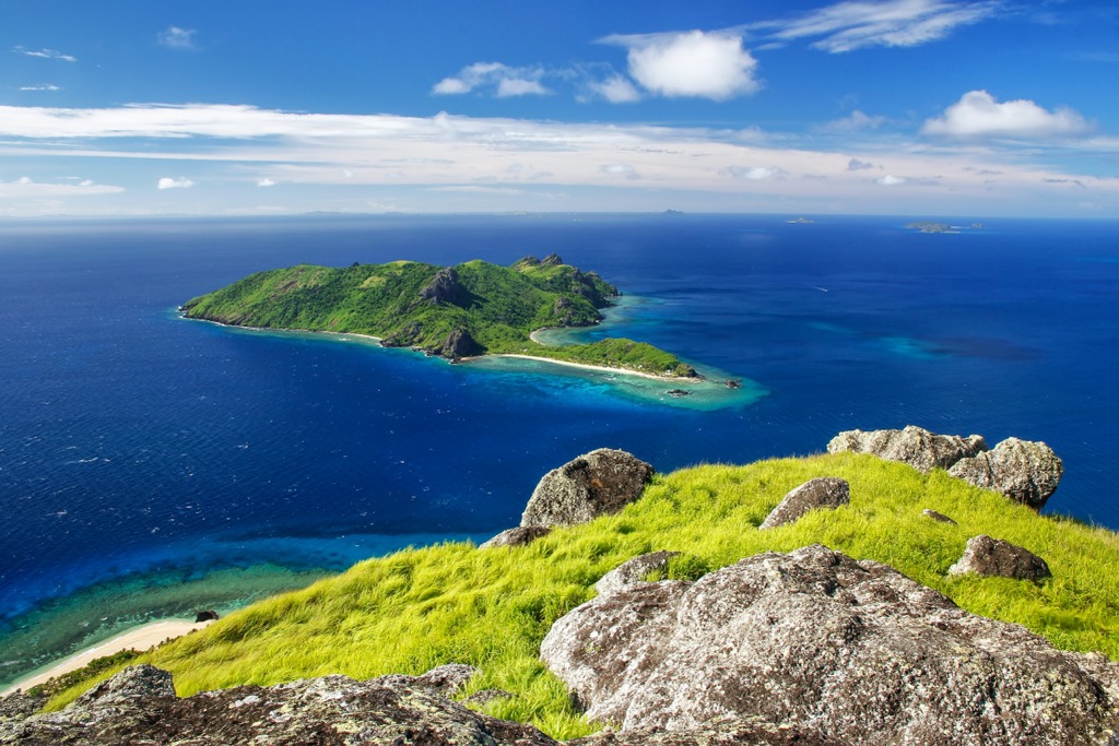
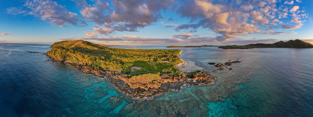
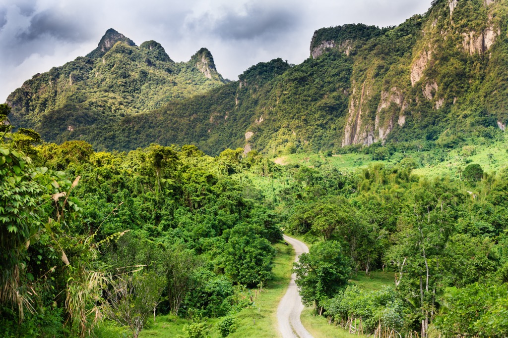
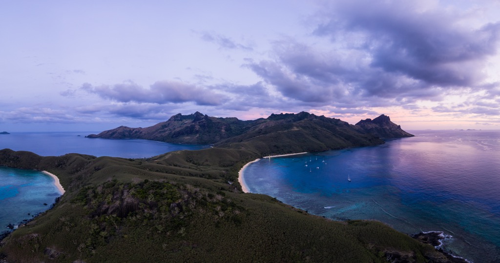
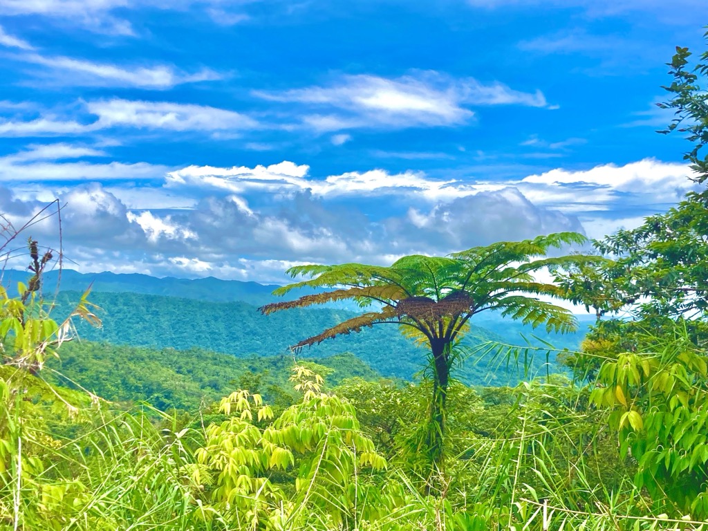
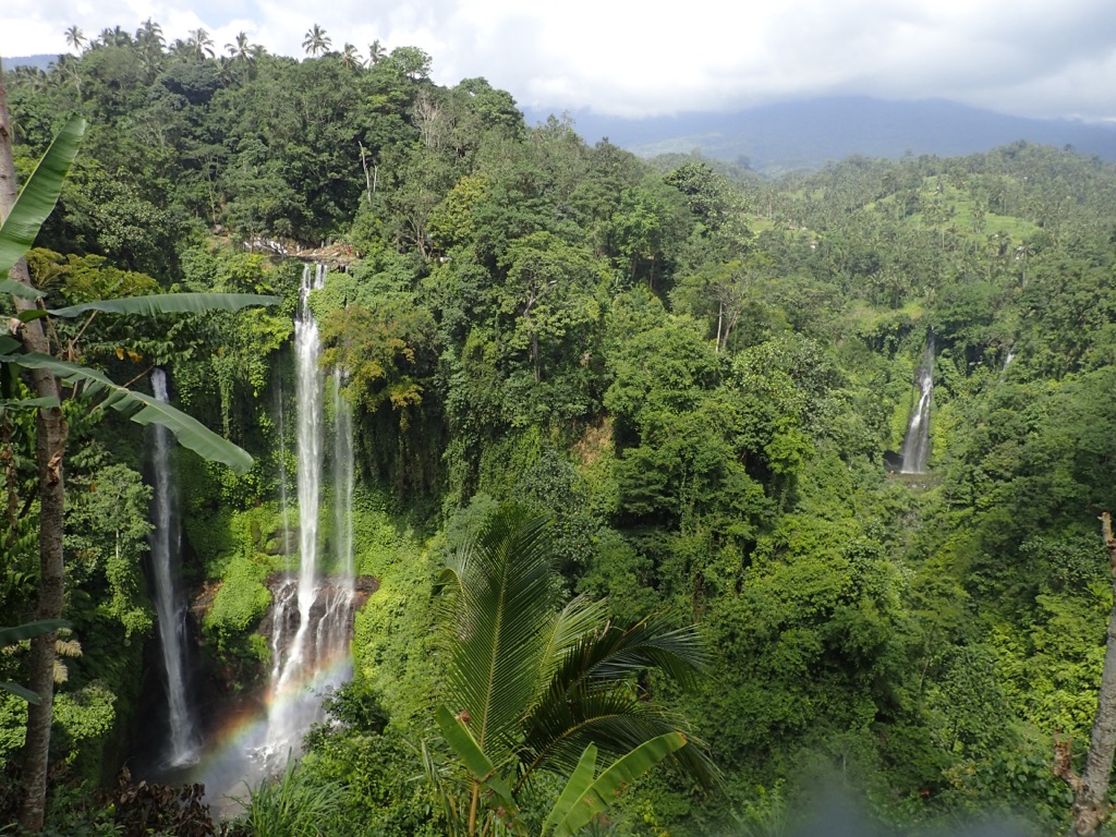
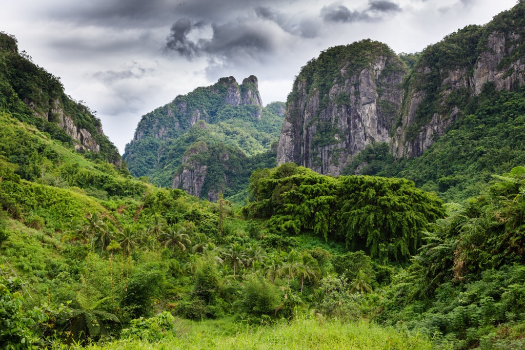
The terrain of Fiji is equally beautiful, diverse, and complicated, characterized by jagged, volcanic mountains covered in lush rainforests, some of the world’s largest and healthiest coral reefs, picturesque beaches, green valleys, rivers, plateaus, and lowlands.
Fiji is roughly 80% mountainous, with the two highest peaks, Voma and Tomanivi, located on the main island of Viti Levu. Both mountains identify with the island’s prominent Nakauvadra Range, a rugged dividing ridge running north to south. The rest of the island has several less pronounced ranges that average around 600 m (1,968 ft) above sea level, and divide Viti Levu into four upland quadrants.
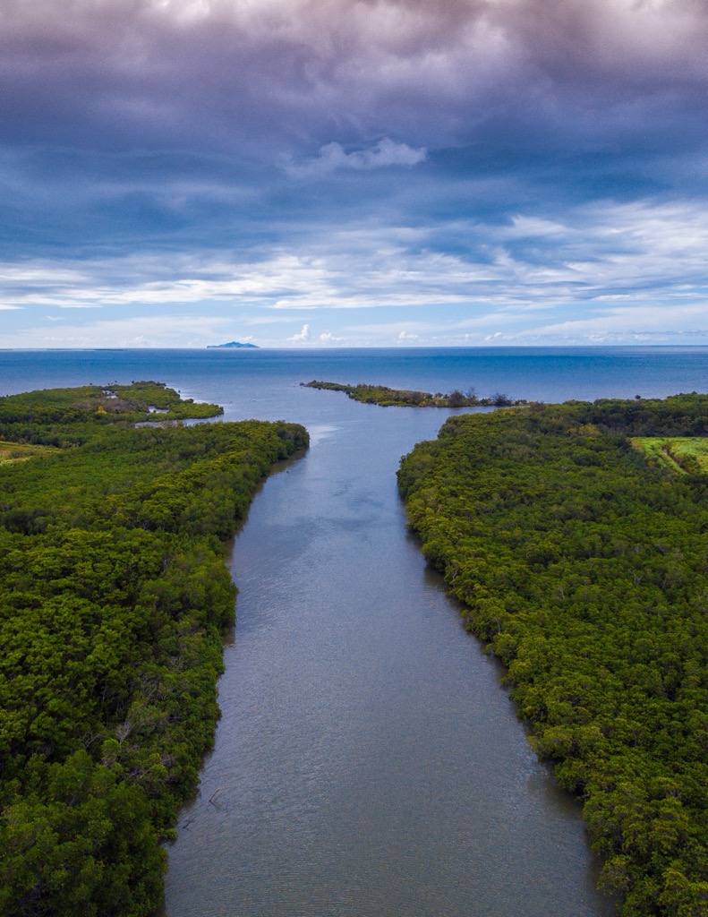
About 55.5%, or 1,014,000 hectares, of Fiji’s landscape is forested, according to the U.N. Food and Agriculture Organization (FAO). Tropical moist forests make up the windward side of the two largest islands, while grasslands and tropical dry forests dominate the leeward slopes in the northwestern parts of these islands. Fiji has about 46,600 hectares of mangrove forests, primarily along the coastlines and riverbanks, making up about 4% of total forest cover. This represents the third-largest mangrove area within the Pacific Island region at 517 sq km. (321 sq mi).
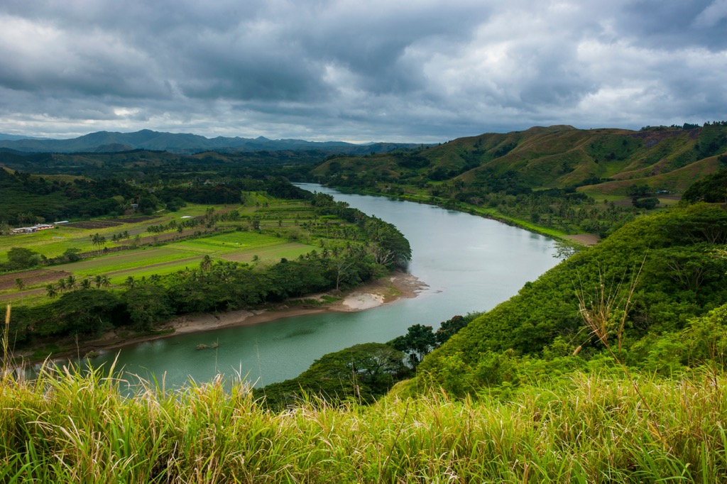
Coastal plains and lowlands found in the west, northwest, and southeast make up about 15% of the land area of Viti Levu. These zones form Fiji’s main agricultural and population centers.
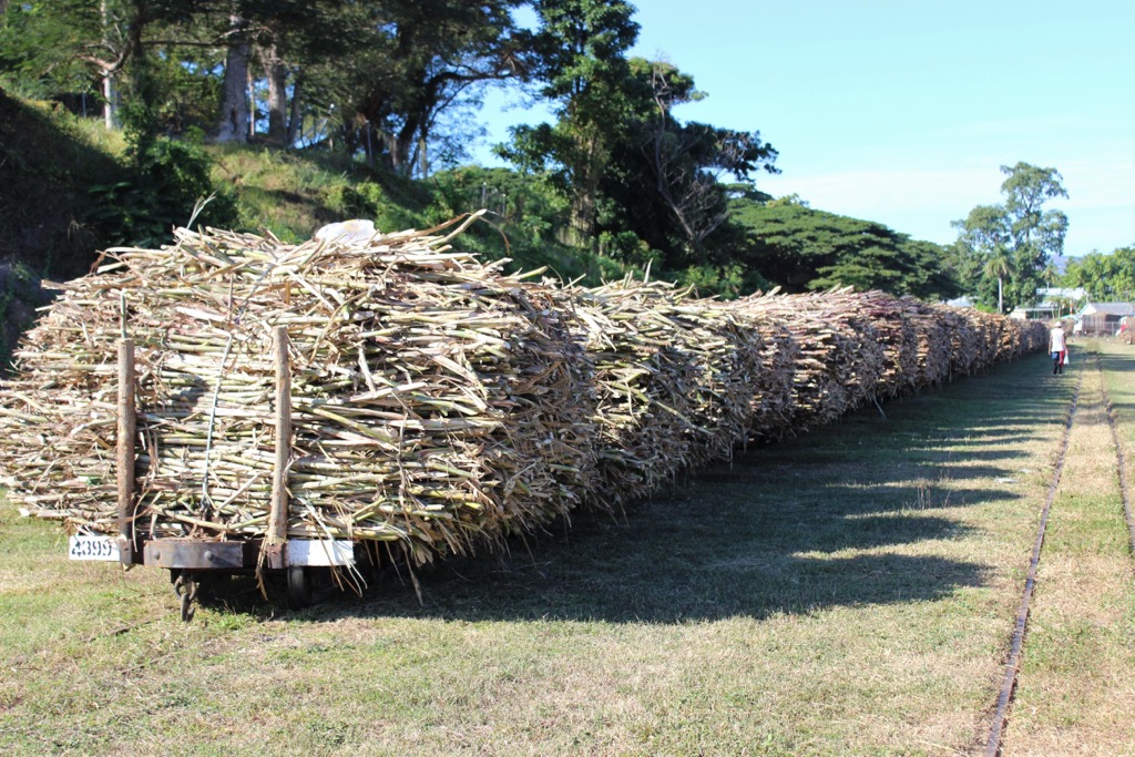
The Sigatoka Valley of southern Viti Levu has particularly fertile soil and is regarded for its sugarcane production, which has been a vital industry for centuries.
In the center of the mountain range on the main island is the Nadrau Plateau, a low-relief highland and another fertile agricultural center.
The four main rivers of Viti Levu include the Rewa, Ba, Navua, and Sigatoka, which all have their headwaters in the Nakauvadra Range. The longest river in Vanua Levu is the Dreketi River, at 55 km (34 mi).
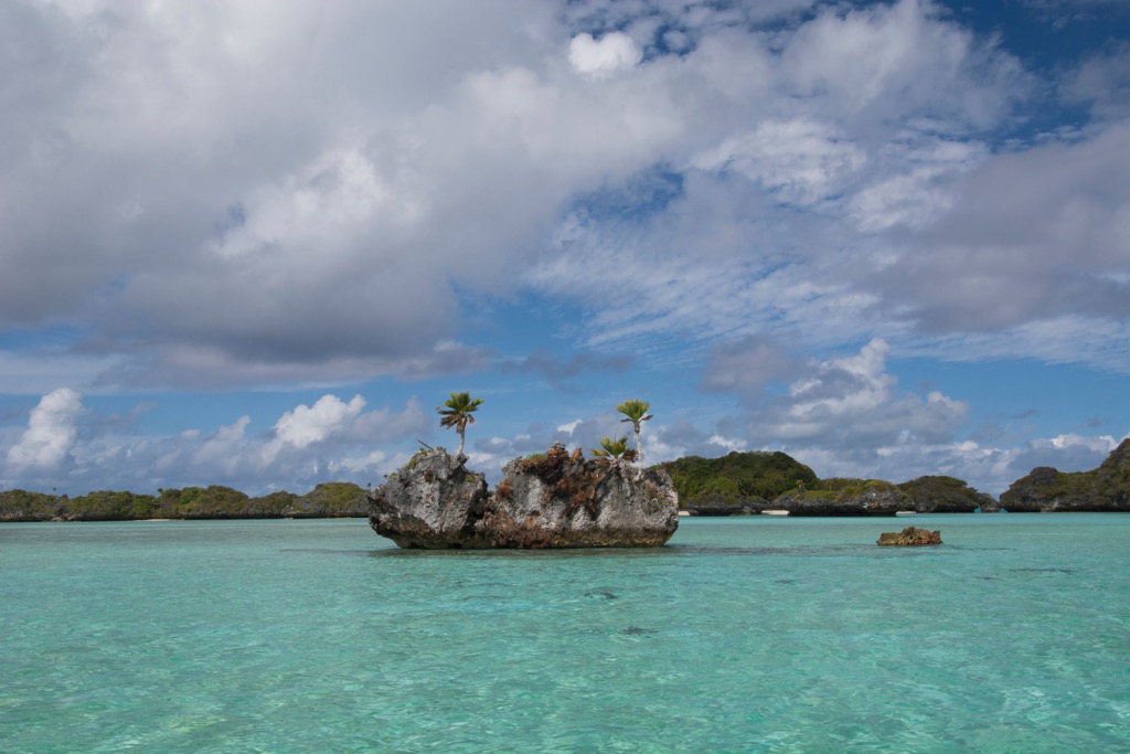
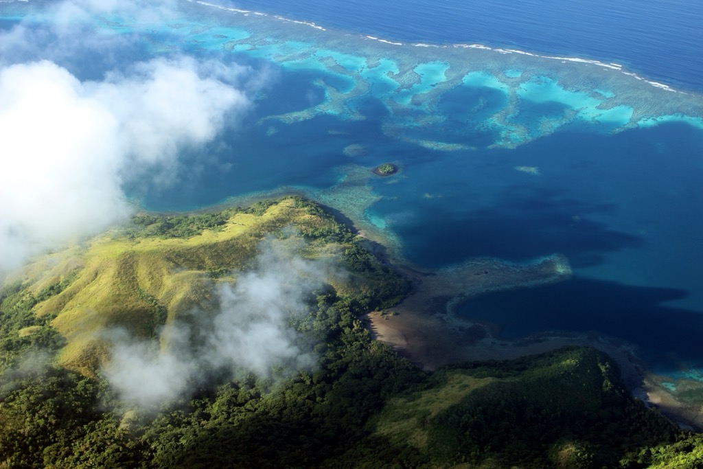
Fiji is home to one of the planet’s most vibrant and vigorous coral reef systems, home to an eye-popping 10,020 sq km (3,938 sq mi) of reef across its archipelago.
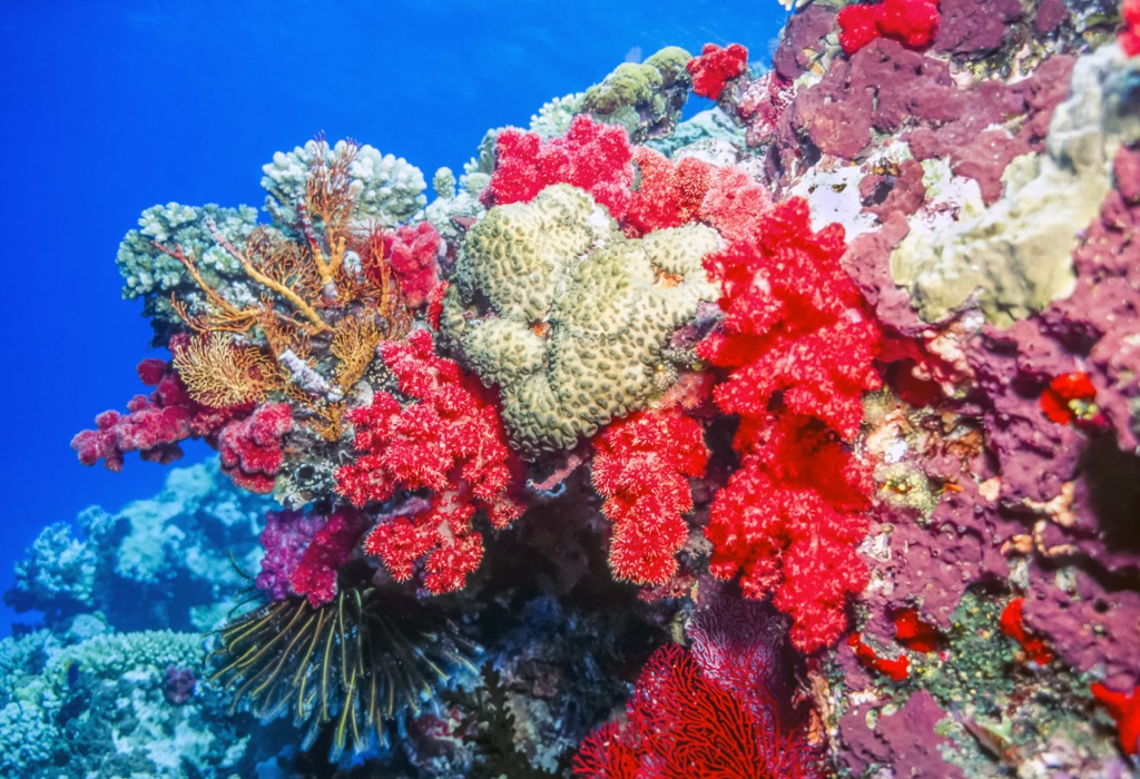
The most prominent, the Great Sea Reef, sprawls out in an arc for more than 450 km (173 mi), making it the world's 3rd largest continuous barrier reef. The reef serves as a natural separation between the two main islands. It is remarkably biodiverse, with 75% of all coral species and half of Fiji’s endemic species making their home in this delicate and wondrous ecosystem.
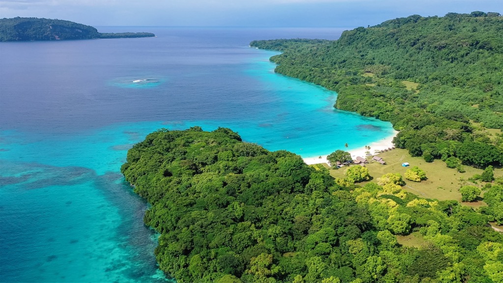
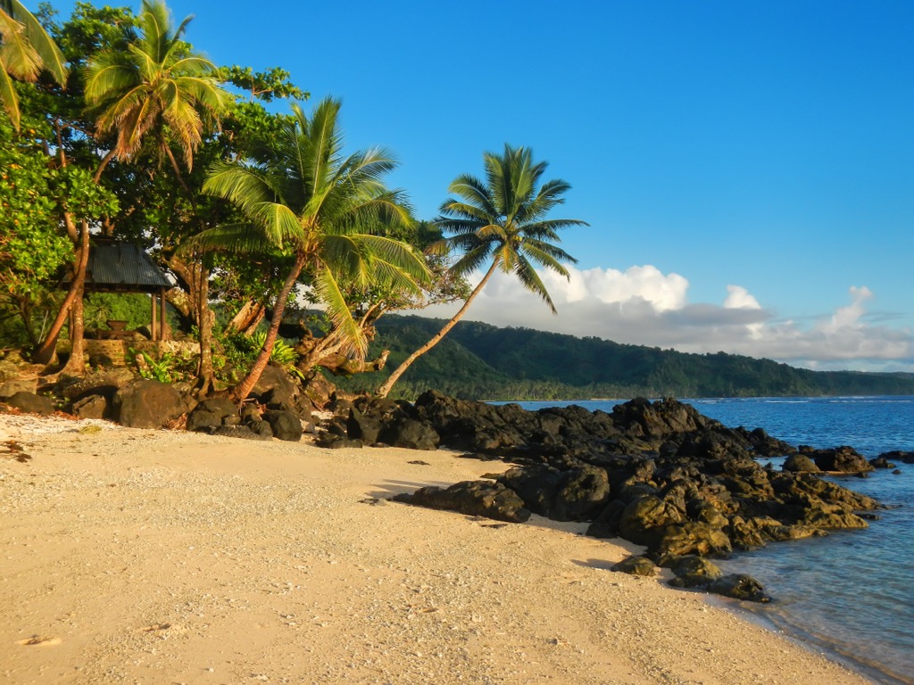
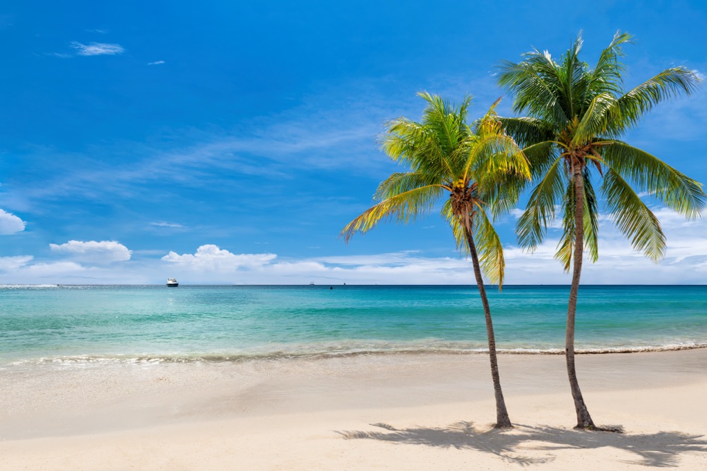
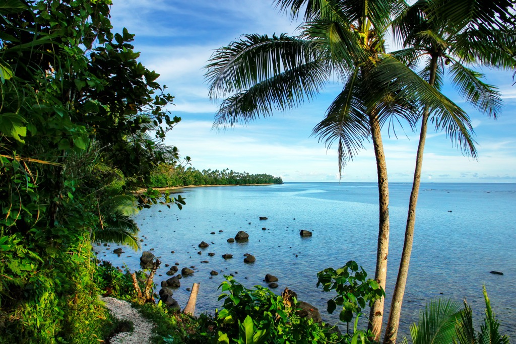
The coastline of Fiji is 1,129 km (701 mi) long and is, by far, Fiji’s main attraction. While the larger islands, primarily volcanic in nature, are largely surrounded by extensive mangrove forests and developed resort compounds, many smaller islands and islets are made of coral and offer immaculate white sand beaches.
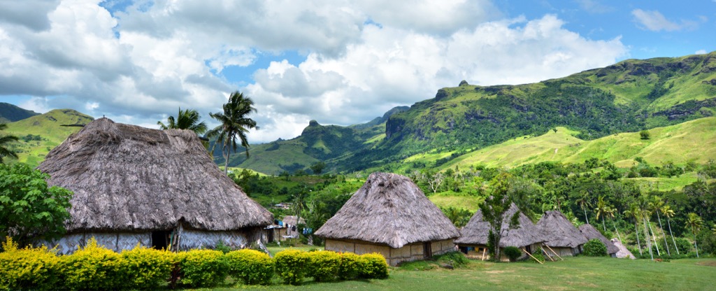
Fiji is the hub of South Pacific tourism, and for good reason. Not only is Fiji the most well-developed region of the South Pacific islands, but the people of Fiji are among the friendliest anywhere. It has excellent tourist infrastructure, a warm, pleasant year-round climate ideal for beach lovers, and an otherworldly tropical rainforest landscape void of poisonous snakes, spiders, or insects. Not to mention, English is one of the three official languages, in addition to Fijian and Fiji Hindi.
In 2023, about 930,000 travelers visited Fiji, mainly from Australia and New Zealand. The tourism industry makes up around 40% of the country’s GDP.
Of course, doing plenty of online research before your trip is never frowned upon. At PeakVisor, we always suggest that it’s best practice to visit the tourist office of any international destination upon arrival to get your bearings and ensure your safety.
TOURIST OFFICE - FIJI
Fiji Visitors Bureau
Thomson Street, PO Box 92
Suva
Tel: (679) 302433
Fax: (679) 300970/302751
URL: http://www.BulaFiji.com
E-mail: infodesk@fijifvb.gov.fj
Due to its position at the intersection of the Australian Plate and Pacific Plate, Fiji exists in one of the most geologically complex parts of the world. Most of the 333 islands that make up Fiji are ancient volcanoes that, millions of years ago, formed a continental mass before being broken up by plate tectonics.
The Pacific Plate is the largest tectonic plate on Earth at an estimated 103,280,000 sq km (39,876,000 sq mi). It is closely intertwined with the Pacific Ring of Fire, which is well known to be prolifically active, both seismically and volcanically. The region's geology has had a profound impact on the entire planet, but possibly nowhere in more dramatic fashion than in Fiji, where volcanoes, plate tectonics, and coral reefs interact in original ways.
Most of the islands of Fiji began their formation in the late Eocene and early Miocene epochs. As the Pacific Plate slowly drifted toward the southeast, it began subducting beneath the Australian Plate. The oldest Fiji Islands first emerged from the Pacific Ocean around 5 to 20 million years ago, while the youngest island, Taveuni, came to the surface just 2,000 years ago.
The Fiji Platform is an elevated, hot region of oceanic crust that remains tectonically active. It’s surrounded by fault lines, including the Fiji Fracture Zone to the north, the 176-degree Extension Zone to the west, and the Hunter fracture zone and Lau Ridge to the east.
Today, the soils on the Fiji Islands are primarily composed of volcanic material and sedimentary erosion products, sometimes in combination with uplifted coral reefs.
On the larger islands, the lofty, dividing mountain ranges serve as natural rainmakers, as the southwest trade winds regularly inundate the mountains with storms. This creates a distinct wet zone to the east and a dry zone to the west, which routinely causes cloud formation in the upper reaches of the higher ranges.
The foremost mountain range of Fiji is the Nakauvadra Range, situated on the island of Viti Levu. This central range, known locally as “the Source of the Wind,” runs north to south and divides the island nearly down the middle. Nakauvadra Range is home to Mount Victoria, now named Mount Tomanivi, an extinct, ancient volcano reaching 1,324 m (4,343), and Voma, at 1,382 m (4,534 ft), the two tallest peaks in the island republic. In Fijian mythology, it’s believed the snake god, Degei, lives in a cave near the summit of Uluda, a peak in the northernmost part of the range.
Located on the western side of Viti Levu, entirely within the dry zone, the Koroyanitu Range’s namesake peak is the fourth tallest in Fiji and the third tallest on the island at 1,195 m (3,920 ft). The summit forms a high, narrow, and heavily forested ridge. The Koroyanitu Heritage Park encompasses the peak and surrounding area.
This jagged north-to-south dividing range runs the length of the second-largest island and forms a natural separation between the Provinces of Cakaudrove and Macuata. The highest summits include Nasorolevu, with an elevation of 1,111 m (3,645 ft), and, to the northeast, Dikeva, topping out at 1,030 m (3,379 ft).
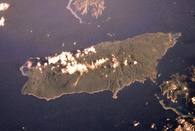
Making up the entirety of Fiji’s third largest island, Taveuni is an enormous shield volcano rising from the floor of the Pacific Ocean. Now believed to be dormant, it last erupted 500 years ago.

It features rich volcanic soils, and about 60% of the terrain here is covered in dense rainforest. Taveuni is the site of one of Fiji’s most popular attractions, Lake Tagimaucia, which fills up a volcanic crater at an altitude of 800 meters (2,600 ft).
The biota of Fiji is highly diverse and heavily endemic due to a combination of factors, including its remote, tropical location, physical isolation, and complex volcanic landforms with massive vertical relief. Its extensive marine habitat, including seagrass, lagoons, coral reefs, and estuaries, further enhances Fiji's wild and unique biodiversity.
Fiji has a subtropical marine climate that allows for mild and comfortable temperatures all year round. The moisture-laden southeast trade winds are the predominant winds over Fiji. The rainiest month is typically March, while the driest month is July. Fiji has a distinct wet season that runs from December to April. That said, the rain is often orographic, so the higher elevations collect considerably more rainfall.
The two largest islands have wet climatic zones on their windward side and dry climatic zones on their lee sides. The northwestern parts of these islands exist in a rain shadow and typically get under 100mm of rain monthly during the dry season.
Throughout Fiji, there are 1,518 documented species of plants, and just over 50% of these are endemic, including all 24 palm species. Trees make up approximately 45% of all flora, and about 80% of Fiji’s native forests are communally owned, which helps in conservation efforts. Native forests are divided into three categories: preserved, protected, and multiple-use.
Some common tree species include mahogany, pine, pandanus, mangoes, guava, and figs. An iconic South Pacific tree, the coconut palm, is often found along the shoreline.
Fiji is also well-regarded for its rare, often endemic orchid species. Some of the more unique varieties include the Viti Levu Orchid, known for its large, showy, and vibrant colored flowers, and the Yasawa Orchid, curiously enough, known for the opposite: small, white, or pale pink flowers.
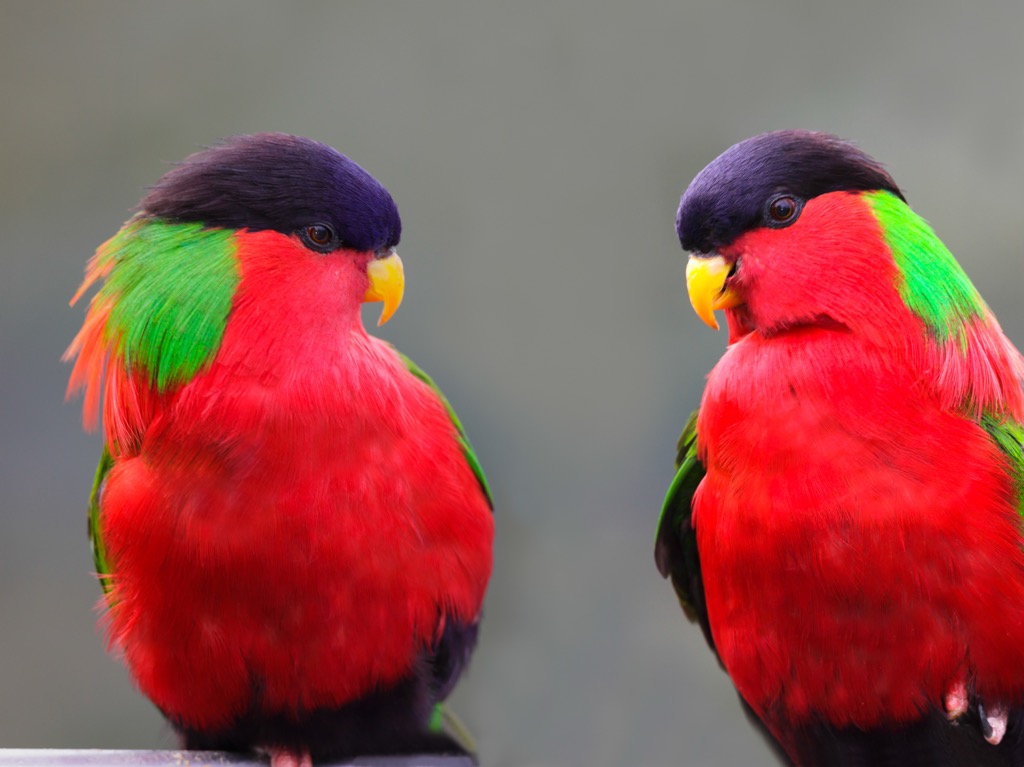
The national animal of Fiji is the Collared Lory. This beautiful parrot is recognizable by its brilliantly colored feathers, including reds, greens, and purples and complemented by orange and pink feet.
There are 166 species of birds in Fiji. Of these, 80 varieties breed on the islands, and 35 are endemic. It is truly a birdwatcher’s sanctuary.
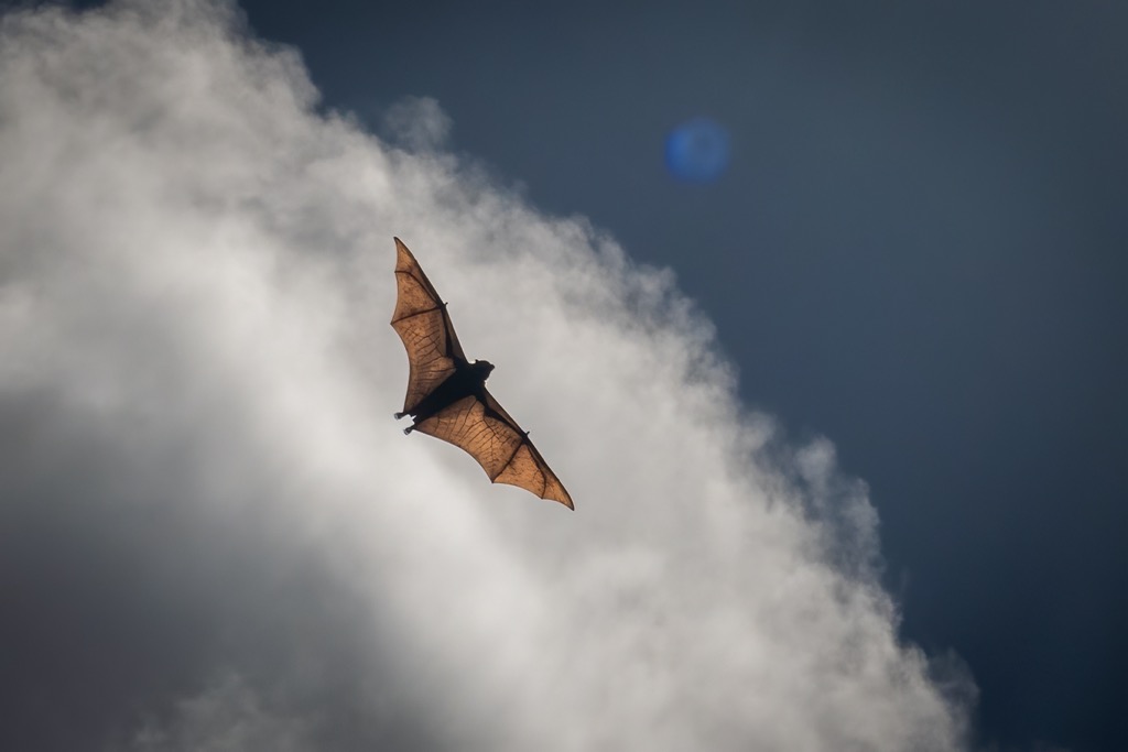
The only indigenous terrestrial mammals are six species of bats; however, the surrounding seas of Fiji are home to 10 confirmed cetacean mammals, including the killer whale, spinner dolphin, and sperm whale.
Regarding the rest of the marine life, 1,198 fish species, 1,056 marine invertebrates, and approximately 1,000 coral reefs have been identified in Fiji. Of the 32 terrestrial reptiles of Fiji, 14 are endemic. Both of Fiji’s frog species are endemic.
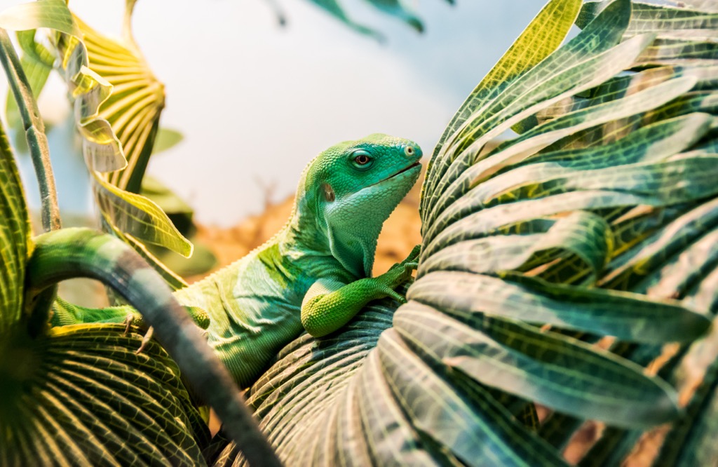
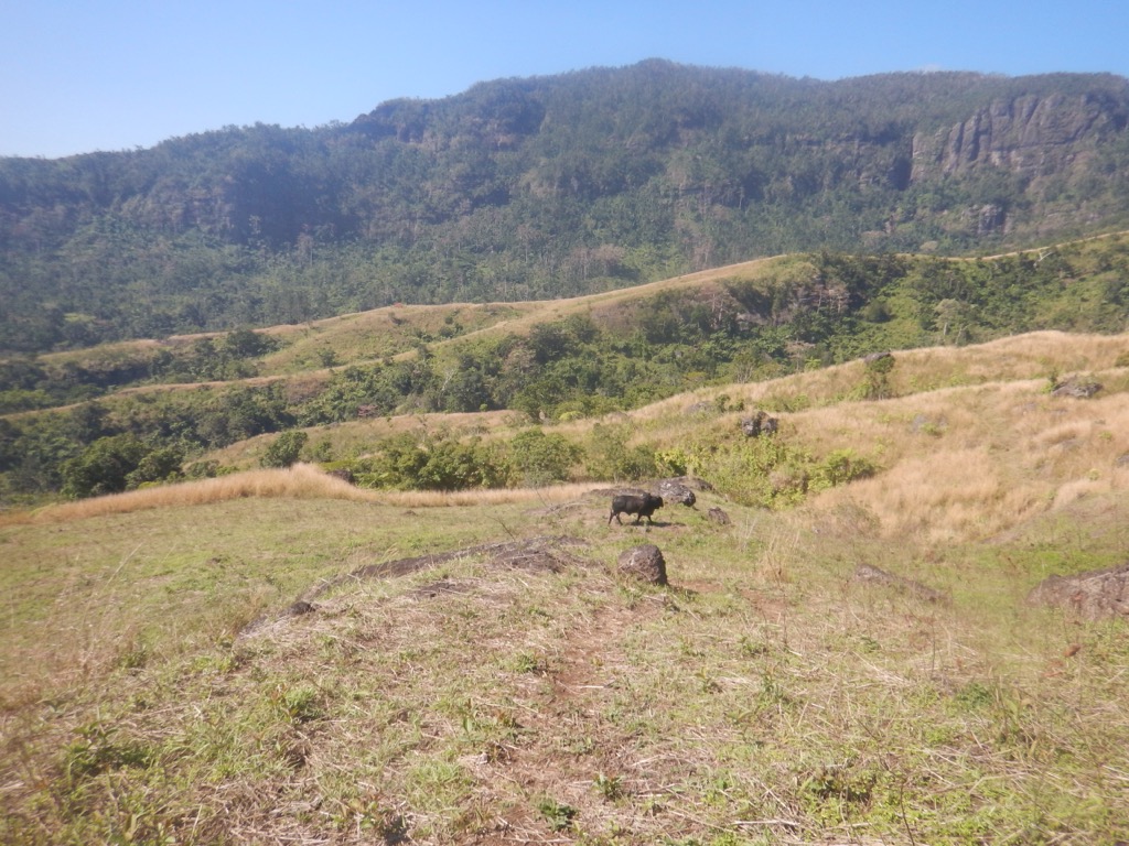
Some of the more common wildlife you are likely to encounter in your travels include mongoose or wood swallows on land and manta rays or dolphins while diving. While it would be exceptional to cross paths with the Fijian Monkey-Faced Flying Fox, whose numbers are dwindling as it faces near extinction, you can’t rule it out.
According to excavated pottery art, the first settlers of Fiji are believed to have arrived around the year 1,500 BCE from Melanesia.
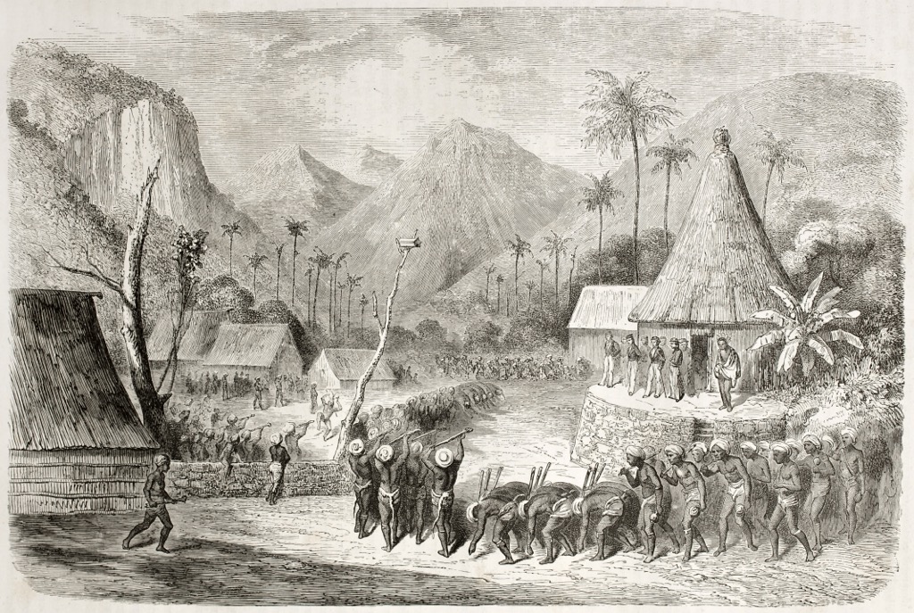
European explorers caught their first glimpse of the Fiji Group in 1642, and by the late 1770s, they had effectively suppressed Fijian culture and spirituality to help ensure British control. It was during this time that Fiji gained a reputation as an island of cannibals. However, it’s argued that the narrative was simply used as a tactic to rationalize colonial intrusion. Following decades of war between Europeans and native Fijian communities, Britain was eventually victorious in 1874 and the once politically independent archipelago of Fiji became a crown colony.
The following year, one-third of the population was decimated by a measles epidemic. Between 1879 and 1916, over 60,000 indentured laborers were brought from India to work the sugar plantation, as the defeated Fiji natives simply refused to do the work for the British after losing much of their cultural identity.
Fiji finally gained its independence from Britain in 1970 as a parliamentary democracy, with Ratu Sir Kamisese Mara of the AP as prime minister. Since that time, political upheaval has largely centered around an ongoing rivalry between indigenous Fijians and ethnic Indians.
Considered one of the most beautiful hikes in Fiji, the Lavena Coast Trek takes travelers along Taveuni’s volcanic southeastern coastline for an unforgettable adventure. This easy, mostly flat 10 km (6.2 miles) round trip hike takes most people around 4–5 hours to complete, passing beaches ranging in color from white, ash grey to black sand, crossing creeks, hidden waterfalls, freshwater pools, rocky outcrops, plantations, and villages.
Located in Taveuni’s Bouma National Heritage Park, the most challenging portion requires a rope to cross the stream. Don’t forget a bathing suit, as the hike's highlight is Wainibau Waterfall near the trail’s end, which requires a short swim through a gorge. If your legs give out, you have the option to cut the journey In half with a boat ride back to the trailhead, but only at high tide.
For a real adventure, this challenging 3-hour hike ascends the ridge to Mount Batilamu at an elevation of 798 m (2,621 ft). It’s an excellent day hike at 12 km (7.5 mi) and 5-6 hours round trip for most hikers; you can tackle this peak yourself or with a guide.
Located within the Korovanito National Heritage Park, the precipitous trek offers incredible 360-degree summit vistas of Nadi and nearby islands. For those who want to savor the experience, there is a lodge with a basic cooking setup and bathrooms at the summit, where you can stay the night and experience some of the best stargazing and sunset views anywhere.
As soon as you put boots on the ground of Taveuni Island, you will know why it has long been heralded as “The Garden Island.” Bouma National Heritage Park is the home of Tavoro waterfalls and accounts for over three-quarters of the island.
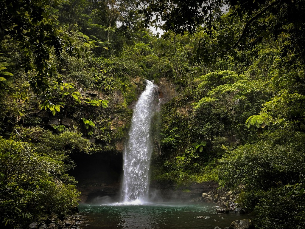
The 7 km (4.3 mi) hike starts out extra-mellow, and it’s just a short ten-minute stroll along the gentle pathway to the first of the three waterfalls, the tallest of the trifecta. There is a great swimming hole here, perfect for families. The trails to the second and third falls are a bit more rugged.
Extra credit: If you put in the work and make it to the third waterfall, bring a snorkel, and you will be greeted with an incredible show of underwater prawns in their natural environment.
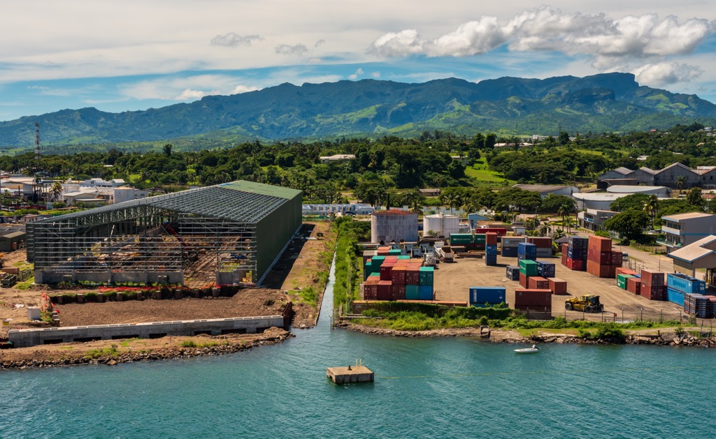
The capital of Fiji since 1882, Suva is a tropical metropolis and the most important urban center in the South Pacific. Situated on the southeast coast of Viti Levu, between the mouth of the Rewa River and Suva Harbor, it is a major port used for trans-Pacific shipping.
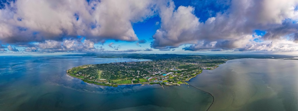
Suva is home to 100,237 Fijians, making it the main populous center in the country. The city is known for having great diversity among its inhabitants. It is the country’s media center and education hub, with schools including Fiji School of Medicine and the University of the South Pacific. It is also the location of an international airport called Nadi or Nandi.
Nasinu is in the southeastern part of Viti Levu, along the Pacific Ocean. It is the second most populated town in Fiji and is primarily a residential hub for workers of Suva, which is only approximately 11.9 km (7.4 mi) away, as the crow flies. The Fiji National University makes its headquarters here for its College of Business Hospitality and Tourism Studies and College of Humanities and Education.
The 3rd largest metropolitan area in Fiji, “Sugar City” as it is known, is located on the northwestern coast of Viti Levu. This is the heart of the sugar cane country, so it’s no surprise that The Lautoka Sugar Mill, which was built in 1903, is the biggest employer in the city, with more than 1,300 employees.
The city is also known for its incredible marina at Vuda Point, which is the primary port for the island's western end and is used mainly for sugar, molasses, woodchips, petroleum, and gas.
While it’s less of a tourist destination than many parts of Fiji, Lautoka is well known for its botanical gardens, which are worth a visit.


Yes. Fiji Mountains has 895 named mountains. The highest is Voma at 1,382 m.
The highest mountain in Fiji Mountains is Voma, at 1,382 m.
Fiji Mountains has 895 named mountains.


