
Share

Scan the QR code and open PeakVisor on your phone
Scan the QR code and open PeakVisor on your phone
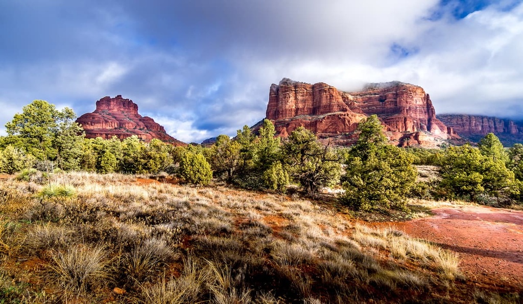
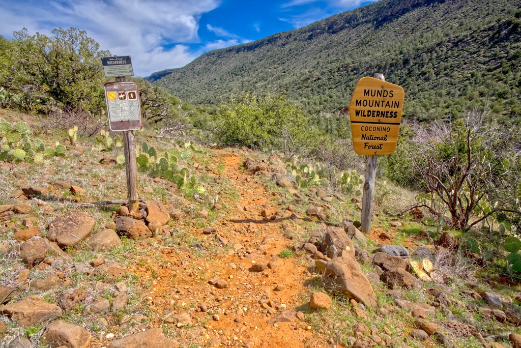
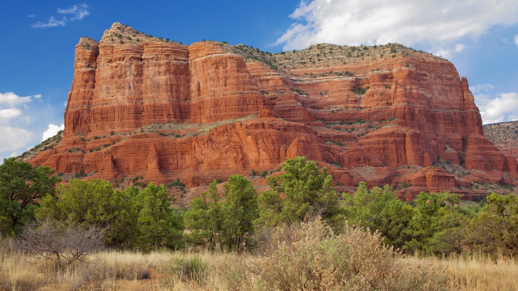
The Munds Mountain Wilderness covers over 18,000 acres (7,285 ha) in central Arizona, USA. Located within Coconino National Forest and surrounded by beautiful red rock formations, the wilderness area has 10 named mountains that are part of the Colorado Plateau. Munds Mountain is the highest at 6,850 ft (2,088 m) and the most prominent is Courthouse Butte (5,459 ft/1,664 m) with a prominence of 984 ft (300 m).
Munds Mountain Wilderness includes 18,150 acres (7,345 ha) in the Red Rock Ranger District of Coconino National Forest in central Arizona. It was established in 1984 and extends from the tops of Munds Mountain and Lee Mountain to the Jacks, Woods, and Rattlesnake Canyons.
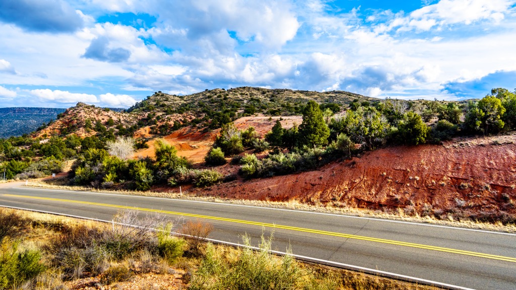
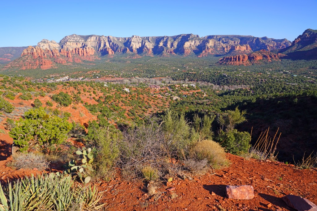
The wilderness area occupies part of the Colorado Plateau and backs up to Sedona and Oak Creek, offering quick access from the towns’ resorts and galleries into stunning rock formations and vistas.
Sedona sits at 4,500 ft (1,370 m) elevation at the base of the Colorado Plateau, the southern section of which is known as Mogollon Rim. Flagstaff, 50 mi (80 km) to the north of the wilderness, sits at around 6,000 ft (1,830 m) on the plateau itself.
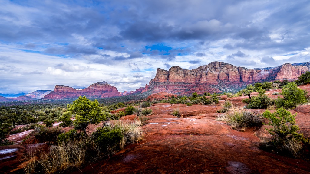
The four tallest peaks are Munds Mountain (6,850 ft/2,088 m), Lee Mountain (6,594 ft/2,010 m), Jacks Point (6,165 ft/1,879 m), and Courthouse Butte (5,459 ft/1,664 m). The Munds Mountain Wilderness is south of Slide Rock State Park and east of Red Rock State Park.
The area’s geological history began about 500 million years ago. From 500 to 200 million years ago, prior to the rise of the Colorado Plateau, the area was alternately ocean bottom and coastal plains. During this time, sediment accumulated, eventually forming sandstone.
From 65 to 20 million years ago, there was uplift in southern Arizona and down faulting and erosion in the north. From 20 to 12 million years ago, volcanic activity led to Verde Valley down faulting, creating the Mogollon Rim with the accompanying deep basin and lake beds. This volcanic activity also left behind a layer of lava basalt which can be seen along the top of the rim.
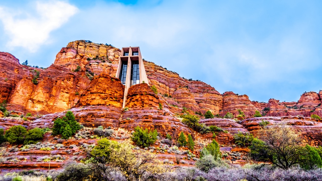
As the plateau lifted, it broke the basalt and exposed sedimentary layers beneath. The exposed sandstone eroded quickly, leaving behind the region’s many canyons and unique red rock formations.
In addition to the sandstone, redwall limestone that formed 300 to 400 million years ago makes up the lowest visible strata in the red rocks. This dark brown layer contains fossils of fish, snails, clams, trilobites, and brachiopods.
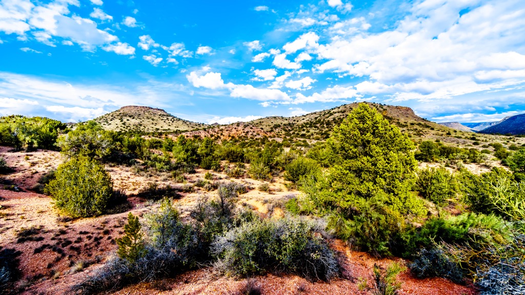
The Munds Mountain Wilderness has a semi-arid climate. Chaparral, shrubs such as pointleaf manzanita and sagebrush, agave, and cactus are common. Arizona cypress, sycamore, ponderosa pines, and cottonwoods are the main tree species. Overall, the landscape includes a number of plant communities including desert grasslands, short grass plains, oak woodlands, and pinyon-juniper woodlands.
A number of animals make their homes in this desert environment. Coyotes, cottontails, jackrabbits, raccoons, bats, lizards, quails, ravens, red tail hawks, and turkey vultures are commonly spotted. Others, such as bobcats and mountain lions, live here but are rarely seen. Hikers should keep an eye out for scorpions, tarantulas, and snakes, as there are a few species here that can be dangerous.
Humans have lived in the area for around 6,000 years. The first peoples were hunter-gatherers around Verde Valley and Prescott. Between 900 and 1350 AD, the more advanced Sinagua peoples began building pueblos and cliff houses. They were farmers with a grasp of astronomy, and made baskets, pottery, and jewelry. Trade routes ran through the region, connecting them with people from the Pacific Coast, Mexico, and Central America.
Only a few artifacts remain from this time – a few pots, stone tools, and baskets. Those who occupied the pueblos moved away by 1400, around the same time the Yavapai and Apache moved in.
In 1583, Antonio de Espejo came looking for gold, followed a few years later by Marcos Farfan de los Godas. They traveled through the region, though not necessarily through Sedona itself. The Spanish controlled the area until Mexico gained independence in 1821. Subsequently, the Treaty of Guadalupe Hidalgo in 1848 transferred the Arizona territory to the United States.
Anglo settlers began to arrive around Oak Creek Canyon in the 1870s. Many were homesteading families, eking out a living in the arid environment, while some came to the region for mining in Jerome.
Coconino National Forest was established in 1908 and the Wilderness Act led to the creation of the Munds Mountain Wilderness in 1984.
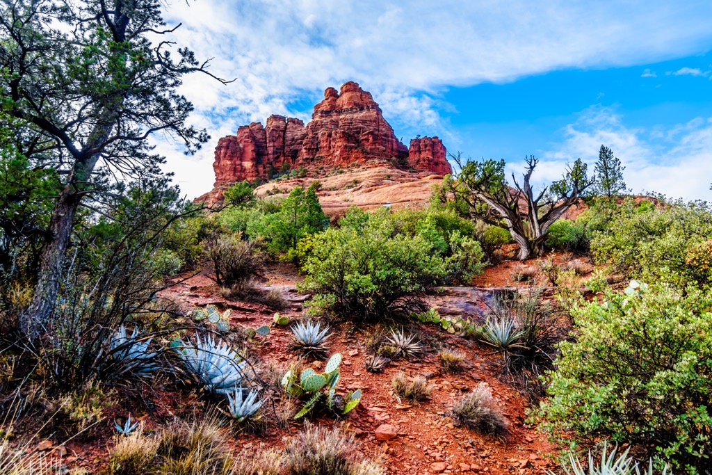
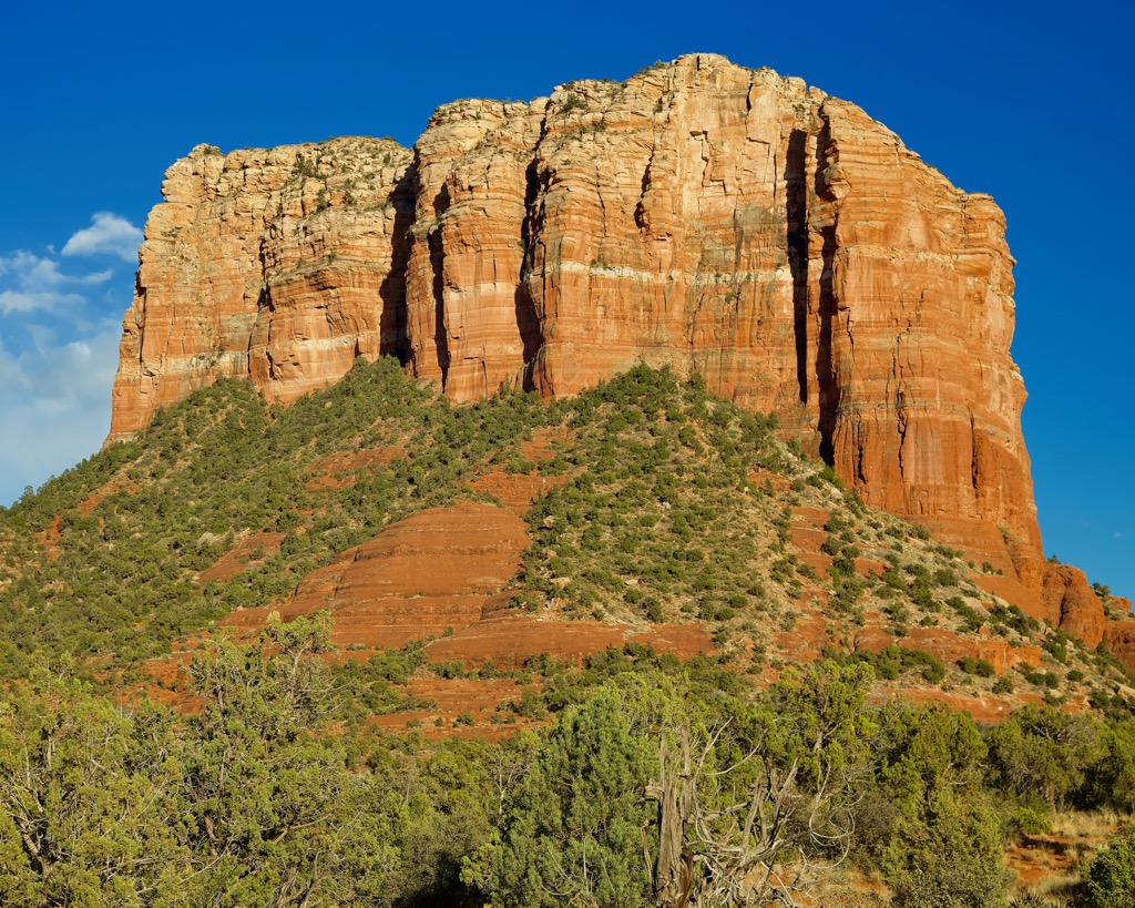
Of the impressive red rock formations and canyons, Courthouse Butte (5,459 ft/1,664 m) and Bell Rock (4,852 ft/1,479 m) are two of the area’s more iconic features. Situated close to Sedona and Oak Creek, those looking for a bit more solitude should check out the Jacks Canyon Trail and the Hot Loop Trail.
The Jacks Canyon Trail is 6.5 mi (10.5 km) with elevations ranging from 4,280 ft to 6,347 ft (1,305 m to 1,935 m). It goes from the bottom of the gorge amidst high chaparral, passing through stands of Arizona cypress, catclaw acacia, false palo verde, and banana yucca.
Early on, the trail passes through a section affected by the 2006 La Barranca fire. It then follows an old jeep trail to Jacks Canyon tank, before dropping and crisscrossing the dry streambed. At the end of the canyon, the path climbs to a high saddle between Mogollon Rim and Munds Mountain.
For the best panoramic views, continue on a short, steep trail to the top of Munds Mountain.
The 10.2 mi (16.4 km) Hot Loop Trail has two trailheads – one at Jacks Canyon near the Pine Flats subdivision and the other in Woods Canyon off of SR 179. From the Jacks Canyon trailhead, take a connector trail over a low saddle to merge with the Hot Loop trail for the steepest part of its 1,000 ft (305 m) climb to Horse Mesa (5,289 ft/1,612 m).
From the Woods Canyon trailhead (near the Red Rock Ranger District Visitor Center), follow the Woods Canyon trail for 1.25 mi (2 km). At this point, a sign marks where the Hot Loop trail diverges. Following this, the trail climbs to the top of Horse Mesa before wandering across the flat plain to a sweeping overlook of the eastern edge of the Sedona red rocks.
It then continues on to lookout points of Woods Canyon. From here, the trail ascends Jacks Point, cuts across the rim, and loops back down to Jacks Canyon Trail.
The Munds Mountain Trail is 2.8 mi (4.5 km) and is reached by following the Schnebly Hill Trail. The first 0.75 mi (1.2 km) presents a steady climb up the west side of the Schnebly Hill, unshaded but with great views of the red rocks. The trail then becomes partially shaded. At 1.25 mi (2 km) in, take a right at the sign marking “Munds, Jack, Hot Loop.”
From here the trail climbs another 0.75 mi (1.2 km) before flattening out and providing great views of Munds Mountain, Bear Wallow Canyon, and several red rock formations.
It remains level for a quarter of a mile (0.4 km) and then drops to a saddle between Schnebly Hill and Munds Mountain. Continue past the sign for Hot Loop Trail, and shortly thereafter there are signs for Jacks Canyon Trail and Munds Mountain Trail.
The Munds Mountain trail climbs 500 ft (150 m) in just over half a mile (0.8 km) to emerge on the flat top. Although the trail continues, the views are best when cresting the top and many choose to turn around at this point.
The popular Courthouse Butte Loop Trail is 4.2 mi (6.8 km) and has two points of access. From the south, join the trail from Bell Rock Pathway. It begins with a gentle ascent and half a mile (0.8 km) in are signs for the Courthouse Butte Loop trail. Continue on the wide trail (for going clockwise) to climb west and then north around Bell Rock.
From the north, begin at Courthouse Vista. Head southeast towards Bell Rock for a quarter mile (0.4 km) to intersect with the Bell Rock Pathway. Follow this route to the east to go clockwise around Bell Rock and Courthouse Butte.
Follow the cairns to a sign indicating Courthouse Butte Loop trail and follow it to the east. The trail passes a dome-shaped rocky outcrop and circles Courthouse Butte.
This loop passes into and out of the wilderness area. It is mostly unshaded so it can be hot in the summer.
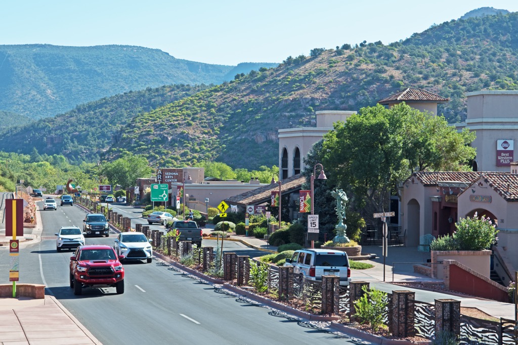
The Munds Mountain Wilderness runs into the backyards of Sedona and Oak Creek with their resorts and galleries, making it an easy jump from nature to culture. Flagstaff and Phoenix are less than one and two hours drive away, respectively.
Only a stone’s throw from the wilderness area, Sedona has a population of 10,000 people and a bursting arts and culture scene. The town has more than 80 art galleries and festivals ranging from wine to international film. A number of trails through the red rocks and nearby national forest are ideal for hiking and mountain biking. For history buffs, the area around Sedona houses several cliff dwellings and rock art sites.
The scenic city has a number of lodging options including spa resorts, cabins tucked in among the desert landscape, and family friendly hotels. In many of the restaurants, locally sourced products shine. Whether it is trout from nearby creeks, beef from local ranches, or produce, fruits, and herbs grown in the Verde Valley, the menus reflect what the landscape has to offer, with seasonal ingredients shaping the flavors.
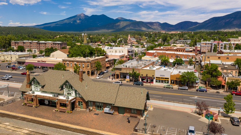
Flagstaff lies 50 mi (80 km) to the north and has a population of 73,000 people. The city is only 80 mi (130 km) from Grand Canyon National Park, making it an easy day trip. Other popular outdoor explorations lead to the underground tunnel at the Lava River Cave or to Humphrey’s Peak (12,635 ft/3,851 m), the highest point in Arizona.
Dive into the history of the area by visiting the cliff dwellings at Walnut Canyon National Monument and the rock-walled pueblos of Wupatki National Monument, once home to the Sinagua and Ancestral Puebloans tribes. The Museum of Northern Arizona explores in depth the diverse Native cultures of the Colorado Plateau.
There’s plenty to eat in Flagstaff’s dining scene from French bakeries to fish and chips, as well as classic Italian, Mexican, and American food joints. For accommodation, choose from historic hotels, B&Bs, or convenient hotels and motels located around the city.
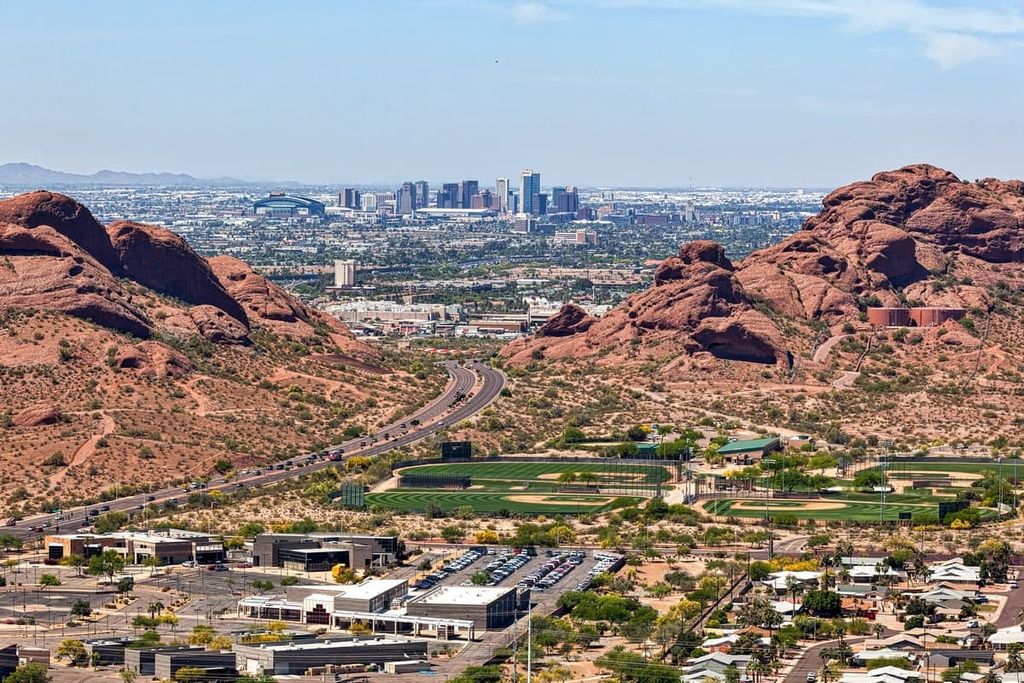
115 mi (185 km) south of the Munds Mountain Wilderness is Phoenix, Arizona’s capital and home to 1.66 million people. The Sonoran Desert surrounds the city, inviting visitors to hike and mountain bike through the captivating landscape, whether it is in search of ancient petroglyphs, to summit Camelback Mountain (2,707 ft/520 m), or crisscrossing the trails between the red sandstone formations of Papago Park.
Be sure to stop by the Heard Museum, highlighting and celebrating the cultures and art of Natives of the southwest. The Phoenix Art Museum and Pueblo Grande Museum and Archaeological Park are also worth a visit.
For staying over, book a hotel in the heart of the city, or escape to a peaceful resort or scenic dude ranch outside the city. There are also plenty of options for nearby campsites and RV parks for those looking for more rustic digs. The city also has a diverse dining scene with everything from top-notch tacos to prickly pear margaritas and some of the best rooftop dining around to take in the city and surrounding desert landscape.

Explore Munds Mountain Wilderness with the PeakVisor 3D Map and identify its summits.


