
Scan the QR code and open PeakVisor on your phone
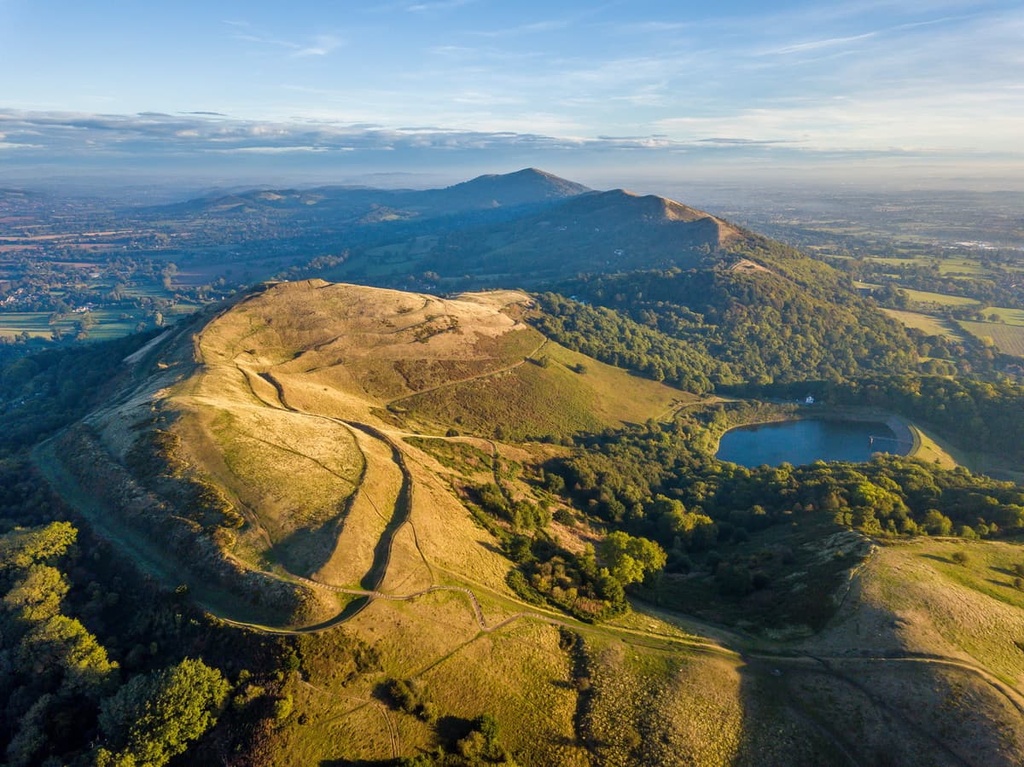
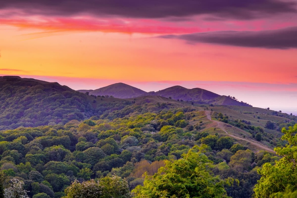
Rolling hills, charming villages, and panoramic views await anyone visiting the Malvern Hills Area of Outstanding Natural Beauty (AONB) in the West Midlands of England. There are 32 named high points in Malvern Hills AONB. The highest and the most prominent hill is Worcestershire Beacon (425 m/1,394 ft).
The Malvern Hills AONB is an area of protected countryside that's located in the West Midlands region of England. The AONB covers an area of 40 square miles (105 sq. km) across the counties of Worcestershire, Herefordshire, and a small section of southern Gloucestershire.
The Malvern Hills are a range of hills that stretch for 9 mi (14 km) from north to south from Colwall to Great Malvern. The main summits in the Malvern Hills range are:
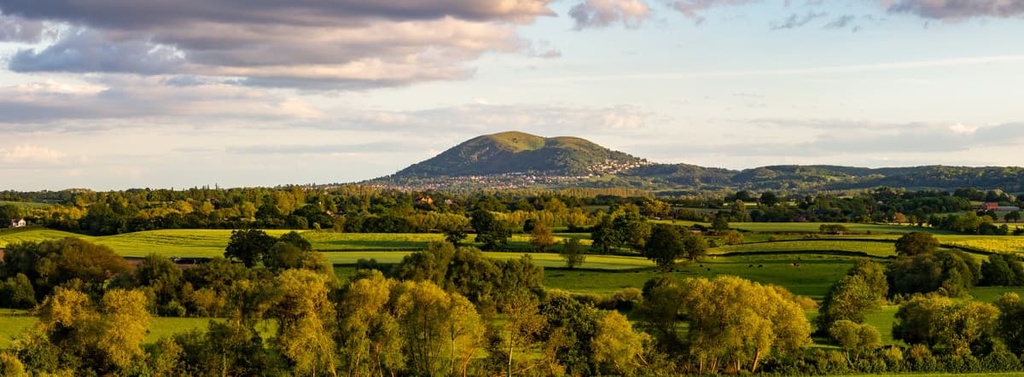
The highest summit in the Malvern Hills is Worcestershire Beacon, which is located on the Herefordshire-Worcestershire border.
The Malvern Hills AONB contains several rare landscapes that need protecting. The slopes and summits of the hills in the AONB feature heathlands and acid grasslands. In the valleys, there are semi-ancient broadleaved forests and hedge-lined farmlands, both of which are home to a variety of flora and fauna.
One of the most famous features of the Malvern Hills is its spring water. Known as Malvern Water, this spring water was initially discovered through holy wells. This discovery led to the development of local spa towns, namely Malvern. The discovery of Malvern Water led to the creation of modern bottled drinking water.
Due to its position in rural western England, the Malvern Hills AONB is located close to several other AONBs and even a national park.
The Cotswolds AONB is located approximately 50 mi (80 km) to the southeast of Malvern Hills, while the Wye Valley AONB is approximately 20 mi (32 km) to the southwest. Additionally, Brecon Beacons National Park is approximately 65 mi (105 km) to the west of the Malvern Hills AONB.
There are a few notable settlements in and around the Malvern Hills AONB. The largest settlement in the AONB is the spa town of Malvern, which is located at the eastern edge of the Malvern Hills.
The closest large city to the Malvern Hills AONB is Worcester, which is located roughly 10 mi (16 km) to the northeast. Other notable nearby towns and cities include Gloucester and Cheltenham, which are around 25 mi (40 km) to the south and southeast, respectively.
The Malvern Hills feature some of the oldest rocks in the UK. The hills are composed of igneous diorite and granites, as well as metamorphic schists and gneisses. These rocks date back to the late Precambrian (about 680 million years ago), which is the earliest part of Earth's history.
The Malvern Hills fall on the Malvern Line, a series of geological faults and folds that run from south to north from Bristol and up past Kidderminster.
During the Precambrian, the land that is now the Malvern Hills was located near the equator, underneath the sea on the northern edge of the Gondwana supercontinent.
Eventually, the collision of two tectonic plates led to the subduction of one plate under the other. The immense heat and pressure caused by this event led to the formation of the igneous and metamorphic rocks that we see in the region today.
Around 100 million years after their initial formation, the Malvern Hills were subjected to intense volcanic activity. This violent volcanic activity is evidenced by the presence of basalt as well as pyroclastic rocks, known as ignimbrites. These rock types are visible on several hills, including Tinker's Hill (224 m/734 ft) and Hangman's Hill (295 m/967 ft).
The youngest rocks in the Malvern Hills are Silurian rocks, which are approximately 425 million years old. During this period, the Malvern Hills were located on the east coast of Wales.
At the end of the Ordovician Ice Age, melting ice caused sea levels to rise. The rising sea level eroded rocks from the east and sediment was carried across the Malvern Hills.
Over millions of years, this sediment was turned into sedimentary rocks like breccias, siltstones, and sandstones. Many of the fossils found in the Malvern Hills date back to the Silurian period.
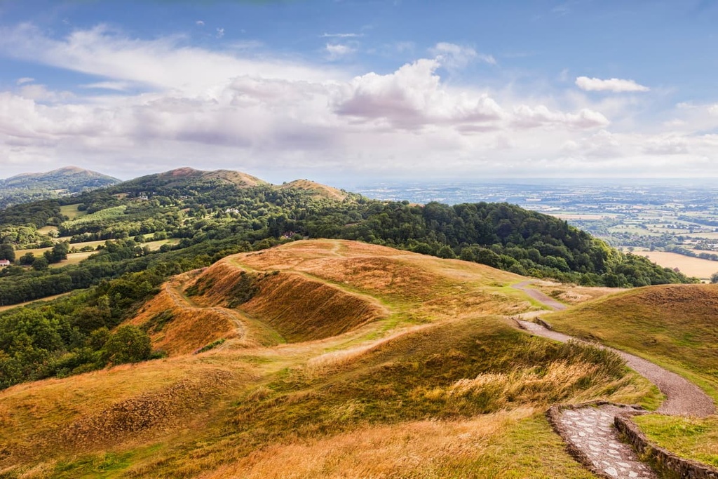
Today, the Malvern Hills are a small range of undulating hills that rarely exceed 400 m (1,312 ft) in elevation. The only hill to exceed 400 m is Worcestershire Beacon (425 m/1,394 ft). Known locally as The Beacon, it's also the only Marilyn (a peak with a prominence of 150 m/492 ft or more) in the Malvern Hills.
Other notable and popular peaks in the Malvern Hills include North Hill (398 m/1,305 ft), Herefordshire Beacon (338 m/1,108 ft), and Jubilee Hill (328 m/1,076 ft).
Thanks to its untouched open grasslands, heathlands, and ancient semi-natural woodlands, the Malvern Hills are home to some rare flora and fauna. There are 60 Special Wildlife sites and 15 Sites of Special Scientific Interest (SSSIs) across the Malvern Hills AONB.
Among the notable fauna in the Malvern Hills AONB are a number of bird species that inhabit the area's meadows, grasslands, and woodlands.
During spring, you can expect to see nuthatches, pied flycatchers, and marsh tits in the area's woodlands. In the meadows and grasslands of the Malvern Hills, rare species include skylarks, bullfinches, and green woodpeckers. Several birds of prey also inhabit the Malvern Hills, including peregrine falcons, kestrels, and buzzards.
One of the rarest and most interesting sights in the Malvern Hills AONB is the UK's only venomous snake—the adder. There are thought to be nine colonies of adder in the Malvern Hills; however, this number is in decline. Other more common reptiles in the Malvern Hills include green snakes, slow worms, and common lizards.
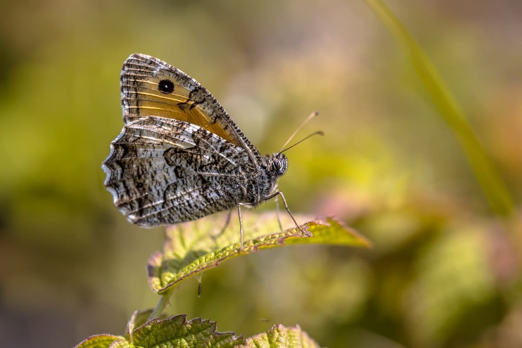
The area's acid grasslands and meadows are also home to rare insects. One of the most notable examples is the grayling, a species of butterfly usually only found on rocky coastal cliffs.
Once widespread across the UK, graylings have been in decline since the 1950s. The Malvern Hills is one of the last remaining places where graylings are found away from the coast. Other common insects include high brown fritillary butterflies, dingy skippers, and white-letter hairstreaks.
Additionally, the Malvern Hills' scrub and bracken provide a habitat for several rodent species, most notably the endangered dormouse. The woodlands of the Malvern Hills are home to 13 bat species, including pipistrelles, lesser horseshoes, and barbastellus.
One of the most fascinating and elusive mammals living in the Malvern Hills is the polecat, which is becoming more common in the UK outside of the species’ usual range in central Wales.
Due to the Malvern Hills' varied landscape, it's home to a wide variety of trees, flowers, and fungi. One of the most interesting tree species in the AONB is black poplars.
There are roughly 80 black poplars in the Malvern Hills AONB. There's thought to be only 7,000 black poplars in Great Britain, making it one of the island's rarest trees. The Malvern Hills are also home to apple, cherry, and pear orchards.
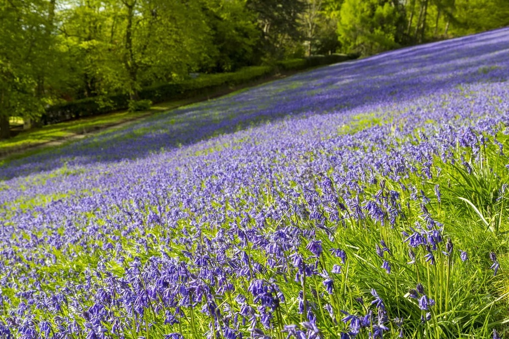
The grasslands of the Malvern Hills contain a range of vibrant wildflowers. During the summer, you're likely to see bilberry, harebells, and heath bedstraws. In the spring, bluebells and wild garlic carpet the area's woodlands. The grasslands are also a great place to see some unusual fungi like waxcaps.
There are several plant species listed as threatened or endangered within the boundaries of the Malvern Hills. While exploring the area, keep an eye out for some of these rare plants, including common rock-roses, smooth cat's-ears, and early forget-me-nots.
Humans have inhabited the Malvern Hills since before the Bronze Age, which was over 4,000 years ago. Archeologists have found a number of Bronze Age flints and arrowheads in the Malvern Hills.
One notable example of early inhabitation of the Malvern Hills is British Camp, a 2,000-year-old Iron Age hill fort located at the summit of Herefordshire Beacon (338 m/1,108 ft). Legend has it that British chieftain Caratacus made his last stand against the Romans at the British Camp. However, this account is at odds with a report by the Roman historian Tacitus.
In medieval times, the area was a royal forest known as Malvern Chase. In 1630, King Charles I attempted to remove legal protections from the land, prompting riots and legal challenges from local landowners. Fortunately, only a third of the area was affected.
Issues with preserving the Malvern Hills continued. In 1884, an Act of Parliament established the Malvern Hills Conservators to protect the hills. Despite these efforts, quarrying was already widespread across the Malvern Hills, and increased provision did little to stop quarrying in the area.
In fact, quarrying continued until 1966, causing irreversible damage to the landscape. Conversely, some argue that quarrying has enriched the landscape in a few ways. For example, new cliffs have created more nesting sites for birds.
Despite changes to the landscape, the Malvern Hills are a very popular destination, and in 2002 they were voted the most popular free tourist attraction in the West Midlands. Today, approximately 12,000 people live in the area. The Malvern Hills AONB receives about 1.25 million visitors annually and the area is under the management of the Malvern Hills Trust.
The Malvern Hills are the perfect place to escape the city for a day and take in some of the finest views in the West Midlands. Read on to find out about the Malvern Hills' main hiking areas and trails.
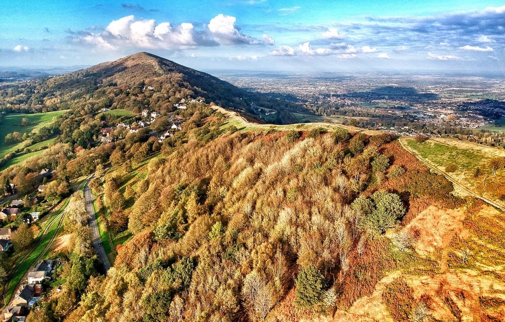
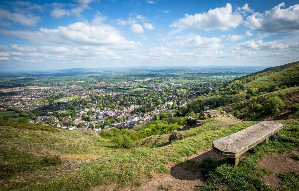
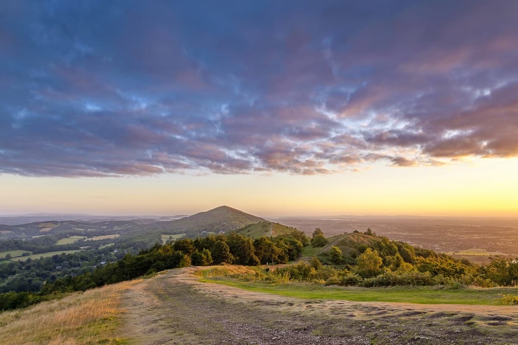
The highest summit of the Malvern Hills, Worcestershire Beacon (425 m/1,394 ft) is one of the AONB’s best hiking areas. Known locally as The Beacon, Worcestershire Beacon affords panoramas of the Shropshire Hills, the Cotswolds, and mountains along the Welsh border.
Worcestershire Beacon has a long history as a signaling beacon and was even mentioned in a sixteenth-century poem by Lord Macaulay called Armada. The poem describes the hill being set alight to warn people during the Spanish Armada's attempted invasion of England.
Another interesting fact about Worcestershire Beacon is that if you draw a line directly to the east from the summit, you won't reach a higher point until the Ural Mountains in Russia.
Worcestershire Beacon is popular partly due to a network of trails that run over the summit and around the hill. If you're looking to climb to the top of Worcestershire Beacon, you can start the walk from the village of Upper Wyche. There are three car parks near the village, but street parking is limited.
The walk up Worcestershire Beacon is a looped trail that's 4.5 mi (7 km) long and takes approximately 3 hours to complete. The walk is straightforward and involves walking to the end of the tarmac road and following the dirt path to the summit of Worcestershire Beacon. From atop The Beacon, you'll be treated to vistas of Worcester, Gloucester, and the Cotswolds.
From atop Worcestershire Beacon, descend onto the col to the north. You'll see North Hill (398 m/1,305 ft) just ahead, the second tallest of the Malvern Hills. Follow one of the several tracks that lead to the top of the hill. It's also possible to take a short detour to the top of Sugarloaf Hill (369 m/1,210 ft).
After taking in the views, descend from North Hill along the grassy path to the northeast. Follow the path along the eastern slopes of Worcestershire Beacon before returning to your starting point.
There are a few alternative walks near Worcestershire Beacon and North Hill. Instead of climbing to the summit of either hill, you can follow two trails that loop around the hills. These trails are about 3 mi (5 km) each and take two hours to complete.
Despite not being in the top 10 tallest peaks in Herefordshire, Herefordshire Beacon (338 m/1,108 ft) is very popular with hikers due to its impressive history. The hill was once home to British Camp, an Iron Age hillfort that once contained a motte-and-bailey castle and as many as 120 huts.
The most popular way of climbing Herefordshire Beacon is along the trail from the British Camp car park. The walk is 3.5 mi (5.5 km) long and takes 2 or 3 hours to complete. The trail is steep in places, yet easy to follow, with several waymakers along the route.
The path starts by leading uphill through some trees to the top of Herefordshire Beacon. You'll then continue along the ridge and descend down some steps. At the waymarker, you'll need to follow the Shady Bank Common trail. Here, you'll pass over Millenium Hill (329 m/1,079 ft).
Just after passing the summit of Hangman's Hill (295 m/967 ft), you'll reach a five-way intersection. Continue straight at the crossroads, and pass near the summit of Swinyard Hill (271 m/889 ft), the final hill of the walk. Upon reaching a large flat area, you'll actually be at the edge of an overgrown quarry, where the paths become very steep, so take care.
You'll then follow the path as it loops around back onto Swinyard Hill's ridge. You'll pass the human-made Clutter's Cave on the return leg, which was used in early geological studies of the area.
Located at the southern end of the Malvern Hills, the village of Hollybush and the surrounding region is a picturesque hiking area. The village is sandwiched between two hills, with Ragged Stone Hill (254 m/833 ft) to the south and Midsummer Hill (284 m/931 ft) to the north.
These hills have a few notable features. For example, Midsummer Hill is topped with the remnants of an Iron Age hillfort. Meanwhile, Ragged Stone Hill has a strong literary history as it is mentioned in a poem by Wilfrid Wilson Gibson and a novel by Charles F. Grindrod.
There are several ways of scaling both these hills, with paths that crisscross the slopes and summits. If you're looking to climb to the top of Ragged Stone Hill, you can start from the Hollybush car park. Hikers need to follow the clear path uphill, which leads directly to the summit. The walk is less than a mile (1.6 km) and takes 15 to 20 minutes.
Alternatively, you can walk up Midsummer Hill. It's possible to scale Midsummer Hill from the British Camp car park to the north or the Hollybush car park to the south. Both walks follow clear paths. The walk from the British Camp car park is the longer route and is around 2 mi (3.2 km) and takes an hour.
If you fancy a longer trek, there's a figure-eight walking route that takes you around the two hills. Starting from Hollybush, you'll walk southwards along the eastern slopes of Ragged Stone Hill, through Ladywell Coppice, and back round to Hollybush.
Then, the route takes you north onto the slopes of Midsummer Hill. You'll walk past ancient earthworks and monuments, through woodlands, past an abandoned quarry, before finishing back at your starting point. The walk is 3.2 mi (5 km) long and takes two hours to complete.
Located at the heart of the Malvern Hills are the often overlooked Pinnacle Hill (358 m/1,174 ft), Jubilee Hill (328 m/1,076 ft), Perseverance Hill (328 m/1,076 ft). These hills provide breathtaking views across the Malvern Hills and are becoming increasingly popular with hikers. Walkers will need to be comfortable with heights atop Perseverance Hill, as it includes a section of the Malvern Hills' steep ridge.
Interestingly, Jubilee Hill was the most recently named of the Malvern Hills. Jubilee Hill didn't receive an official name until 2002, in honor of The Queen's Golden Jubilee. There's a plaque atop the hill, which was presented by the Duke of York. It's still known locally as its unofficial name, Dad's Hill.
The best way to hike up these hills is from Wyche to the north. The walk is 5 mi (8 km) long and takes 2 or 3 hours to complete. Walk south from the Wyche Inn down the Old Wyche Road to reach the trail. The walk takes you first to the summit of Perseverance Hill, then Jubilee Hill, and finally over Pinnacle Hill (358 m/1,174 ft).
During your walk, ensure you stop atop Jubilee Hill for spectacular views of the neighboring summits. You can loop back around to your starting point from Sally's Place Cafe near Herefordshire Beacon.
With its sparse population and beautiful landscape, the Malvern Hills are ideal for a quiet weekend getaway. Read on to find out about the area’s main settlements and where to stay.
Resting on the River Severn, about 10 mi (16 km) to the northeast of the Malvern Hills is the cathedral city of Worcester. The county town of Worcestershire, Worcester is one of the most interesting places to stay near the Malvern Hills. The city is famous for being the site of the Battle of Worcester in 1651, the final battle in the English Civil War.
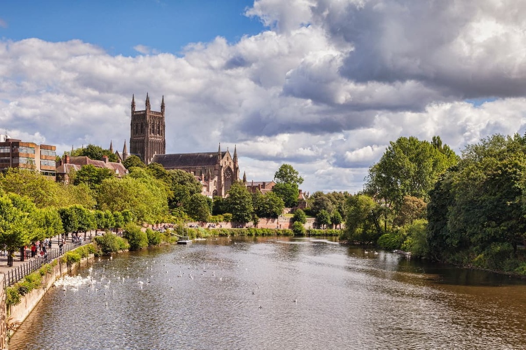
When you're not off hiking, you'll get to tour the medieval Worcester Cathedral and peruse the collection at the Worcester City Art Gallery and Museum. You won't be short of highly-rated hotels to choose from in Worcester, with Browns at the Quay, the Old Infirmary, and Fownes Hotel.
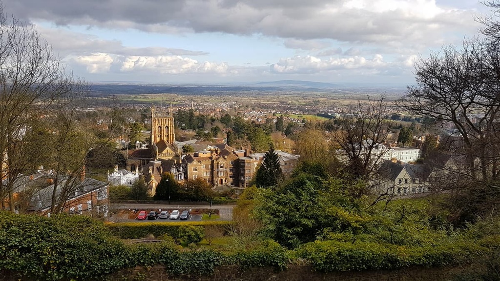
If you're looking to stay a stone's throw from the area's best hills, book a room in Malvern. Stretching onto the eastern flanks of the Worcestershire Beacon and North Hill, Malvern is a bustling spa town and popular tourist destination. The town also has a long history and was founded by Benedictine monks in the eleventh century.
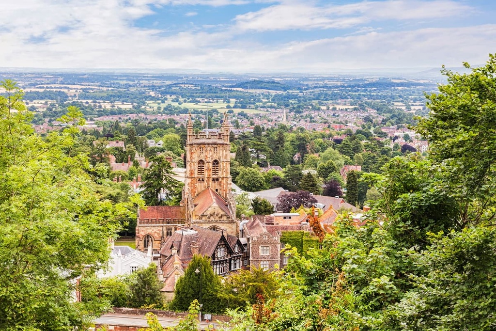
During your stay, ensure you visit the Great Malvern Priory, which took 500 years to build and was once a Benedictine monastery. There are some quaint hotels in and around Malvern, too, including The Abbey Hotel, Mount Pleasant Hotel, and The Malvern Spa Hotel.
Another charming town worth visiting near the Malvern Hills is Ledbury. Located on the southwestern edge of the Malvern Hills AONB, Ledbury is a historic market town famous for its timber-framed houses. One of the most famous timber-framed houses in the town is the seventeenth-century Market House, which sits at the center of Ledbury.
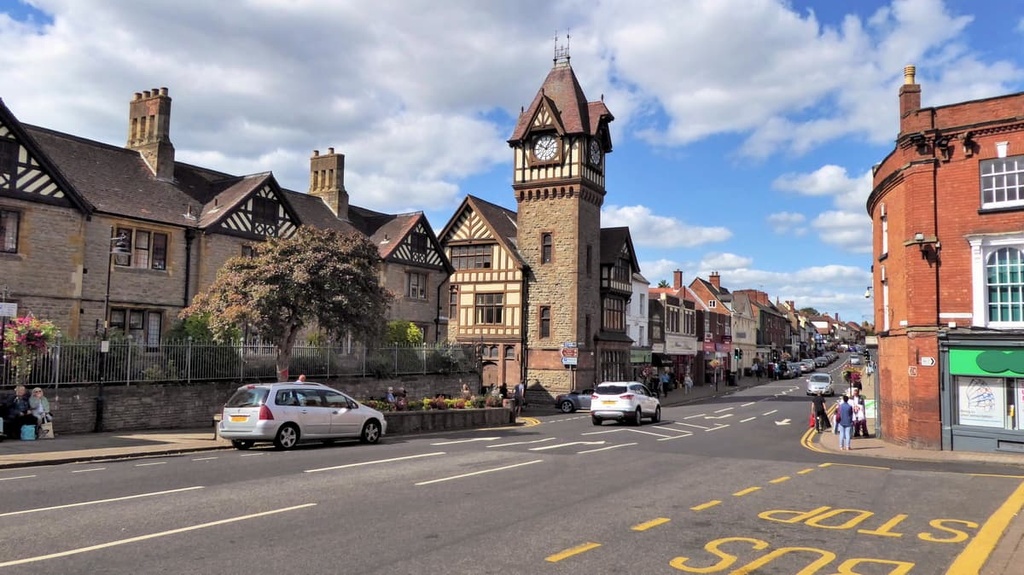
If you fancy learning more about Ledbury's unique and historic architecture, pay a visit to Ledbury Heritage Centre. Ledbury is also within 5 mi (8 km) from one of the Malvern Hills' best hiking areas, Herefordshire Beacon (338 m/1,108 ft). Popular hotels in Ledbury include the Feathers Hotel and the Talbot Hotel.
If you're set on spending the night along Great Britain's longest river but don't fancy staying in Worcester, check out the postcard-perfect town of Upton upon Severn. Located just 5 mi (8 km) southeast of Malvern, Upton upon Severn is a convenient place for hikers to stay. It’s also the smallest town in the county, making it ideal if you're looking to escape civilization.
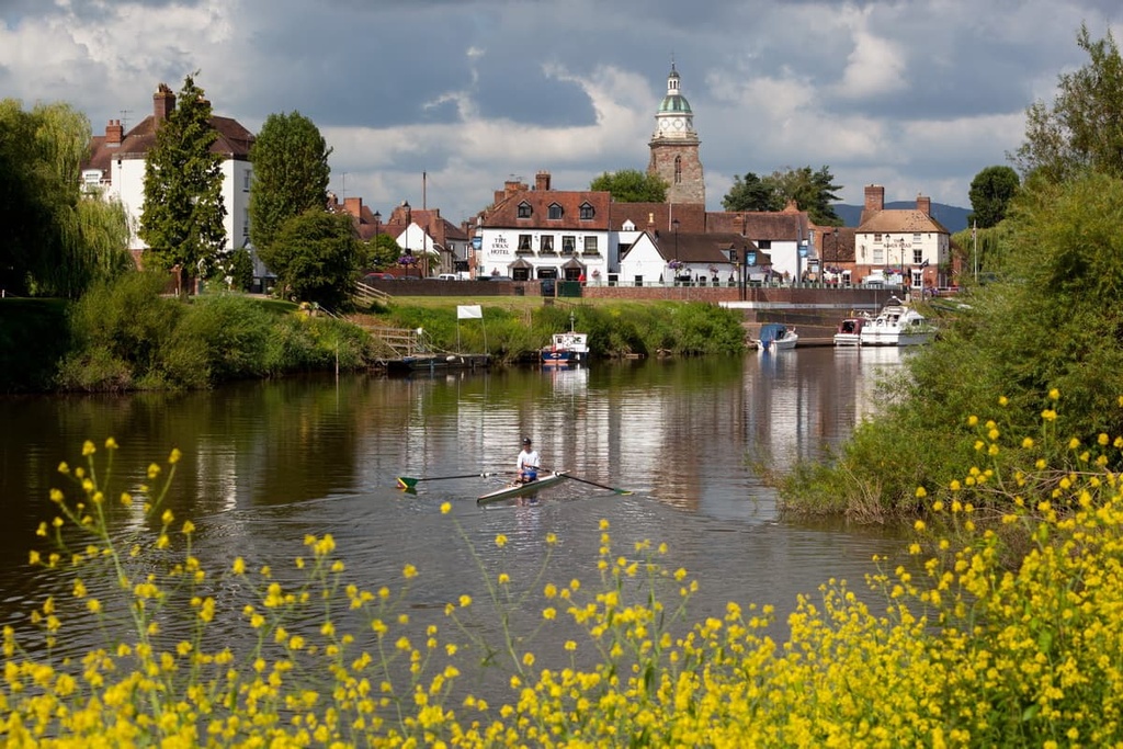
As is the case with Worcester, Upton upon Severn played an important role in the English Civil War. Additionally, it was once home to renowned Tudor astronomer and mathematician John Dee. You can learn more about the town's fascinating history at the Tudor House Museum. If you're planning to stay in Upton upon Severn, consider booking a room at the White Lion Hotel or the Swan Hotel.


