Scan the QR code and open PeakVisor on your phone
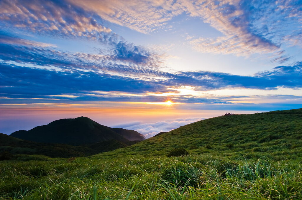
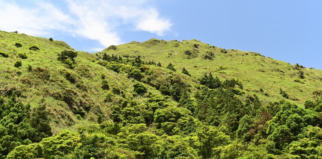
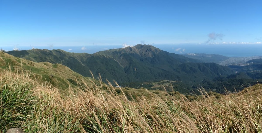
One of three protected areas in northern Taiwan’s Yangmingshan National Park (陽明山國家公園), Huangzuishan Ecological Reserve (磺嘴山生態保護區) is an area of truly stunning and wild broadleaf forests. At an elevation of 912 m (2,992 ft), Huangzuishan (磺嘴山) is the highest and most prominent of the 8 named peaks in the reserve.
Huangzuishan Ecological Reserve is situated in both the Wanli District (萬里區) of New Taipei City (新北市) and the Shilin District (士林區) of Taipei City’s (臺北市) in northern Taiwan.
The reserve covers an area of 640 ha (1,581 ac), most of which is hilly, volcanic land. It is entirely surrounded by Dajianhou Mountain Special Scenic Area (磺嘴山大尖後山外圍核心特別景觀區), a region of Yangmingshan National Park.
As the Huangzuishan Ecological Reserve is geologically part of the Datun Volcano Group’s (大屯火山群), the land in the reserve is undulating, and it features a number of dormant volcanoes. For example, Huangzuishan, Dajianhoushan (大尖後山), Dajianshan (大尖山), and Shitishan (石梯嶺) all belong to the Datun Volcano Group.
Huangzuishan’s remote location in the park prevents Yangmingshan’s signature large crowds from exploring the region. However, fewer crowds ensure a more intimate and enjoyable experience among the reserve’s pristine rolling hills, verdant valleys, and dense forests.
Since it is situated in northern Taiwan, Huangzuishan enjoys a humid subtropical climate. The Pacific Ocean lies on Wanli District’s east coast and only 7 km (4.3 mi) of land separates Huangzuishan Ecological Reserve and the seashore. Thus, coastal winds drift into the protected area, keeping the air fresh and chilled throughout the year.
As the region is vastly unprotected by any large peaks, summer’s stormy typhoons and winter’s infamous northeast monsoon rains both hammer the reserve. Therefore, Huangzuishan Ecological Reserve experiences a large amount of rainfall each year and it has an average annual precipitation of 4,000 mm (157 in).
Yangmingshan’s tallest peak, Qixingshan (七星山), lies to the west of Huangzuishan Ecological Reserve in the Qixingshan Special Scenic Area (七星山自然文化景觀核心特別景觀區). To the north lies Yangmingshan’s other protected area, Lujiaojeng Ecological Reserve (鹿角坑生態保護區). Meanwhile, Taipei City is in the south, while Wanli’s Yehliu Cape Nature Reserve (野柳岬自然保護區) is located to the east.
The Datun Volcano Group consists of a band of 20 volcanoes in northern Taiwan’s Taipei and New Taipei City that erupted between 200,000 and 1 million years ago. These hills form a network of andesitic lava volcanoes, branching from Qixingshan’s dormant mound.
Thus, the geological rock contains andesitic and sedimentary rock from the Pleistocene epoch.
Two types of volcanoes can be found in Huangzuishan Ecological Reserve. Conical volcanoes have a steep, cone-shaped appearance, with a gently raised pinnacle. Composite volcanoes (also known as stratovolcanoes) have a steep incline, but unlike conical volcanoes, they cave in at the top, forming craters.
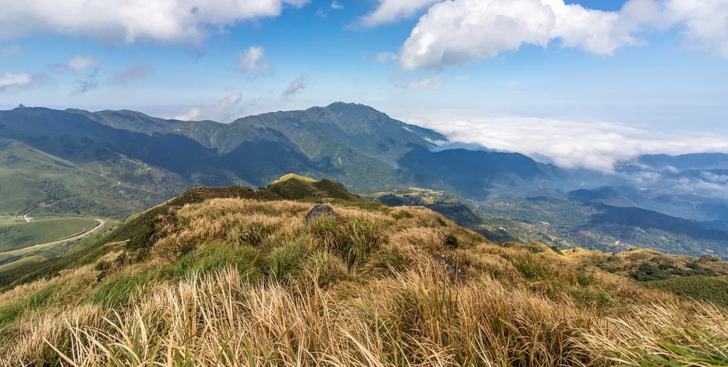
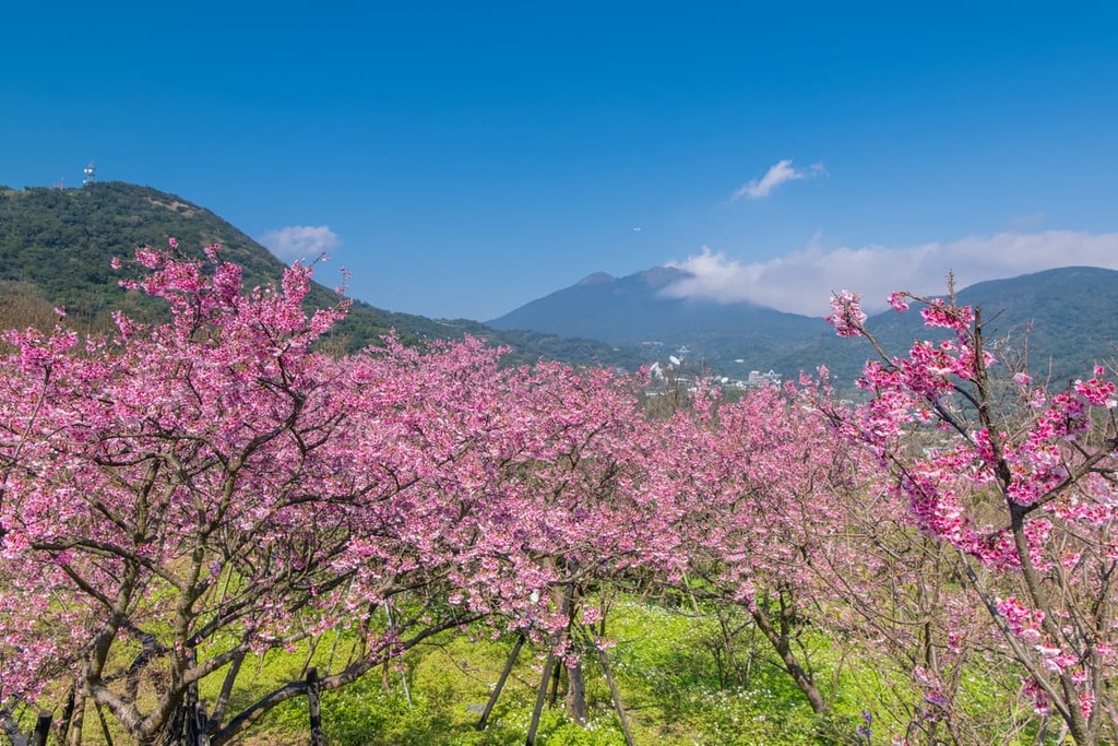
Huangzuishan Ecological Reserve is dominated by a luscious broadleaf forest that consists of Taiwan cherry, Formosan sweetgum, and Jiuxiong trees. At higher elevations, you’re more likely to see coniferous and evergreen trees, such as Japanese cedar and star anise.
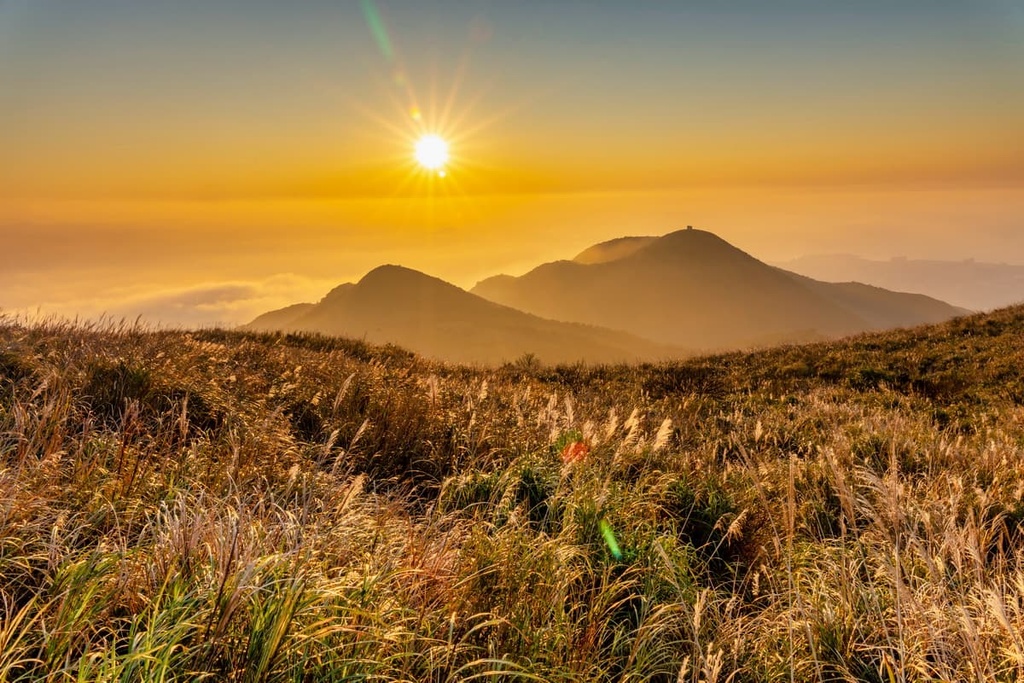
A dense thicket of silver grass grows near the mountaintops in the reserve. Additionally, a type of bamboo known as Pseudosasa usawai thrives in hilly regions in the reserve above 500 meters (1,640 ft) in elevation, adding to the wild barrage of hardy plants that block hikers’ paths to the summit.
Wildflowers such as Ceylon hound’s tongue, Taiwan lily, and rhododendron all thrive in the reserve’s forest. Huangzuishan Ecological Reserve also features a number of incredible plants, such as Jasminanthes mucronata, Deutzia cordatula, and Ligularia japonica.

In terms of wildlife, the civet cat, Formosan rock macaques, and Taiwan wild boar are some of the 25 species of mammals that you’ll find in the reserve. Birdwatching in Huangzuishan is a popular pastime, too, as 43 species, such as the Taiwan blue magpie, blue whistling thrush, and the great crested grebe, frequent the area.
A staggering 223 species of insect inhabit the reserve, nearly 80 of which are butterflies. Furthermore, Huangzuishan is home to 17 reptilian species, 4 species of fish, and 9 species of amphibians.
The Huangzuishan Ancient Road, otherwise known as the Rongrun Ancient Road, crosses into the area that is now Huangzuishan Ecological Reserve. It connects the area to the more well-known Jinbaoli Ancient Road in Qingtiangang.
While little is known of this once utilized path, people from Wanli are believed to have used it during the Japanese Occupation Era as old maps from that time note the trail. Historians believe that its usage was to connect the busier Jinbaoli Ancient Road, Wanli District’s Lukuping Ancient Road (鹿堀坪古道), and the Fuji Ancient Road (富士古道).
As the Huangzuishan Ancient Road is now disused, the road’s path is both wild and overgrown.
Here are some of the best hiking trails and areas in the Huangzuishan Ecological Reserve to check out during your next visit to the area.
The trek to Huangzuishan passes through Qingtiangang carpeted meadows, the Cuicui Valley's (翠翠谷) fertile swamp, and Huangzuishan Ecological Reserve's flourishing broadleaf flora. The 4.7 km (3 mi) long Huangzuishan Hiking Trail begins to the west in Qingtiangang and heads east toward the volcano itself.
The trail has a gentle elevation gain of under 200 meters (656 ft); thus, the hike has no intense uphill climbs. However, a thick Pseudosasa usawai bamboo forest lies just below the summit, which increases the trail's difficulty as you will have to clamber your way through the dense, tall shoots.
On Huangzuishan's summit, you can see Huangzuishan Lake below. Yangmingshan's tallest peak, Qixingshan, is also visible to the west, and Zhuzi Shan (竹子山) is visible to the north.
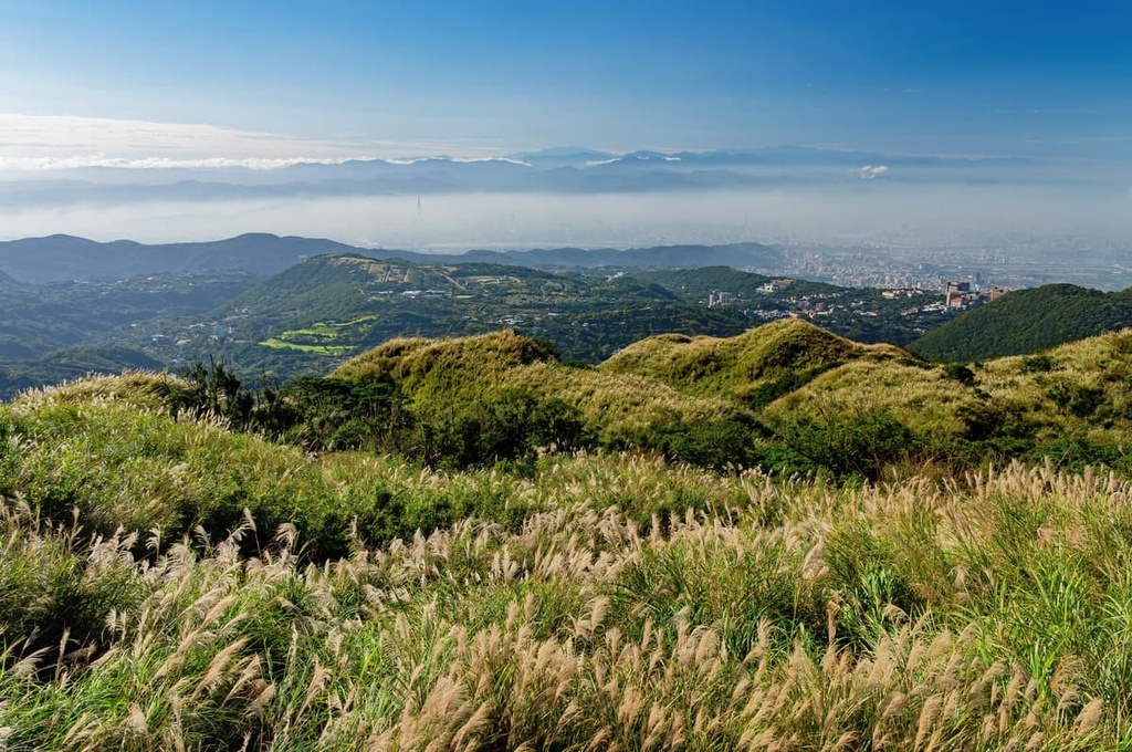
At the summit, you can even admire New Taipei City's coastline to the east, where Yehliu and Keelung Islet (基隆嶼) are in sight. Furthermore, you can easily appreciate Huangzuishan Ecological Reserve's pristine and primitive emerald forest and valleys from above.
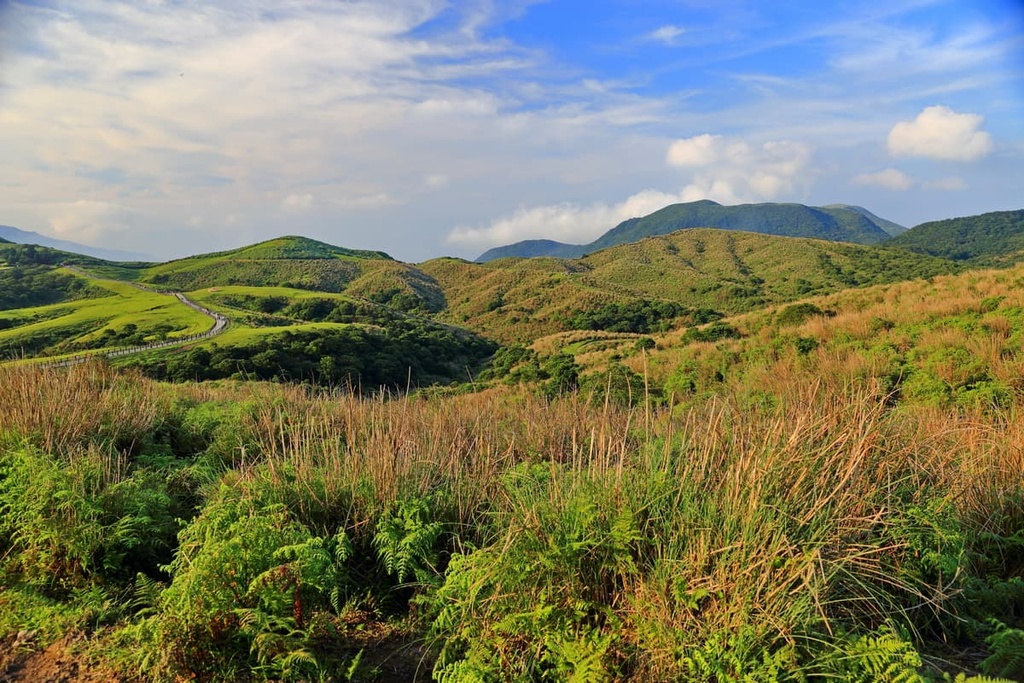
A trail to the second-tallest peak in the Huangzuishan Ecological Reserve, the Dajianhoushan Hiking Trail is very similar in character to the Huangzuishan Hiking Trail. Swarms of silver grass cover the slopes of Dajianhoushan, which is a conical volcano.
To reach Dajianhoushan, you first need to climb Lengshui Dashan’s (冷水大山) and follow the saddle connecting the two peaks. Prepare yourself to encounter the endless onslaught of rampant silver grass as you progress your journey to Dajianhoushan’s summit. Additionally, the climb becomes steep in parts, so take caution when approaching cliff edges as you make your way up the trail.
Once you have reached Dajianhoushan’s peak, the views are particularly rewarding. As Dajianhoushan lies to the west of Huangzuishan, you can admire more of the Qixingshan Special Scenic Area’s landscape.
From the summit, Qixingshan, Qigushan (七股山), Shamaoshan (紗帽山), Qingtiangang East Peak (擎天崗東峰), and Qingtiangangshan (擎天崗山) are all in plain view. Moreover, you can admire Huangzuishan to the east and Zhuzi Shan in the north from the top of Dajianhoushan.
As it is one of the least-visited trails in the Huangzuishan Ecological Reserve, the Huangzuishan Ancient Road is not clearly marked or mapped. However, if you want to wander in the lavish wilderness and avoid encountering fellow hikers on your journey, this path is well worth considering.
Starting in the northern edge of Huangzuishan Ecological Reserve near Fuguishan Cemetery, you enter a wild broadleaf forest as you begin your climb. A mess of silver grass greets you as the path surges onward.
An hour into the trail, you will reach the road’s highest point at 760 meters (2,493 ft) in elevation once you make it to the saddle between Huangzuishan and Dajianhoushan.
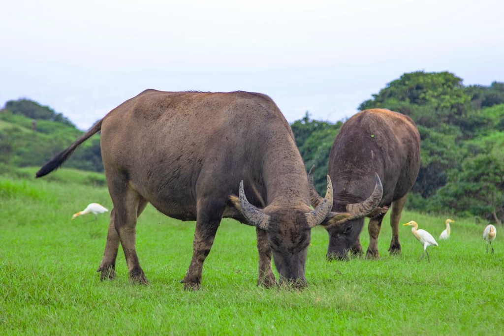
Afterward, you will descend into the Cuicui Valley and make your way toward the Shanghuang River. You can observe marine life in the stream, and you may spot wildlife grazing in the wetlands, like rabbits, goats, and cattle. The path then connects with the Jinbaoli Ancient Road, which leads to Qingtiangang’s fertile meadows.
This once well-traveled path connects to many ancient trails in the region. Residents of the Wanli District have long used this 6 km (3.7 mi) road to travel through what is now Yangmingshan National Park in order to trade their wares with people from Taipei City’s Shilin District.
The Lukuping Ancient Road follows along the Touqian River as you make your way through a dense bamboo forest. Due to the density of the bamboo, it’s a good idea to track your route using a GPS, just in case you veer off the road itself. Along the way, you will encounter the magnificent but small 4 meters (13 ft) high Touqian Waterfall, which is often cloaked in emerald foliage.
The trail rises as you climb the toward the summit of Mount Lukuping (鹿堀坪山). During the climb, the sweet fragrance of plum blossoms lingers in the mountain air, while the scent of deep magenta blooms creates a dreamy mood.
A final patch of dense silver grass signals the trail’s arrival at the summit of Mount Lukuping. From here, you can even see the nearby mountains of Dajianshan and Huangzuishan.
Located partially in both Qixingshan Special Scenic Area and Huangzuishan, the 6.6 km (4.1 mi) long Dingshan Shitiling Hiking Trail begins in Qingtiangang. It then heads westward and leads you to the summit of Shitishan and Dingshan (頂山).
The journey along the undulating Dingshan Shitiling Hiking Trail is a continuous series of climbs and declines as you pass through flourishing peacock pine forests and aromatic cedar woodlands. The vegetation on the trail is lush, and it offers ample opportunity for forest bathing, especially in Shitishan’s dense, emerald groves.
Showers of springtime flowers liven up the trail. Along the way, you’re likely to see blooms of wild peonies, golden rhododendrons, and milky white ginger flowers. Moreover, fruit-bearing plants add to the rainbow of color on the trail as lilac Formosan beauty berries contrast beautifully with the forest’s plush carpet of velvety moss.
While the forests of both Dingshan and Shitishan are magnificent, the views from the top of both peaks are particularly captivating. At the summits, you can marvel at the 360-degree panorama of the nearby Yangmingshan National Park.
Some of the many peaks that you’ll see from the summits include Qixingshan, Qingtiangangshan, Dajianhoushan, and Huangzuishan. On a clear day, the distant hills of Zhuzi Shan and Xiaoguanyinshan (小觀音山) are also visible.
Taipei and Keelung City (基隆市) are two cities located close to Huangzuishan Ecological Reserve that offer both natural beauty and a glimpse into Taiwan’s historical past. Here’s what you need to know about each city before your next trip to the region.
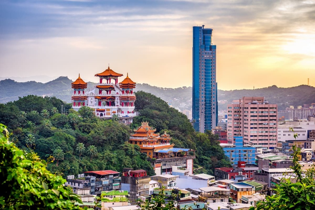
Taiwan’s capital and most vibrant city, Taipei, is a strikingly friendly city given its large size and population. Known for its cultural fusion of Chinese, Japanese, and Indigenous Taiwanese customs, Taipei is both culturally rich and surrounded by natural beauty.
To get a better view of Taipei's striking skyscrapers, climb up the 600 steps to the summit of Elephant Mountain (象山). As Elephant Mountain is located just a short walk away from Taipei 101, the summit provides the perfect view of this iconic skyscraper all year long.
Or for a trip into the heart of Taipei, venture to the electrifying Ximending District (西門町區). Here, giant illuminating billboards and fluorescent lighting add to the buzz of energy in this futuristic shopping district. Dubbed the 'Harajuku of Taipei,’ the Ximending District is a great place to meet residents who spork quirky cosplay costumes as they enjoy themselves in this buzzing pedestrian zone.

Another of Taipei's main attractions is Taiwan's national pride, the National Chiang Kai-shek Memorial Hall. The grand five-arched gate sets the theme of this stately homage to Taiwan's past leader, Generalissimo Chiang Kai-shek. The eight-sided 76 meter (249 ft) tall white marble structure houses a bronze large-scale statue of Chiang, which is protected by guards at all times.
For a chance to unwind from your sightseeing adventures, head to Taipei's only natural thermal bath, Beitou Hot Springs. This retreat is located near Yangmingshan National Park in the Beitou District (北投區), though it is quite busy on weekends. The 70°C (158°F) waters of the hot springs are surrounded by a verdant paradise, which makes for a great environment if you’re looking to relax after the day’s activities.
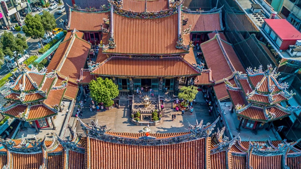
Finally, for a cultural experience, visit the Mengjia Longshan Temple, one of Taiwan's oldest and largest temples. Constructed in 1738, the Buddist site's hall was bombed during the Second World War, though it has since been rebuilt and restored. Upon entering the temple, a feeling of calm will overtake you as the respectful silence of Mengjia Longshan stands in stark contrast to the busy streets of Taipei.
The seaside Keelung City is known mainly for its old fishing harbor, which was a thriving port during the Japanese Occupation Era. Nowadays, Keelung remains a beautifully scenic destination thanks to its nearby coastal hills, cerulean ocean, and rustic seaport.
If you’re venturing to Keelung, be sure to make the trip to Zhongzheng Park. As the park is perched on a hillside, it offers the most beautiful views of this port city. Head up to the fourth floor of Zhuptan Temple for unrivaled views of Keelung’s harbor, the distant Keelung Islet, and the deep blue Pacific Ocean. Zhongzheng Park is also home to a 25 meter (82 ft) tall Goddess of Mercy statue, the highest in Southeast Asia.
After a trip to Zhongzheng Park, venture downhill and catch a ferry to Keelung Islet for a day of hiking on this volcanic island. While here, you can admire the plentiful native plants that populate the island while also enjoying some whale watching and dolphin spotting from the island’s beaches.

For a taste of Taiwan, be sure to visit the Miaokou Keelung Night Market, which is known for its fresh seafood dishes. A total of 200 vendors are jam-packed into this 400 sq. meter (4,306 sq. ft) area, and all of them sell scrumptious dishes to curious passersby. Some of the many dishes you can sample at the market include Shenji Paopao shaved ice, Keelung crab soup, grilled squid, beef noodle soup, and bubble tea.
Another one of Keelung’s highlights is Dawulan Beach and its golden, sandy landscapes. The turquoise water lapping the shoreline of the beach is truly beautiful, especially at sunrise and sunset. If you’re looking for a short hike, consider a walk down the Lovers Lake Nature Trail, which leads from Dawulan Beach and through a forest of eucalyptus trees to the aquamarine pond of Lovers Lake.
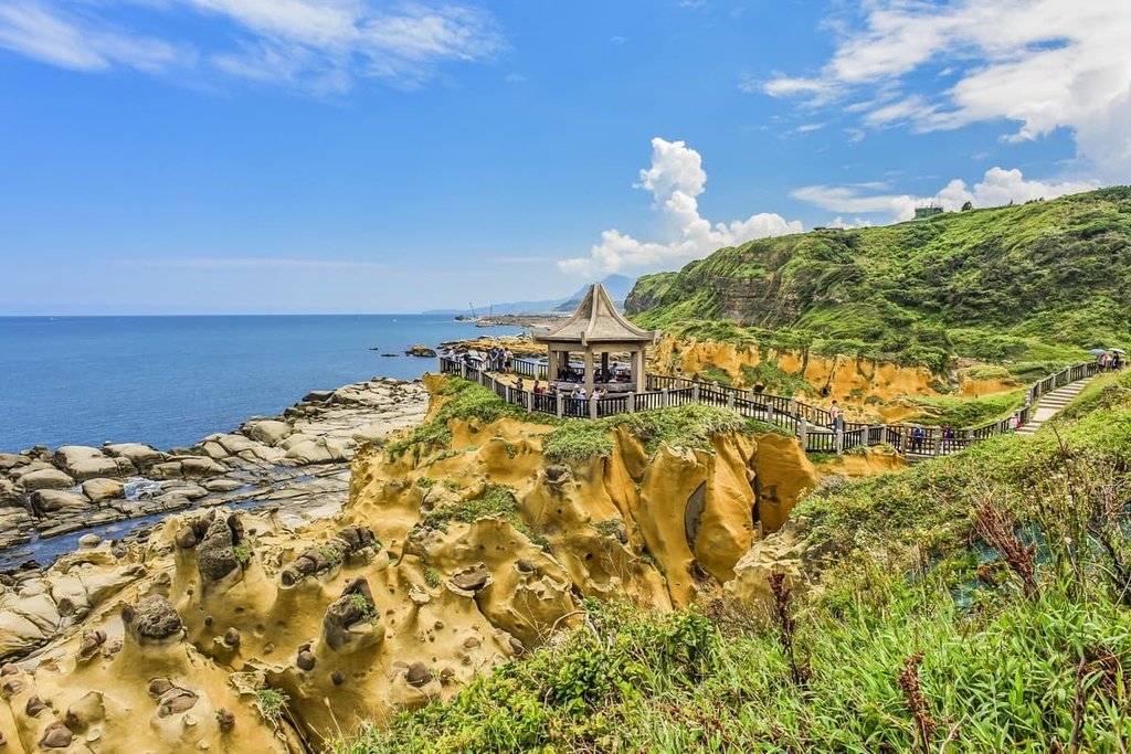
Finally, for great views of Keelung’s shoreline and nearby New Taipei City, take a trip to Heping Island, which is located right off the coast of Keelung. From here, you can see Yehliu’s unique rock formations. Heping Island also boasts its own collection of weathered rocky outcrops that are well worth checking out.
To get to Huangzuishan Ecological Reserve, start at Taipei Main Station and take the MRT Red Line to NTU Hospital Station. From here, head to the Gongyuan/Taipei Main Station Bus Station.
Board the 1717 bus to Jinshan Station, but get off at the Shuanghuangxi Bridge stop. The Shuanghuangxi Parking Lot is located close by. From here, you can walk toward the Huangzuishan Ecological Reserve.
Alternatively, you can make the 32 km (20 mi) drive from Taipei to the Huangzuishan Ecological Reserve if you rent a car or a scooter.