Scan the QR code and open PeakVisor on your phone
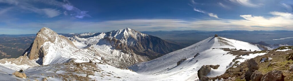
Djurdjura National Park is a protected area in northern Algeria that’s known for its tall peaks and deep gorges. The park is also home to many grottoes, which is rare in the region. There are 14 named mountains in the park. The tallest and most prominent is Lalla Khedidja at 2,308 m (7,572 ft) in elevation with 1,718 m (5,636 ft) of prominence.
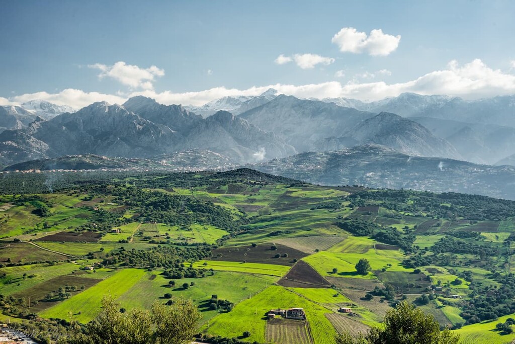
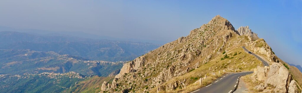
Djurdjura National Park is situated in northern Algeria. Located in the Tell Atlas mountains, the park has both vast forests and towering rugged peaks. The park spans 185 sq. km (71 sq. miles) across the provinces of Bouira and Tizi Ouzou.
The Tell Atlas mountains are home to the Djurdjura massif for which the park is named. Lalla Khedidja is the tallest peak in the massif and the park.
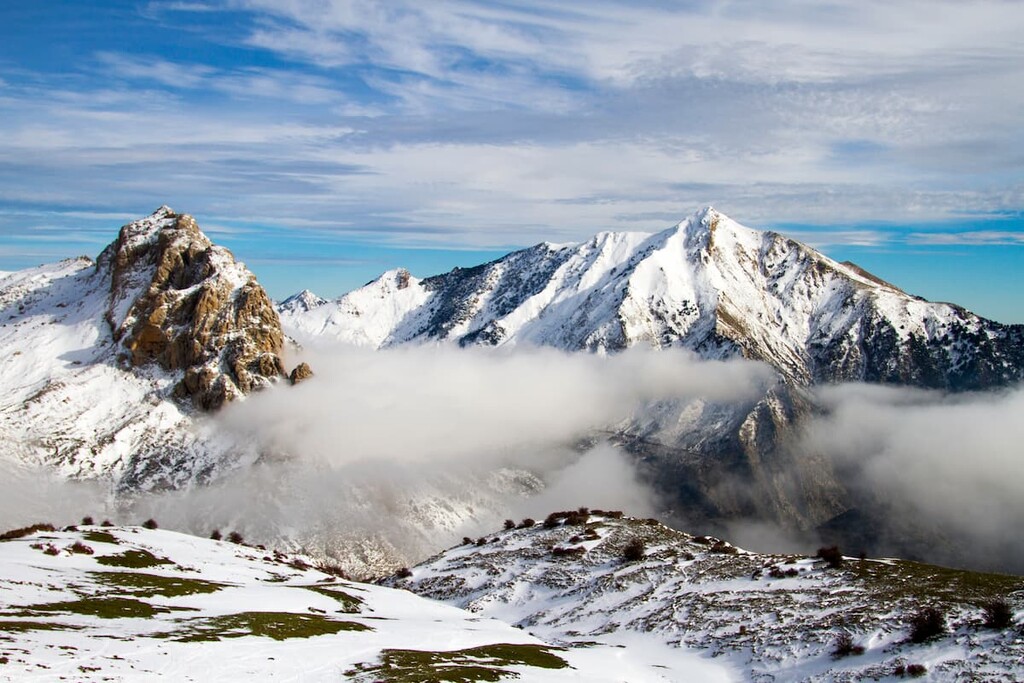
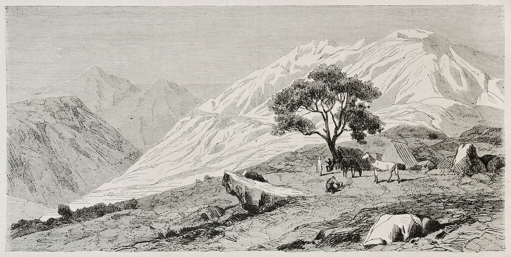
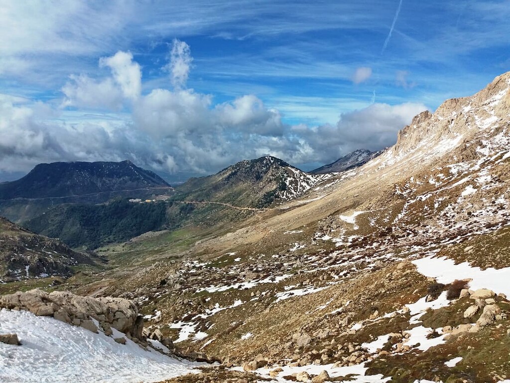
The peaks of the Tell Atlas dominate the park and its surrounding landscape. The northern side of the massif is home to deep river valleys and gorges. The steep rock faces showcase the glacial history of the massif. There are many grottoes located to the north of the massif.
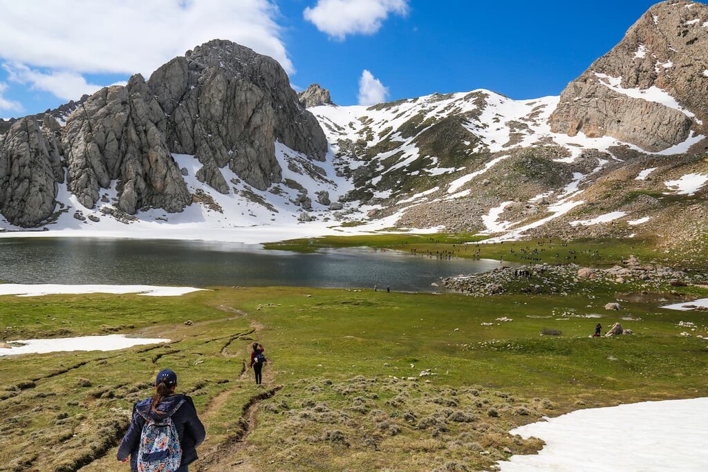
The southern side of the Djurdjura massif is marked by dense cedar forests. Just south of the park lies the high plateau known as the Hautes Plaines. Rivers and streams wind through the many canyons of the park, while glacier lakes can be spotted at higher elevations.
The Tell Atlas extend west to east across northern Algeria, Tunisia, and Morocco, thus forming a natural barrier between the Mediterranean and the Saharan Desert. The headwaters of the Chelif River are located within this subrange.
Additionally, Djurdjura National Park is located near other parks in northern Algeria. These include Chrea National Park to the west, Belezma National Park to the southeast and El Kala National Park to the east.
The mountains within the Djurdjura National Park are part of the Tell Atlas range, a subrange within the Atlas Mountains. The Tell Atlas range spans far beyond the park boundaries, and totals 1,500 km (932 miles) in length.
The Atlas Mountains, including the peaks in the park, began forming during the Mesozoic era. Thick sedimentary basins in the region began forming due to rifts in the Earth’s crust.
Starting around 66 million years ago, the Atlas Mountains were uplifted when the European and African plates collided. The two plates collided at the Iberian Peninsula which also led to the formation of the Alps and Pyrenees.
To this day geologists are still puzzled by the lack of crustal thickening surrounding the range. This has led scientists to believe that movement in the Earth’s mantle helped create the range.
Major peaks within the park include Lalla Khedidja, Ras Tamedouine, Adrar Akuker, Djebel HaÏzer, and Le Gouffre.
While the northern side of the massif that dominates Djurdjura National Park is marked by minimal amounts of flora, the southern face is abundant with dense vegetation. The Atlas cedar can be found at higher elevations in the park while pine and juniper trees populate lower elevations.
These forested sections provide ideal habitats for numerous animal species. Indeed, the park acts as a refuge for many endangered species in the region.
One of the most notable animal species in the park is the endangered Barbary macaque. Other animals include wild boar, hyena, red fox, weasel, wild cat, harre, and the crested porcupine.
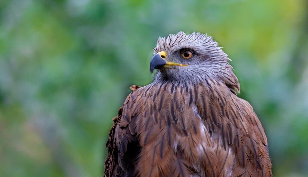
Besides hiking, the park is known for its bird watching as it is home to many birds of prey. Large populations of golden eagles, booted eagles, black vultures, peregrine falcons, and long-legged buzzards can often be spotted in the park.
Human history in the park can be traced through that of the larger Kabylia region. The historic, cultural, and natural region of Kabylia spans far outside the park into both Tizi Ouzou and Bejaia provinces.
From 202 to 46 BCE, Kabylia was part of the Kingdom of Numidia. A revolt in the fourth century CE marked some of the first written history of this civilization. In the centuries that followed, many different groups ruled over the region until the Zirid Dynasty took control.
Through the fifteenth century to the eighteenth century, the region was known as the Regency of Algiers. Under this rule most of Kabylia was independent. The region greatly resisted French colonization yet France assumed control of the region in 1830.
The country’s war for independence from the French took place from 1954 to 1962. Since independence was achieved, there has been tension between the Kabyle leaders and the central government that have led to numerous riots and protests.
The park was originally created in 1925 when the region was still under French control. However, after gaining independence the region was reestablished as a national park in 1983. Today there are many small mountain huts throughout the park for visitors to enjoy.
Djurdjura National Park is home to many hiking trails which have become more popular in recent years. Since the park is not yet a major destination for international tourists, there is little information in English about the many routes within the park boundaries.
Therefore, it’s best to hire a guide if you’re looking to visit Djurdjura National Park. Algeria has some superb trekking routes, however, organizing the logistics of these routes can be difficult.
Indeed, the park service that manages Djurdjura highly recommends that people come with a qualified guide who understands the rules and regulations of the region before embarking on a trip into the mountains.
Looking for a place to stay near the Djurdjura National Park? Here are some of the best cities and villages to check out in the region:
On the north side of the massif, and the park, lies Tizi Ouzou (Tizi Wezzu). With a population of nearly 150,000 people, Tizi Ouzou is one of the largest cities in the region. Tizi Ouzou lies within the valley of the Wadi Tizi Ouzou. The name roughly translates to “mountain pass” due to its close proximity to the Djurdjura massif.
The city has a long and rich history, having been founded during the Ottoman period. There are a number of important cultural sites in the region, as well as museums, markets, and regular festivals.
On the south side of the park lies Bordj Bou Arréridji. The city has a population of over 160,000 people with an economy based largely on agriculture and forestry.
Bordj Bou Arréridji is also known for its technology companies. Numerous highways pass through the city making it a transportation hub for the region. Near the city lies the Al Qal’a of Beni Hammad ruins that date back to the eleventh century. The city is also home to a castle as well as an old mosque that was built in the Ottoman style.