Scan the QR code and open PeakVisor on your phone
Delaware State Forest is an outdoor recreation destination located in the US state of Pennsylvania. Situated in the Pocono region of the state, the forest features numerous lakes and bogs. Delaware State Forest contains 22 named mountains. The tallest and most prominent peak in the forest is High Knob at 2,057 feet (627 m) tall with 377 feet (115 m) of prominence.
Delaware State Forest encompasses 83,519 acres (33,800 ha) of terrain, and it is located in the eastern stretches of the US state of Pennsylvania. The forested landscape covers land in Pike, Monroe, Northampton, and Carbon counties.
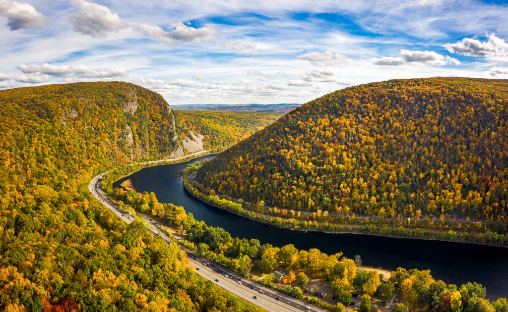
The forest is named after the Delaware River which flows north, east, and south of the protected region. Delaware State Forest is made of multiple non-contiguous parcels of land with a majority of the landscape being densely forested.
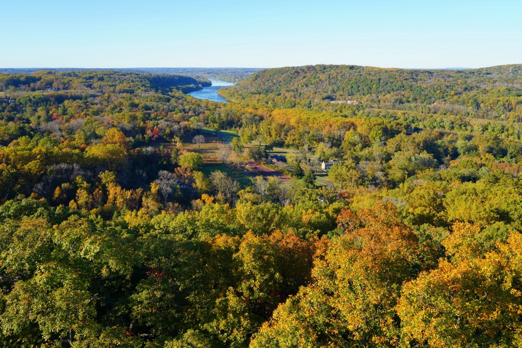
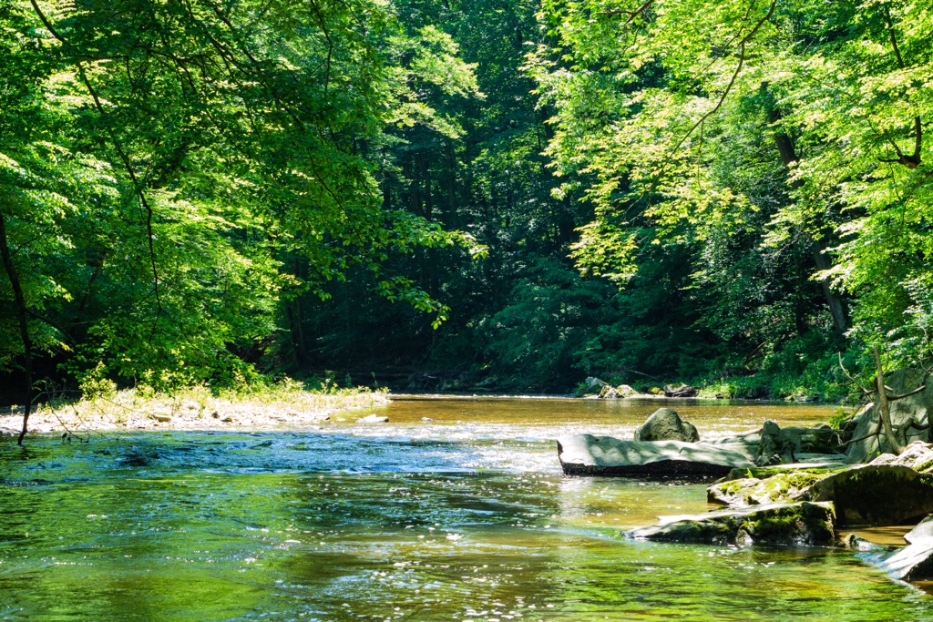
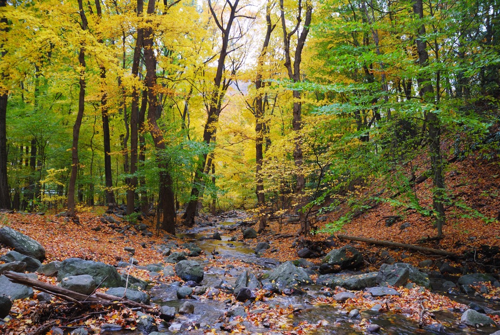
Amidst the rolling hills lie a plethora of lakes, creeks, streams, and bogs. Some of the most prominent lakes in the region include the Shohola Marsh Reservoir, Lake Wallenpaupack, Pecks Pond, Porters Lake, and Promised Land Lake among various others.
Terrain in the state forest is similar to that found throughout the Pocono Mountains and Pocono region of Pennsylvania. This geographic region spans roughly 2,500 square miles (6,500 square km).
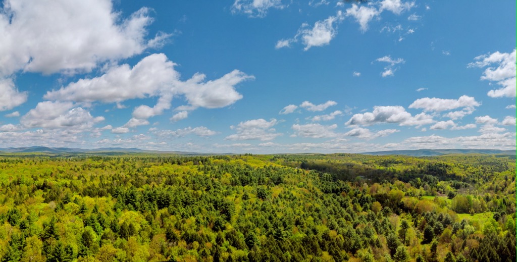
The rolling hills and streams of the region are home to numerous small waterfalls and expansive bogs. This plethora of freshwater sources allows for biodiversity to thrive in the region. A vast majority of the hills and peaks are forested, providing minimal viewpoints of the sweeping forested landscape.
Additionally, Delaware State Forest is located near numerous other parks and state forests. The Pinchot State Forest lies to the north while William Penn State Forest is situated to the south. Weiser State Forest lies to the west along with the Promised Land State Park. North of the forest lies the Upper Delaware Scenic and Recreational River.
The peaks and ridgelines within Delaware State Forest are part of the Pocono Mountains, a subrange situated on the Allegheny Plateau. This large plateau is part of the greater Appalachian Mountains, which span across the eastern US and into Canada.
These peaks, along with the rest of the Appalachian Mountains and the Allegheny Plateau, began forming around 480 million years ago. Thrusting and faulting of the Earth’s crust ultimately changed the direction of the Susquehanna River.
Over the course of 150 million years, the Susquehanna River carved out a sweeping valley in present-day Pennsylvania. Continued tectonic activity led to the more dramatic peaks of the nearby Appalachian Mountains. The river continually eroded the landscape, leaving behind the alternating peaks and valleys visible today.
A vast sheet of ice covered much of present-day Pennsylvania during the last glacial maximum. Glacial runoff in the region added to the force of the Susquehannock River, while sediment slowly filled in the sweeping valley.
Bedrock found in the region, and much of northeastern Pennsylvania, consists of a variety of sandstone and quartzite. These rocks are thought to have formed during the Appalachian orogeny.
Major peaks located within Delaware State Forest include High Knob, Pine Knot Ridge, Bald Hill, and Low Knob.
Delaware State Forest is home to flora and fauna that are commonly found throughout the Poconos. The densely forested landscape, coupled with the abundance of fresh water, allow for biodiversity to flourish.
The forested region of the protected land supports northern hardwood forests. Common species include Appalachian oak, eastern hemlock, balsam fir, and eastern white pine. Maple and chestnut trees are common near the waterways of the region.
During the summer months, hikers are likely to spot a variety of wildflowers including dogwoods, mountain laurel, goldenrod, asters, and sumacs.
Commonly spotted mammals include cottontail rabbits, ground squirrels, and white-tailed deer. Less populated sections of terrain are home to bobcats, wild turkeys and porcupines. The lakes and rivers of the region support a plethora of fish species; including largemouth bass, striped bass, smallmouth bass, brown trout, rainbow trout, and northern pike.
The land within and surrounding Delaware State Forest is part of the ancestral homelands of many Indigenous peoples, primarily the Munsee Lenape. These peoples are part of a subtribe of the Lenape peoples.
Their traditional homelands lie along the upper portion of the Delaware River in present-day New York, New Jersey, and Pennsylvania. Due to their communities being located on and near the Delaware River, the Munsee Lenape were some of the first Indigenous peoples to encounter European colonizers.
In 1669, the Munsee peoples joined forces with the nearby Esopus in order to attack the Dutch colonizers of the region. Despite their efforts, the tribes were defeated in what would later be known as the Esopus Wars.
A fraudulent treaty, known as the Walking Purchase, forced a majority of the Munsee peoples to leave the Delaware River. Many of these people relocated to land near the Susquehanna River on parcels of land designated by the Haudenosaunee. In the following decades they moved further west to join other Lenape settlements located on the Ohio River.
The Munsee who remained near the Delaware River were eventually incorporated into the Mohawk. Today, descendants of the Munsee Lenape are part of the Delaware Tribe of Indians, Stockbridge-Munsee Band of Mohican Indians, Delaware Nation at Moraviantown, and Ramapough Lenape Nation.
As populations of Europeans continued to grow in the region, other Indigenous peoples were continually harassed, attacked, displaced and murdered. The arrival of infectious diseases, such as smallpox and measles, decimated many tribes whose people had no natural immunity to the illnesses.
Widespread logging and mining took place throughout Pennsylvania in the mid to late nineteenth century. A majority of the old-growth forest was destroyed while only clear cut land was left behind. Sparks from steam locomotives in the region started wildfires in the area, further halting the growth of second growth forests.
Conservationists soon feared the land may never recover, and urged the state to purchase and protect the land. The establishment of the state forest, and other nearby parks, has allowed for the landscape to slowly recover and rebuild over the past century.
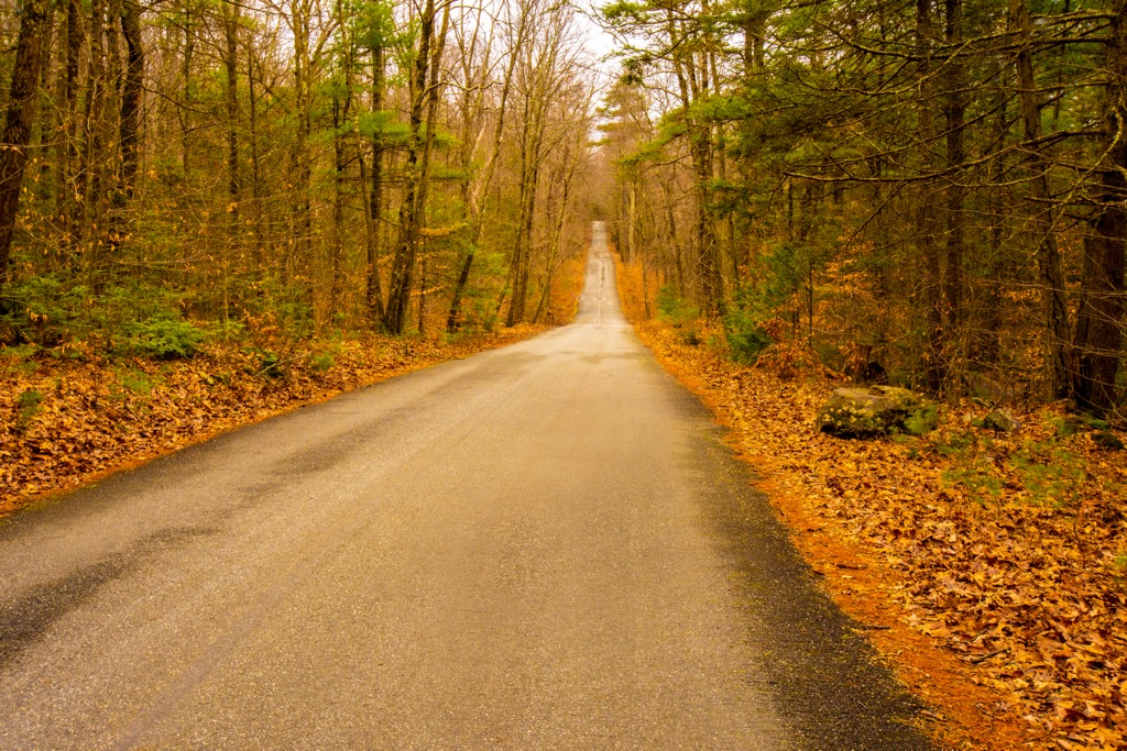
Delaware State Forest is home to a number of excellent trails for outdoor recreation. Below are a few of the most popular hiking trails in the region to check out on your next visit:
This loop route is located in the southern section of the state forest. The trail is part of the Thunder Swamp Trail system which winds through the numerous ponds, streams, and wetlands of the region.
The route features numerous small climbs and descends, creek crossings, and forested terrain. The entire loop is often completed as a backpacking route and can also be used for mountain biking and snowshoeing. The loop is 34 miles (55 km) long and features 2,588 feet (789 m) of elevation gain.
The Thunder Swamp Loop offers a shorter route for those wishing to explore the southern section of forest. The trail begins rather rocky before opening up to a more designated trail near Red Rock Run and Saw Creek. This loop trail showcases some of the flora of the region totaling 4.5 miles (7.2 km) in length with 436 feet (133 m) of elevation gain.
The Maple Run Ramble route is located along the northern shores of Pecks Pond. This out and back trail winds through the forested landscape before passing over Maple Creek.
Hikers follow along a gravel path with views of wetlands and bogs. The shorter route can also be used for mountain biking and trail running. The entire route is 5.2 miles (8.4 km) long and features 328 feet (100 m) of elevation gain.
Looking for a place to stay near Delaware State Forest? Here are some of the best cities and villages to check out in the region.
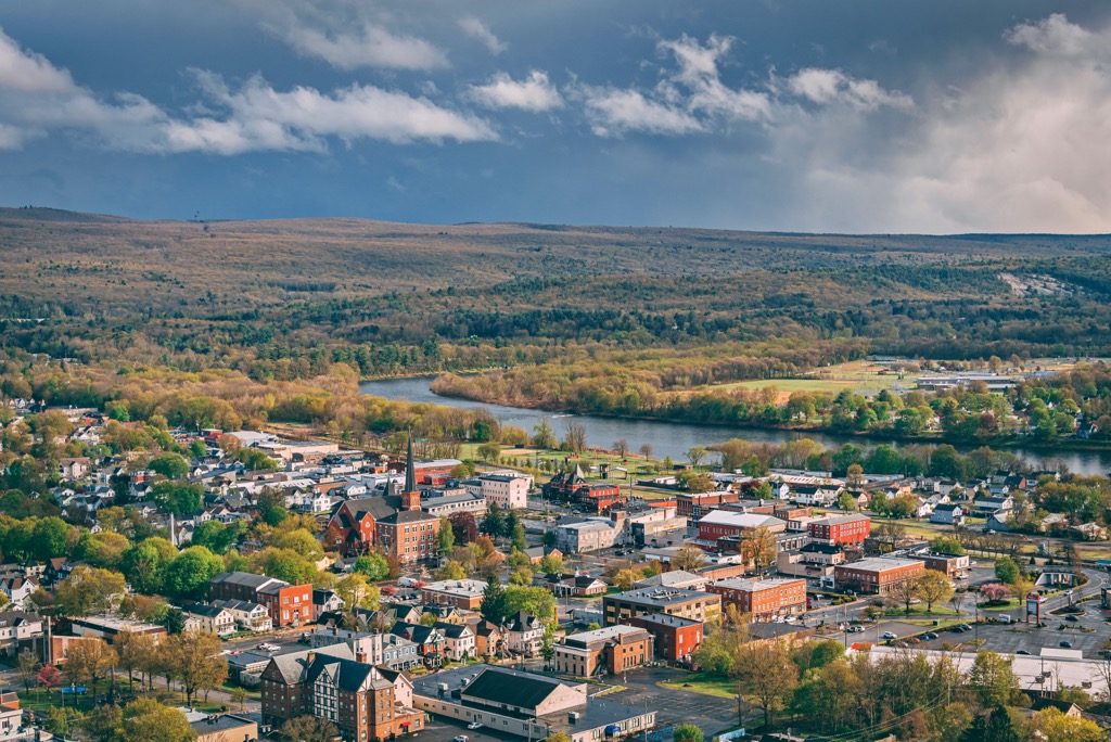
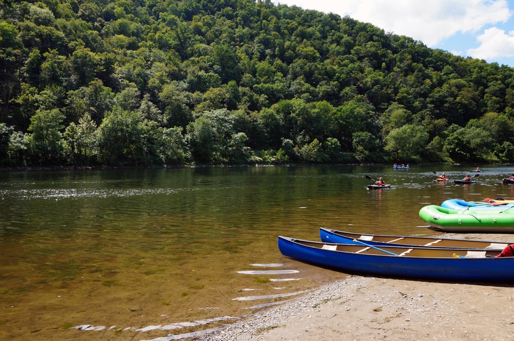
Port Jervis is a small city located a few miles east of the state forest. Situated along the Delaware River, the city lies along the border between New York, Pennsylvania, and New Jersey. The Tri-States Monument is located in the city, marking the tripoint between the three states.
Home to roughly 9,000 residents, the city is situated on the edge of the Pocono Mountains. Despite its relatively small size, each year the city is full of thousands of tourists who come to explore the nearby Delaware Water Gap National Recreation Area and the Upper Delaware Scenic and Recreational River. The waterways in the region provide opportunities for canoeing, rafting, and kayaking.
Scranton and Wilkes-Barre are two cities located northwest of the state forest. Situated in the Wyoming Valley, Scranton is home to 76,000 residents while nearby Wilkes-Barre has 45,000 residents.
The city of Wilkes-Barre was established as a coal mining town back in 1770 and has recently blossomed into a hub for outdoor recreation. Situated along the Susquehannock River, visitors have opportunities to enjoy kayaking, whitewater rafting, hiking, and mountain biking.
Other popular sites in the area include the Luzerne County Museum, River Street Historic District, Wyoming Monument, and the F. M. Kirby Center for the Performing Arts. Scranton is known for Steamtown National Historic Site, Electric City Trolley Museum and McDade Park.