Scan the QR code and open PeakVisor on your phone
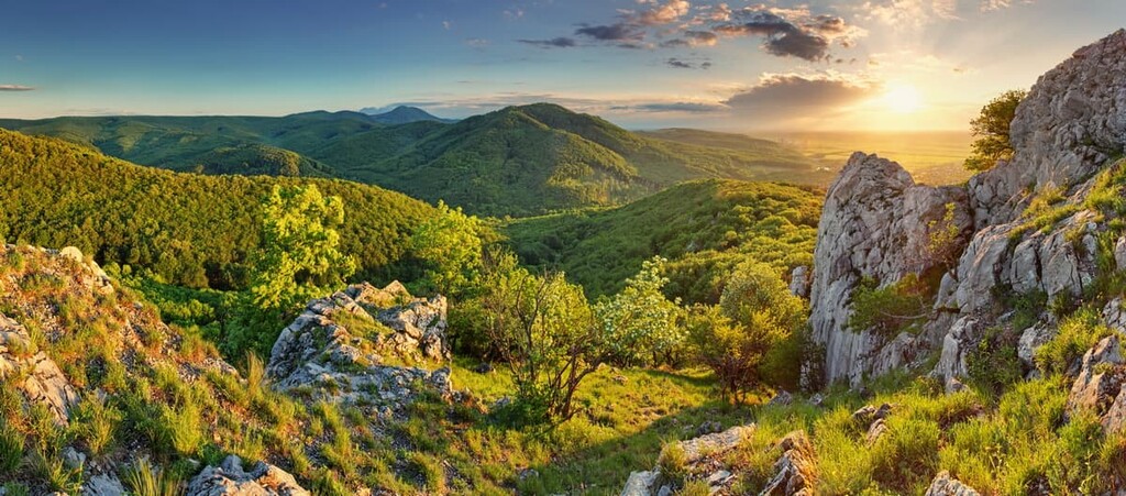
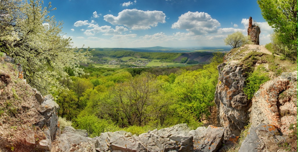
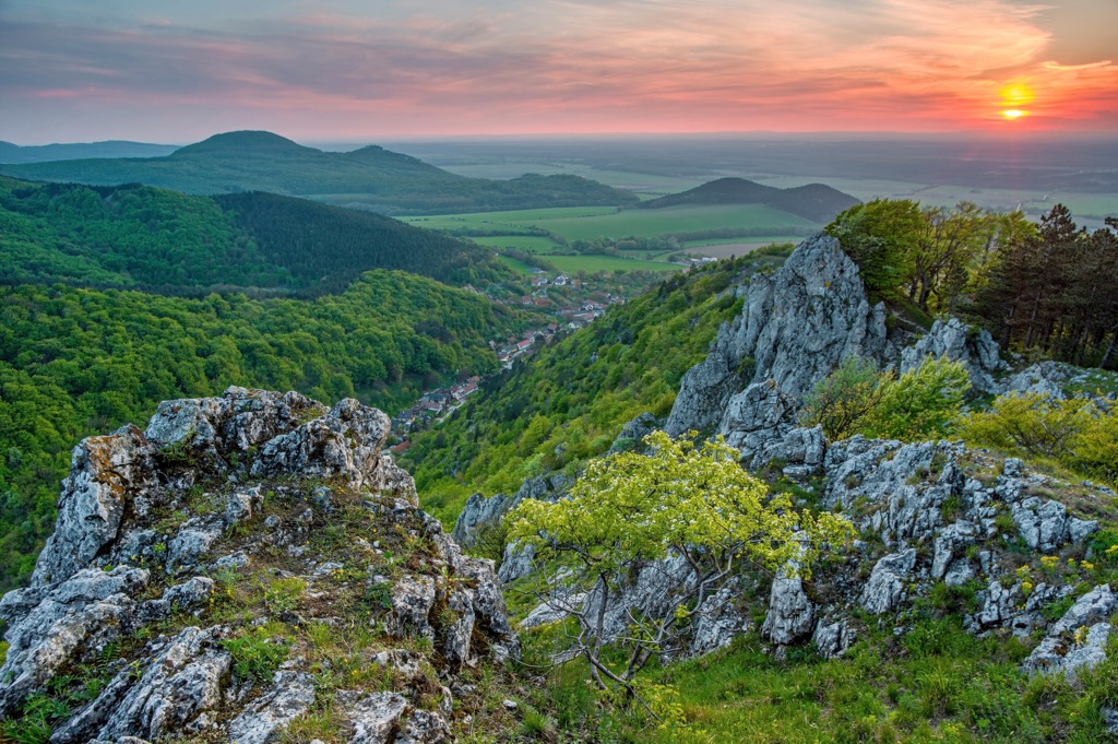
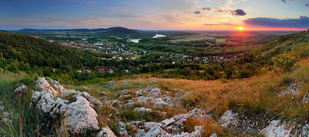
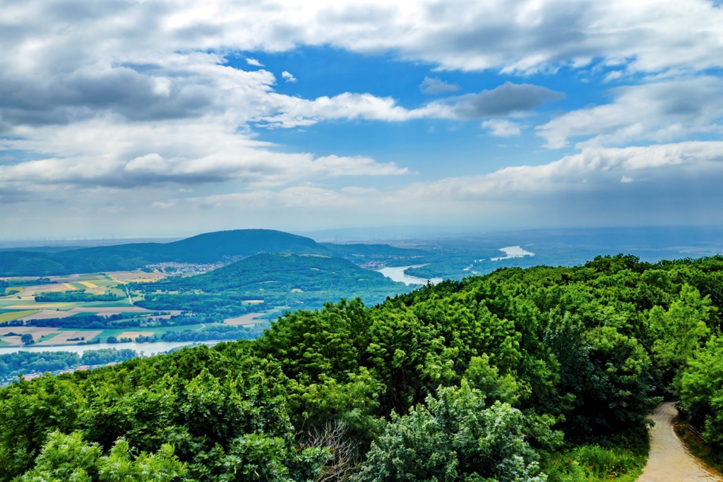
Little Carpathians Protected Landscape Area (CHKO Malé Karpaty) is one of the main natural areas in Slovakia in Central Europe, which covers the whole Little Carpathians range—a part of the Carpathian Mountains, in order to protect its nationally significant landscape, flora, and fauna. It is also the main area for hiking and other outdoor activities for residents and guests of the country's capital, i.e. the park is synonymous with the Bratislava mountains. Another unique feature of the range is that it literally connects the Carpathians with the Alps—like a bridge between the two largest mountain systems in Europe. There are 329 named mountains in the Little Carpathians Protected Landscape Area. The highest and the most prominent mountain is Záruby (768 m / 2,519 ft).
The meaning of the name of the natural area is easy to guess. It means that these are smaller mountains in relation to the main range (or rather a system of ranges) of the Carpathian Mountains. The Little Carpathians are sometimes also called the Small Carpathiand or the Lesser Carpathians.
The word 'Carpathians' in turn is derived from the Proto Indo-European root 'skerp' can mean 'mountain', 'rock', or 'rugged', 'sharp', 'harrow', and the like, or a mixture of these meanings. For example, the closest analog in modern Polish is the word 'skarpa', which means a 'sharp cliff' or other kinds of vertical terrain.
The name of the mountain system in Slovak is Malé Karpaty. In German: Kleine Karpaten, in Hungarian: Kis-Kárpátok, in Czech: also Malé Karpaty — these are three "neighboring" languages, as will become clear immediately below.
As for the second part of the name, it is one of the 14 protected landscape areas in Slovakia, which was created in 1976 from six separate small nature reserves, which could still be found on its territory. In general, it is one of the most common types of protected natural areas in the country on a par with national parks. As the name suggests, their primary task is to protect the country's unique landscapes, as well as flora and fauna.
The full name of the territory in Slovak: Little Carpathians Protected Landscape Area (Chránená krajinná oblasť Malé Karpaty, CHKO Malé Karpaty).
Little Carpathians Protected Landscape Area is located northwest of Slovakia, a country in Central Europe. The area begins immediately from the capital Bratislava in the namesake Region of Bratislava (that's why it is synonymous with the Bratislava mountains) and extends 100 km (62 mil) northeast to the small town of Nové Mesto nad Váhom in the Region of Trenčín north of another relatively large city of Trnava in the Region of Trnava. As a result, the territory is located in three regions at once.
The area covers the entire Lesser Carpathians range, which in turn occupy 646 sq km (249 sq mi) of the 190–210 sq km (mi) of the Carpathian Mountains in an area or about 100 km (62 mi) of the 1,700 km (1,056 mi) in length.
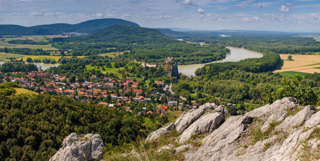
As I noted in the introduction, the unique thing about this mountain range is that it actually connects the Carpathian Mountains with the Alps. More precisely, it connects it with the Northern Lower Austria Alps, and Styrian Prealps—two of the northeasternmost large mountain ranges in the Eastern Alps through the small Hundsheimer Berge range with the eponymous highest peak Hundsheimer Berg (481 m / 1,578 ft) of the larger Devín Carpathians range in the state of Lower Austria. In other words, part of the Lesser Carpathians (and the Carpathians as a whole) is in Austria, known above all as an Alpine country.
To the north of CHKO Malé Karpaty are Bohemian Ranges in the Czech Republic, and to the south—the Little Hungarian Plain in Hungary.
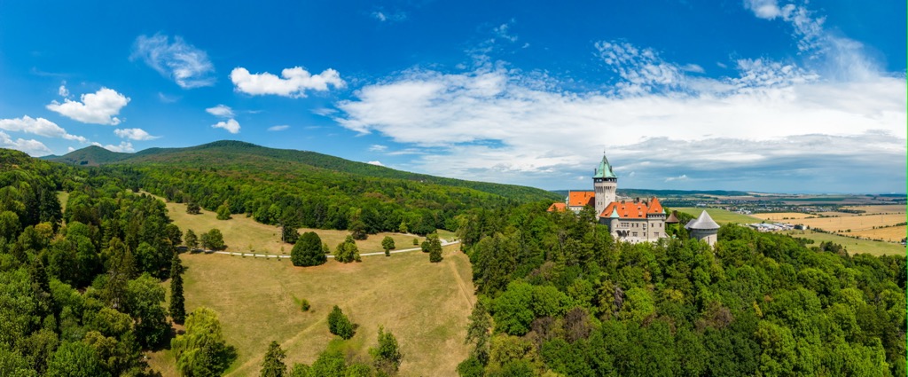
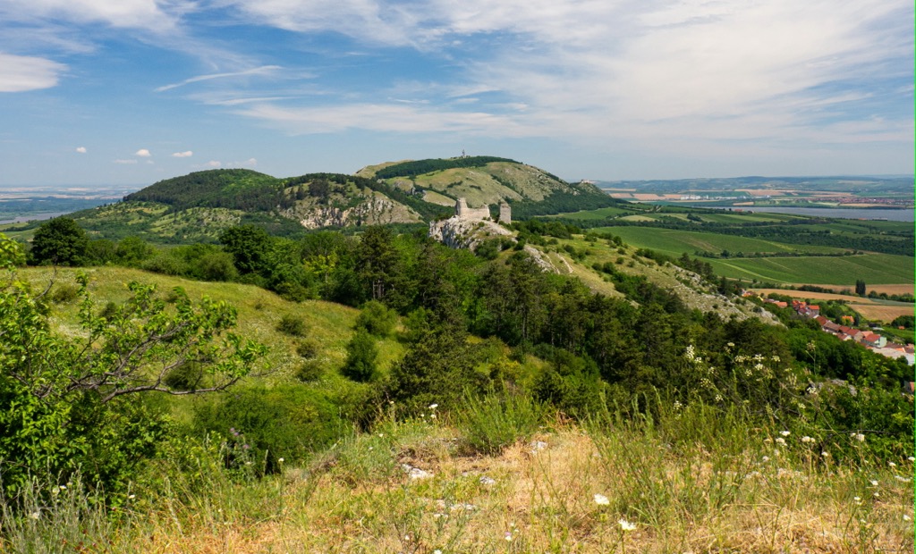
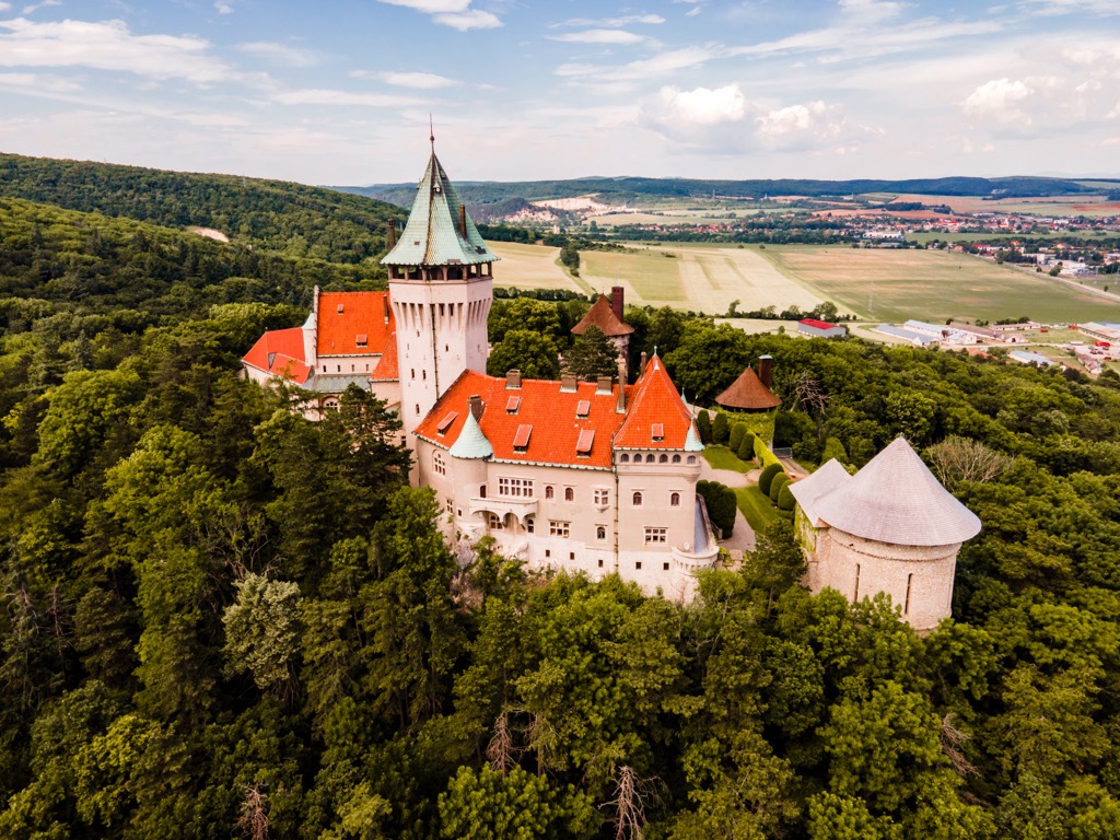
Little Carpathians Protected Landscape Area is designed primarily to protect the nationally important landscape of Slovakia, whose main feature is a large number of all kinds of medieval castles (’hrad’ in Slovak, which means also 'the city') built mostly in the Little Carpathians but also in other part of the state.
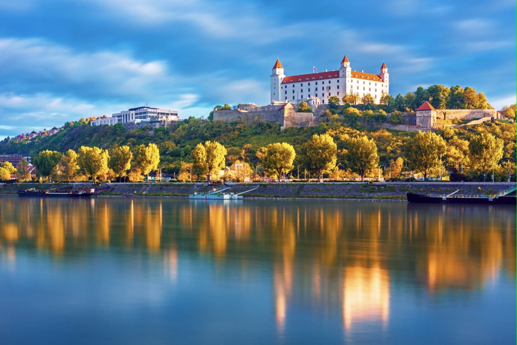
The biggest and best known of them is Bratislava Castle built in the 9th century and rebuilt many times after, located on a hill in the center of the city. Today the Slovak National Museum is situated inside — a must-visit place, especially in bad weather during the mid-season and winter.
Other castles (from southwest to northeast) include Devin Castle*, Pajštún Castle*, Biely Kameň Castle*, Plavecky Castle, Budmerice Castle, Mon Repos-Pálffyovská horáreňand Castle, Smolenice Castle, Ostry Kamen Castle*, Korlátka Castle*, Dobrá Voda Castle*, and Čachtice Castle, the furthest from Bratislava above the town of Nové Mesto nad Váhom, and some others. They are in varying degrees of preservation from still active sites to the empty towers and walls, and ruins*.
The second main feature of the landscape area is natural. The Little Carpathians or Bratislava mountains are notable for the large number of karst caves, which are a result of their geology—they were formed in the Triassic period and are composed mainly of various kinds of limestone.
Among the main caves are two: Driny Cave—the deepest of 636 m (2,086 ft), located 2 km (1.2 mi) southwest of the village of Smolenice; Deravá Skala Cave—with evidence of Neolithic man, located 1.4 km (0.8 mi) south of the village of Plavecký Mikuláš, and many others.
The Little Carpathians or Bratislava mountains is one of the more than a dozen mountain ranges within the greater Fatra-Tatra Area range, which in turn is one of the five parts of the Inner Western Carpathians—one of the two parts of the Western Carpathians along with the Outer Western Carpathians, which in turn is one of the three largest parts into which this entire mountain system is divided (others: the Eastern Carpathians and the Southern Carpathians).
Within the Little Carpathians is divided into four main sections (also as before in the guide from southwest to northeast):
Each of them in turn is divided into several other parts. For example, in the Devín Carpathians there are four inner parts:
As for the individual mountains, there are 329 named peaks in total within the mountain range and respectively the natural area. Among the main ones are the three highest summits—in the center and at the western and eastern extremes of the park:
In the Little Carpathians Protected Landscape Area and Bratislava mountains, you can hike to the summits of almost all the peaks of the mountain range, including the three highest, following the marked trails from nearby towns and villages. The same goes for castles and caves. These are routes of about 10 km (6 mi) round trip.
As I know, there is no official Slovak long hiking trail through the Little Carpathians. However, through all of the range passes the E8 European long distance path, which begins in Cork, Ireland, and ends in Bulgaria, whose total length is 4,700 km (2,920 mi). So you can follow its signs. You can also combine some of the short trails of the area on your own some locals do, creating longer routes of tens of kilometers (miles) and two to three or more days of hiking. Overall, the entire area is literally riddled with trails. Check this local online map of trails in the Little Carpathians for more details.
The territory’s only long trail refers to another feature of its landscape that I haven’t mentioned before — the Lesser Carpathians have the largest number of vineyards in Slovakia. You can go through it by car or bike following “The Small Carpathian Wine Route” or “The Wine Road of Malé Karpaty”. The route begins in Bratislava, goes through the towns of Svätý Jur, Pezinok, and Modra, as well as over 120 viticultural communes, and ends in Trnava. And of course, you can get out anywhere to explore parts of the region on foot.

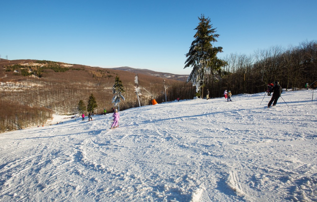
So there is a small ski resort in the Little Carpathians and the Bratislava mountains—Pezinská Baba (Lyžiarske stredisko Pezinská Baba), which is located in the middle of the range on the road crossing it from south to north and vice versa. It has 3.7 km (2.2 mi) of slopes and 5 ski lifts. It is also the main ski resort near Bratislava.
The larger ski resorts of Slovakia could be found in the northeast of the country in the High Tatras mountain range, the highest in the entire Carpathian Mountains. In particular, these are Jasná Nízke Tatry with 45 km 48 (mi) of slopes and 18 ski lifts, as well Vrátna, Kubínska hoľa, Ruzomberok Skipark, Veľká Rača, Tatranská Lomnica, Donovaly (Park Snow), Šachtičky with more than 10 km (6 mi) and several ski lifts each.
Check the Bratislava ski resorts map on the larger Europe ski resorts map in the World Mountain Lifts section of the site. It includes information about open ski lifts / slopes in the Little Carpathians in real-time with opening dates and hours. There are also year-round cable cars, funiculars, cog railways, aerial tramways, and all other types of mountain lifts.
Before or after hiking the Bratislava mountains, visit the official tourist office of the city to learn more on the spot, get a paper map, ask for advice, and the like.
Bratislava Tourist Information Centre—Old Town
Klobučnícka 2, 811 01 Bratislava, Slovakia
Daily from 9 am to 12:30 pm and from 1 to 6 pm (on Sundays until 4 pm)
+421254419410
touristinfo@visitbratislava.com
The most logical choice for accommodation in the Little Carpathians is small family hotels or B&Bs, which are called ’penzión’ in Slovakia—a local type of a guest house, and which, in contrast to the large chain hotels, will help you better immerse yourself in the country, and which you can also easily find in almost any town and village within the park's territory.
For example, in the Devínska Kobyla area, you will find Penzión Pegas Bratislava, Penzion Helios, and Penzión a Reštaurácia U Srnčíka; in the Záruby area these are Pension Villa Agnes, Pension Smolenice, and Pension Under the Castle; in the Salášky area—Penzion Park, Pension Pikolo, and Penzión ’Adriana’.
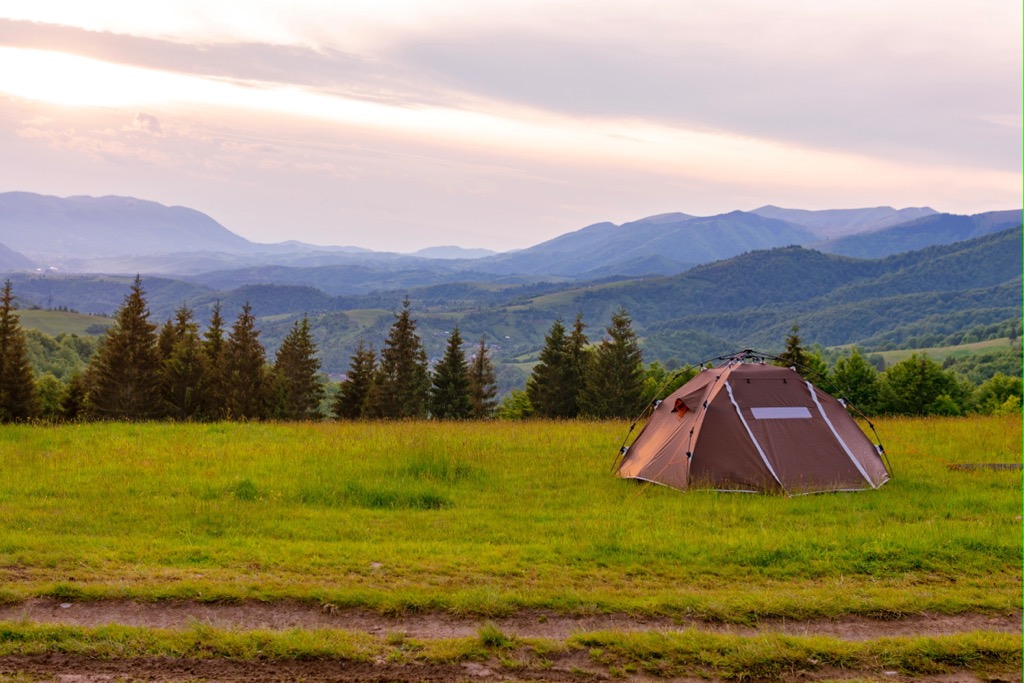
If you travel by caravan or if you want to set up a tent, you can use one of the three permanent large camping sites: Camping Park Karpaty in the west of the park; and Camping Pullmann, and Camping Zelená Voda in the northern part. Otherwise, as elsewhere in Europe, putting a tent anywhere within the park is prohibited.
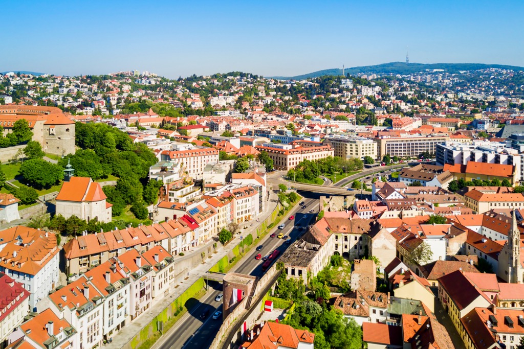
As has become clear from the very beginning of the guide, Bratislava is the main and largest city for the Little Carpathians Protected Landscape Area, which is located on its western borders.
In addition to Bratislava Castle, the city is also known for Devín Castle ruins; Bratislava Old Town, including the Michael’s Gate through which you will enter it; several large religious buildings such as St. Martin’s Cathedral and Church of St. Elisabeth; Rusovce Manor House with an English park around it; Grassalkovich Palace—a seat of the president of Slovakia; and many others.
Among the modern architecture, these are Most SNP (Slovenského národného povstania)—the main bridge of the city also known as the UFO Bridge; the National Bank of Slovakia; Eurovea shopping center; other high-rise buildings at Mlynské Nivy business district; Digital Park administrative complex, houses on the New Danube waterfront, and others.
When in Bratislava, nature lovers also must visit the Natural History Museum, one of the 11 museums of the larger Slovak National Museum, with exhibitions on local, European, and world flora and fauna, which is located in a separate building at Vajanského nábrežie, 2, a riverfront street in Bratislava’s Old Town, so it’s hard to miss when walking around the city.
The closest major cities to Bratislava for a trip for a day or two out of it are Vienna in Austria and Budapest in Hungary.